
Heavy to excessive rainfall will continue today from the Texas Big Bend region into southern Oklahoma. Locally considerable flash and urban flooding is possible, and river flooding will continue in central Oklahoma. Scattered severe thunderstorms are possible in parts of the Mid-Atlantic Friday. A Typhoon Watch has been issued for Guam and CNMI. Read More >
Grand Rapids, MI
Weather Forecast Office
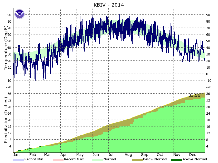
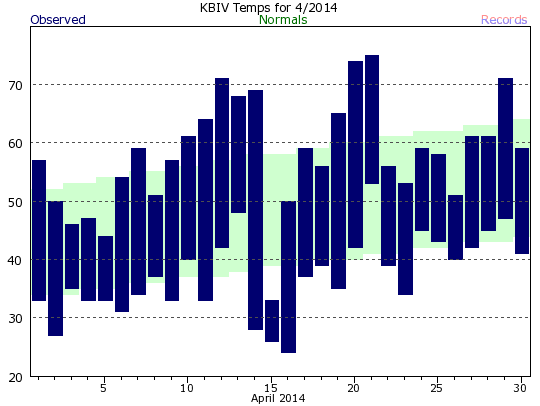
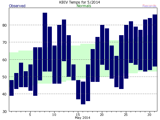
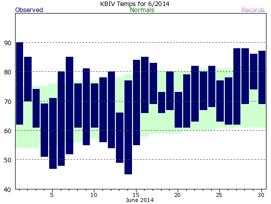
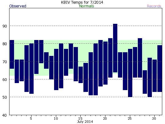
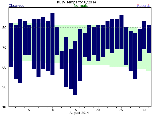
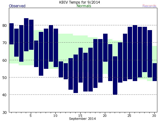
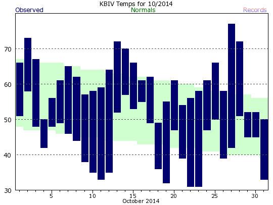
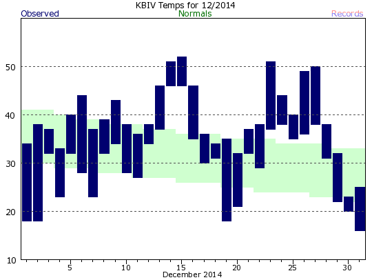
This data can also be found in text table format on our climate page. (For daily data for a month, choose "Preliminary Climatology Data (CF6)")
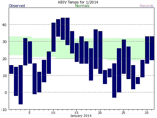 |
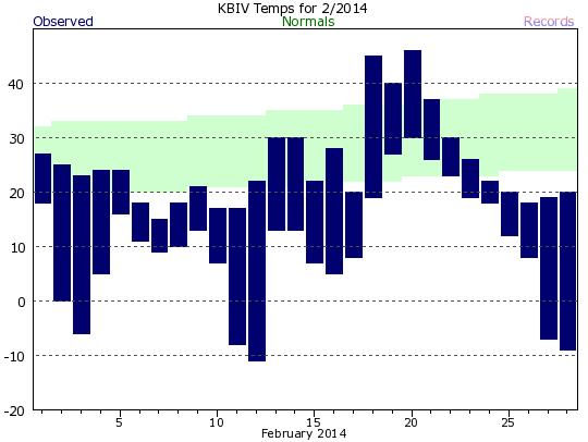 |
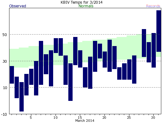 |
 |
 |
 |
 |
 |
 |
 |
 |
 |

US Dept of Commerce
National Oceanic and Atmospheric Administration
National Weather Service
Grand Rapids, MI
4899 Tim Dougherty Drive SE
Grand Rapids, MI 49512-4034
616-949-0643
Comments? Questions? Please Contact Us.


 Follow us on X
 Follow us on Facebook
 Follow us on YouTube
 GRR RSS Feed