
Severe thunderstorms capable of large hail and damaging wind gusts appear possible over the central and southern High Plains and eastern Kansas into Missouri Friday afternoon and evening. Rounds of storms Friday ahead of a slow moving frontal boundary will bring locally heavy rainfall and scattered flash flooding potential to the Mid-Mississippi, Ohio, and Tennessee Valleys, and the Appalachians. Read More >
Grand Rapids, MI
Weather Forecast Office
Overview
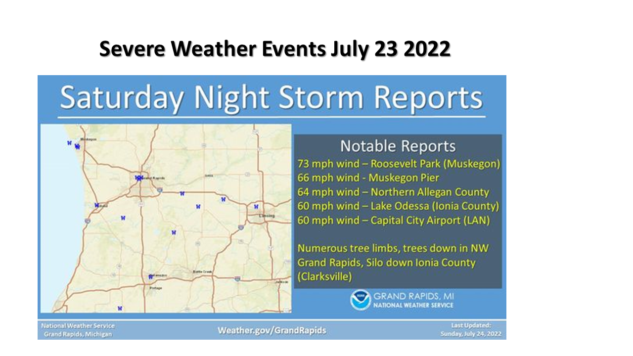
Two convective clusters moved through southwest Michigan during the July 23rd into the early morning hours of July 24th. There were numerous reports of damaging winds both convective clusters. Widespread rainfall amounts in the 1 to 3 inch rain occurred.Wind Reports:
Wind Reports
Two convective clusters brought damaging winds to Southwest Michigan
Radar
RADAR
Radar Reflectivity for bowing line that caused damage Saturday night, July 23rd, 2022
Velocity data from KGRR Radar from Saturday night July 23rd, 2022
Storm Reports
.PNG)
Rain Reports
.PNG)
 |
Media use of NWS Web News Stories is encouraged! Please acknowledge the NWS as the source of any news information accessed from this site. |
|
US Dept of Commerce
National Oceanic and Atmospheric Administration
National Weather Service
Grand Rapids, MI
4899 Tim Dougherty Drive SE
Grand Rapids, MI 49512-4034
616-949-0643
Comments? Questions? Please Contact Us.

