
Dangerous heat will expand from the Gulf Coast into the Southern Plains and Desert Southwest through week's end. Additional extreme heat impacting the Pacific Northwest will shift to the northern Plains by the weekend. Tropical Storm Bertha is expected to continue to impact portions of the northern Gulf Coast from the western Florida Panhandle to southeastern Louisiana through tonight. Read More >
Grand Rapids, MI
Weather Forecast Office
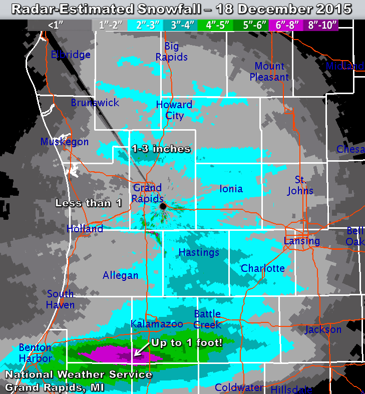
On December 18, 2015, light lake-effect snow with bands of heavy snow produced accumulations across western & southern Lower Michigan ranging from a dusting to one foot. Many traffic accidents and slide-offs occurred within heavier bursts of snow, especially in the Grand Rapids and Lansing areas. Snow initially melted on pavement before freezing into extremely slippery glare-ice.
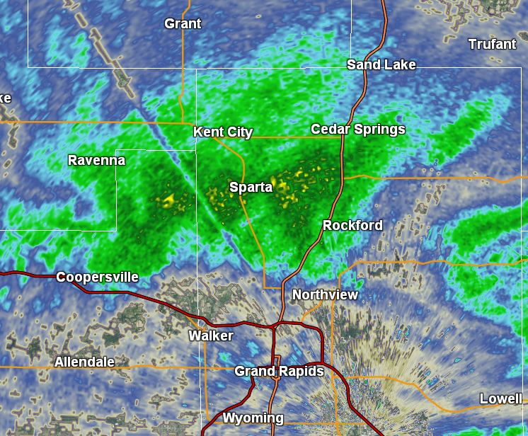
Heavy lake-effect snow affected locations north of Grand Rapids between 2:15 and 3:30 pm, turning roads into ice. This caused traffic accidents and lengthy backups on US-131 between Cedar Springs and northern Grand Rapids. Over 50 vehicles were involved in collisions or slide-offs on the highway south of Cedar Springs. Both directions of US-131 were closed hours.
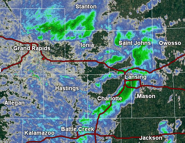
Bursts of heavy snow moved through Lansing between 3:15 and 3:45 pm. While accumulations were under an inch, temporarily icy road conditions led to slide-offs, accidents, and lengthy rush-hour backups.
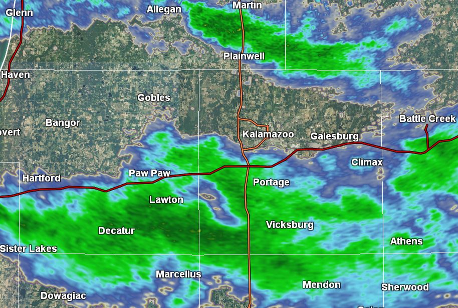
A persistent band of heavy snow parked over southern Van Buren and Kalamazoo counties between 8:00 and 11:30 pm. Large snow crystal aggregates piled up quickly, reaching over 8 inches between Decatur, Lawton, and Schoolcraft. An isolated 10-12 inches was also measured.
US Dept of Commerce
National Oceanic and Atmospheric Administration
National Weather Service
Grand Rapids, MI
4899 Tim Dougherty Drive SE
Grand Rapids, MI 49512-4034
616-949-0643
Comments? Questions? Please Contact Us.

