
Flash flooding threatens areas from the Tennessee Valley to the Carolinas as storms repeat along a stalled front. Monsoonal storms may trigger flooding in the Southwest. Dangerous heat expands across the Desert Southwest, Plains, mid-Mississippi Valley and Southern Tier. Critical fire weather for interior Pacific Northwest. Cooler, drier air brings brief relief to the Great Lakes and Northeast. Read More >
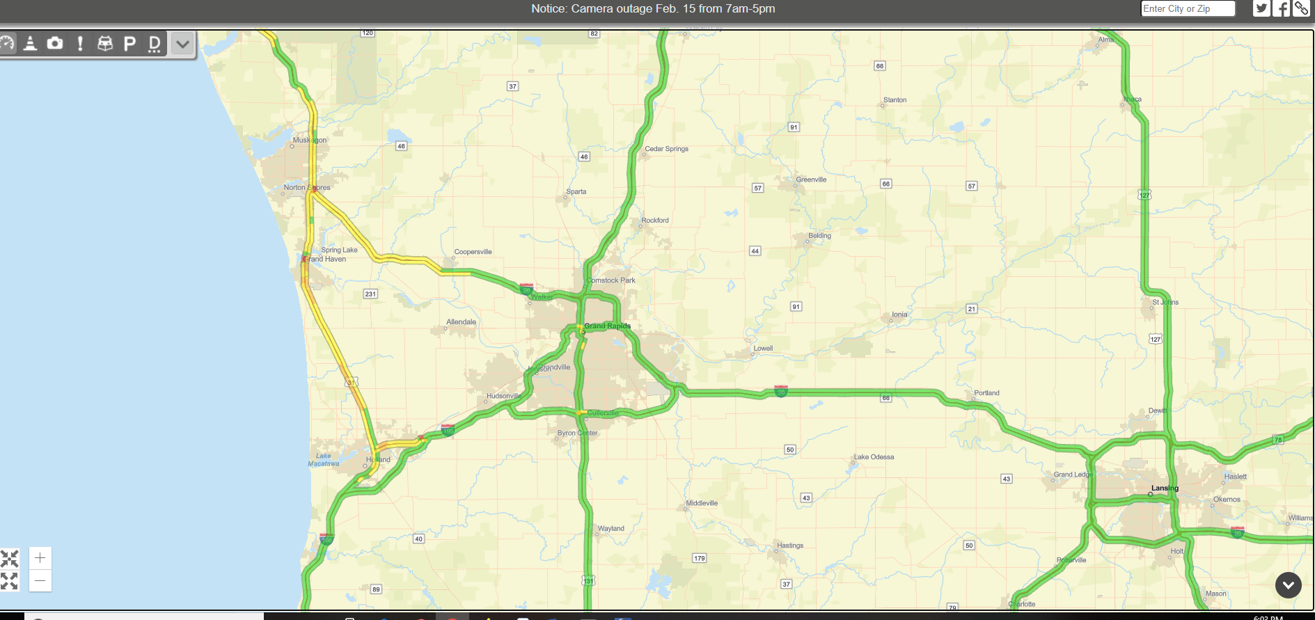 The heavy snow band was causing slow travel between Holland and Norton Shores on US-31. Driving speeds were most reduced near Spring Lake.
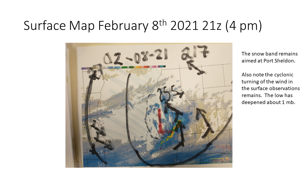
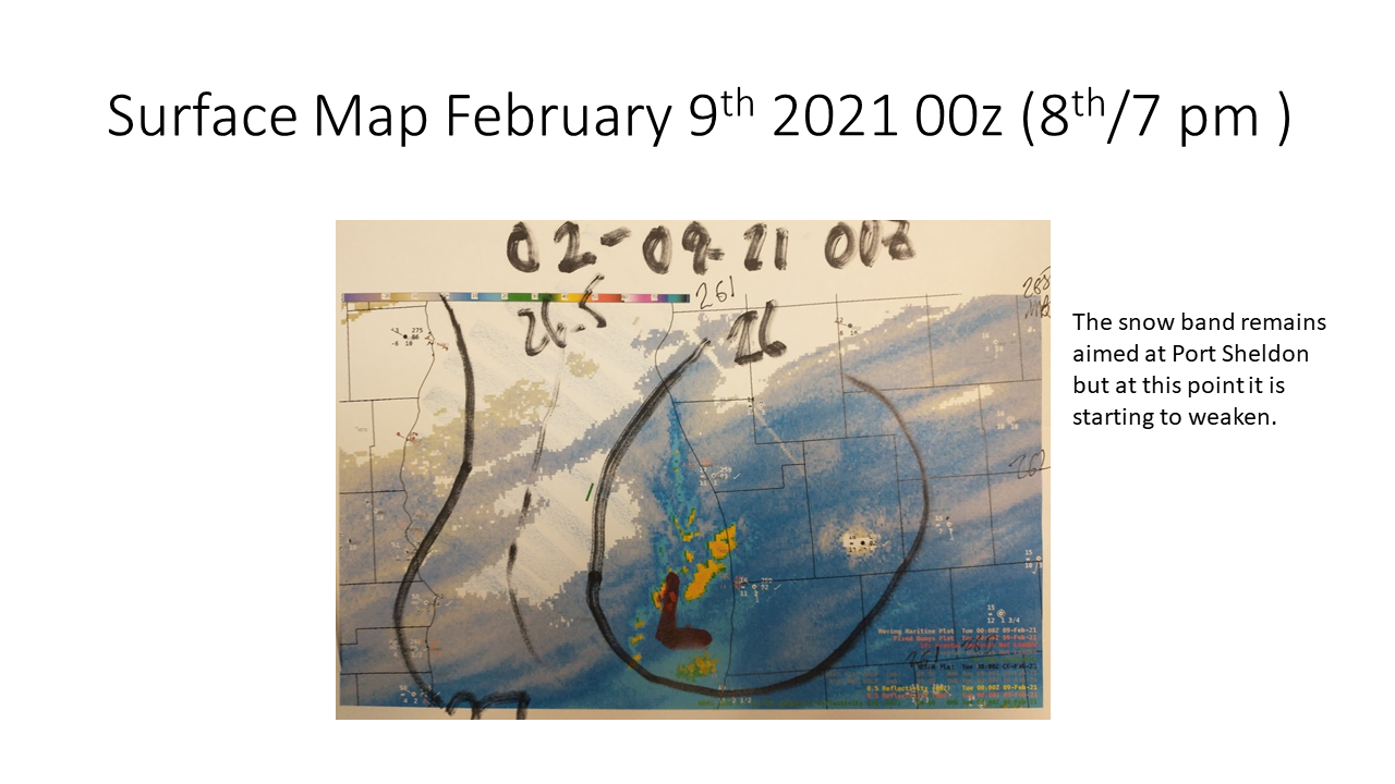
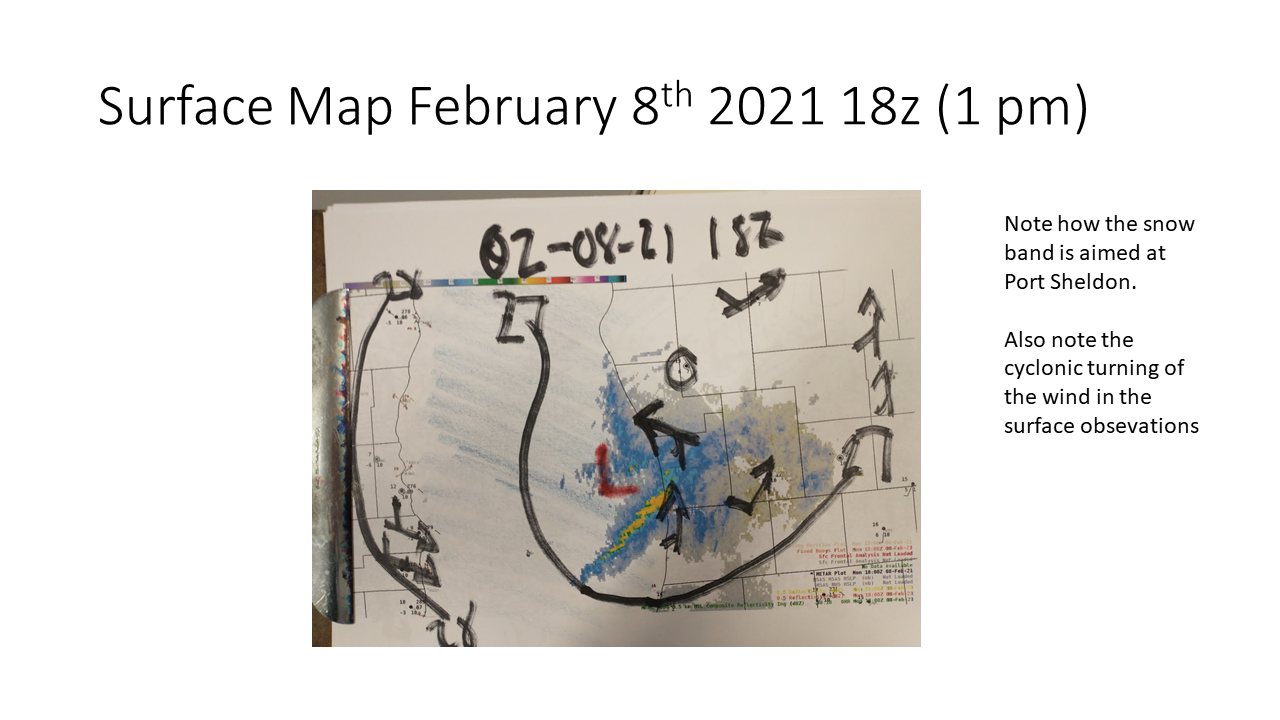 Surface map when the snow was the heaviest.
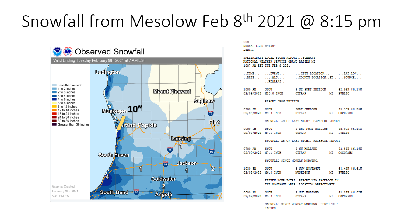
 |
Media use of NWS Web News Stories is encouraged! |
|

