
Widespread life-threatening flash and urban flooding continues in south-central Texas, with considerable flooding impacts possible across central Texas. Wildfire smoke is impacting air quality across much of the Great Lakes region into southern New England and the Mid-Atlantic. Monsoonal thunderstorms may produce isolated to scattered flash flooding across the Southwest into the Great Basin. Read More >
.PNG)
This shows the snowfall for each of the 3 days of this heavy snow event. Wednesday was the day with the most snowfall in the our Northwest Counties. Also note that on Thursday the area of heavy snowfall shifted southward along the lake shore. It was on Thursday when the snowfall was actually the heaviest.
.PNG)
This is this events grand total snowfall. Decatur was the big winner for the greatest snowfall with 20 inches. It should be noted that the area from Holland to Grand Rapids also had similar heavy snowfall amounts in the range of 1.5 feet.
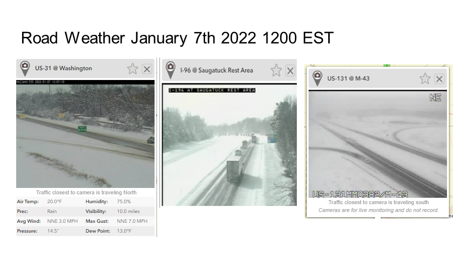
.PNG)
This map shows the actual snowfall reports from various sources during this winter storm event.
.PNG)
.PNG)

 |
Media use of NWS Web News Stories is encouraged! |
|

