
Dangerous heat will expand from the Gulf Coast into the Southern Plains and Desert Southwest through week's end. Additional extreme heat impacting the Pacific Northwest will shift to the northern Plains by the weekend. Tropical Storm Bertha is expected to continue to impact portions of the northwestern Gulf Coast from south central Louisiana to the upper Texas coast today. Read More >
Grand Rapids, MI
Weather Forecast Office
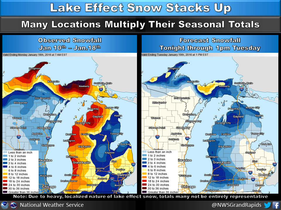
Additional snowfall is expected tonight into Tuesday morning.
Lake effect snow is highly variable. If you have taken a measurement or would like to give us an estimate of what has fallen in your area since the snow began, we would appreciate your reports.
Please go to the following form and submit your report. The data is delivered directly to NWS Meteorologists within a minute of submission. Please note, measurements in the drop down menu are in whole numbers. It is important to add detail (amount to the tenth, blowing snow, drifting snow, hazardous travel conditions, if observed etc.) in the field provided at the bottom of the form.
Link: https://www.srh.noaa.gov/StormReport/SubmitReport.php?site=grr
US Dept of Commerce
National Oceanic and Atmospheric Administration
National Weather Service
Grand Rapids, MI
4899 Tim Dougherty Drive SE
Grand Rapids, MI 49512-4034
616-949-0643
Comments? Questions? Please Contact Us.

