Dangerous heat will expand from the Gulf Coast into the Southern Plains and Desert Southwest through week's end. Additional extreme heat impacting the Pacific Northwest will shift to the northern Plains by the weekend. Tropical Storm Bertha is expected to continue to impact portions of the northern Gulf Coast from the western Florida Panhandle to southeastern Louisiana through tonight. Read More >
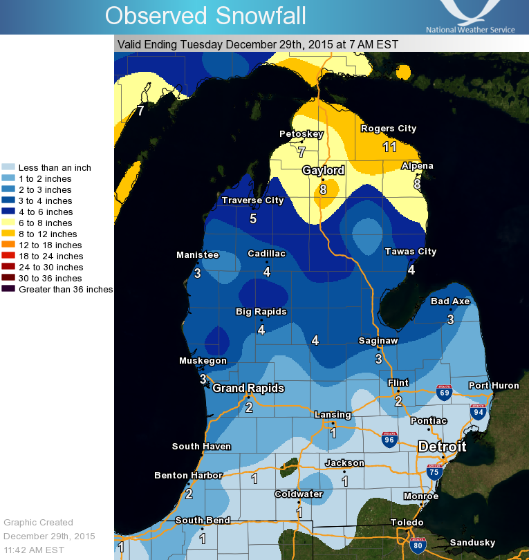
On Monday, December 28, 2015, low pressure tracked north through the western Great Lakes, producing a significant winter storm for much of the region. Lower Michigan received a combination of snow, sleet, and freezing rain. The freezing rain was mainly confined to far Southern Lower Michigan, where up to a quarter inch of ice accumulated. Much of Southwest Lower Michigan reported 1-4 inches of sleet (see reports HERE), while heavier snow fell across Northern Lower Michigan.
Here is a radar loop of the event between 11 AM to 11 PM Monday
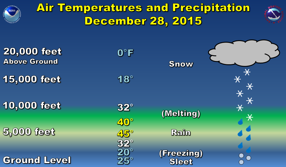
The accumulations as far north as Ludington were mainly in the form of sleet, while the heavier amounts up toward Gaylord were in the form of wet snow. It is unusual to have sleet falling for several hours. A layer of air warmer than freezing was located about 6,000 feet above the ground. This caused snow to melt into rain as it fell through this layer. Below this, air well below freezing from the ground up to about 2,500 feet caused the rain to freeze into sleet. Very strong, cold winds blowing in from the east helped keep cold temperatures in place near the ground, which allowed the sleet to persist well into the evening. Below is a graphic illustrating this process.