
Severe weather and flooding threats will continue for portions of the central U.S. through Thursday, focused from the central High Plains to the Mid-Mississippi Valley. Hot and dry conditions will fuel fire weather concerns for the Intermountain West, and dry thunderstorms may spark additional wildfires. Dangerous heat will build across the southern U.S. Friday into the weekend. Read More >
Overview
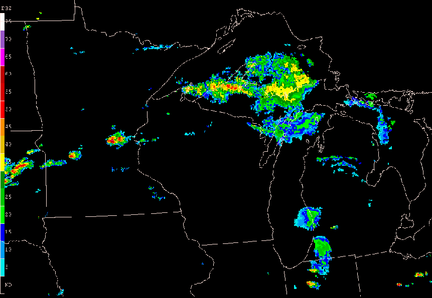
One of the most powerful Michigan storm systems in recent history occurred the morning of May 31, 1998. A cluster of storms developed over South Dakota the evening of May 30 and organized into a rapidly moving line over Minnesota. The storm raced across Wisconsin, Lower Michigan, Ontario, and upstate New York at speeds averaging 65 mph.
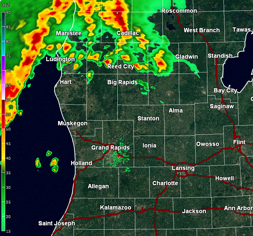
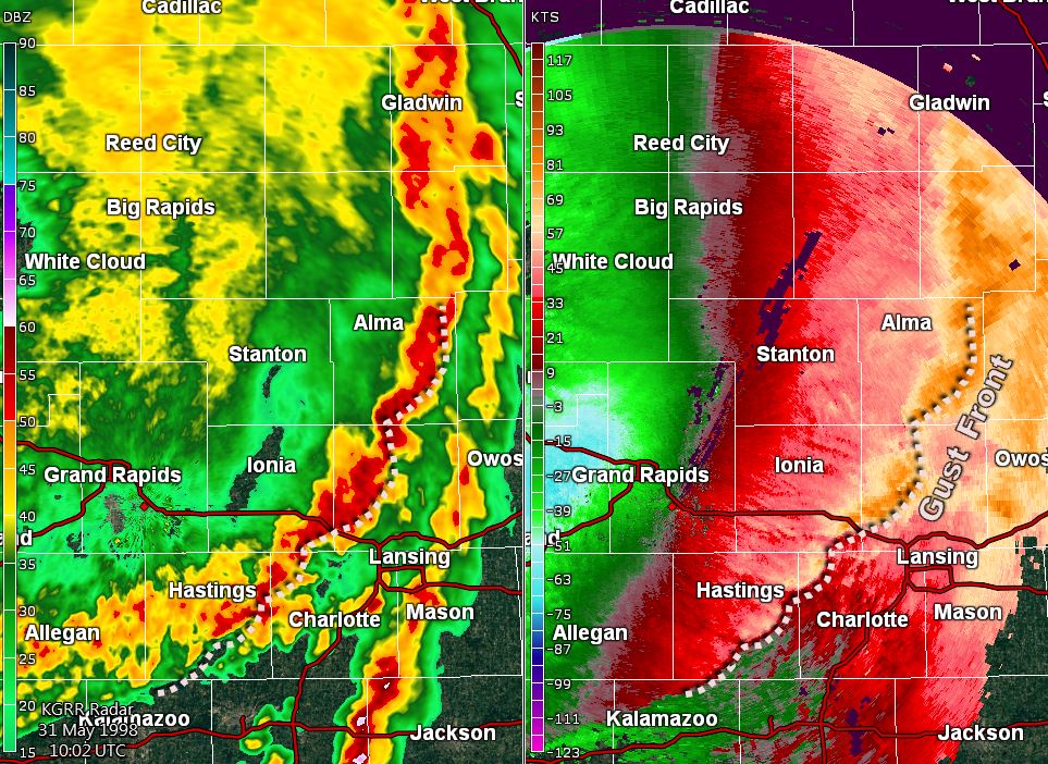
Radar analysis from Grand Rapids indicates the strongest part of the storm (between Ludington, Holland, Bay City, and Lansing) moved across West Michigan at 80 mph or more. Wind measurements between 60 and 90 mph were common, and the magnitude of damage indicated that winds gusted as high as 130 mph in Spring Lake and Walker. The radar animation below happened between 4:26 and 6:22 AM EDT.
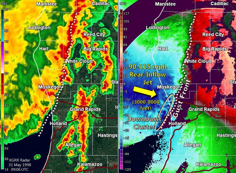
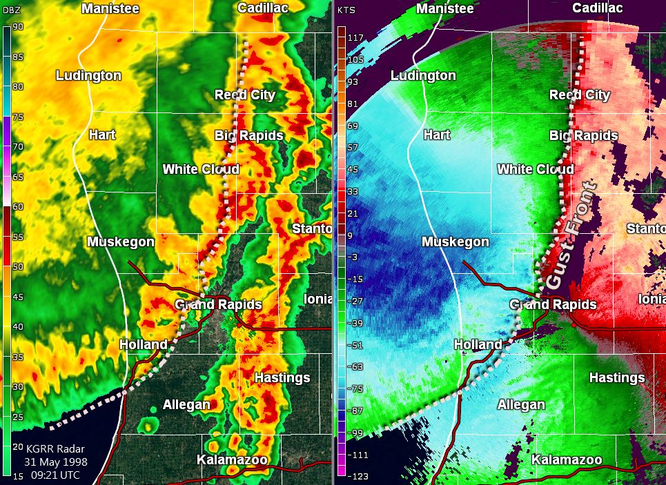
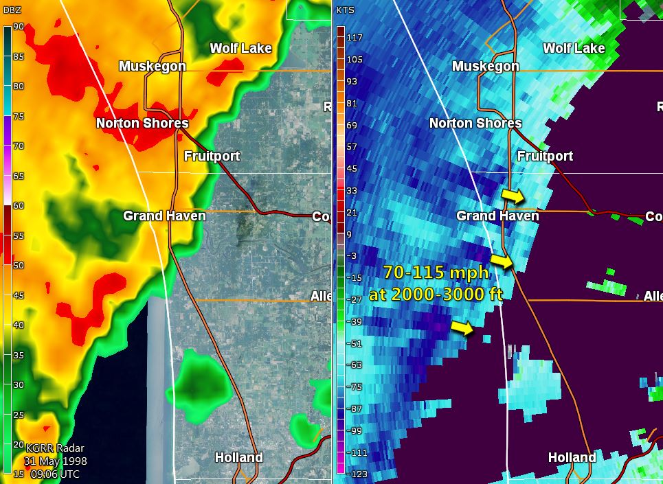
Wind velocity measurements from the Grand Rapids radar show the exceptionally strong nature of the gust front associated with this storm. Winds several thousands of feet above ground were 90 to 115 mph. Near the surface, winds greater than 60 mph were common, and several bursts exceeding 90-110 mph were measured. Click on each image below to expand to full-size.
 |
 |
 |
| 5:06 AM EDT | 5:21 AM EDT | 6:02 AM EDT |
 |
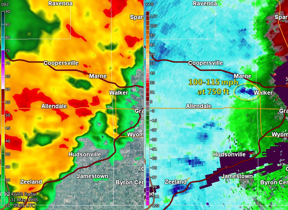 |
| 5:06 AM EDT Grand Haven - Spring Lake | 5:21 AM EDT Walker - Zeeland |
Learn more about "derecho" thunderstorms

Click on the image to learn more about safe boating
 |
Media use of NWS Web News Stories is encouraged! |
|

