
A few severe thunderstorms with large hail and damaging winds are possible this evening into tonight from eastern Kansas into western and central Missouri. Thunderstorms with heavy to excessive rainfall may produce flooding through tonight over parts of the northern High Plains, central Missouri, and along the Florida/Georgia line. Read More >
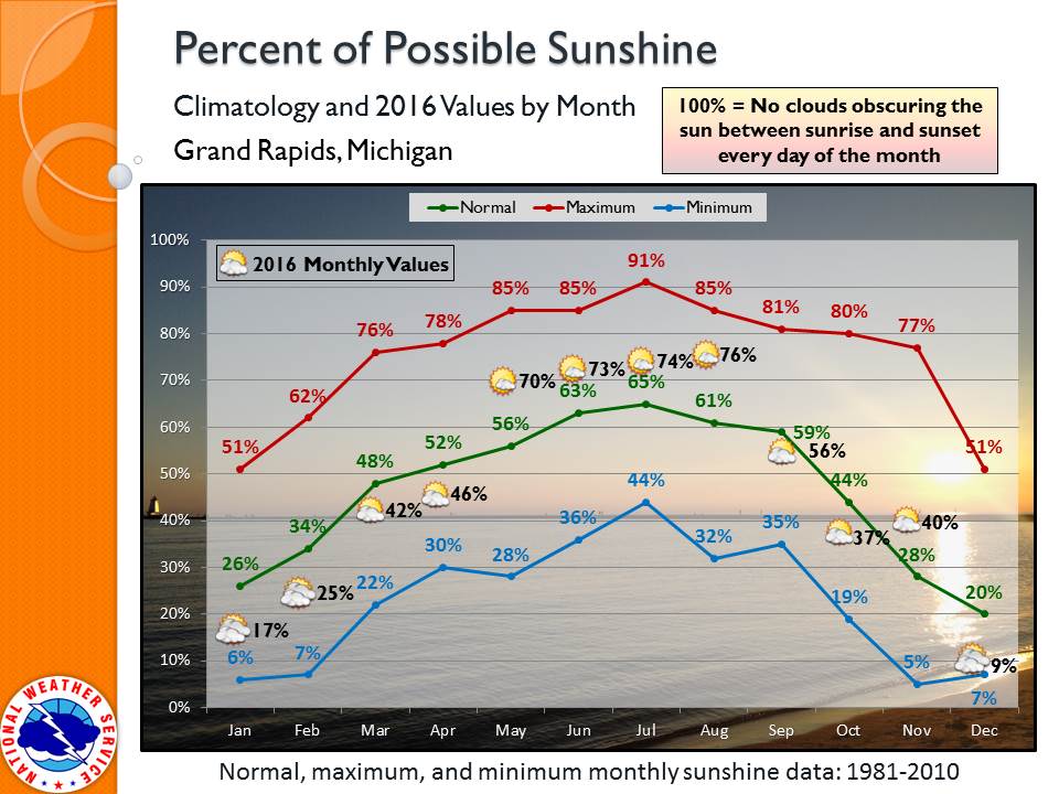
July, usually our sunniest month, was sunnier than average this year. This was the third month in a row we beat the average.
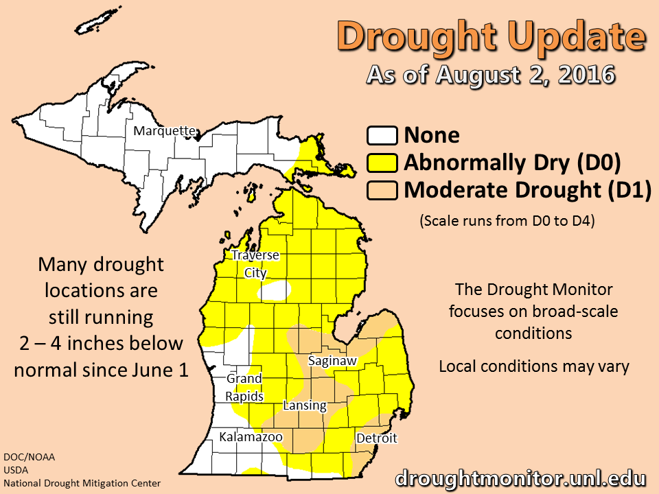
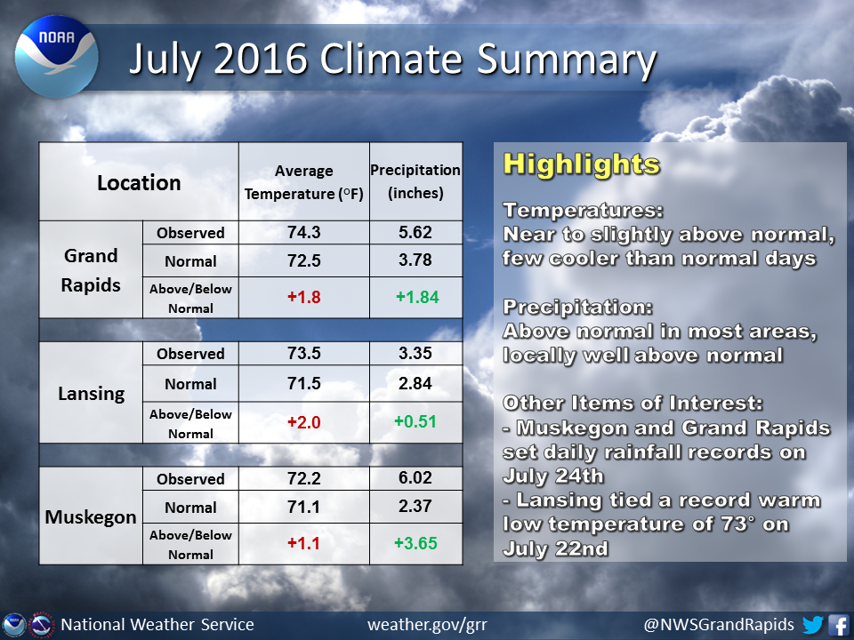
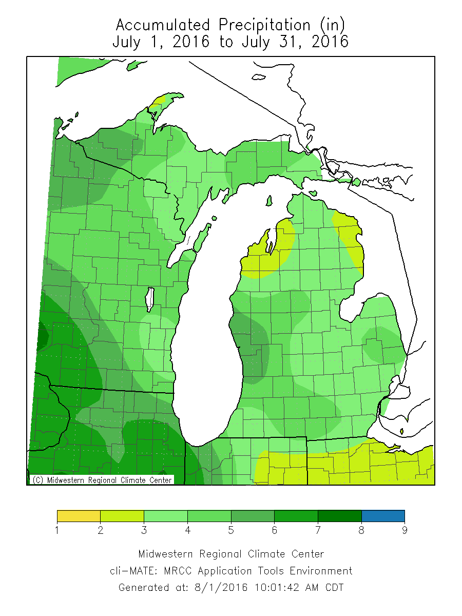
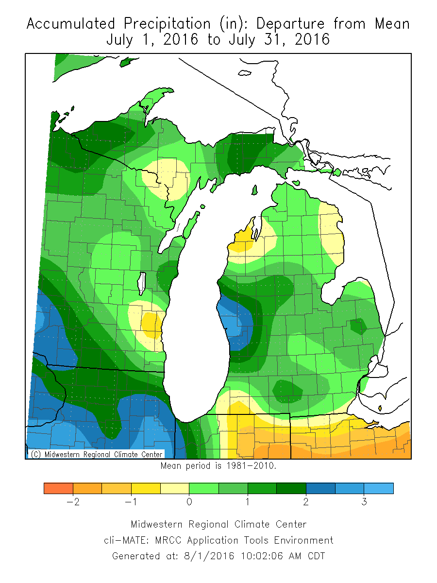
Drought update: Heavy rainfall was very spotty in the past week, and many of the locations in the drought did not receive the lion's share. Though local conditions can vary considerably over the course of a few miles, the broad-scale conditions remain in the moderate drought range for much of central to southeast Lower Michigan. There was some improvement in western Lower Michigan the past 2 weeks. Lansing still has a lot of ground left to gain after having its 3rd driest June on record.
 |
Media use of NWS Web News Stories is encouraged! |
|

