
Dry and windy conditions will bring widespread fire weather concerns to the northern/central Plains and portions of the Southwest into the southern Plains. Severe thunderstorms with large hail and damaging wind gusts are possible over the central Plains today into this weekend. Rain and high elevation snow is expected over parts of the Cascades and Northern Intermountain Region through Saturday. Read More >
Grand Rapids, MI
Weather Forecast Office
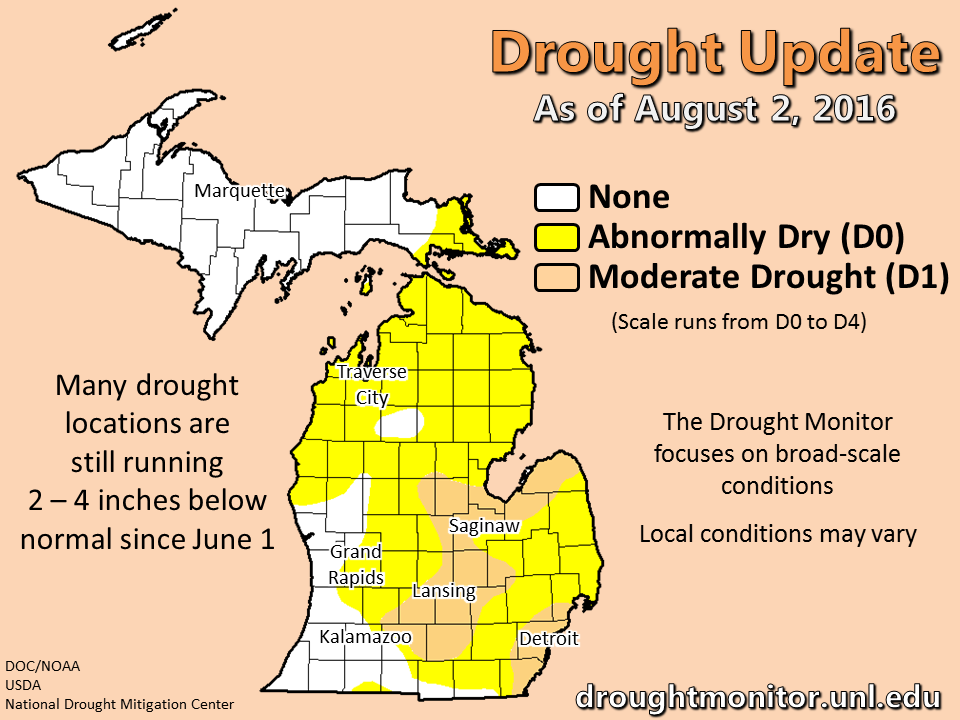
Drought update: Heavy rainfall was very spotty in the past week, and many of the locations in the drought did not receive the lion's share. Though local conditions can vary considerably over the course of a few miles, the broad-scale conditions remain in the moderate drought range for much of central to southeast Lower Michigan. There was some improvement in western Lower Michigan the past 2 weeks. Lansing still has a lot of ground left to gain after having its 3rd driest June on record.
 |
Media use of NWS Web News Stories is encouraged! |
|
US Dept of Commerce
National Oceanic and Atmospheric Administration
National Weather Service
Grand Rapids, MI
4899 Tim Dougherty Drive SE
Grand Rapids, MI 49512-4034
616-949-0643
Comments? Questions? Please Contact Us.

