
Dry and windy conditions will bring widespread fire weather concerns to the northern/central Plains and portions of the Southwest into the southern Plains. Severe thunderstorms with large hail and damaging wind gusts are possible over the central Plains today into this weekend. Rain and high elevation snow is expected over parts of the Cascades and Northern Intermountain Region through Saturday. Read More >
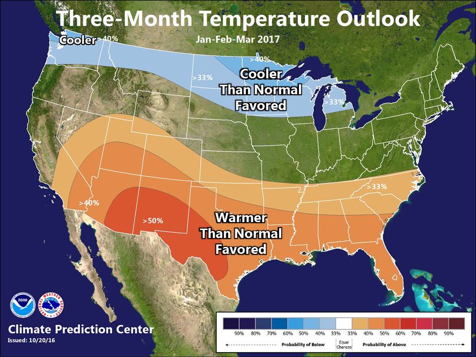 Very mild conditions stretched through October with above normal temperatures extending into early November. Medium to long range forecasts suggest that above normal conditions could play a role through much of November. Despite the mild start to what is typically the cold season, the overall pattern is expected to favor cooler than normal temperatures through the second half of the winter.
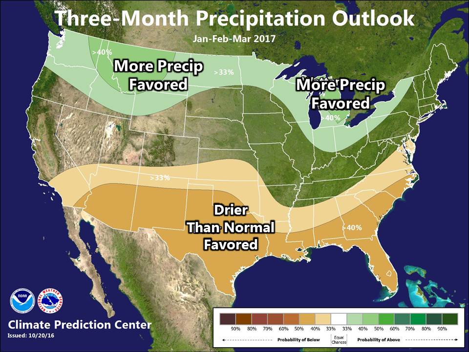
Wetter than normal conditions may continue from fall through the entire winter. Couple the above normal precipitation with below normal temperatures through the late half of the winter season and it could result a rough end to the winter season. The good news is that the warmer start to the winter season could limit snowfall to periodic synoptic (storm systems) snowfall, as opposed to more frequent lake effect snow (snow resulting from cold air passing over the warm lake).
 |
Media use of NWS Web News Stories is encouraged! |
|

