
A widespread heat wave will peak over the South and East today, with several dozen temperature records expected along the East Coast. Heat should begin to ease this weekend in the Northeast, while hazardous heat continues over the South. Severe thunderstorms capable of damaging winds are possible across parts of the Appalachians, Mid Atlantic, and Northeast this afternoon and evening. Read More >
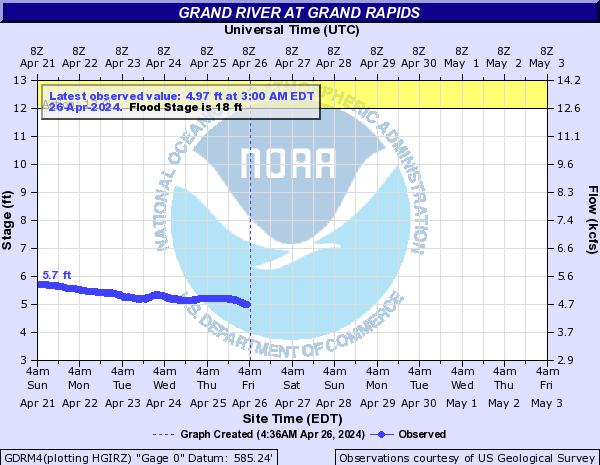
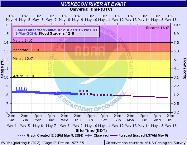
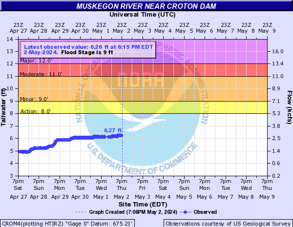
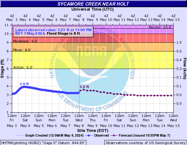
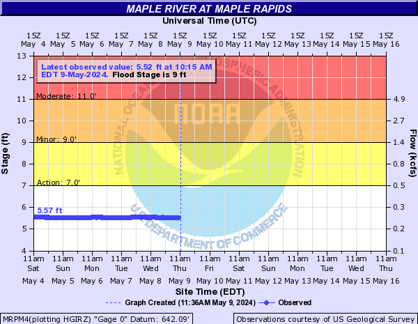
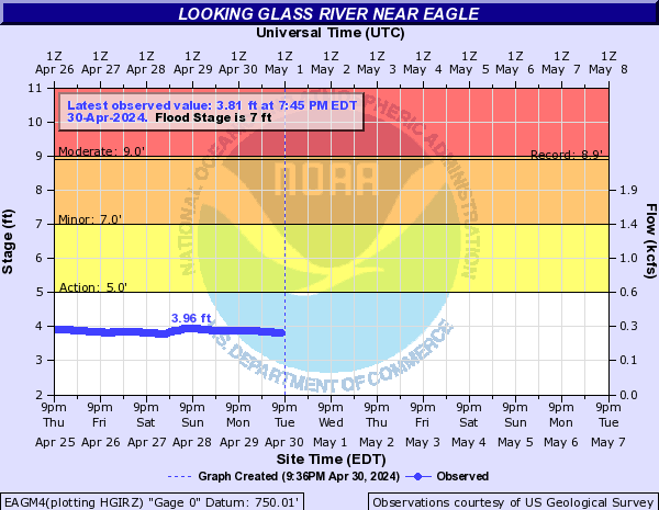
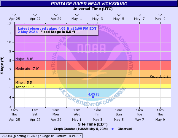
The blue curve on the left half of the chart is the measured river level over the past several days.
The purple curve on the right half of the chart is the forecast river level over the next week.
Forecasts take into account expected precipitation amounts over the next 24 hours.
Click on a chart for additional information about that river point, including flood impact levels and crest history.
Click here for current information on all river levels around the area. The river points below are only a partial selection.
 |
 |
 |
|
Previous Crest: 17.9 feet, April 10 |
Previous Crest: 15.0 feet, April 10 |
Previous Crest: 22.1 feet, April 8 |
 |
 |
 |
|
Previous Crest: 10.5 feet, April 20 |
Previous Crest: 8.4 feet, April 7 |
Previous Crest: 8.8 feet, April 7 |
 |
 |
 |
|
Previous Crest: 9.7 feet, April 7 |
Looking Glass River near Eagle Previous Crest: 8.4 feet, April 7 |
|
Click here for the most recent flood warning bulletins.
Click here for the most recent flood advisory bulletins.
 |
Media use of NWS Web News Stories is encouraged! |
|

