National Weather Service United States Department of Commerce

Warm Temperatures The Rest of the Week

Persistent warmth will continue several more days, though there are signs of it cooling closer to normal with highs in the 70s next week. There is a slight chance of a shower or thunderstorm on Friday, and chances for showers during the first part of next week. Read More >


Snow Friday afternoon Into Saturday Morning
 
* Narrow, but intense, bands of snow near lakeshore
* Locally heavy snowfall (some areas, even near Lake Michigan will receive hardly any)
* Additional amounts as high as 6" (very localized) from Friday afternoon into Saturday morning
* Large changes in visibility and snow intensity, even over a short distance, as bands of snow shift around
* Breaks in snowfall will occur
* Light snow all of West Michigan Sunday


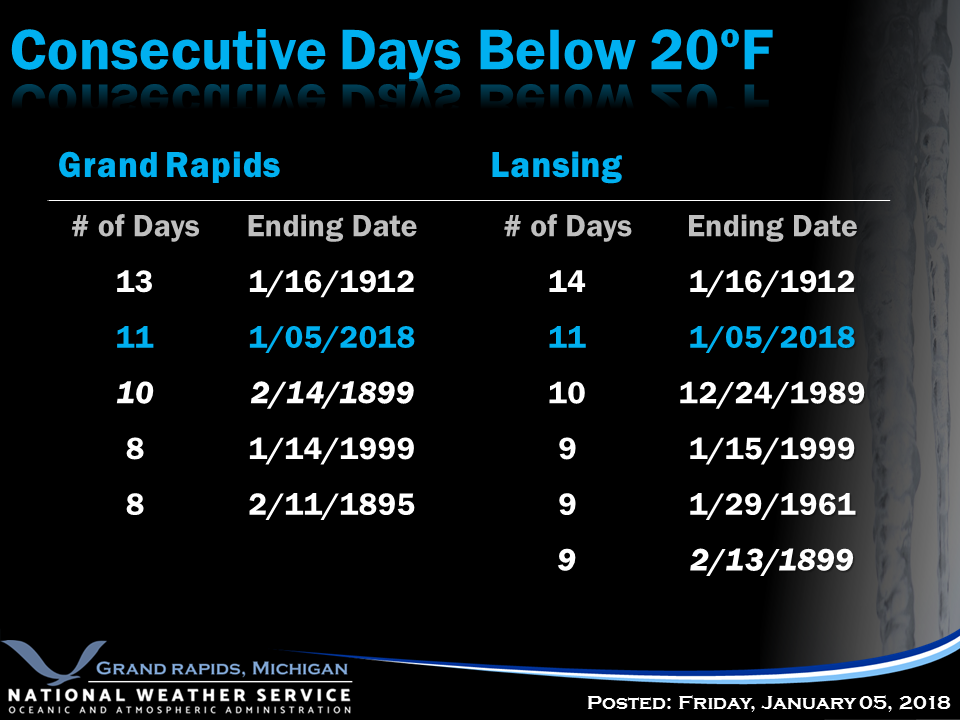
While Muskegon has broken their stretch of days below 20 degrees, Grand Rapids and Lansing will build on their current streaks. Both sites will rank second all-time (12 days) for such a streak after temperatures rise above 20 on Sunday.


nws logo             

Media use of NWS Web News Stories is encouraged!
            Please acknowledge the NWS as the source of any news information accessed from this site.


Return to NWS Grand Rapids Home Page

            
nws logo