
Dangerous heat will expand from the Gulf Coast into the Southern Plains and Desert Southwest through week's end. Additional extreme heat impacting the Pacific Northwest will shift to the northern Plains by the weekend. Tropical Storm Bertha is expected to continue to impact portions of the northern Gulf Coast from the western Florida Panhandle to southeastern Louisiana through tonight. Read More >
Grand Rapids, MI
Weather Forecast Office
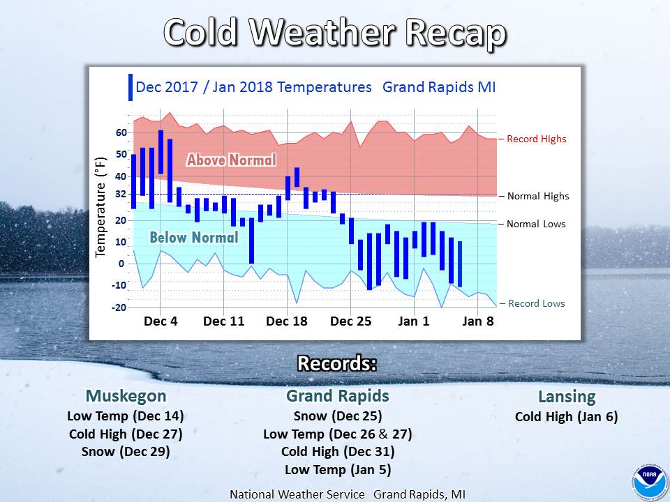
The stretch of very cold and at times record-breaking weather approached two weeks longevity. Dec 25-31 was the coldest final week to any year on record. Temperatures stayed below 20 degrees for 12 days in a row at Grand Rapids -- one day shy of the record (1912).
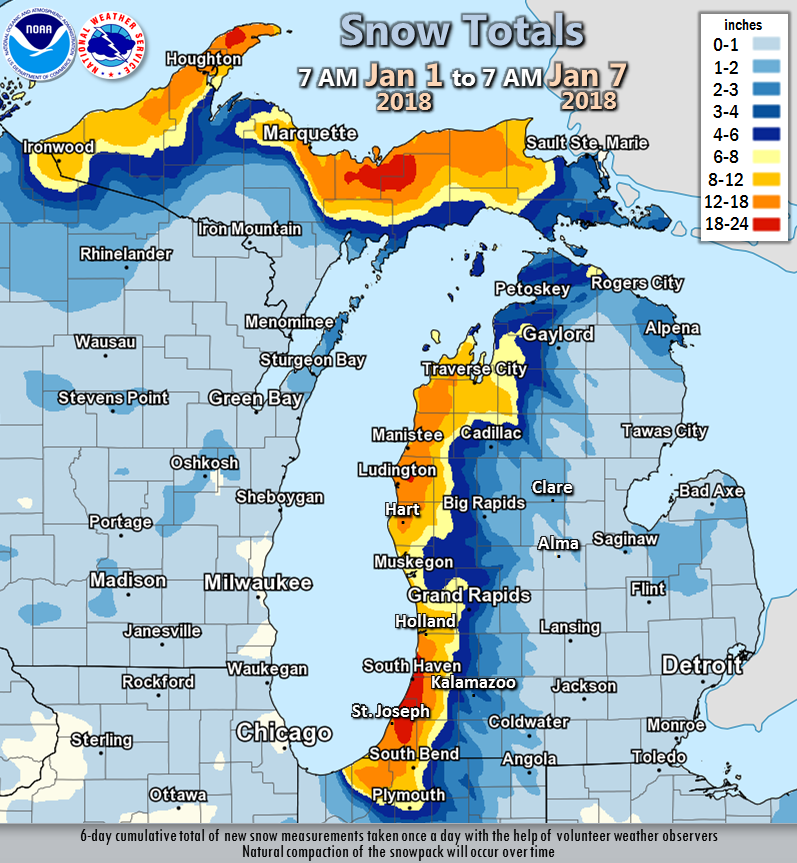
Lake-effect snow produced large totals downwind of the lakes the first week of January, bit little snow fell elsewhere. The lake-effect snow was often observed to be "fluffy" and would gradually settle and compact over time.
 |
Media use of NWS Web News Stories is encouraged! |
|
US Dept of Commerce
National Oceanic and Atmospheric Administration
National Weather Service
Grand Rapids, MI
4899 Tim Dougherty Drive SE
Grand Rapids, MI 49512-4034
616-949-0643
Comments? Questions? Please Contact Us.

