A storm system will bring heavy rainfall, thunderstorms, and flooding threats to portions of the Southern Plains Friday, the Lower Mississippi Valley Saturday, and the Southeast into the Mid-Atlantic on Sunday. High elevation snow and mixed precipitation and rain in the lower elevations will impact the Pacific Northwest this weekend before a stronger system moves in early next week. Read More >
Grand Rapids, MI
Weather Forecast Office
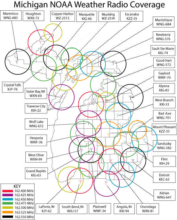
The image map below shows the location and frequencies of NOAA Weather Radio All Hazards transmitters across Lower Michigan. The rings show the approximate areal coverage for each transmitter. Clicking on the name label or the transmission tower icon for a site will display a detailed map of that tower's coverage area.

For a printable version of the coverage map, click here Note that the links will not work in the printable version.
US Dept of Commerce
National Oceanic and Atmospheric Administration
National Weather Service
Grand Rapids, MI
4899 Tim Dougherty Drive SE
Grand Rapids, MI 49512-4034
616-949-0643
Comments? Questions? Please Contact Us.

