
Tropical Depression Two is expected to gradually strengthen and could bring tropical storm conditions to the Florida Panhandle beginning late Monday. Areas of flash flooding will be possible through Thursday along the eastern and central Gulf Coast. Severe thunderstorms will develop and move along a cold front crossing the Upper Midwest Monday, and through the Ohio Valley/Mid-Atlantic on Tuesday. Read More >
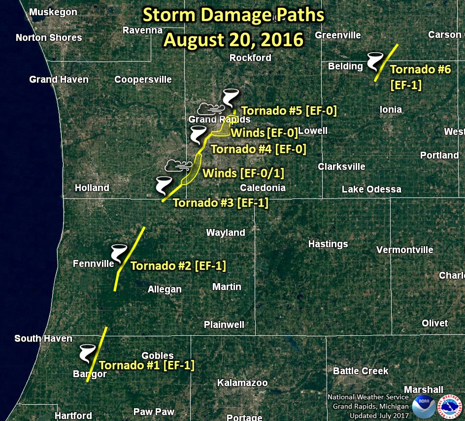
August 20th Tornadoes over Southwest Lower Michigan
Overview
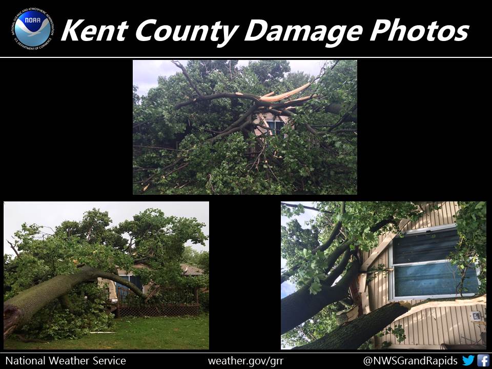
Between noon and 3 PM on August 20th, a total of 6 tornadoes formed in Western Lower Michigan. Over the Grand Rapids metro area, the storm produced a cyclical series of tornadoes and downdraft-related damaging wind gusts. See below for additional tornado strength and location information!
| Storm Damage | # of Injuries | # of Deaths | # of Wind Reports >= 59 mph | # of Hail Reports >= 1 in. | # of Tornado Reports |
| $4,625,000 | 0 | 0 | 0 | 0 | 7 |
1: EF-1 tornado between Bangor and north of Grand Junction, in Van Buren and southern Allegan Counties.
2: EF-1 tornado southeast of Fennville to east of Hamilton, in Allegan County.
3: EF-1 tornado south of Jamestown in far northern Allegan County and southeastern Ottawa County.
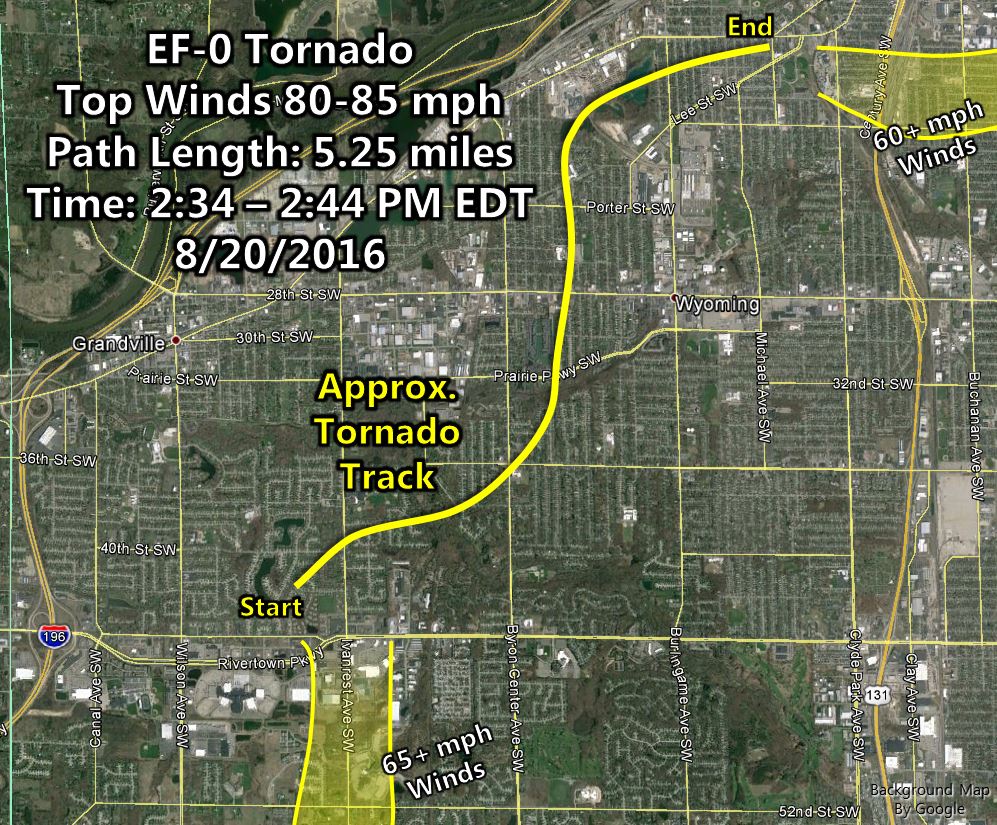
4: EF-0 tornado in Grandville and Wyoming in Kent County. EF-0 to EF-1 winds occurred leading up to this tornado in Byron Township to southern portions of Grandville.
5: EF-0 tornado in northeast Grand Rapids in Kent County. EF-0 winds also occurred leading up to this tornado in south-central Grand Rapids.
6: EF-1 tornado between Orleans and Fenwick in Ionia and Montcalm Counties.
"Feature-following" Radar Loop (YouTube)
Each tab at the top of this story contains more information about each tornado, including maps, photos, and radar loops.
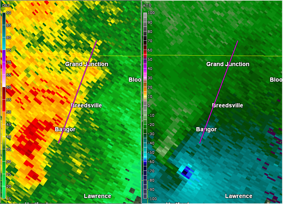
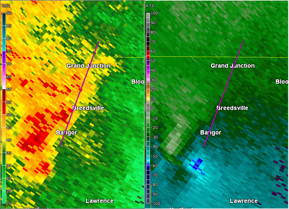
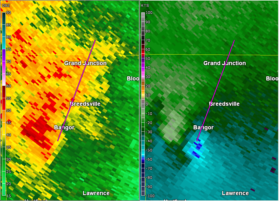
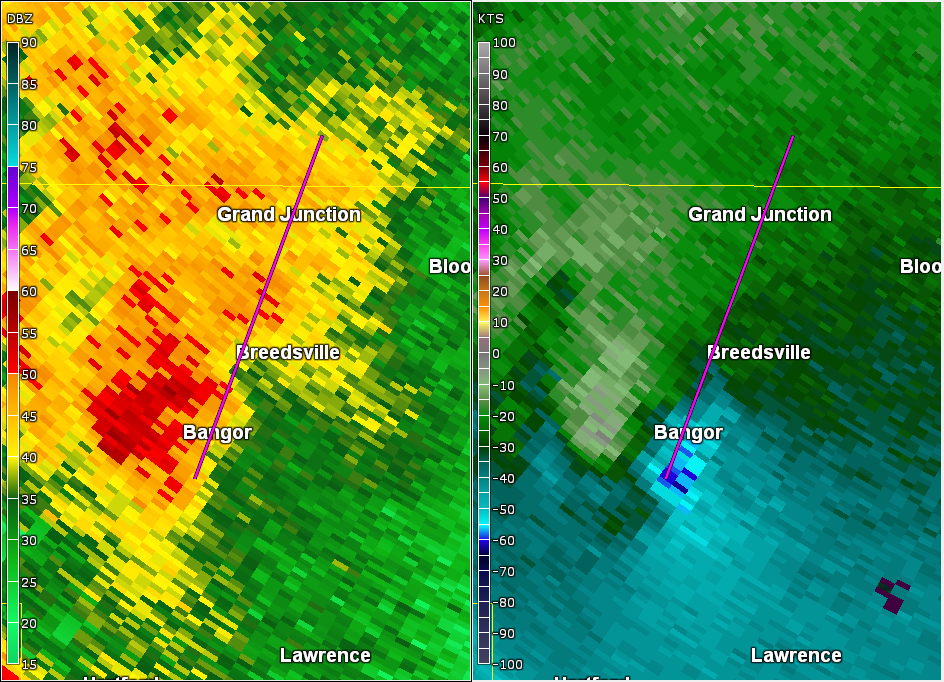
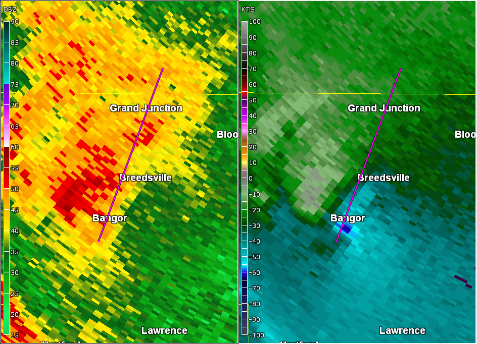
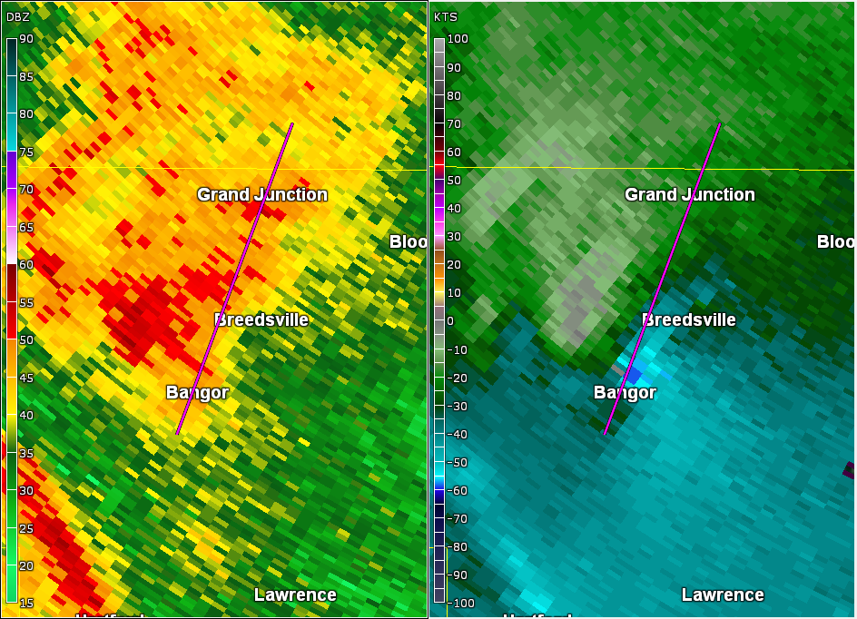
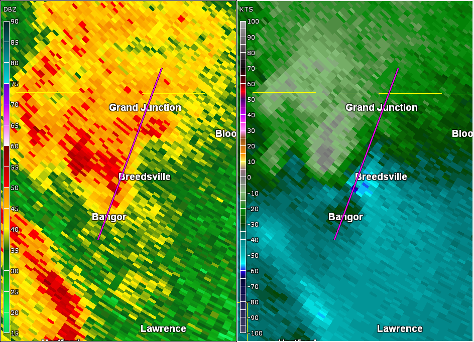
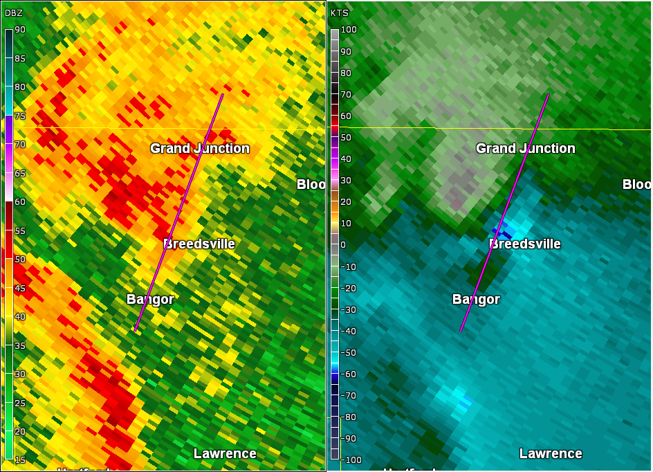
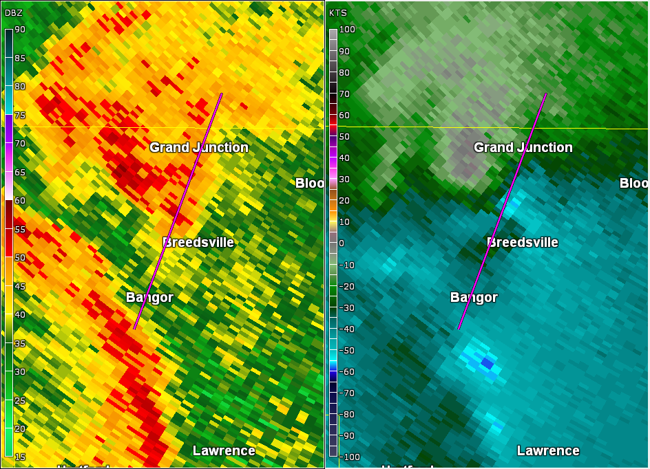
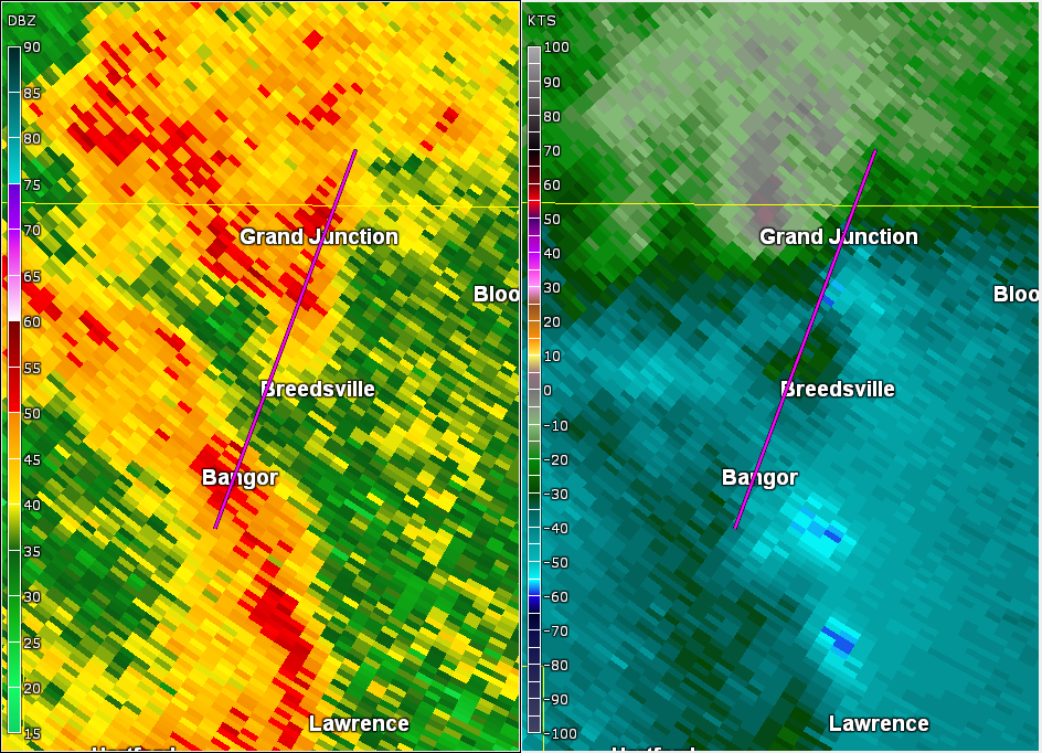
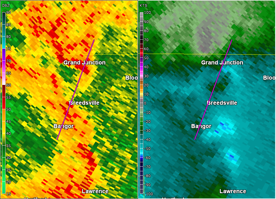
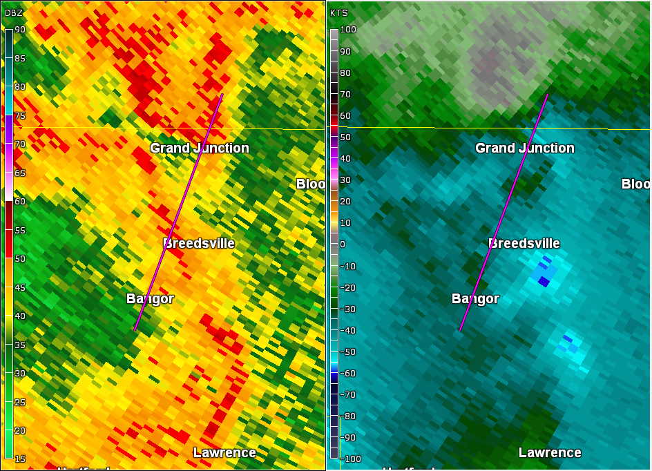
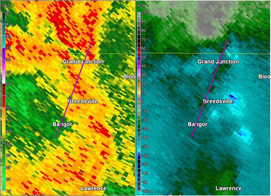
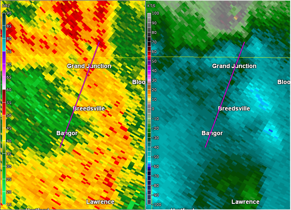
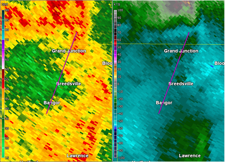
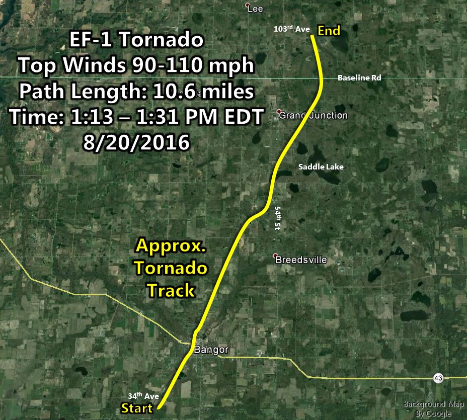
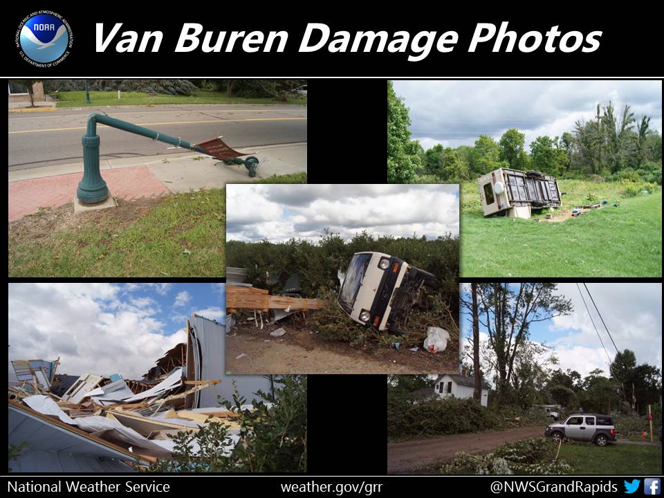
Bangor-Grand Junction EF-1 Tornado (Van Buren, Allegan Counties)
EF-1 tornado damage was found between Bangor and Grand Junction, ending in far southern Allegan County.
An EF-1 tornado touched down just southwest of Bangor Michigan on
Saturday, August 20th and tracked northeast through town. The entire
city lost power as well as hundreds of trees. Multiple structures in
Bangor were damaged as well. Roof damage was noted on Main Street.
New Beginning Ministries and the Bangor Police Department sustained
damage.

The tornado then tracked further northeast, causing significant
damage at True Blue Farms along County Road 215 and the Columbia
Township Hall in Grand Junction. The tornado tracked into extreme
southern Allegan County before lifting about 2.5 miles northeast of
Grand Junction on 103rd Ave west of 52nd Street.


Rating:                 EF-1
Estimated peak wind:    Between 90 and 110 mph
Path length:            Around 10.6 miles
Path width:             Approximately 50 to 150 yards
Fatalities:             0
Injuries:               0

Start date:             Aug 20 2016
Start time:             Approximately 113 PM EDT
Start location:         Around 1.5 miles southwest of Bangor
Start lat/lon:          42.296 N, 86.126 W

End date:               Aug 20 2016
End time:               Approximately 131 PM EDT
End location:           Around 2.5 miles northeast of Grand Junction
End lat/lon:            42.44 N, 86.055 W

EF Scale: The Enhanced Fujita Scale Classifies
Tornadoes into the following categories.

EF0...Weak......65 to 85 mph
EF1...Weak......86 to 110 mph
EF2...Strong....111 to 135 mph
EF3...Strong....136 to 165 mph
EF4...Violent...166 To 200 mph
EF5...Violent...>200 mph

NOTE:
The information in this statement is PRELIMINARY and subject to
change pending final review of the event and publication in
NWS Storm Data.
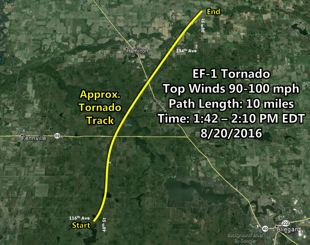
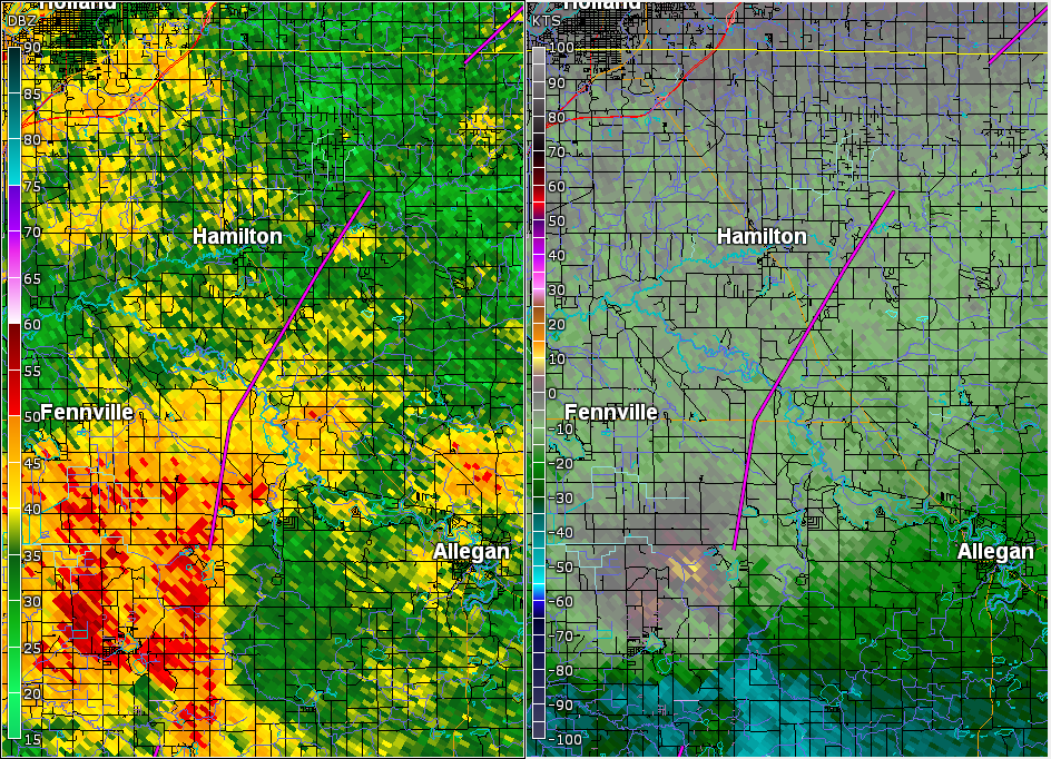
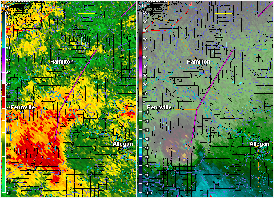
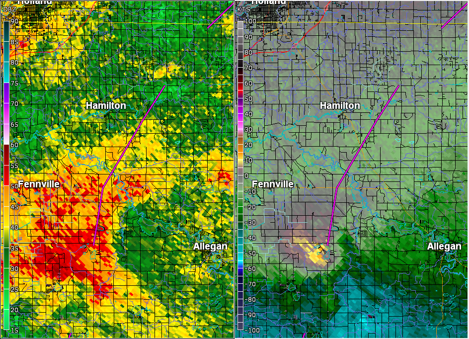
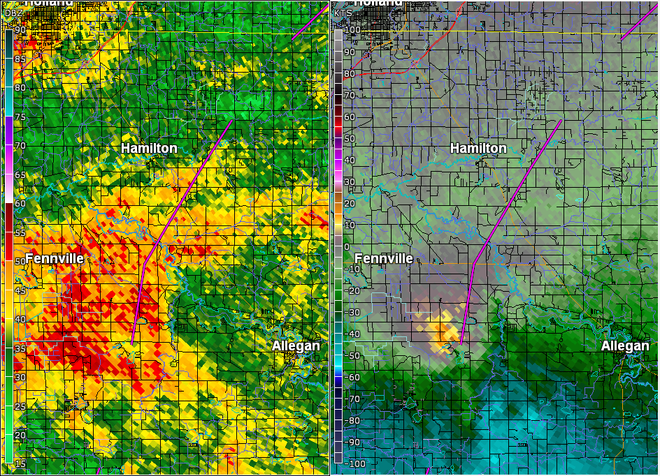
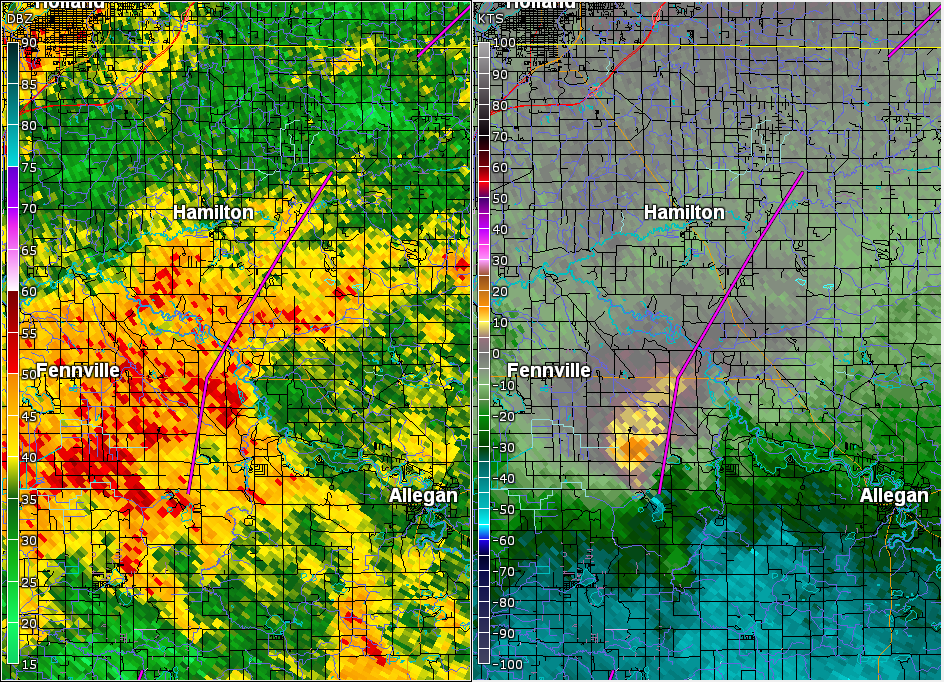
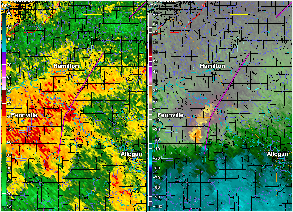
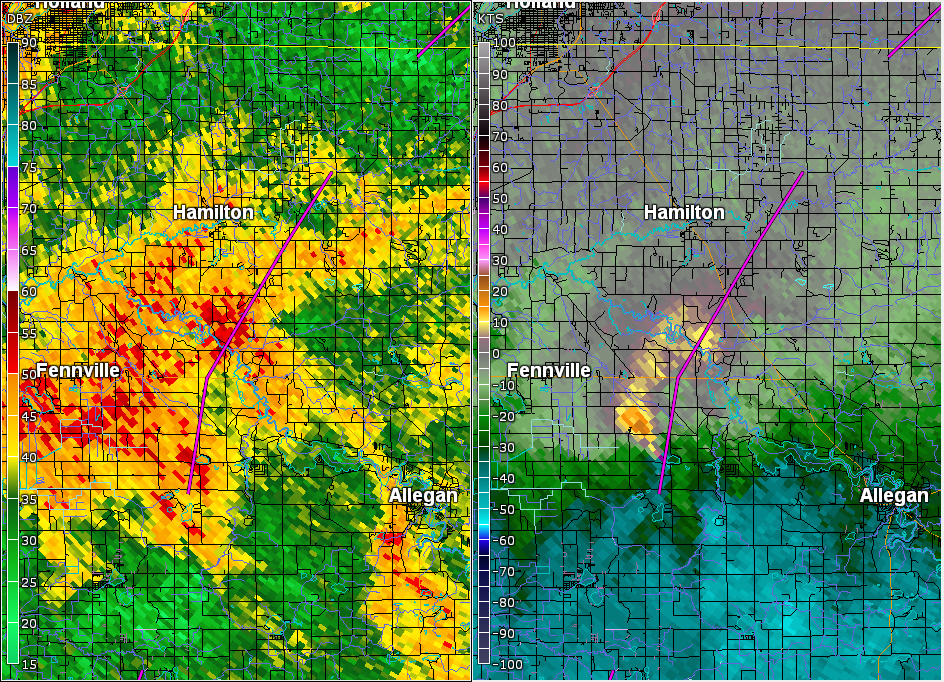
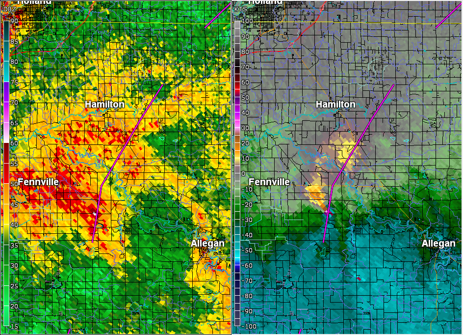
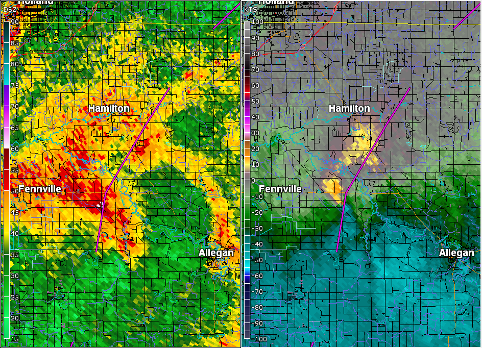
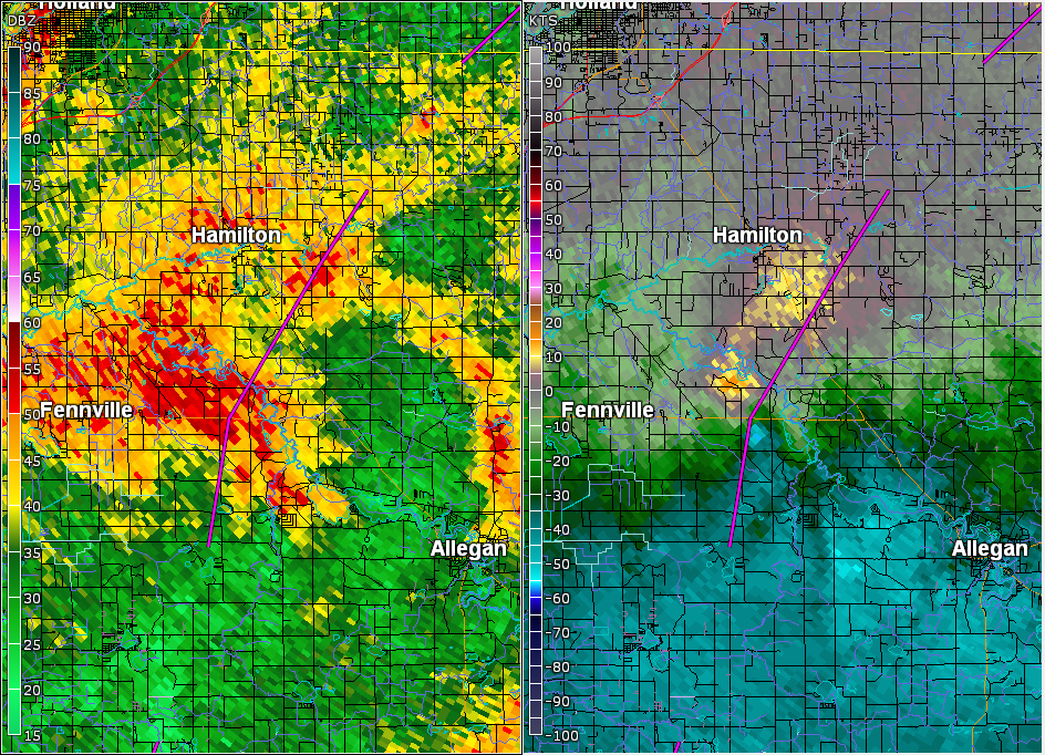
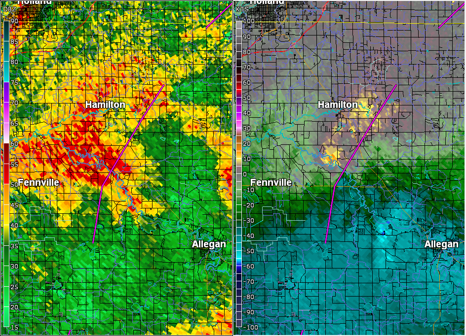
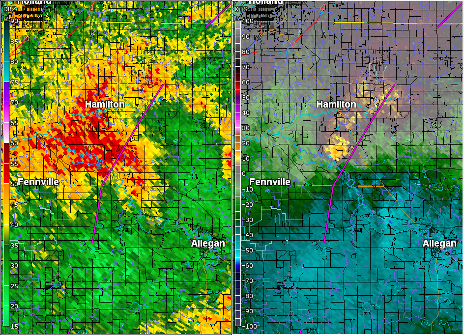
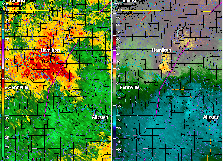
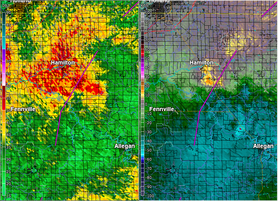
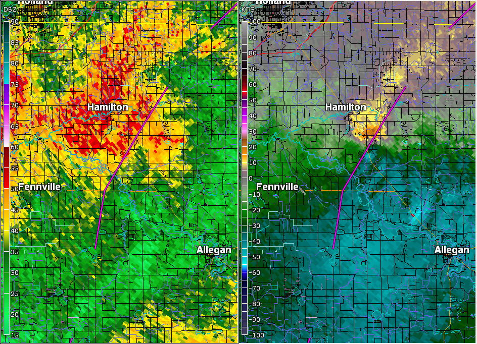
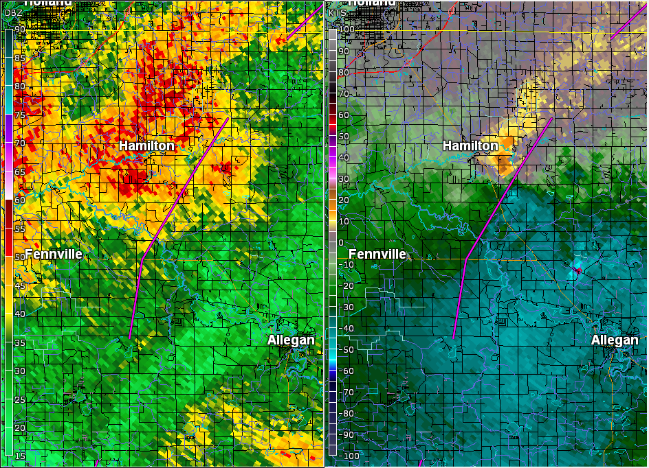
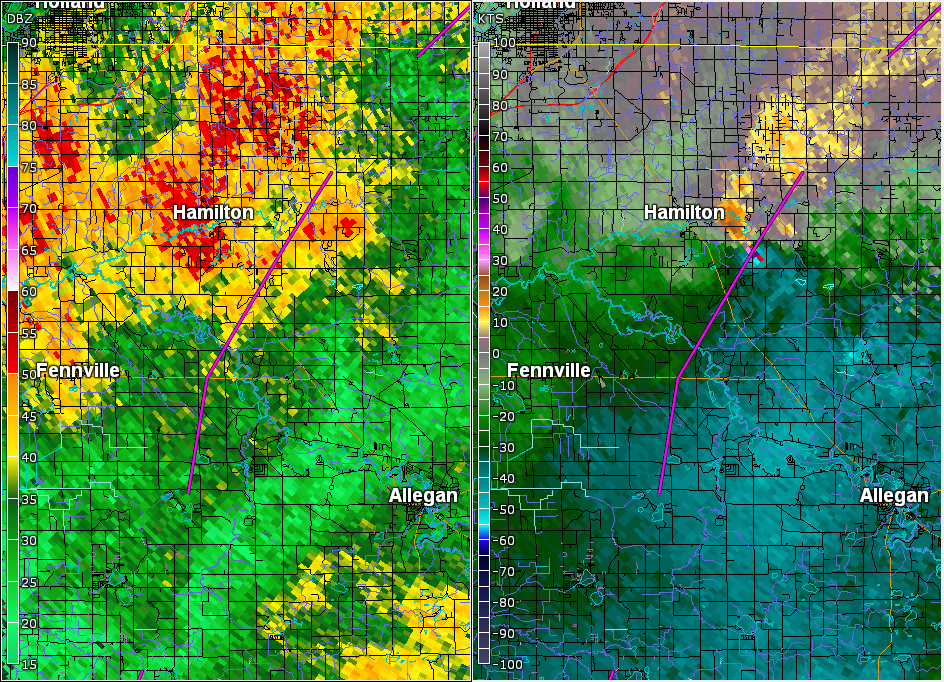
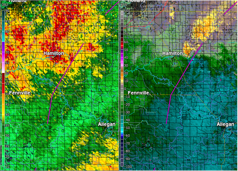
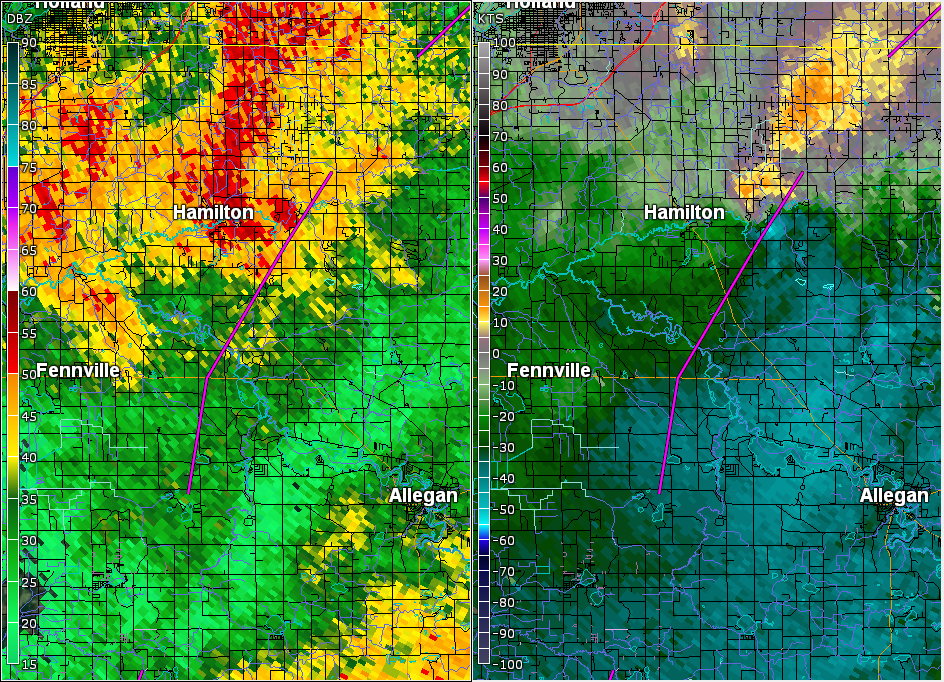
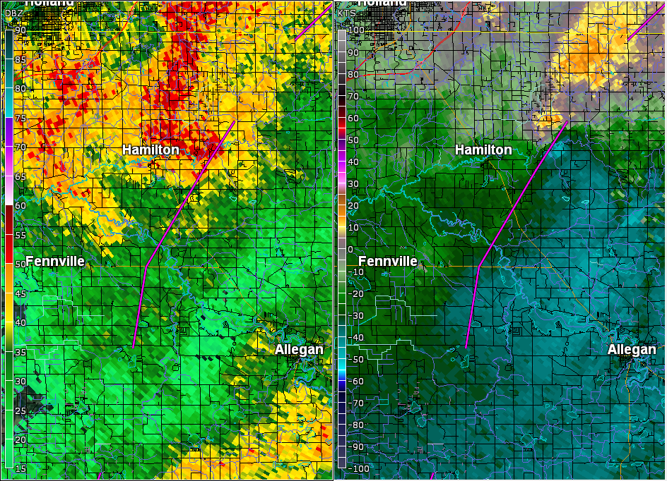
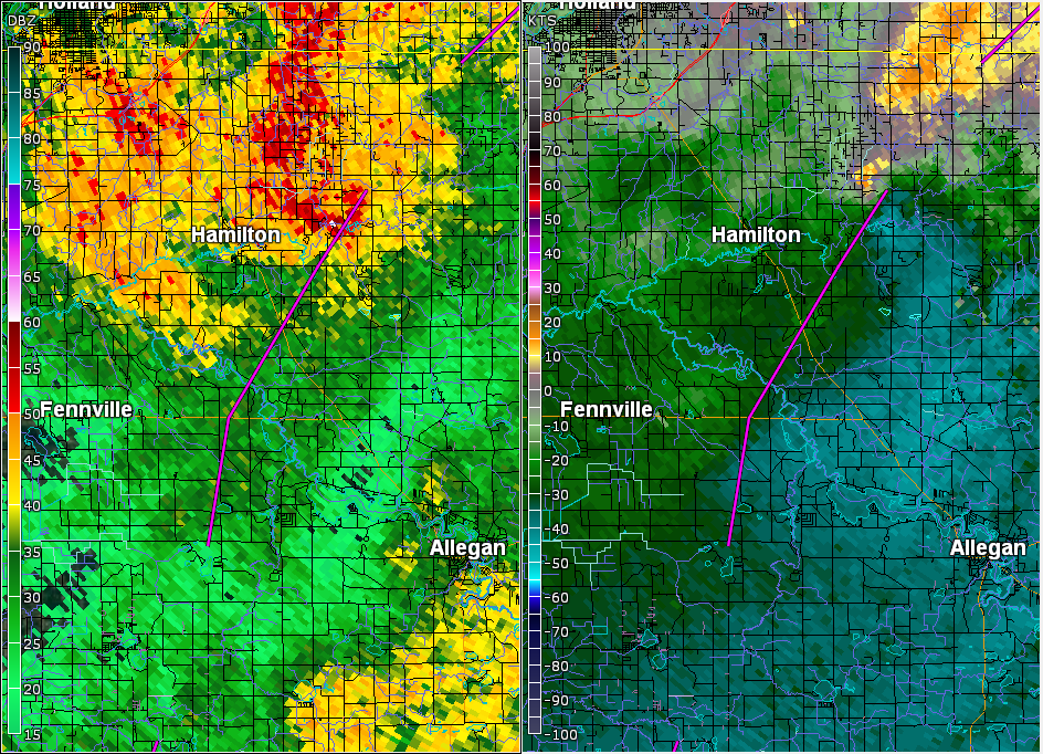
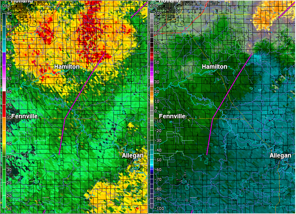
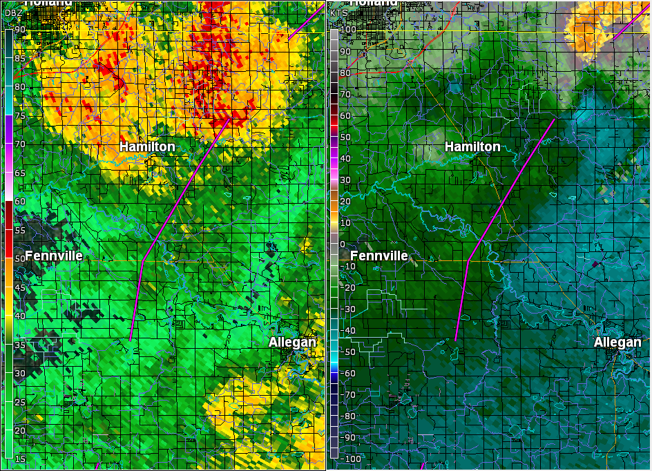
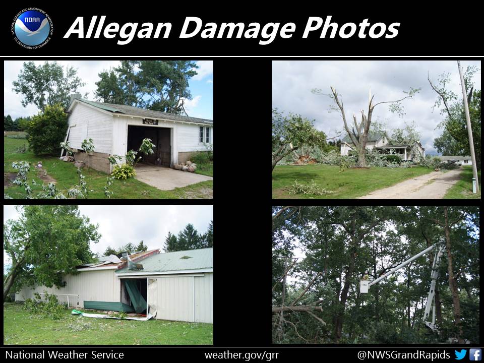
Fennville-Hamilton EF-1 Tornado (Allegan County)
After the first tornado of the day tracked from Bangor to
north of Grand Junction, the second tornado of the day
began 6 miles southeast of Fennville and tracked to 4 miles
northeast of Hamilton and was rated EF-1.

.FENNVILLE TO HAMILTON TORNADO...

Rating:                 EF-1
Estimated peak wind:    90-100 mph
Path length /Statute/:  10 miles
Path width /Maximum/:   50-100 yards
Fatalities:             0
Injuries:               0

Start date:             Aug 20 2016
Start time:             1:42 PM EDT
Start location:         6 miles southeast of Fennville, MI
Start Lat/Lon:          42.533/-86.023

End date:               Aug 20 2016
End time:               2:10 PM EDT
End location:           4 miles northeast of Hamilton, MI
End lat/lon:            42.702/-85.922

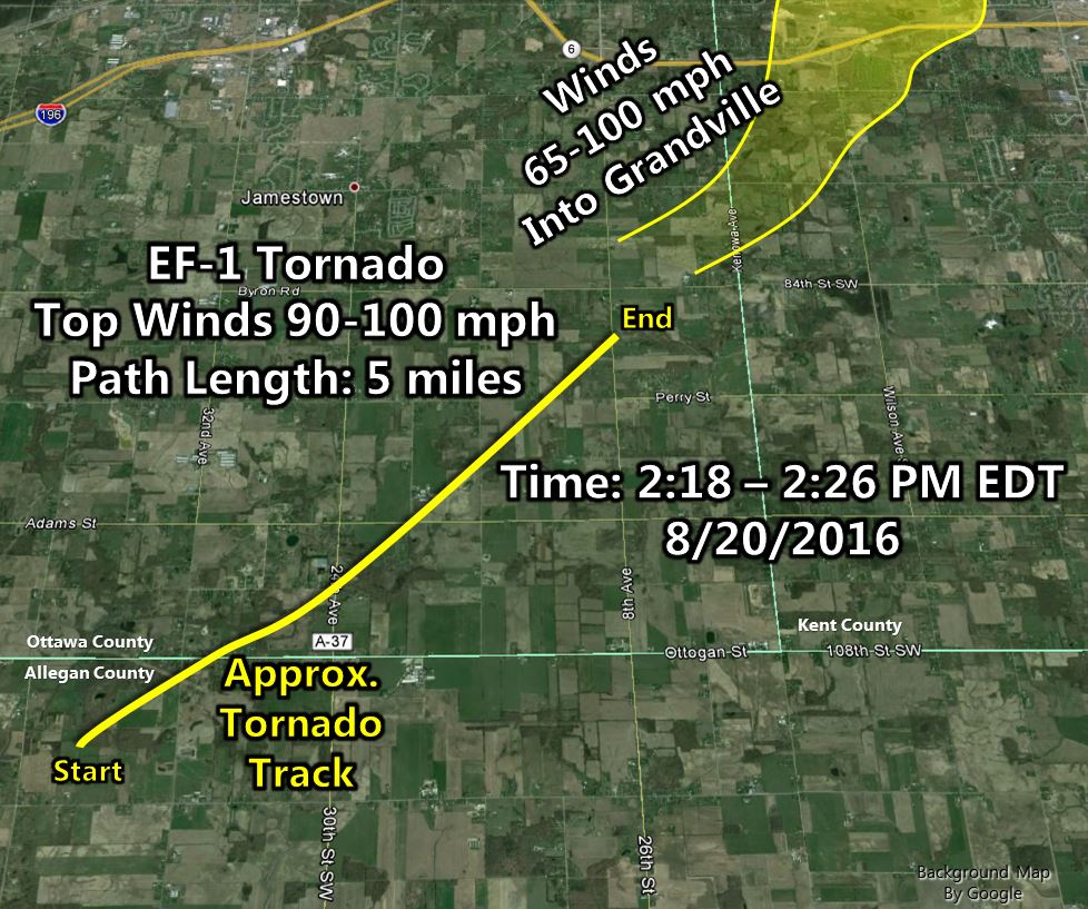
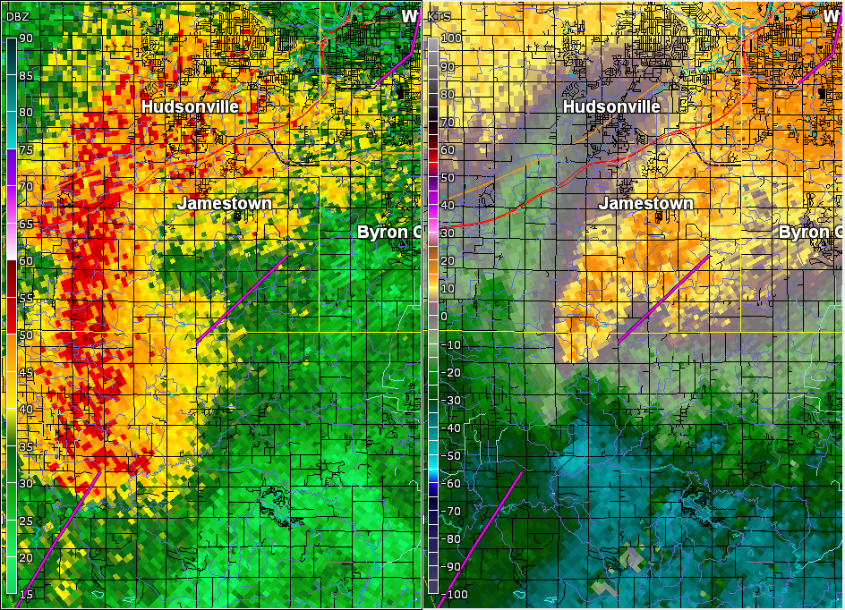
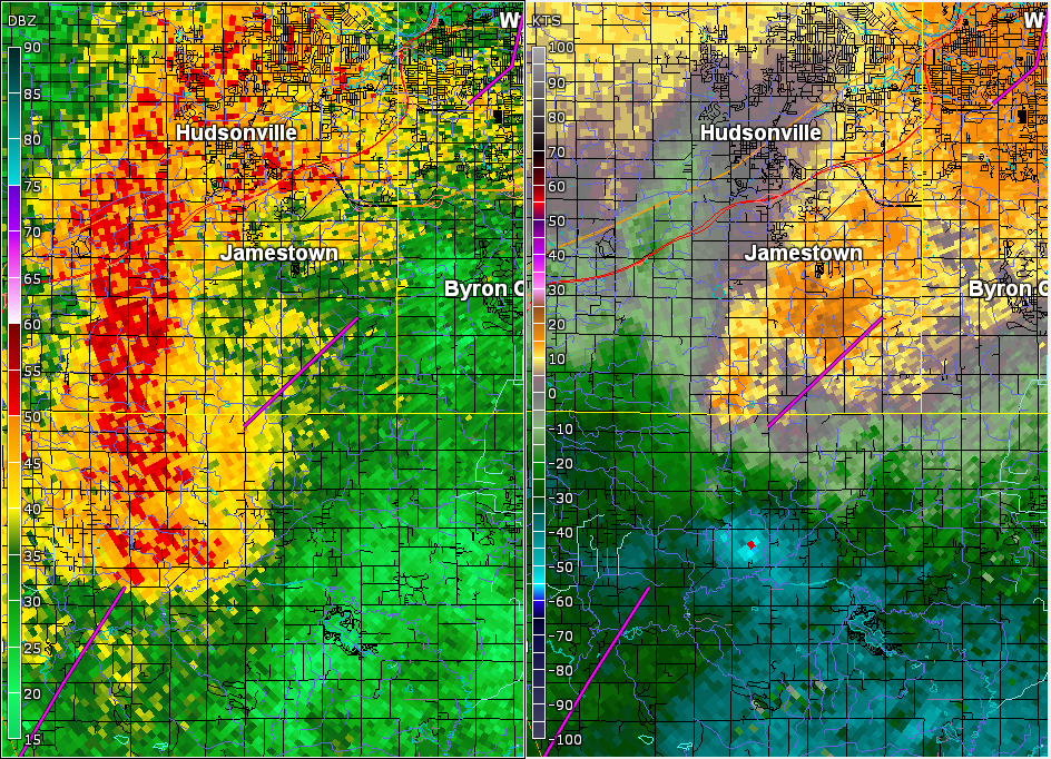
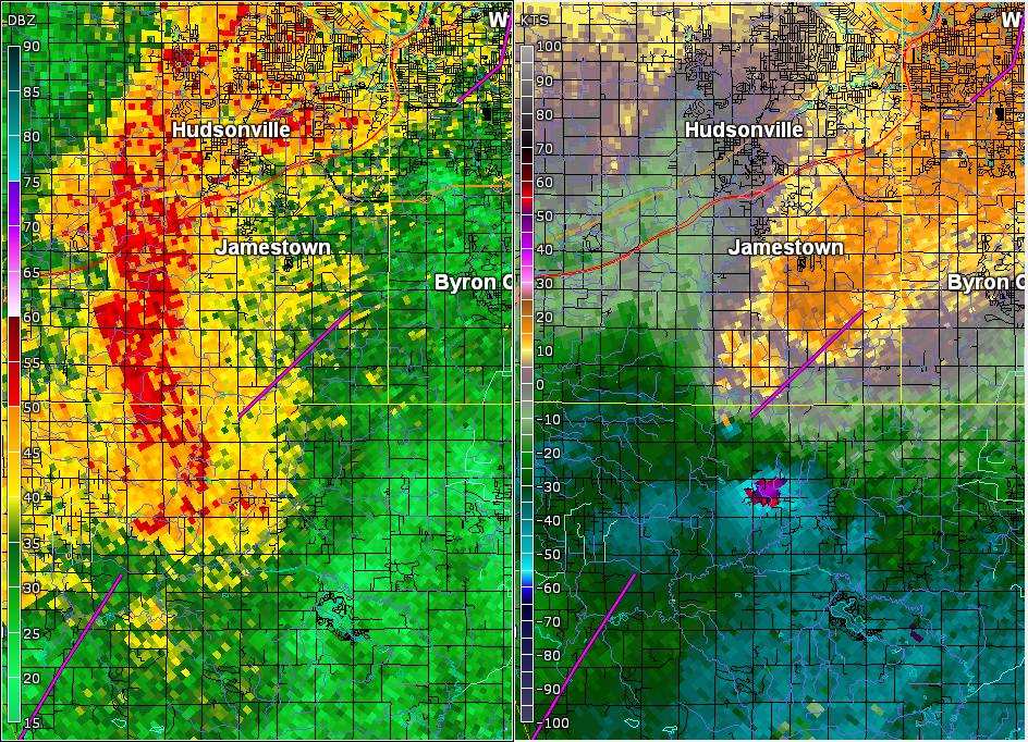
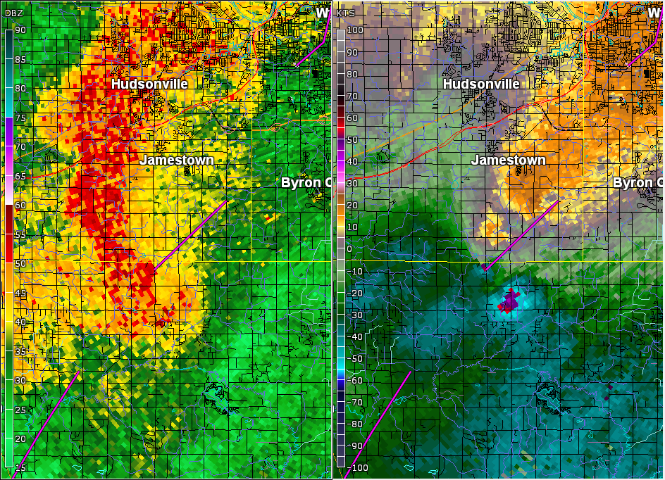
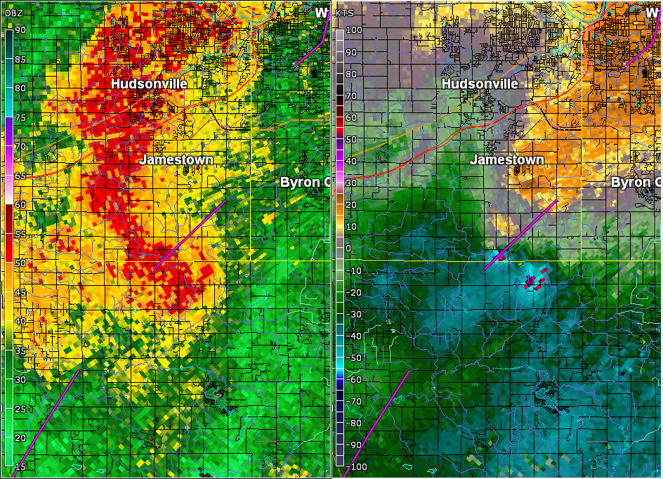
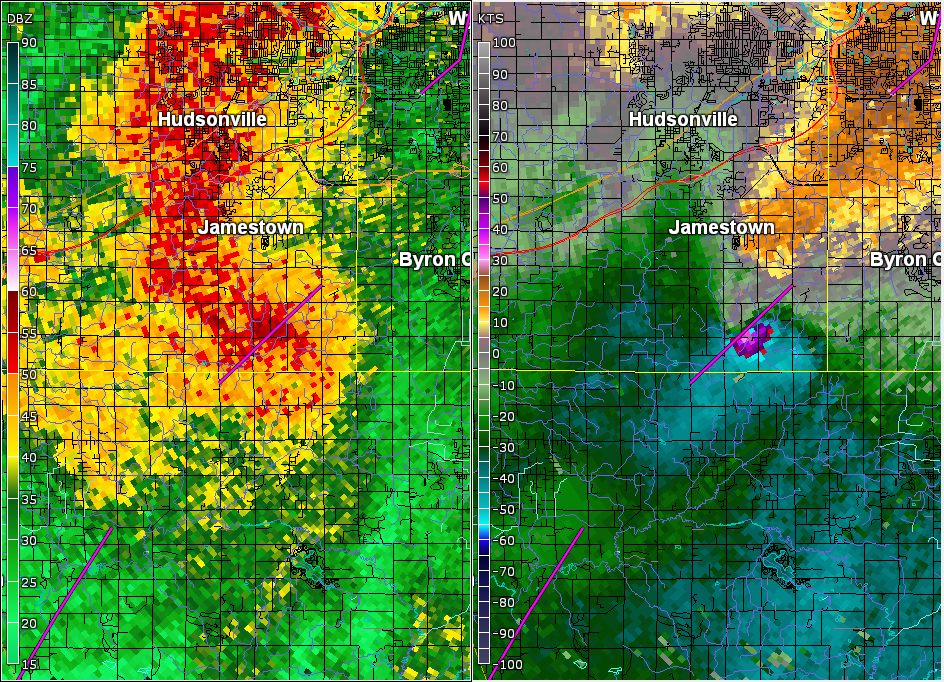
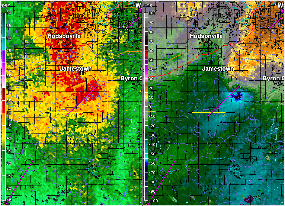
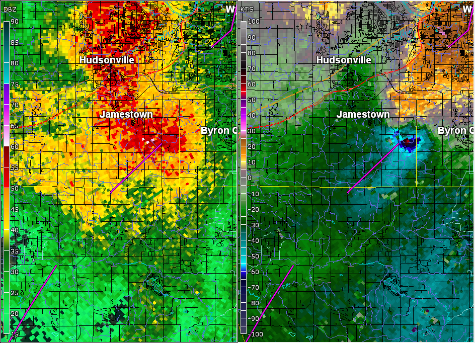
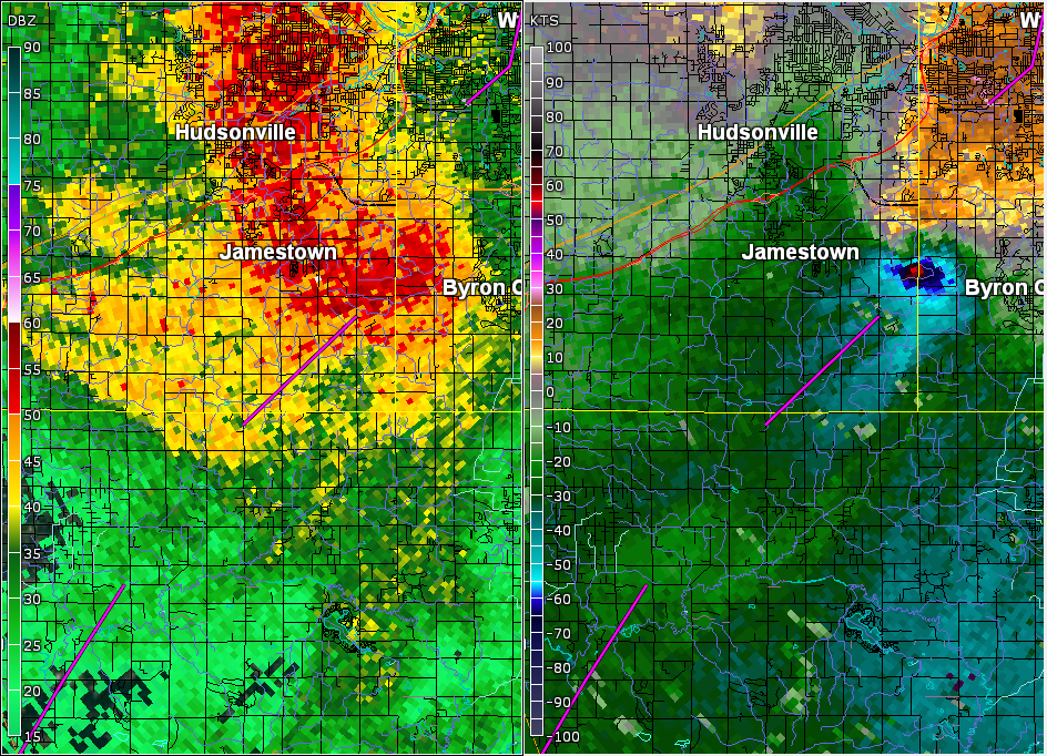
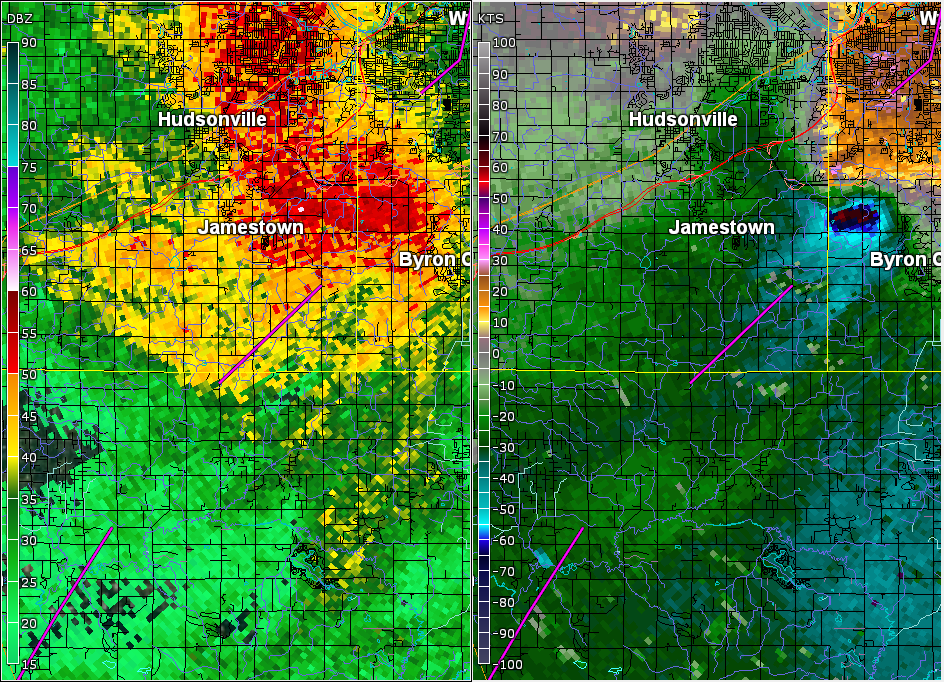
Jamestown EF-1 Tornado (Allegan, Ottawa Counties)
The day's third tornado, also rated EF-1, began 2 miles northwest
of Burnips in extreme northern Allegan County and tracked to
2 miles southeast of Jamestown in southeast Ottawa County.

EF-0 to EF-1 equivalent wind gusts, originating from the storm's
downdraft, continued into southwest Kent County, affecting Byron
Township and southern portions of Grandville.

.JAMESTOWN TORNADO...

Rating:                 EF-1
Estimated peak wind:    90-100 mph
Path length /Statute/:  4 miles
Path width /Maximum/:   50-100 yards
Fatalities:             0
Injuries:               0

Start date:             Aug 20 2016
Start time:             2:18 PM EDT
Start location:         2 miles northwest of Burnips
Start Lat/Lon:          42.763/-85.861

End date:               Aug 20 2016
End time:               2:26 PM EDT
End location:           2 miles southeast of Jamestown
End_lat/lon:            42.804/-85.803

EF Scale: The Enhanced Fujita Scale Classifies Tornadoes into the
following categories.

EF0...Weak......65 to 85 mph
EF1...Weak......86 to 110 mph
EF2...Strong....111 to 135 mph
EF3...Strong....136 to 165 mph
EF4...Violent...166 To 200 mph
EF5...Violent...>200 mph

NOTE:
The information in this statement is PRELIMINARY and subject to
change pending final review of the event and publication in
NWS Storm Data.
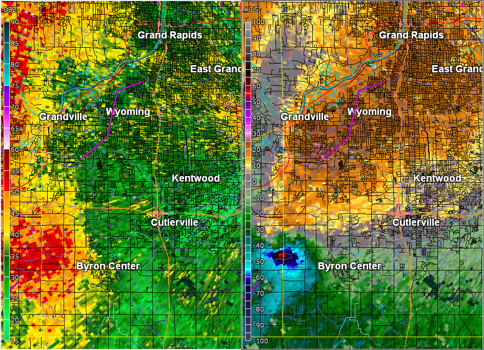
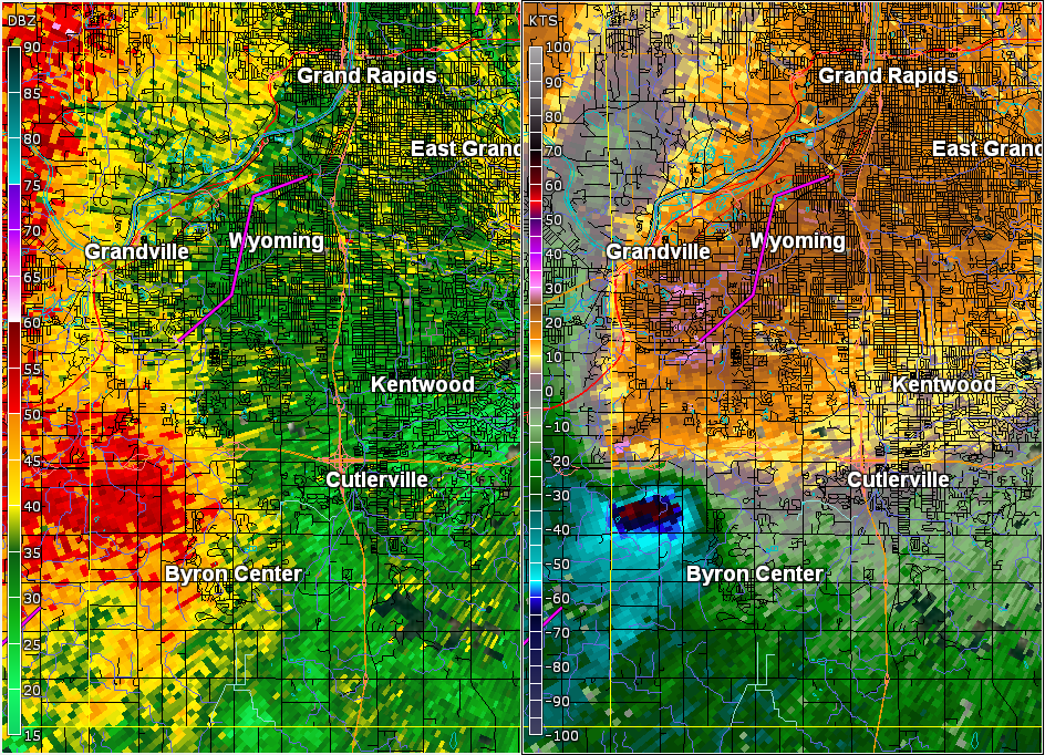
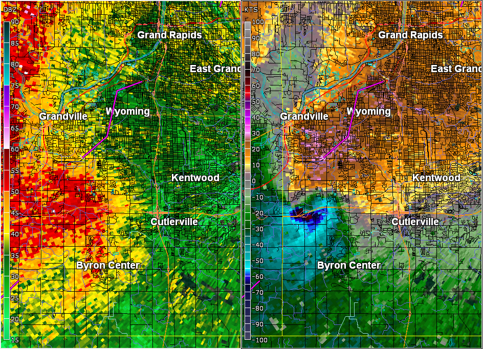
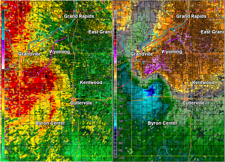
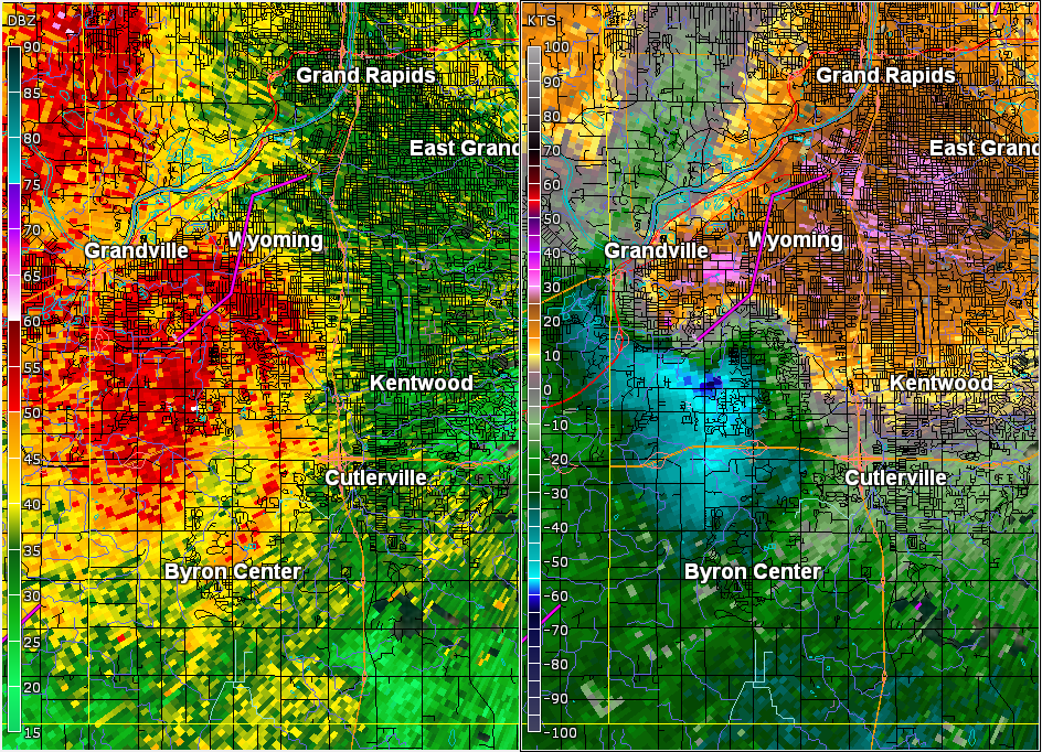
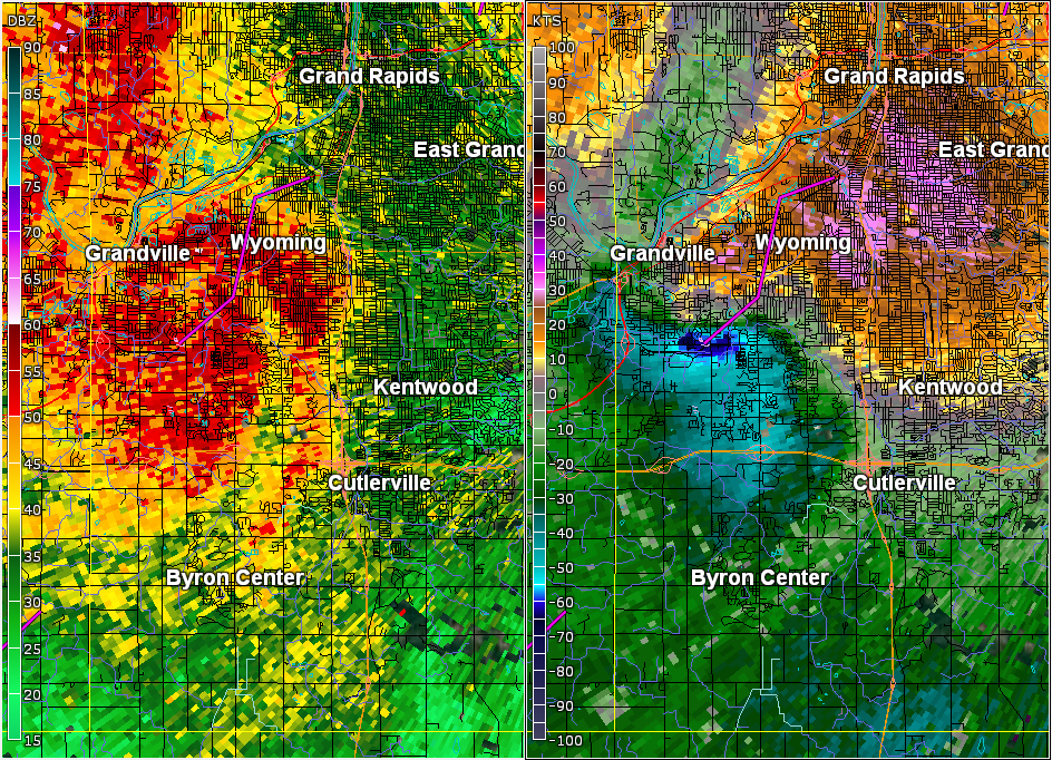
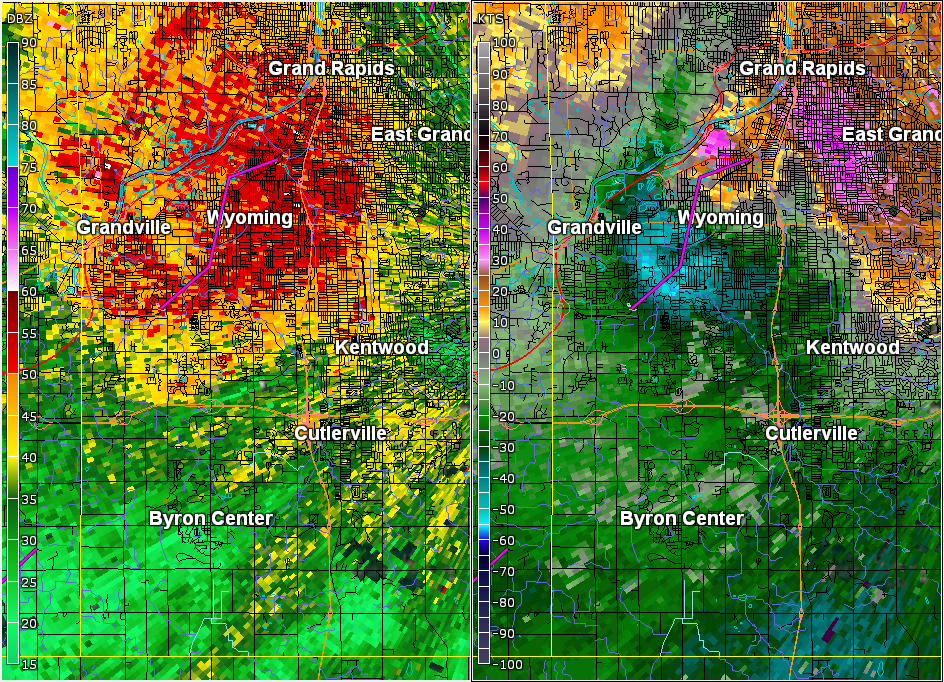
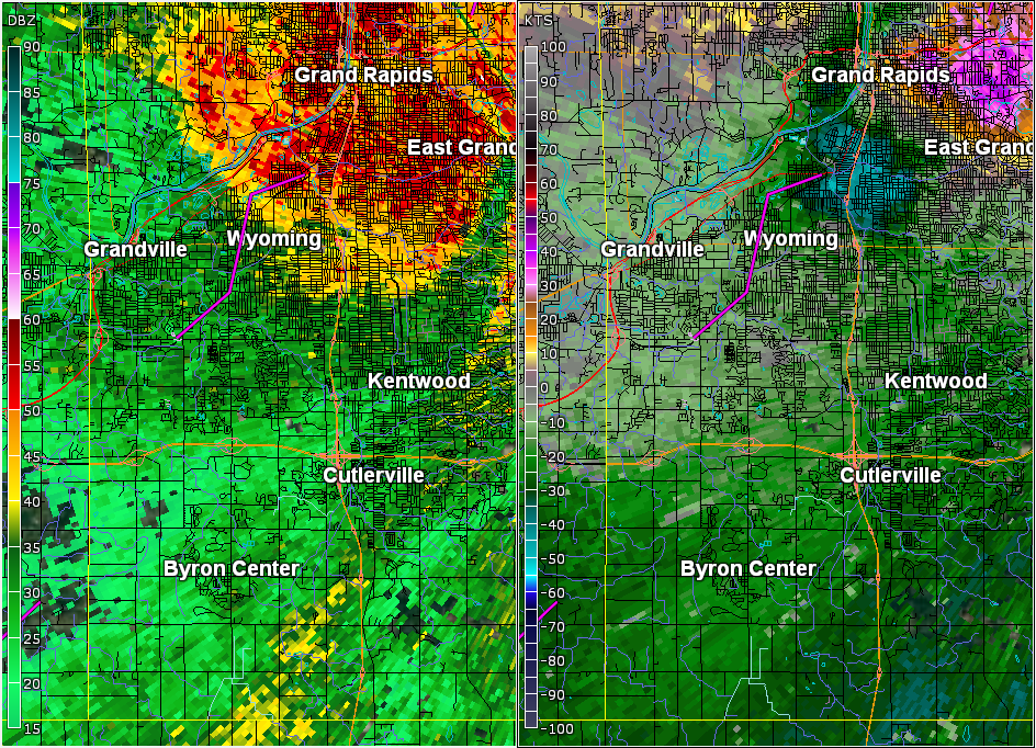
Bryon Twp EF-1 Winds & Grandville-Wyoming EF-0 Tornado (Kent County)
In addition to an EF-0 tornado that moved through portions of
Grandville and Wyoming on August 20th, National Weather Service
damage surveys identified areas of straight line wind damage in
Kent County from August 20th storms.

.Estimated winds of around 100mph...equivalent to EF-1 wind damage

A small area of wind damage caused by estimated 100 mph winds was
found near M6 between Ivanrest Ave SW and Kenowa Avenue SW.

South of M6...Ironwood Golf Course saw the worst of the damage
losing a significant number of large trees. North of M6 just west of
Wilson Ave SW along 64th Street...a number of very large trees were
uprooted causing significant damage to one home.

.Estimated winds of 65 to 75 mph...equivalent to EF-0 wind damage

A long stretch of straight line wind damage occurred from just
northeast of the intersection of M6 and Wilson Avenue SW through
East Grand Rapids. Notable locations that were impacted by
straight line winds include Maple Hill Golf Course and Pinery Park.

This damage was mainly to trees with a few fallen trees resulting in
damage to homes.

An EF-0 tornado touched down near 44th Street and Ivanrest Ave SW in
Grandville Michigan on Saturday August 20th and continued on the
ground along a varying path through Grandville and Wyoming before
lifting near the intersection of Nagel Avenue SW and Chicago Drive SW.

Though the tornado remained west of US-131, it did zig zag
across a number of major roads/intersections in the Grand Rapids
metro area including...

...Ivanrest Avenue SW just north of Rivertown Parkway...
...The intersection of Byron Center Ave SW and 36th Street...
...28th Street SW near Sharon Avenue SW...
...Porter Street SW near Boulevard Drive SW...
...Burlingame Avenue SW just north of Burton Street SW...

Along the path, hundreds of trees were damaged or knocked over
resulting in tens of thousands of power outages. Many homes and a
number of vehicles were damaged from fallen trees.

A couple notable locations the tornado moved through include the
Wyoming Middle School football field where a set of football field
goal posts were bent by soccer goals, and Battjes Park and
Prairie Park where a number of trees were damaged or uprooted.
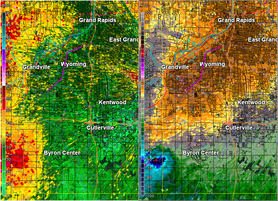
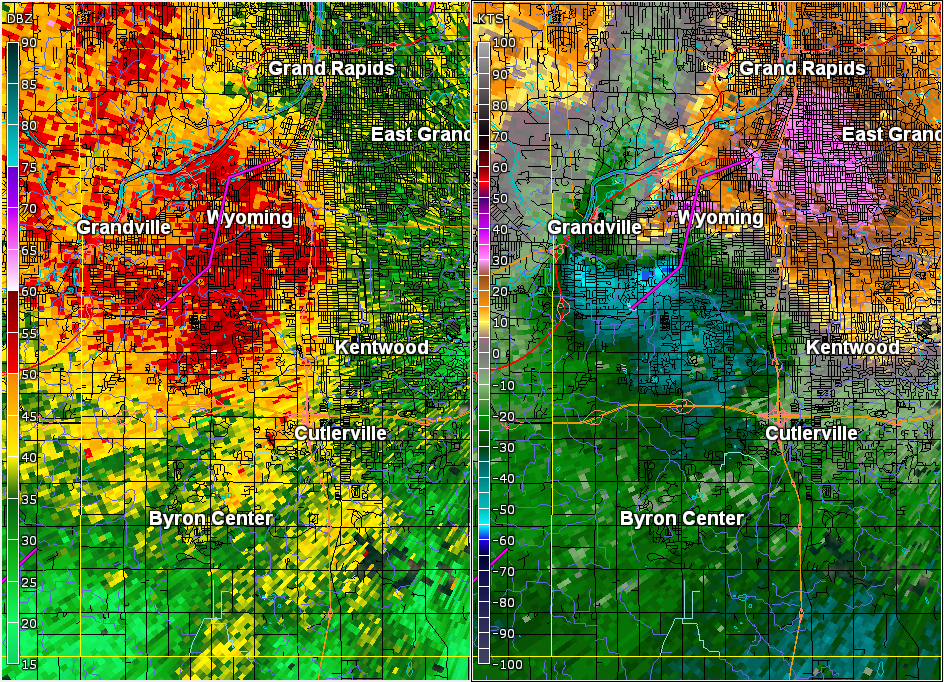
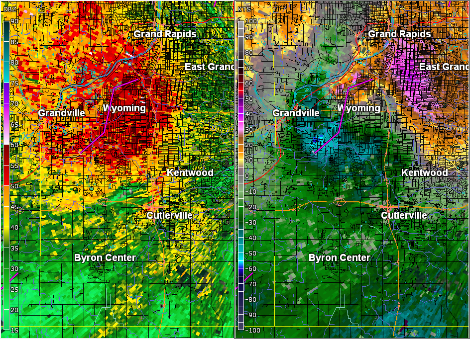
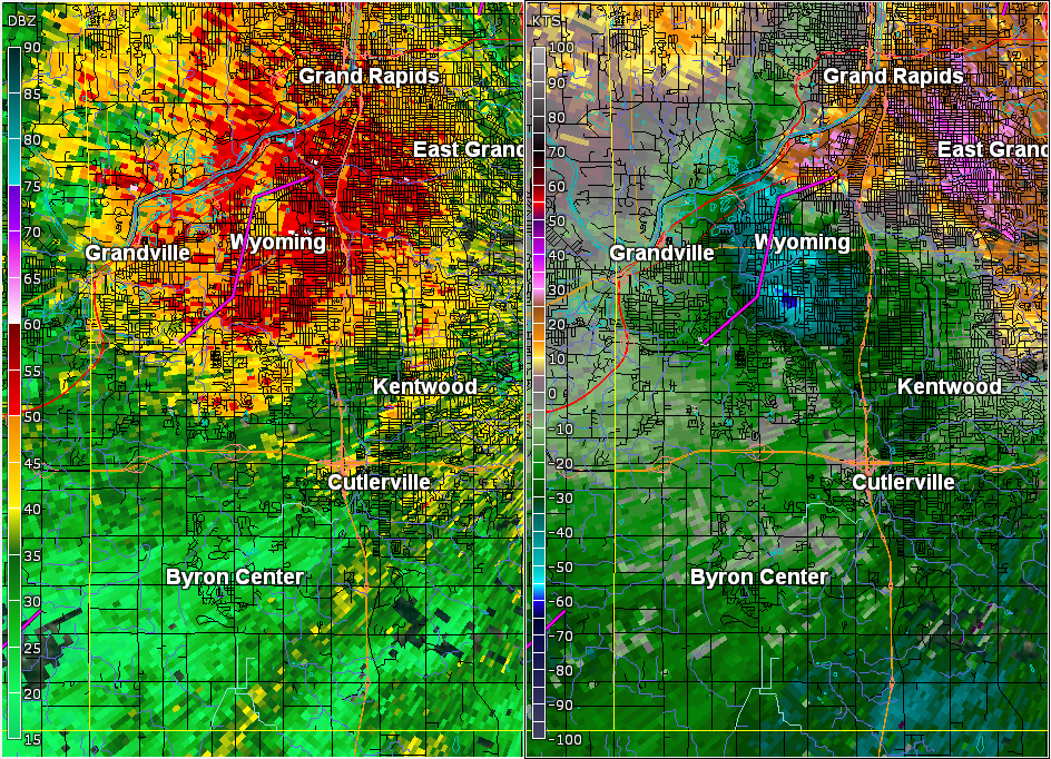
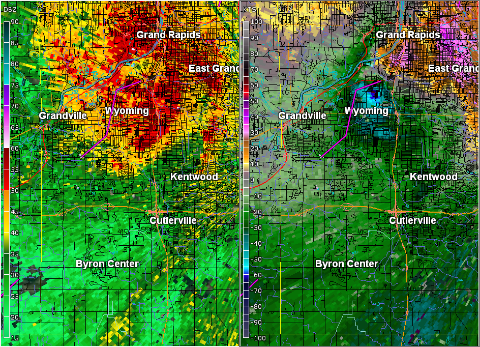
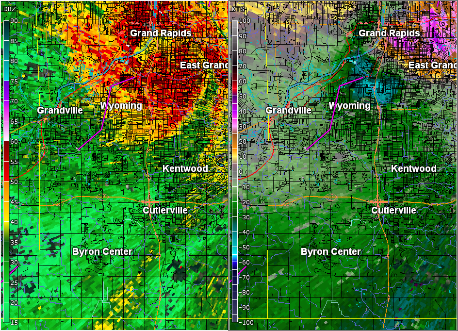
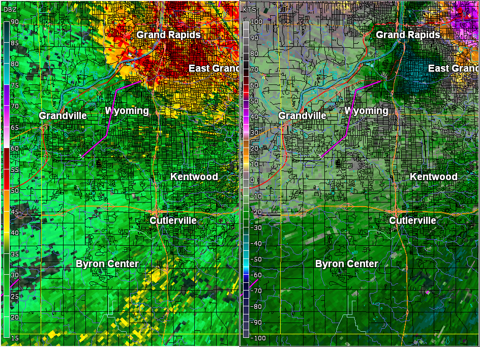
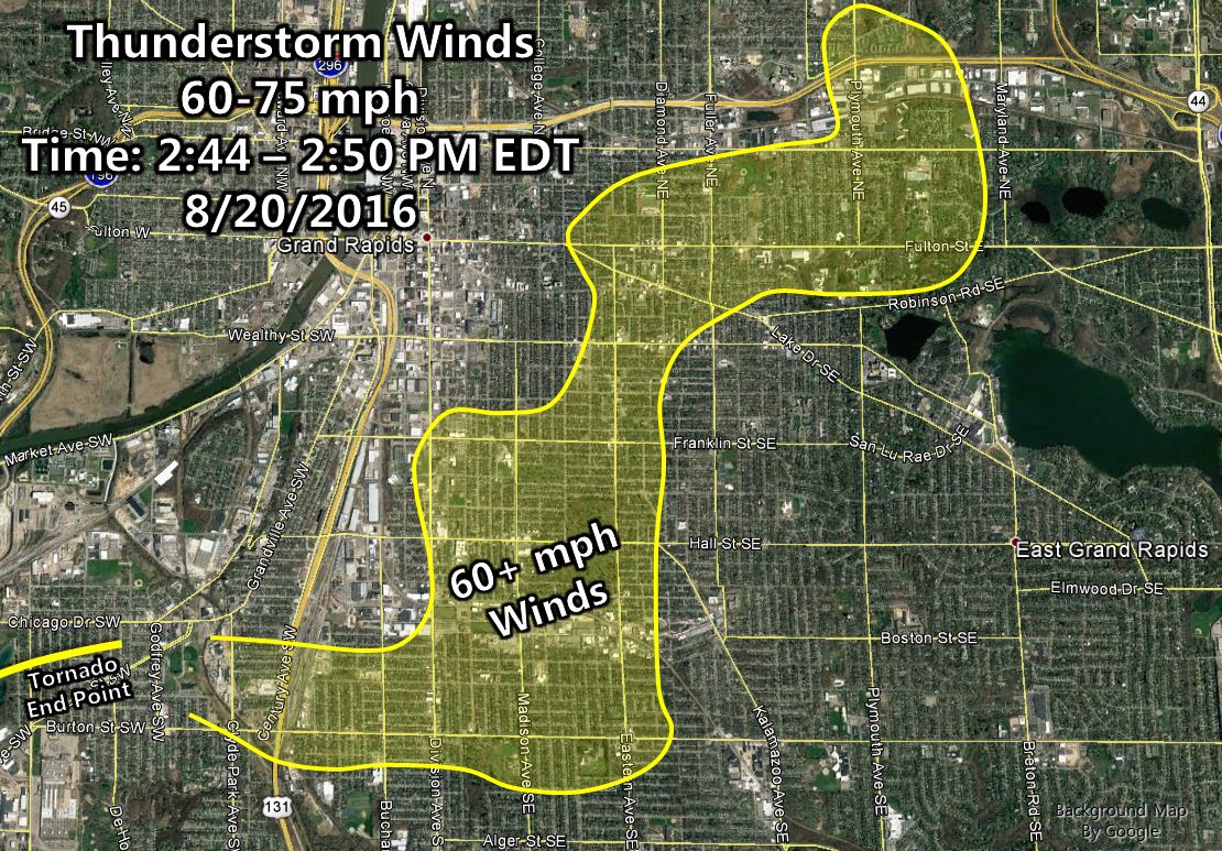
Southeast Grand Rapids Winds & Northeast Grand Rapids EF-0 Tornado (Kent County)
EF-0 wind damage was found in southeast Grand Rapids between the Grandville and northeast Grand Rapids tornadoes. The storm was exhibiting cyclical behavior through the Grand Rapids area, producing surges of downdraft-based winds with updraft-based tornadoes tending to form on the northern side of those wind bursts.
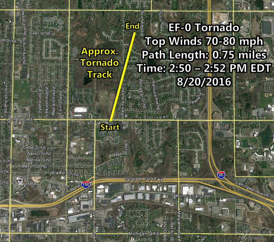
A brief tornado touched down in Kent County near Perkins Avenue
NE between Leonard Street NE and Knapp Street NE. Tree damage and
some property damage from fallen trees occurred as the result of
this brief tornado.

Rating:                 EF-0
Estimated peak wind:    Between 70 and 80 mph
Path length:            Around 0.75 miles
Path width:             Approximately 25 to 50 yards
Fatalities:             0
Injuries:               0

Start date:             Aug 20 2016
Start time:             Approximately 250pm
Start location:         Around 3 miles Northeast of Downtown Grand Rapids

End date:               Aug 20 2016
End time:               Approximately 252pm
End location:           Around 3 miles Northeast of Downtown Grand Rapids

EF Scale: The Enhanced Fujita Scale Classifies
Tornadoes into the following categories.

EF0...Weak......65 to 85 mph
EF1...Weak......86 to 110 mph
EF2...Strong....111 to 135 mph
EF3...Strong....136 to 165 mph
EF4...Violent...166 To 200 mph
EF5...Violent...>200 mph

NOTE:
The information in this statement is PRELIMINARY and subject to
change pending final review of the event and publication in
NWS Storm Data.
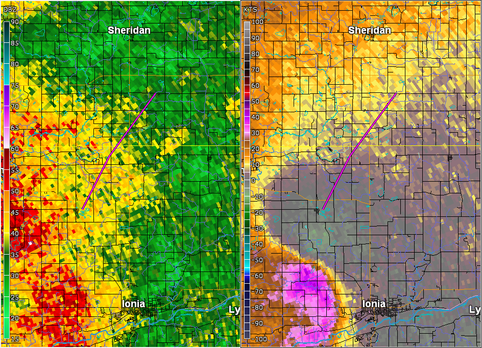
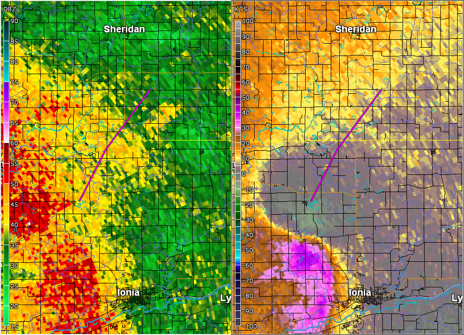
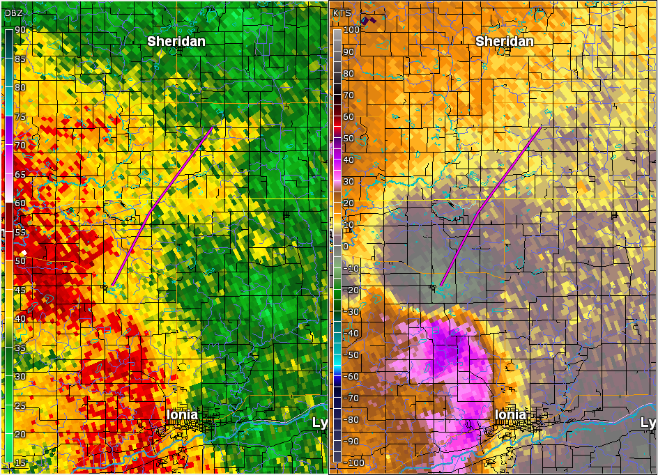
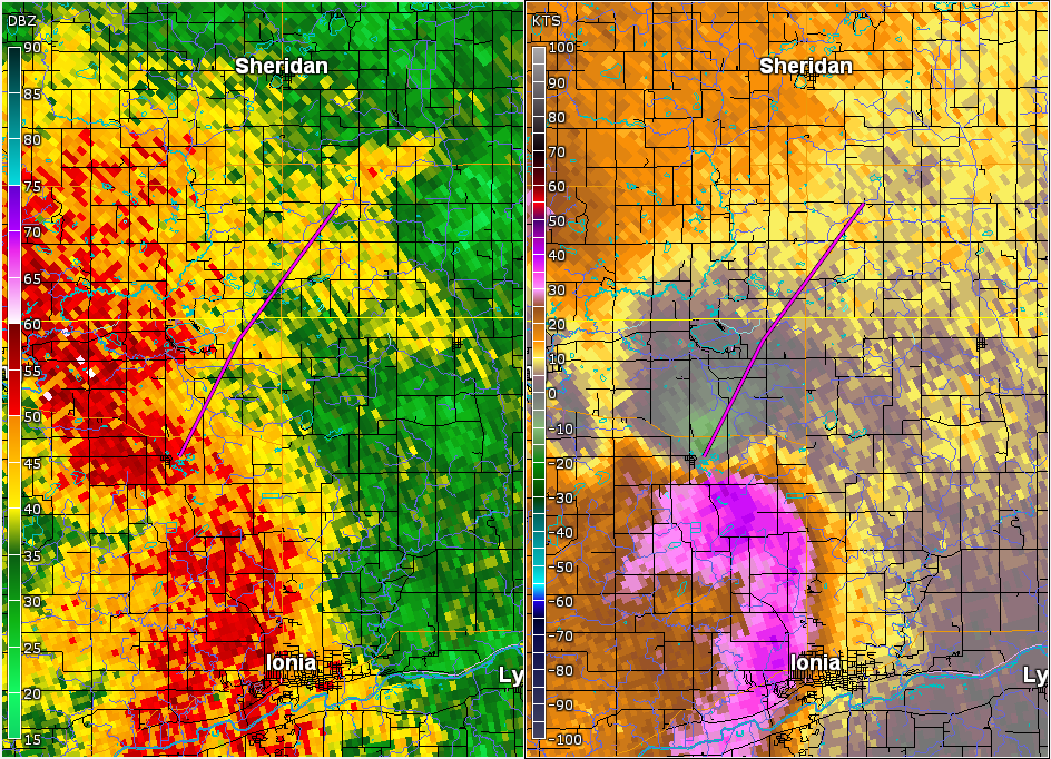
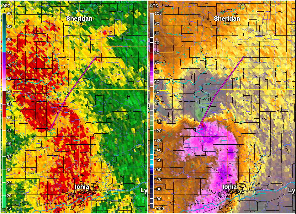
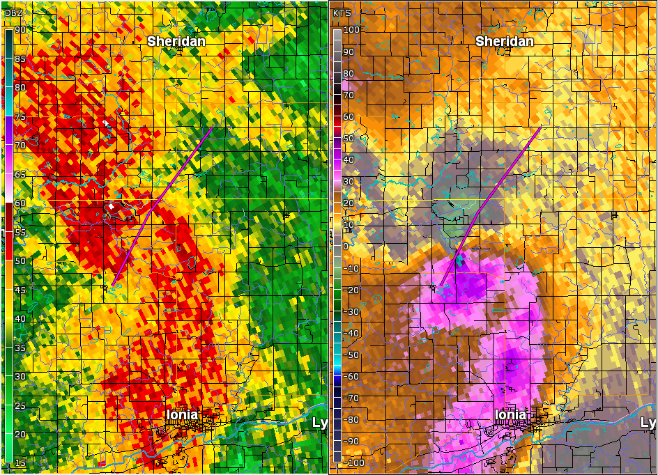
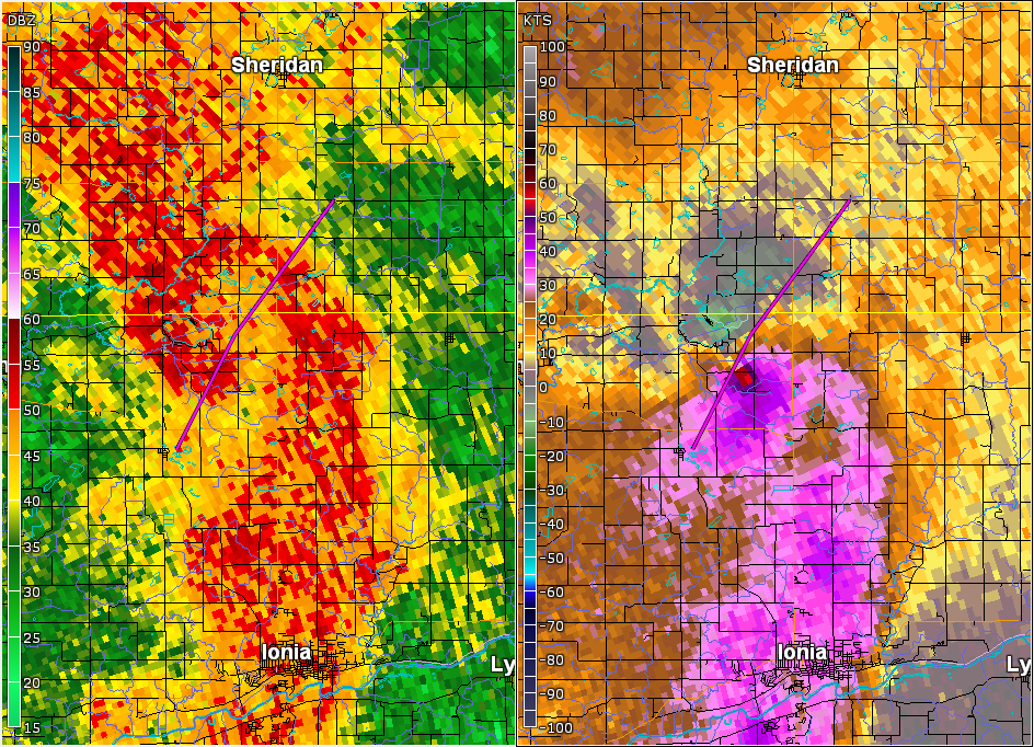
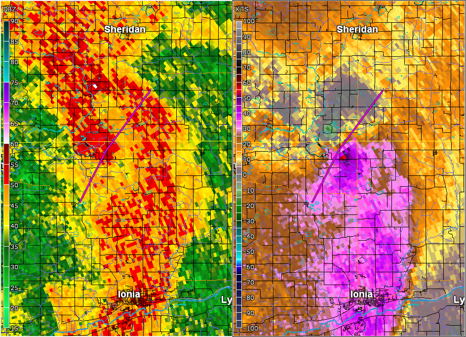
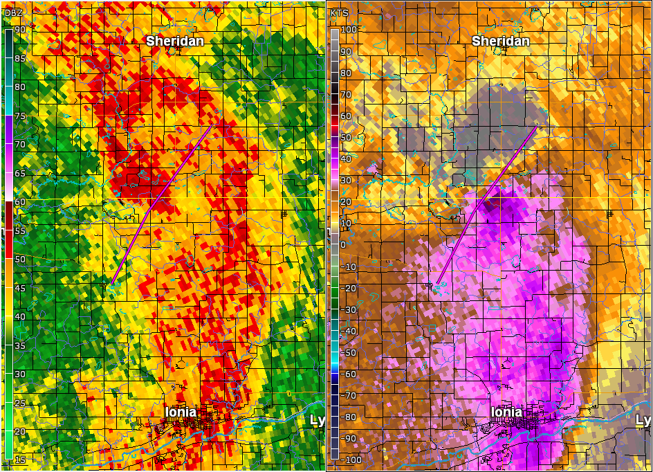
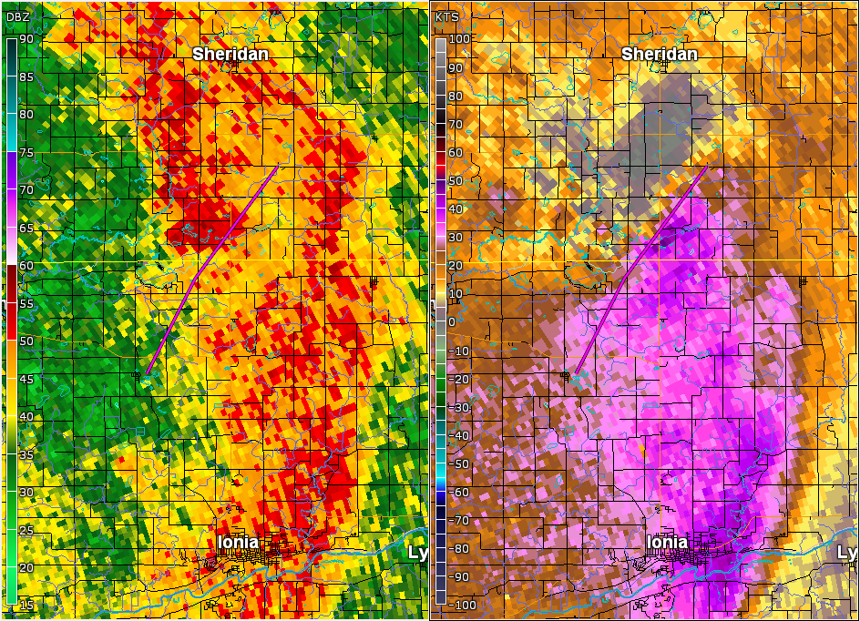
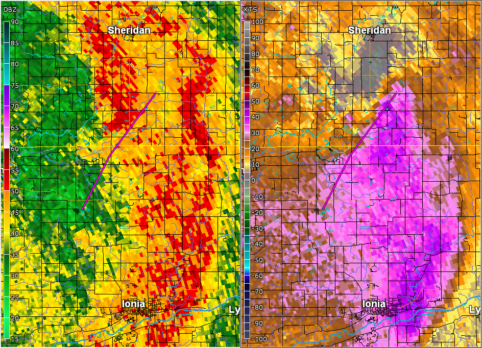
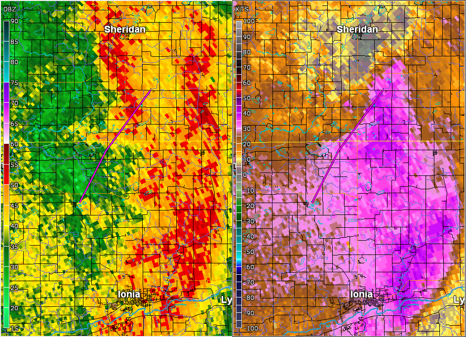
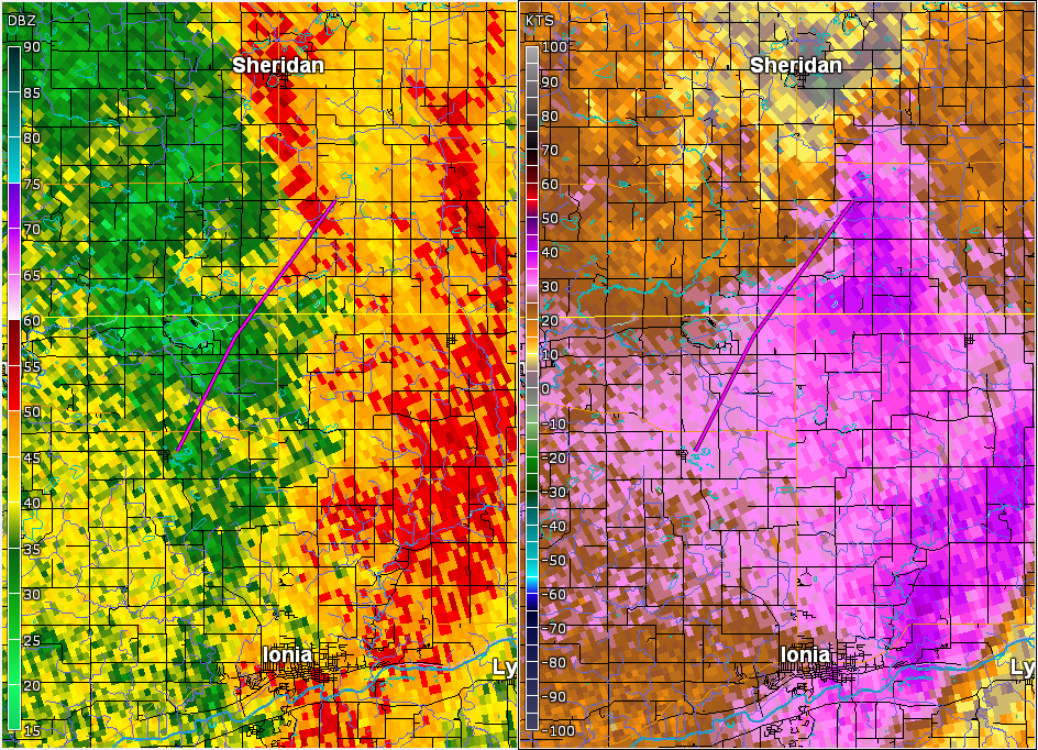
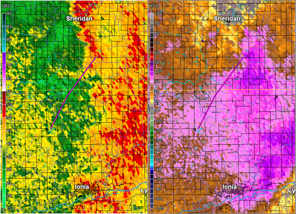
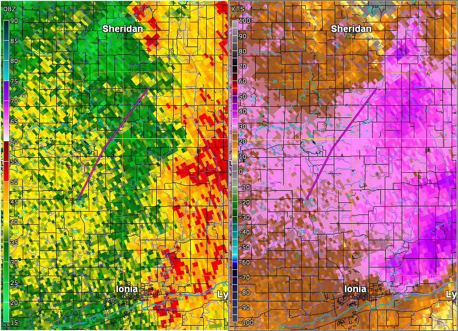
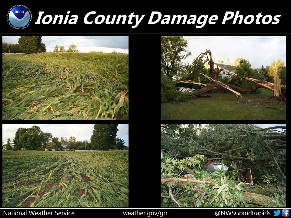
Orleans-Fenwick EF-1 Tornado (Ionia-Montcalm Counties)
Tornado damage began just east of the small town of Orleans and
moved northeast where it crossed M-44, bringing several large trees
down, one of which fell on a house. The tornado then crossed West
Long Lake Road where the concrete block wall of a garage was blown
out and the wind peeled shingles off the roof of a house.

A path of tree damage about a hundred yards wide continued to
the northeast and narrowed as it crossed the Montcalm County line.
The last damage noted was a few downed trees on East Boyer Road
about 3.5 miles southeast of Sheridan.

Rating:                 EF-1
Estimated peak wind:    90 mph
Path length /Statute/:  8 miles
Path width /Maximum/:   100 yards
Fatalities:             0
Injuries:               0

Start date:             August 20 2016
Start time:             310 pm EDT
Start location:         0.4 miles east of Orleans Michigan
Start Lat/Lon:          43.068N -85.128W

End date:               August 20 2016
End time:               325 pm EDT
End location:           3.5 miles southeast of Sheridan Michigan
End_lat/lon:            43.1632N -85.045W

EF Scale: The Enhanced Fujita Scale Classifies
Tornadoes into the following categories.

EF0...Weak......65 to 85 mph
EF1...Weak......86 to 110 mph
EF2...Strong....111 to 135 mph
EF3...Strong....136 to 165 mph
EF4...Violent...166 To 200 mph
EF5...Violent...>200 mph

NOTE:
The information in this statement is PRELIMINARY and subject to
change pending final review of the event and publication in
NWS Storm Data.


 |
Media use of NWS Web News Stories is encouraged! |
|

