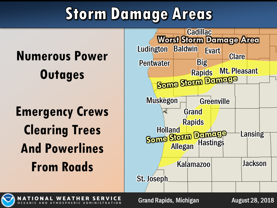
Areas within about 10-20 miles of US-10 between Ludington and Clare were hit the hardest from storms that rolled through Tuesday night. Numerous reports of downed trees and power lines were received. NWS meteorologists are doing damage assessment of the hardest-hit areas.
Confirmed so far:
...Results from Storm Surveys on August 29th and 30th...

In Newaygo County, an area of tree damage consistent with up
to 75 MPH wind gusts was found southeast of Brohman along 6 Mile
Road near Evergreen Drive. This concentrated damage area
extended southeast to Spruce Avenue. Spotty and less intense
damage continued southeastward to approximately Pine Avenue and
East 3 Mile Road.

In Lake County on Wednesday August 29th, a survey confirmed an
EF-0 tornado in Baldwin. Damage southeast of Baldwin from that
survey will continue to be analyzed to determine the exact path
length and width.

The survey continued in Lake County on August 30th. Spotty
tree damage consistent with 60 to 70 MPH wind gusts began
approximately 1 mile south of US-10 around Nugent Lake and
extended southeast to Baldwin where EF-0 tornado damage had
already been confirmed.

In Mason County, extensive tree damage caused substantial damage
to adjacent buildings starting at Tamarack Park along the southeast
side of Hamlin Lake. Damage continued southeast for roughly 20
miles with extensive tree and adjacent structure damage
at Long and Emerson Lakes, including power poles destroyed
between the two lakes along Maple Road. The swath of tree damage
crossed US-10 by Emerson Lake and extended an unknown distance
to the east-southeast on the south side of US-10.

In Oceana County, sporadic damage was noted across much of the
county, but given the extensive clean-up and recovery efforts
that had already occurred, it was not possible to accurately
assess where damage swaths had occurred.
In Mecosta County, damage from thunderstorm winds estimated at 75-90 mph stretched from Paris to Big Rapids to Stanwood. Numerous downed trees and damage to property from falling trees was found. The worst damage was concentrated in Paris and Stanwood.
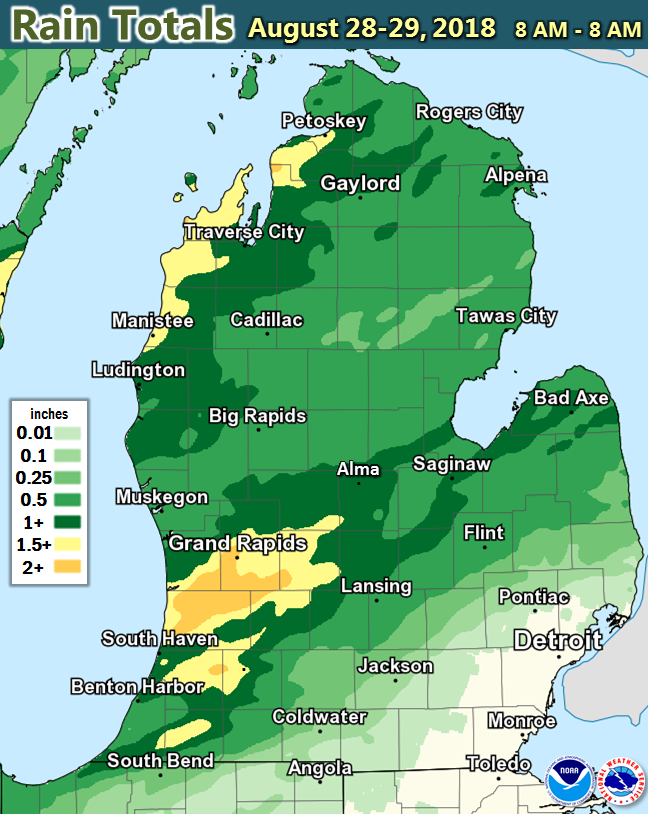
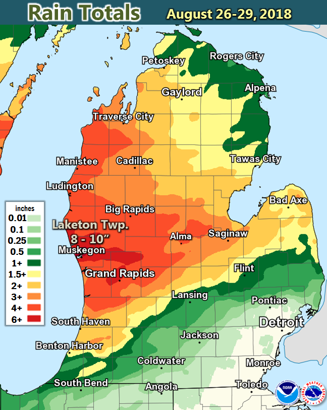
A drought-buster for many of us (but not everyone) since Sunday. A large portion of Lower Michigan received over 3 inches of rain, with 8 to 10 inches measured just north of Muskegon. Areas south and east of Lansing saw very little rain.
 |
Media use of NWS Web News Stories is encouraged! |
|

