Widespread life-threatening flash and urban flooding continues in south-central Texas, with considerable flooding impacts possible across central Texas. Wildfire smoke is impacting air quality across much of the Great Lakes region into southern New England and the Mid-Atlantic. Monsoonal thunderstorms may produce isolated to scattered flash flooding across the Southwest into the Great Basin. Read More >
Event Overview
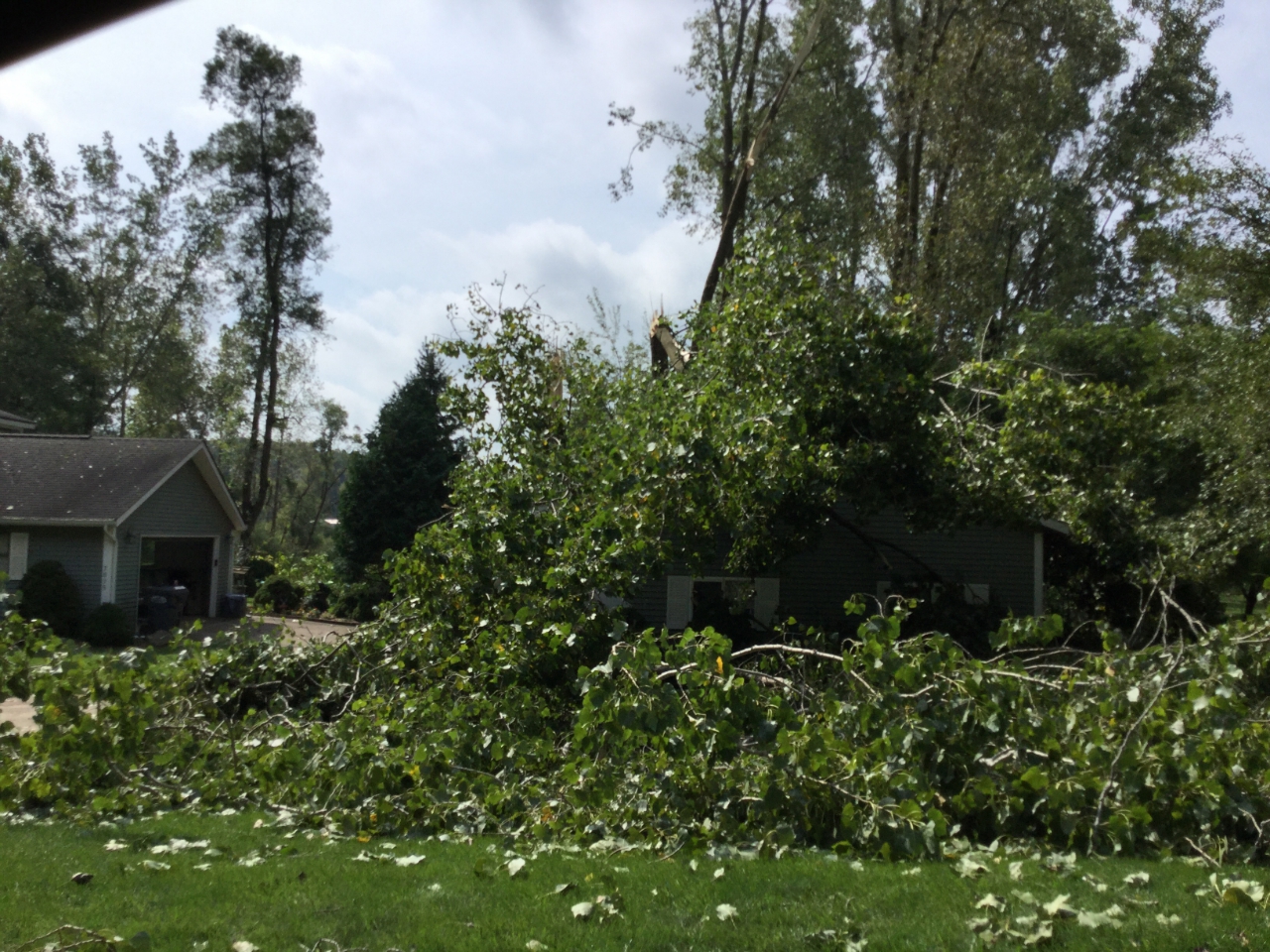
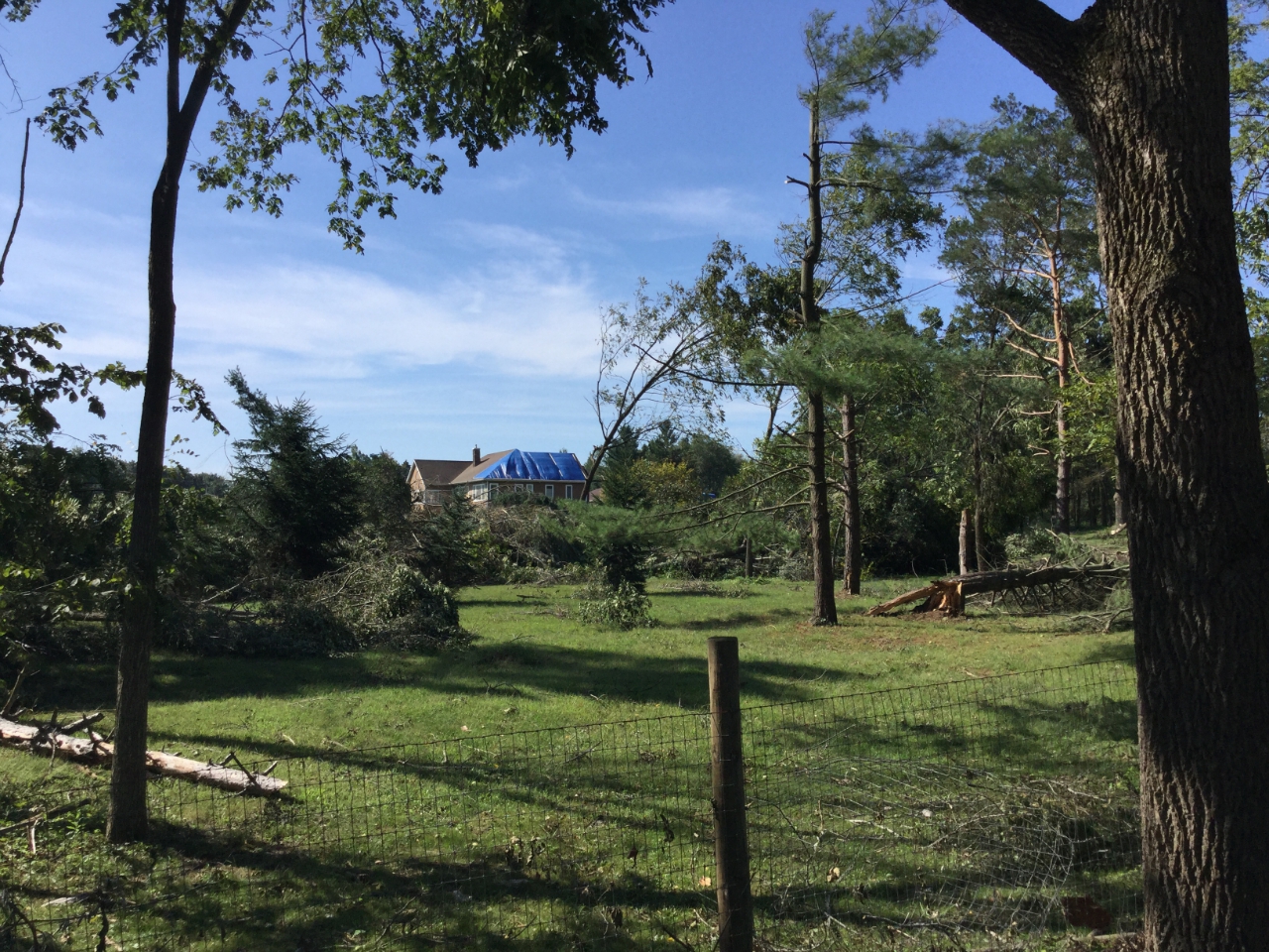
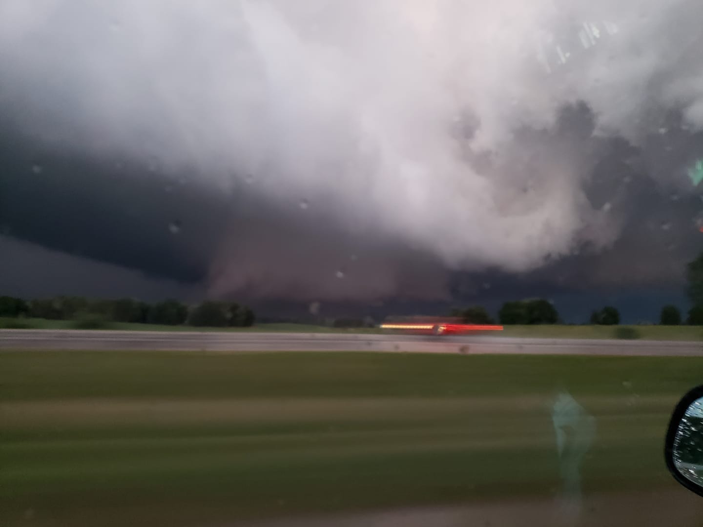
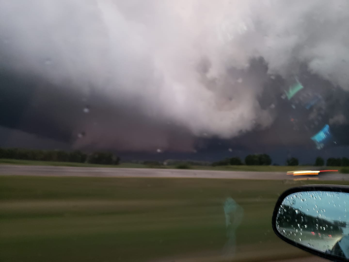
Severe thunderstorms developed across central, southern, and southwestern Lower Michigan during the evening of September 1st, 2018. Four tornadoes have been confirmed as of September 4th, 2018. Most of the damage was confined to trees and associated structural damage due to falling trees. Some of the storms were well-photographed and had a visible structure resembling supercell thunderstorms, including rotating rain-free updraft bases, wall clouds, and brief funnel clouds. Such structures are relatively uncommon in Lower Michigan, especially in the last few years.
Tornadoes:
|
Tornado: SW of Hickory Corners
Track Map 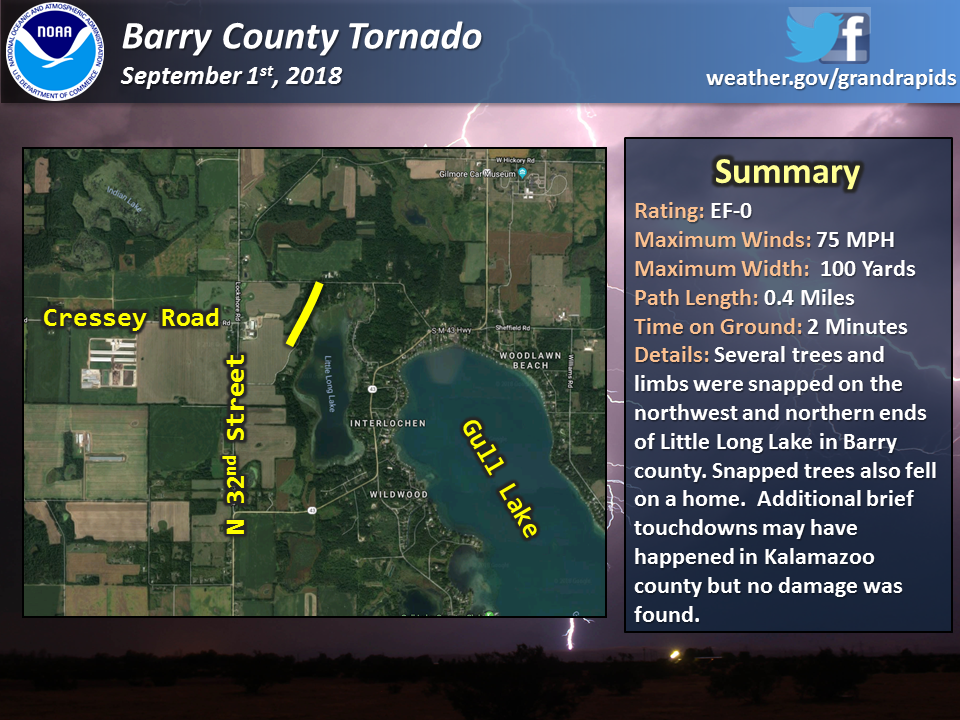
|
||||||||||||||||
 |
 |
||
| Tree damage and the end of Lock Lane | Tree Damage on Bendere Road on the north side of Little Long Lake. | . |
|
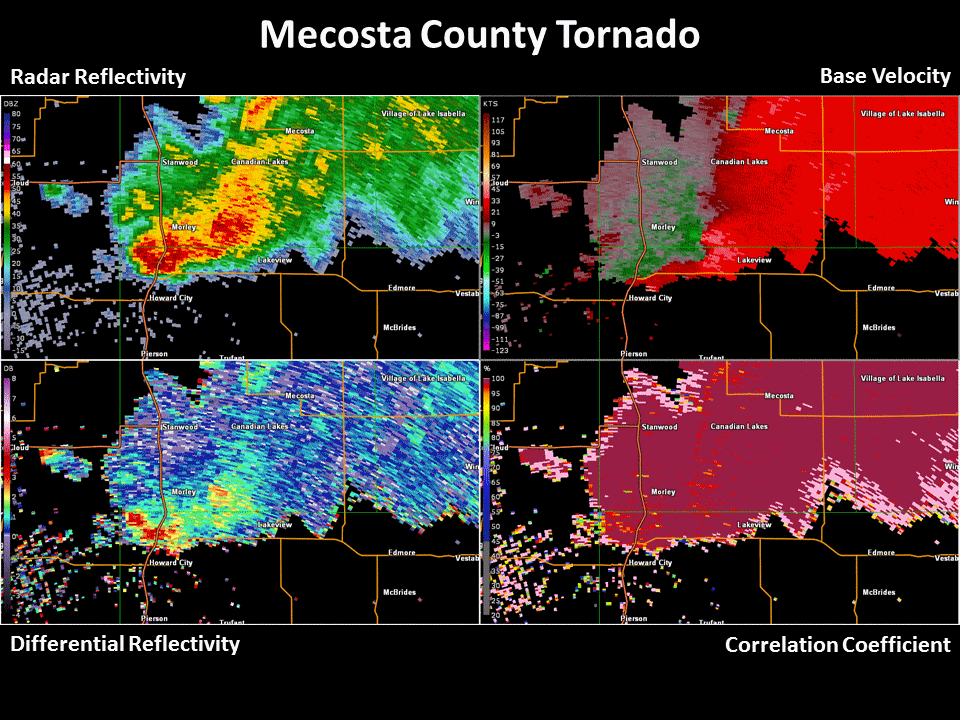
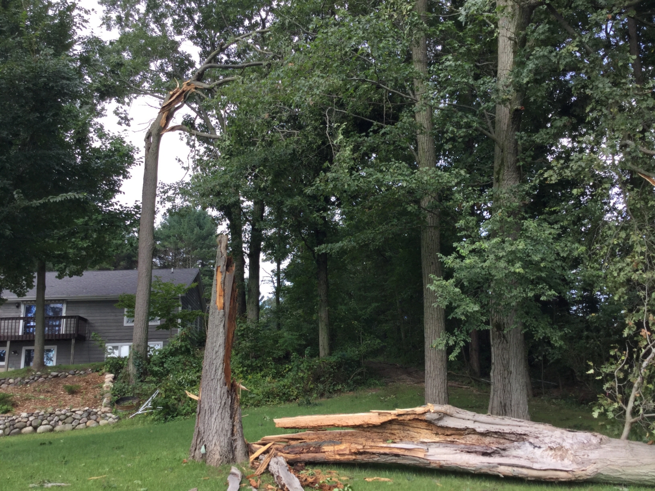
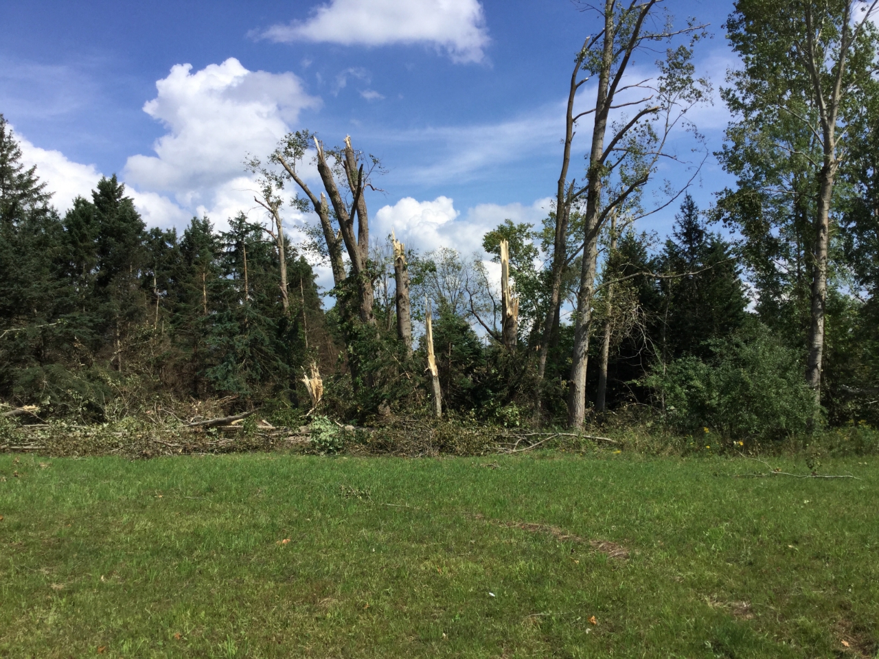
Tornado: East of Morley
Track Map 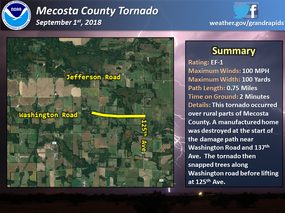 |
||||||||||||||||
 |
|||
| Snapped trees near the intersection of Washington road and 132nd Ave. |
|
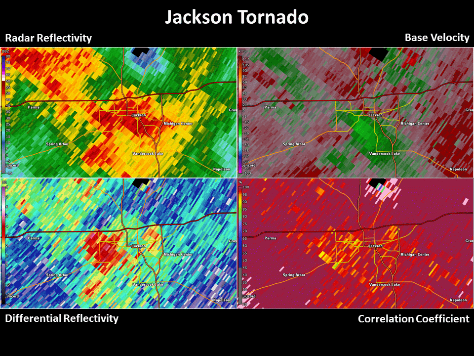
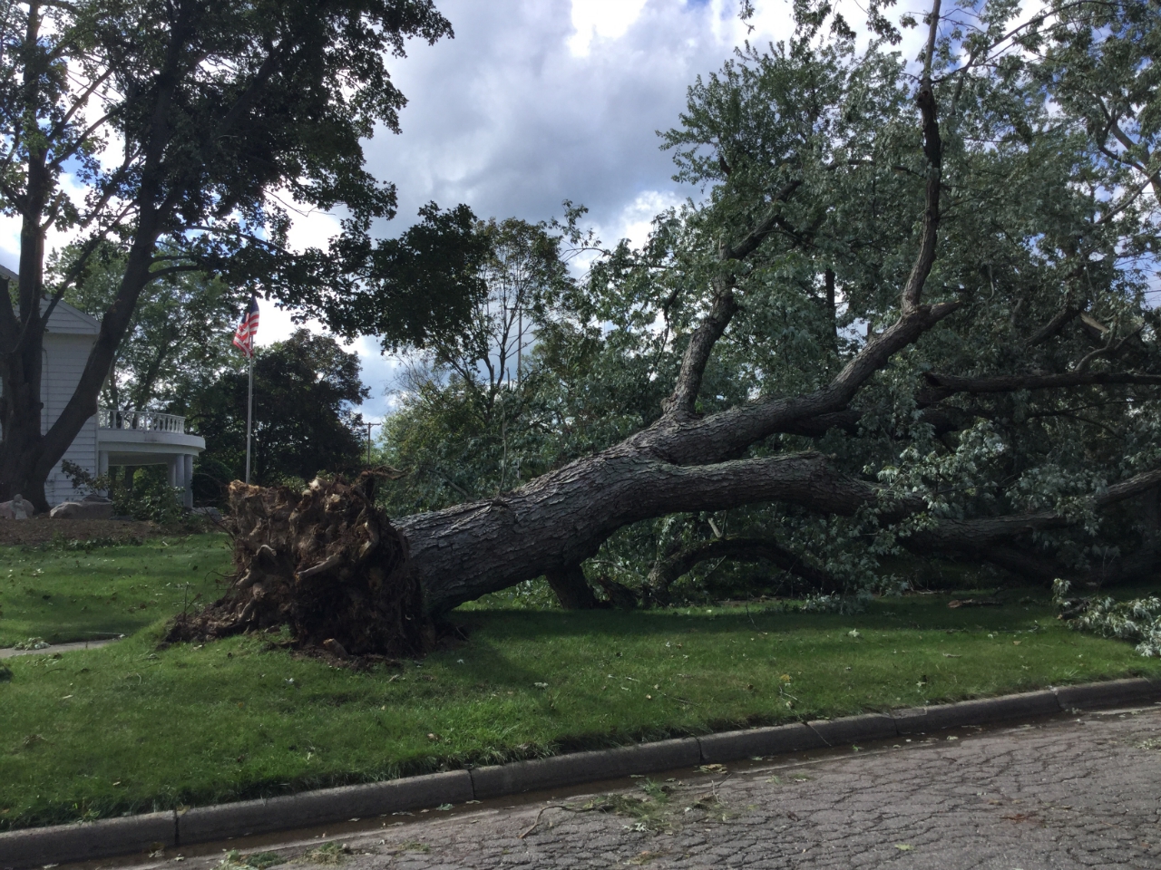
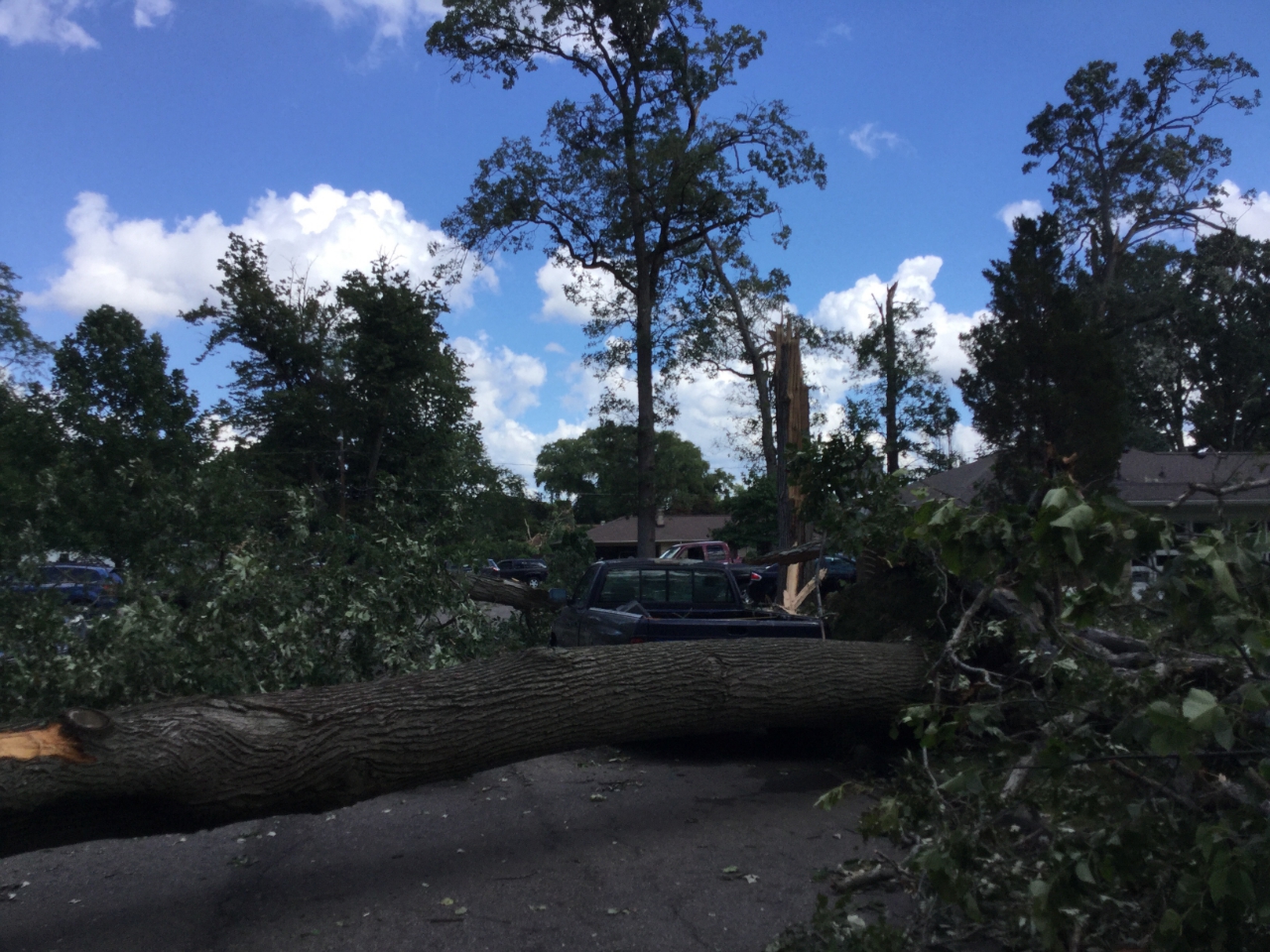
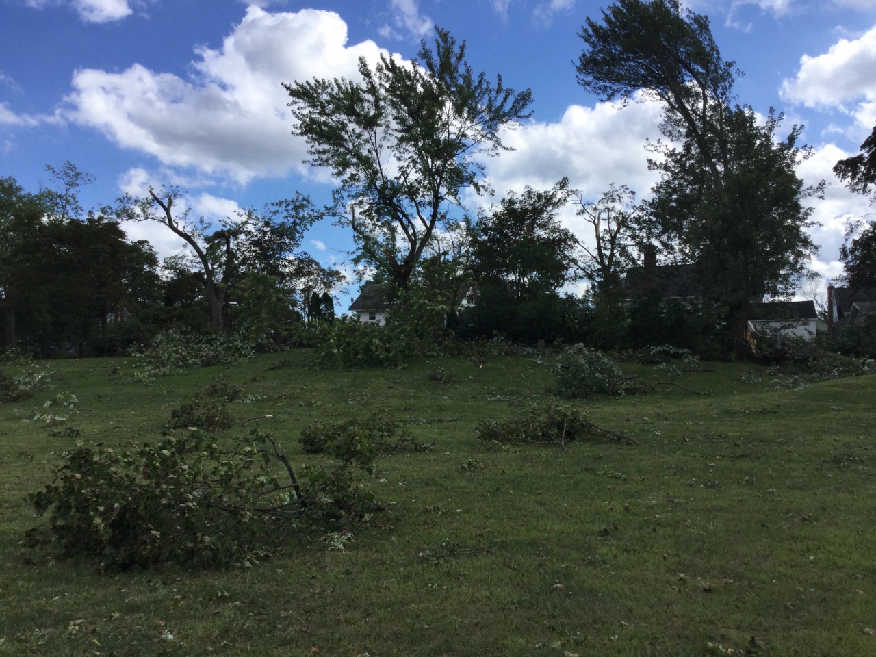
Tornado: Jackson
Track Map 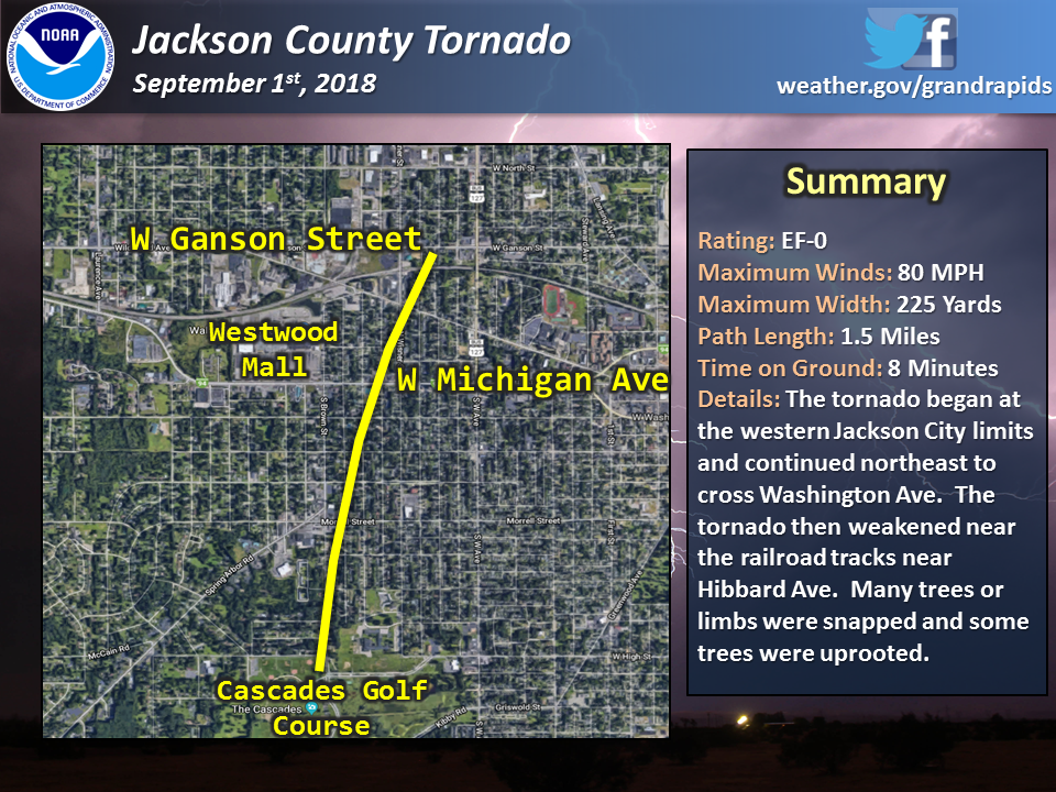 |
||||||||||||||||
 |
 |
 |
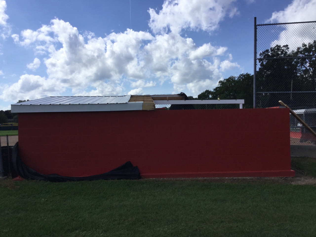 |
| Uprooted tree near West Washington Avenue and South Thompson Street | Felled trees near Brown Street and Oakdale Avenue | Tree damage at Bloomfield Park | Damage to a baseball dugout near High and Brown Streets |
|
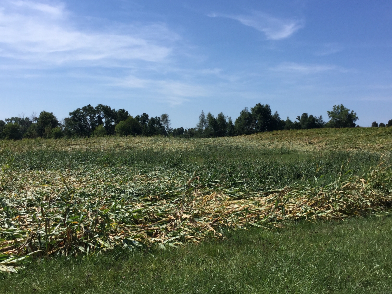
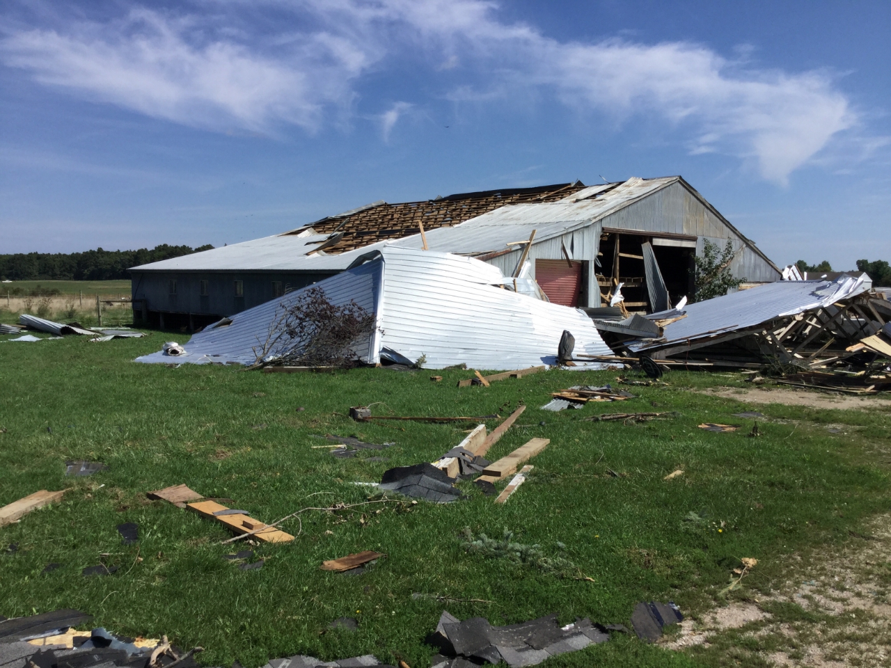
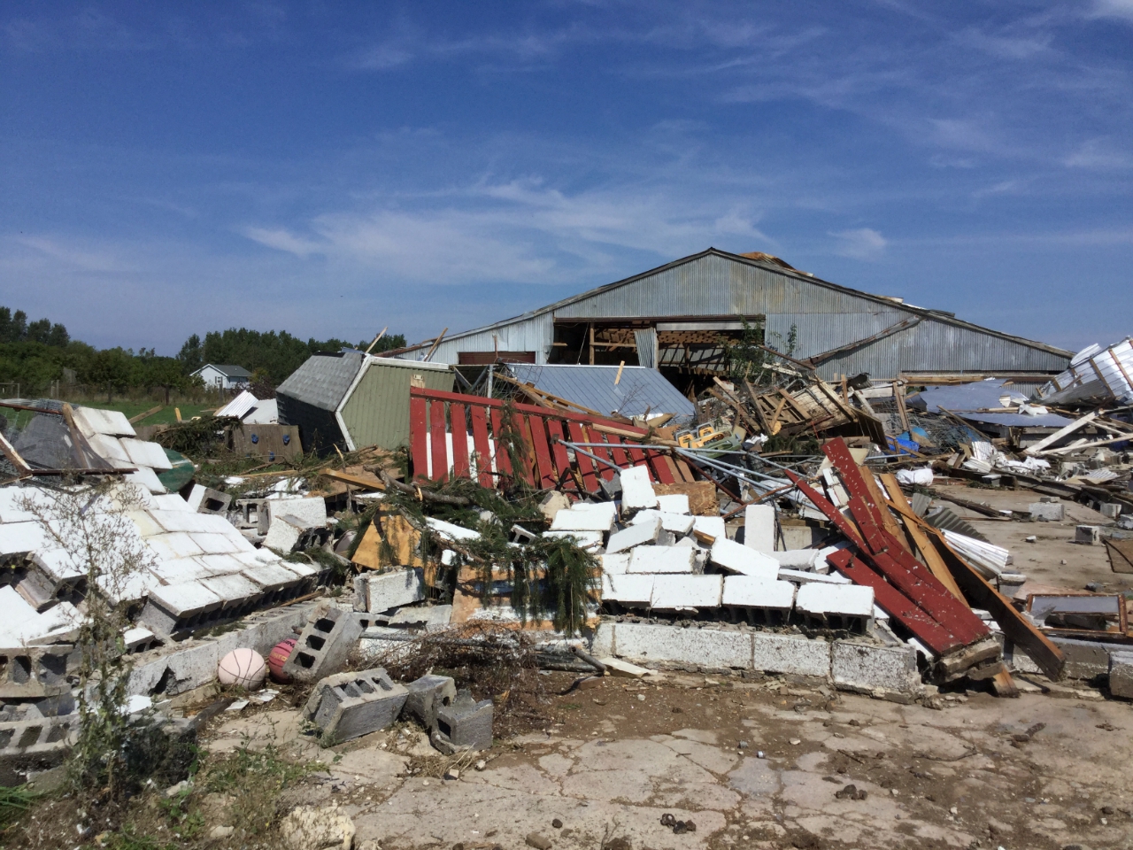
Tornado: Bath Township
Track Map 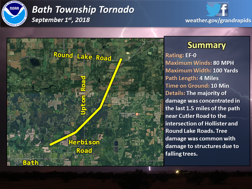 |
||||||||||||||||
 |
 |
 |
 |
| Damage to corn near Hollister and Round Lake Roads | Damage to farm bulidings near Hollister and Round Lake Roads | Damage to small structures near Hollister and Round Lake Roads | Damage to trees near Cutler Road and Tamarack Trail |
 |
 |
||
| Wall cloud seen from US-127 near Howe Rd (Scott Ferguson photo) | Wall cloud seen from US-127 near Howe Rd (Scott Ferguson photo) |
The Enhanced Fujita (EF) Scale classifies tornadoes into the following categories:
| EF0 Weak 65-85 mph |
EF1 Moderate 86-110 mph |
EF2 Significant 111-135 mph |
EF3 Severe 136-165 mph |
EF4 Extreme 166-200 mph |
EF5 Catastrophic 200+ mph |
 |
|||||
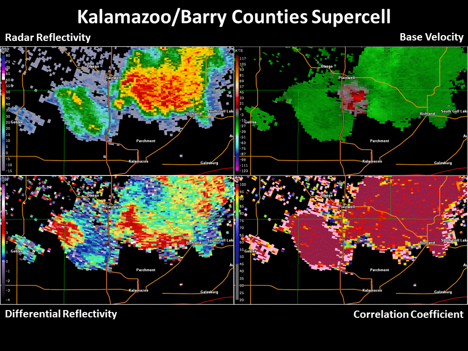
Radar:
Here are loops of the severe storms that produced confirmed tornadoes.
|
|
|
|
|
|
|
|
 |
Media use of NWS Web News Stories is encouraged! Please acknowledge the NWS as the source of any news information accessed from this site. |
|