
Wildfire smoke continues to impact air quality from the Great Lakes region into New England and the Mid-Atlantic today with widespread Air Quality Alerts in effect. Severe thunderstorms are expected across portions of the Ohio Valley and Lower Great Lakes into the Mid-Atlantic and Northeast, this afternoon into the evening. Monsoonal thunderstorms may bring areas of flooding to the Southwest. Read More >
Severe thunderstorms developed across southwestern Lower Michigan during the late afternoon and early evening hours of May 19, 2019. One tornado has been confirmed as of May 20th, 2019. Most of the damage was confined to trees and associated structural damage due to falling trees. Some of the storms were well-photographed and had a visible structure resembling supercell thunderstorms, including rotating rain-free updraft bases, wall clouds, and brief funnel clouds. Such structures are relatively uncommon in Lower Michigan, especially in the last few years.
Tornadoes:
|
Tornado: Between Dowling and Maple Grove
Track Map 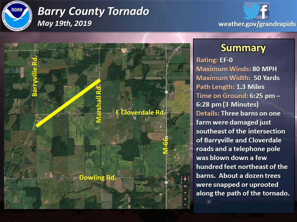
|
||||||||||||||||
| EF0 Weak 65-85 mph |
EF1 Moderate 86-110 mph |
EF2 Significant 111-135 mph |
EF3 Severe 136-165 mph |
EF4 Extreme 166-200 mph |
EF5 Catastrophic 200+ mph |
 |
|||||
|
|
 |
Media use of NWS Web News Stories is encouraged! Please acknowledge the NWS as the source of any news information accessed from this site. |
|


.gif)
 Follow us on YouTube