Dangerous heat will expand from the Gulf Coast into the Southern Plains and Desert Southwest through week's end. Additional extreme heat impacting the Pacific Northwest will shift to the northern Plains by the weekend. Tropical Storm Bertha is expected to continue to impact portions of the northern Gulf Coast from the western Florida Panhandle to southeastern Louisiana through tonight. Read More >
Grand Rapids, MI
Weather Forecast Office
Heavy Rain Event Overview
|
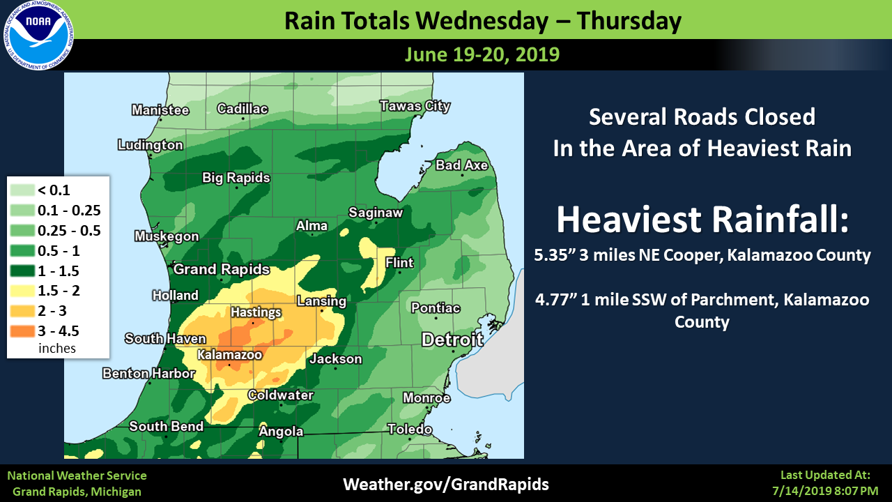
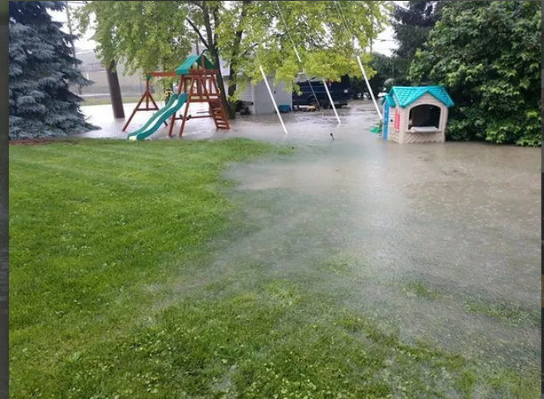
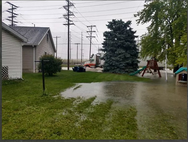
Heavy rain fell over a large part of Southwest Michigan from late in the day on the 19th of June through the early afternoon hours of the 20th of June. The heaviest flooding was in the the Kalamazoo area, where Western Michigan University Stadium flooded. Roads were closed in many areas from Kalamazoo to Lansing from the heavy rain.
Rainfall amounts generally ranged from 2 to 4 inches in the are of heaviest rainfall. Amounts close to 5 inches were reported near Kalamazoo.
|
 |
Media use of NWS Web News Stories is encouraged! Please acknowledge the NWS as the source of any news information accessed from this site. |
|
US Dept of Commerce
National Oceanic and Atmospheric Administration
National Weather Service
Grand Rapids, MI
4899 Tim Dougherty Drive SE
Grand Rapids, MI 49512-4034
616-949-0643
Comments? Questions? Please Contact Us.