
Dangerous heat will expand from the Gulf Coast into the Southern Plains and Desert Southwest through week's end. Additional extreme heat impacting the Pacific Northwest will shift to the northern Plains by the weekend. Tropical Storm Bertha is expected to continue to impact portions of the northwestern Gulf Coast from south central Louisiana to the upper Texas coast today. Read More >
Grand Rapids, MI
Weather Forecast Office
Overview
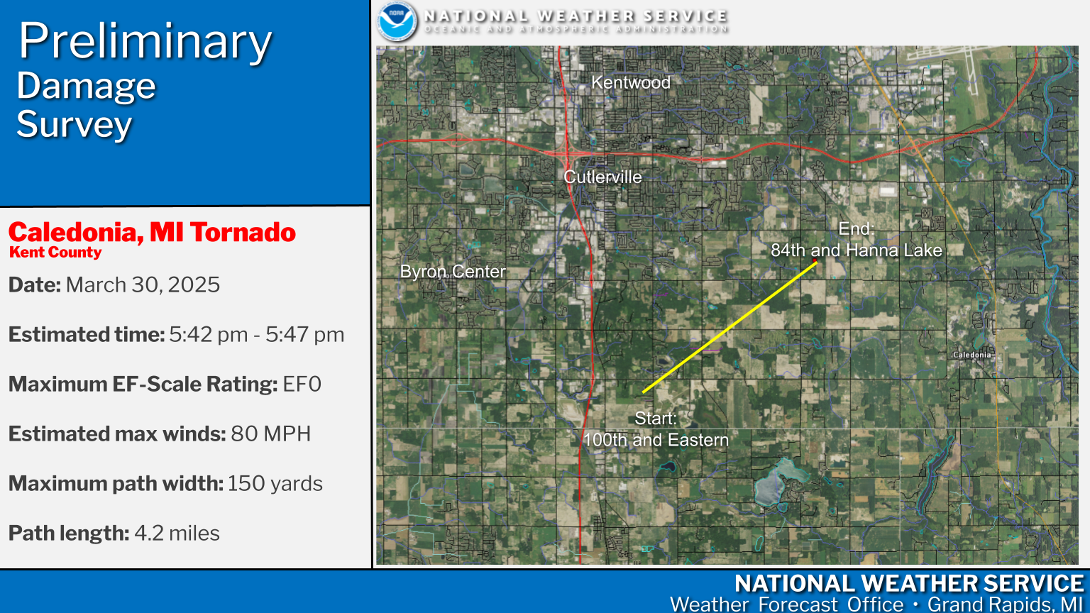
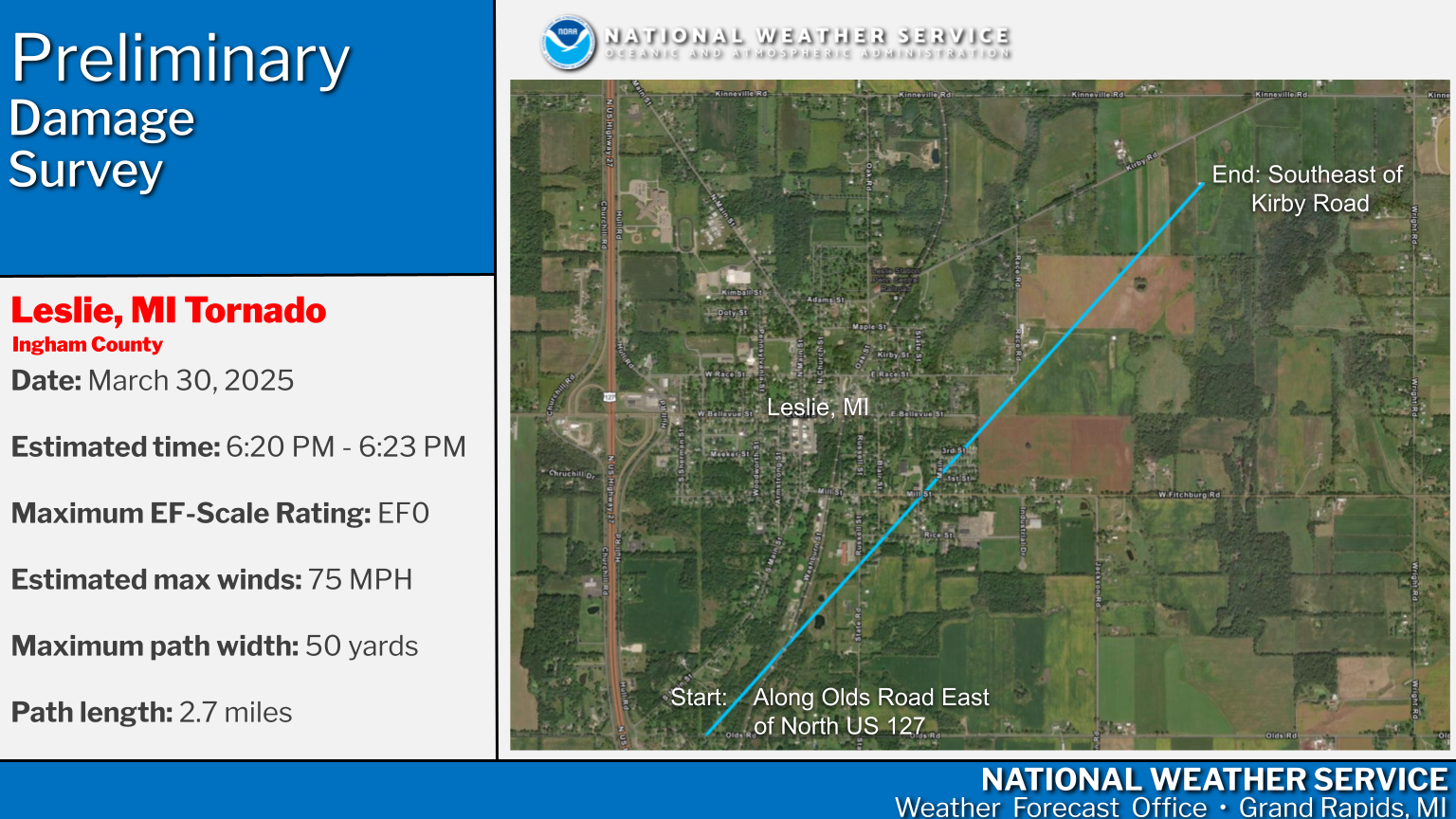
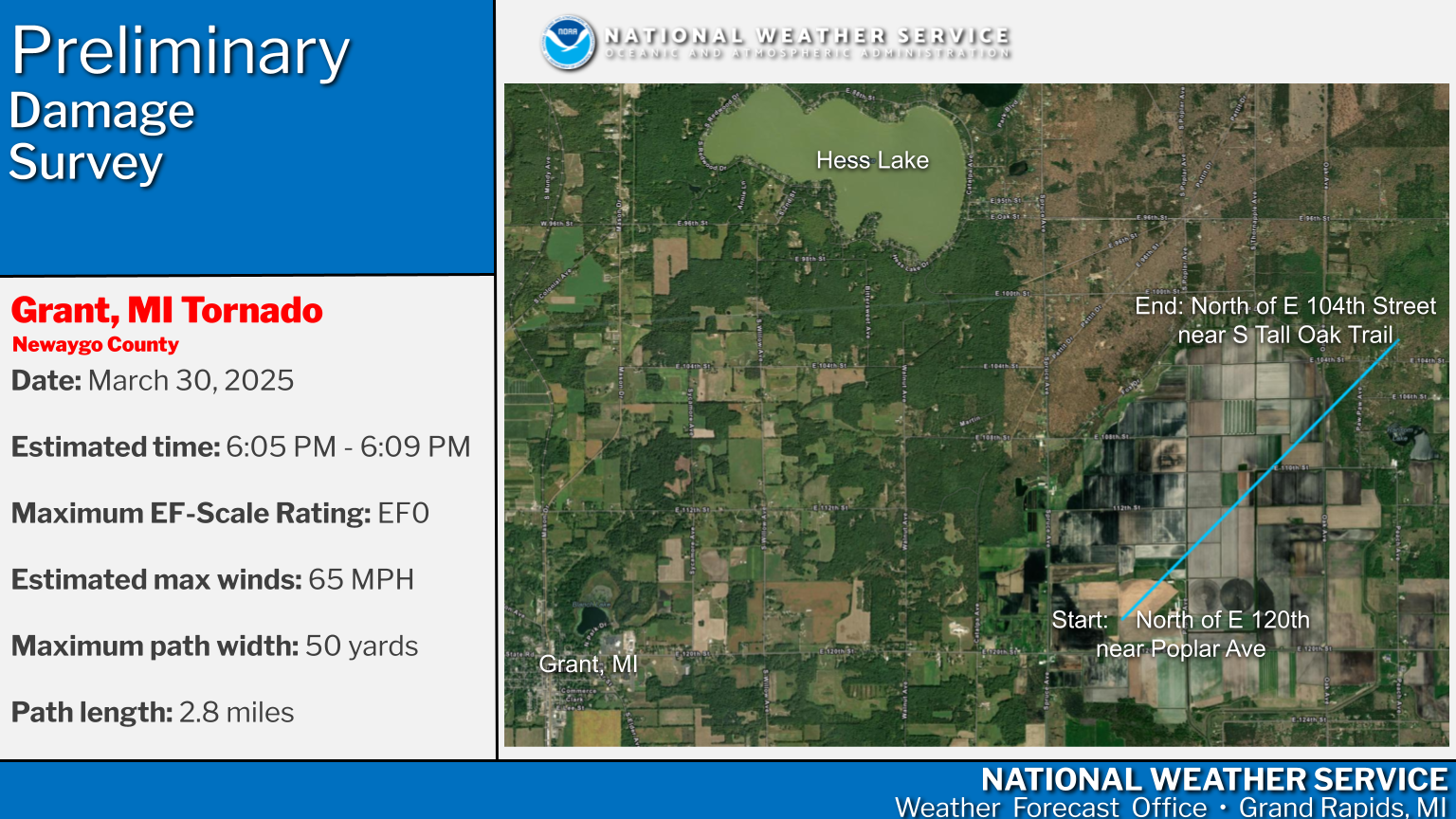
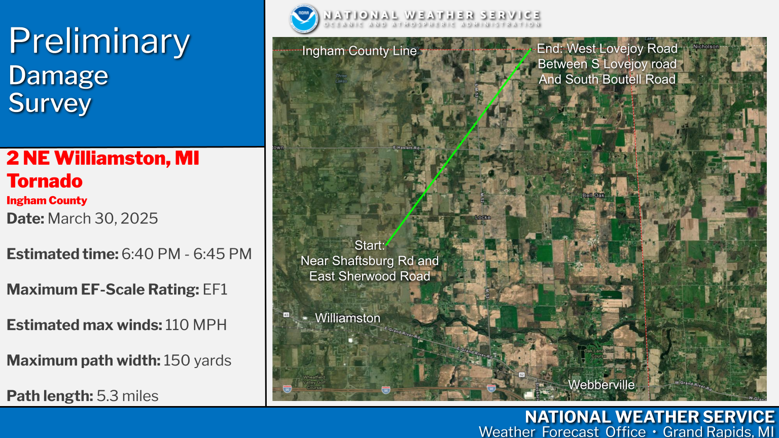
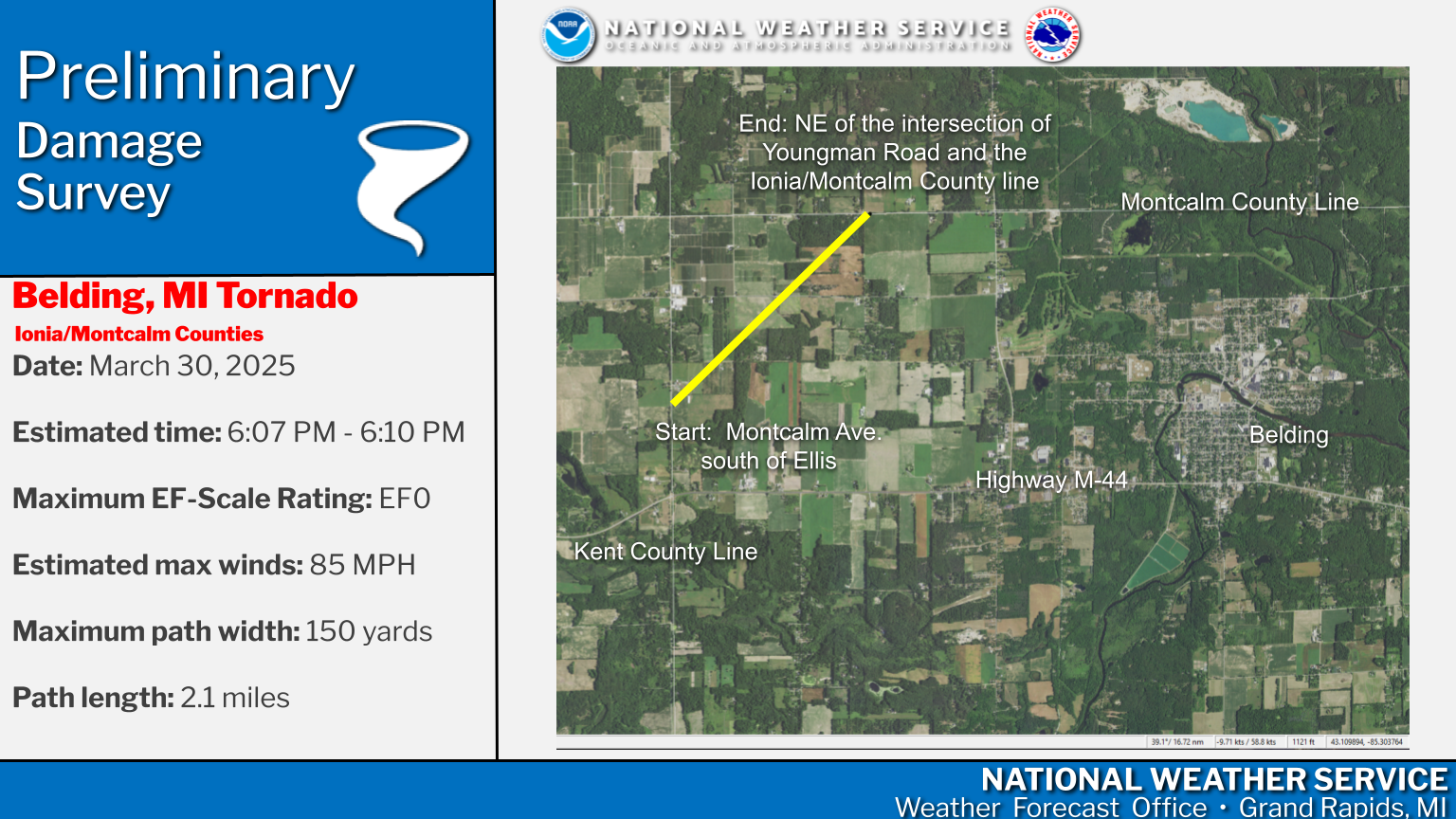
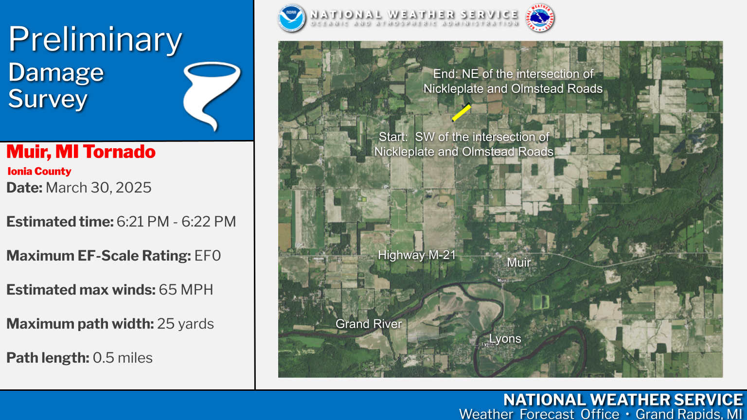
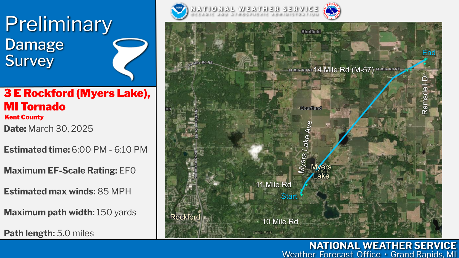
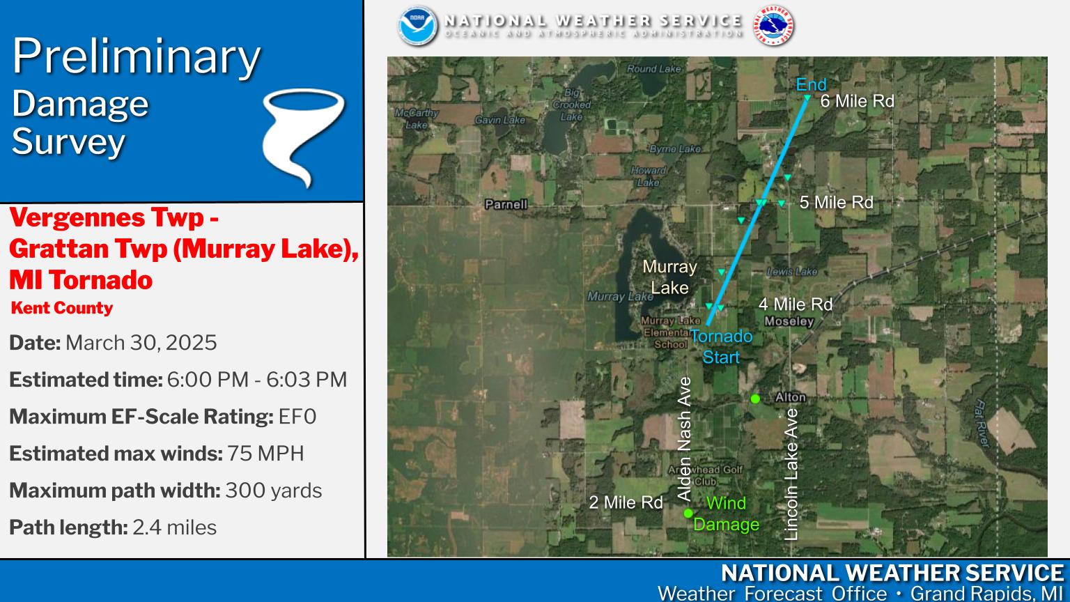
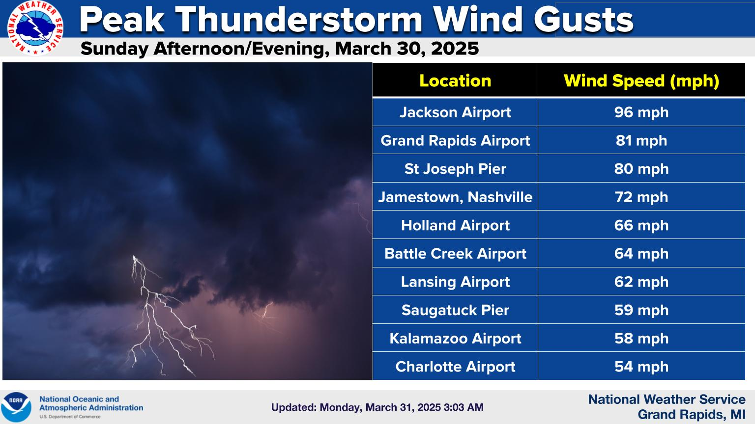
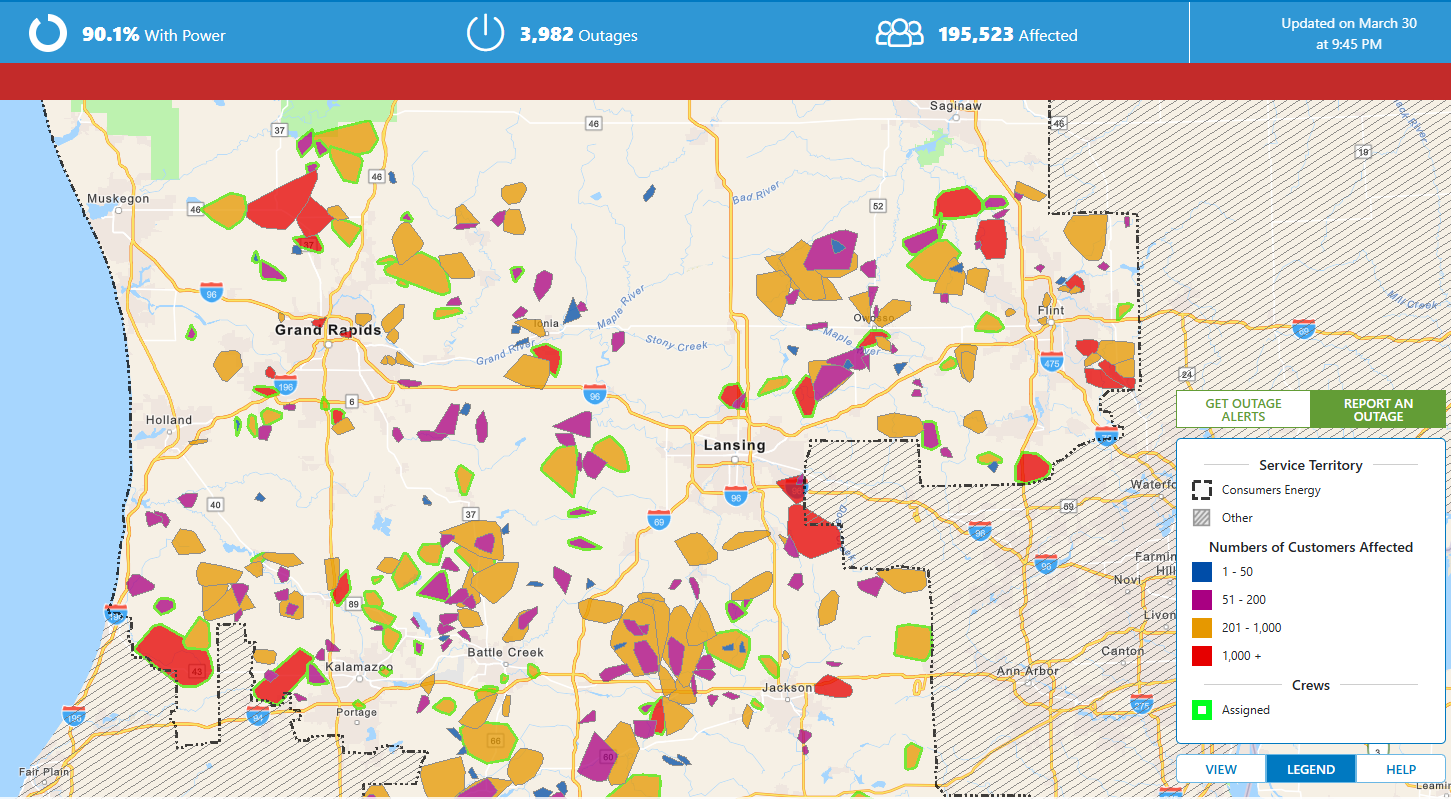
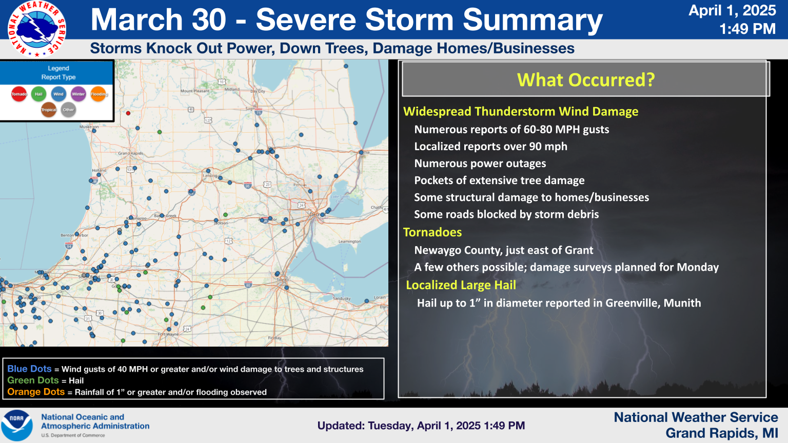
Between roughly 4 PM and 8 PM EDT on March 30, 2025, unusually severe thunderstorm wind gusts brought damage to much of Southwest and Mid Lower Michigan. The Grand Rapids Gerald R. Ford International Airport reported a peak gust of 81 mph and Jackson County Airport reported a 96 mph gust. Eight tornadoes had been confirmed in the Grand Rapids forecast area, and twelve in the state of Michigan.
Tornadoes
Eight Tornadoes have been confirmed as of April 8th, 2025
The Enhanced Fujita (EF) Scale classifies tornadoes into the following categories:
| EF0 Weak 65-85 mph |
EF1 Moderate 86-110 mph |
EF2 Significant 111-135 mph |
EF3 Severe 136-165 mph |
EF4 Extreme 166-200 mph |
EF5 Catastrophic 200+ mph |
 |
|||||
Wind
These are reported peak winds. Many other non-official locations not listed here experienced wind gusts well above 60 mph.
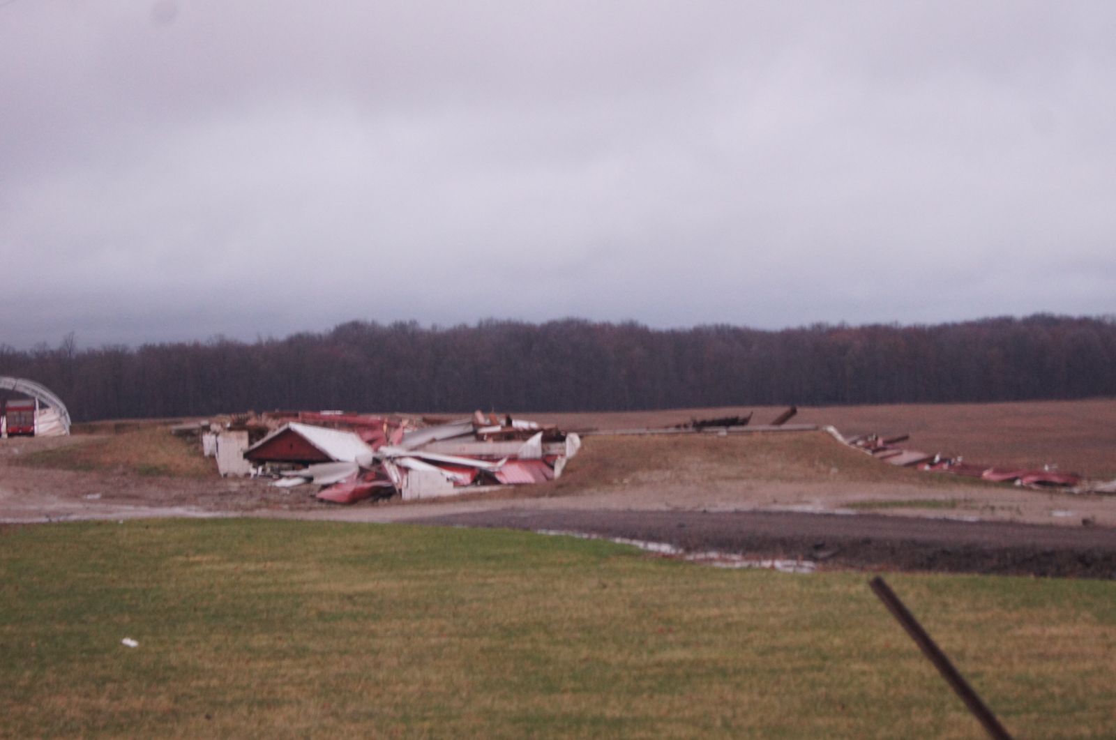
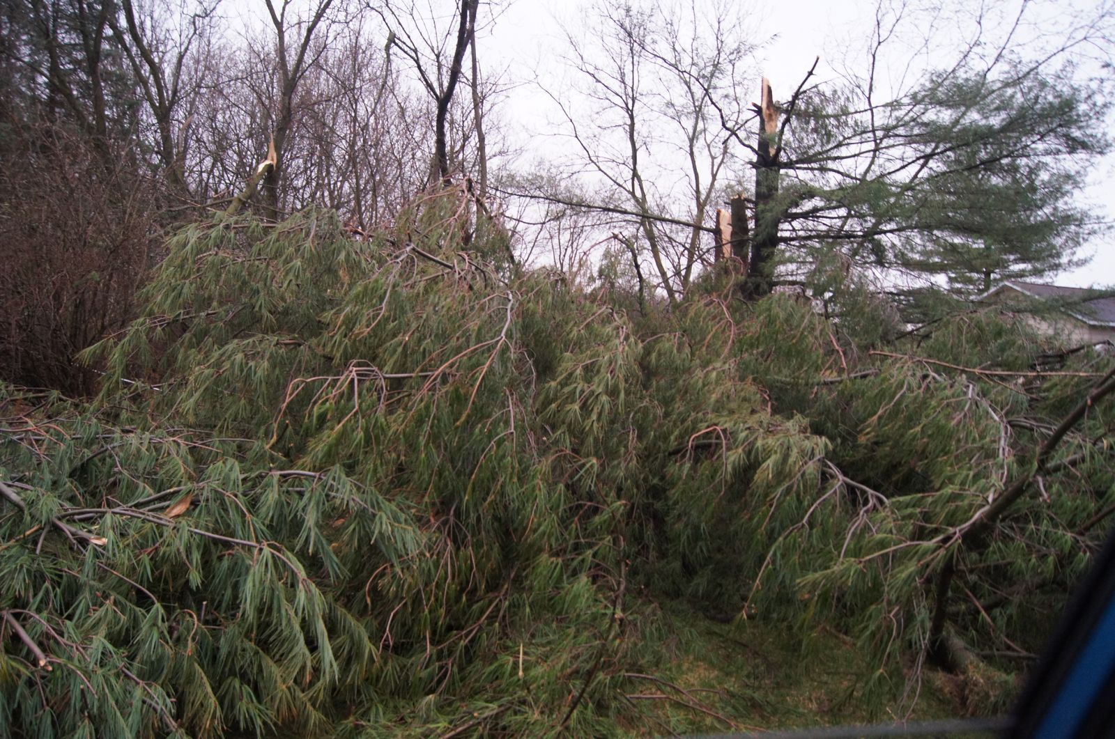
Photos
.PNG)


Radar
Storm Reports
 |
Media use of NWS Web News Stories is encouraged! Please acknowledge the NWS as the source of any news information accessed from this site. |
|
US Dept of Commerce
National Oceanic and Atmospheric Administration
National Weather Service
Grand Rapids, MI
4899 Tim Dougherty Drive SE
Grand Rapids, MI 49512-4034
616-949-0643
Comments? Questions? Please Contact Us.

