
Critical fire weather is expected Friday across the Northern Plains, Upper Midwest, and southern High Plains due to gusty winds and low humidity. Severe thunderstorms capable of large to very large hail, wind damage and tornadoes will be possible Friday and Saturday across parts of the central Plains. Read More >
Grand Rapids, MI
Weather Forecast Office
Overview
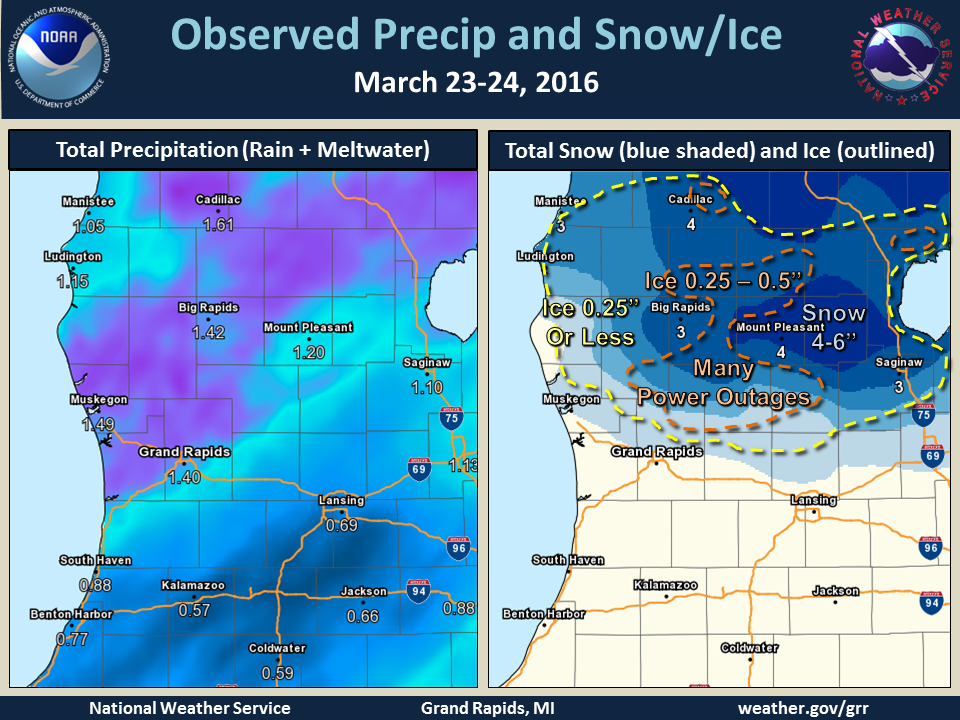
March 23-24, 2016, Winter Storm Summary
Ice near Sidney, MI (Montcalm Co)
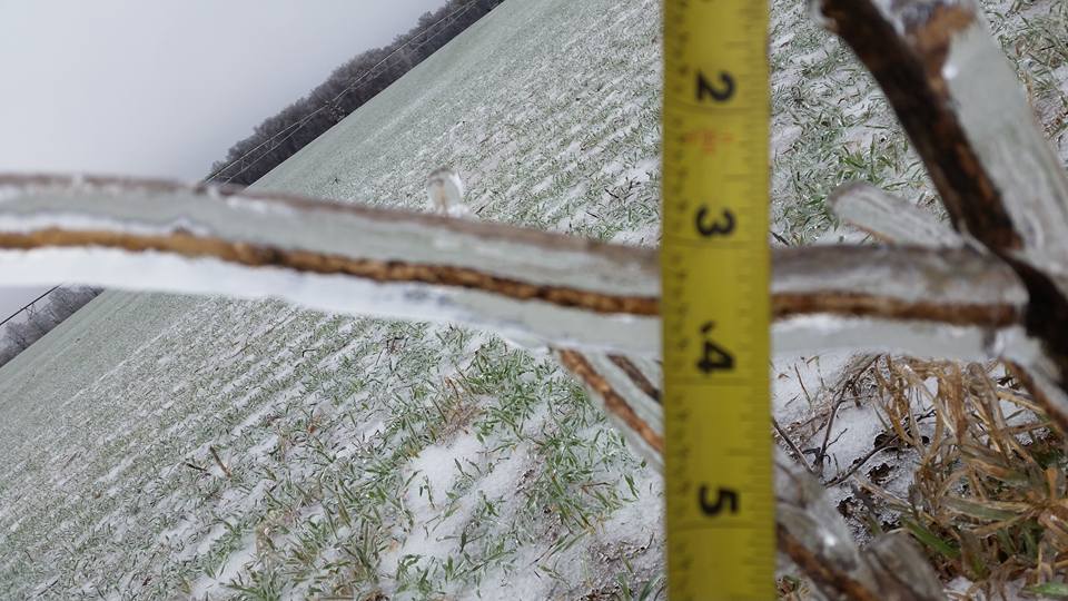
Photo taken by Don McCracken
 |
Media use of NWS Web News Stories is encouraged! |
|
US Dept of Commerce
National Oceanic and Atmospheric Administration
National Weather Service
Grand Rapids, MI
4899 Tim Dougherty Drive SE
Grand Rapids, MI 49512-4034
616-949-0643
Comments? Questions? Please Contact Us.

