
Tropical system in the Gulf expected to gradually strengthen the next couple of days off the Florida Panhandle and Alabama coasts. Instances of flash flooding will be possible through Thursday along the eastern and central Gulf Coast. Severe thunderstorms will develop and move along a cold front crossing the Upper Midwest, and through the Ohio Valley/Mid-Atlantic on Tuesday. Read More >
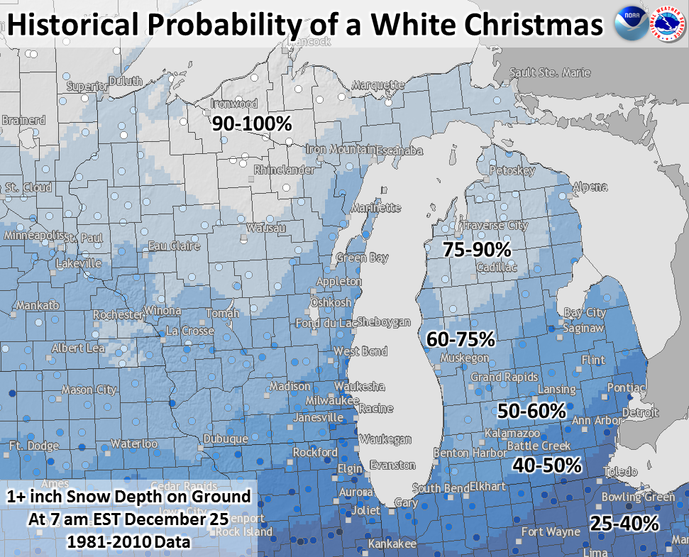
What is the probability of a white Christmas? Using 1981-2010 data from long-running weather stations, the historical probability is shown on the map. This year, the probability of a white Christmas (at least an inch of snow on the ground Christmas morning) is almost certain in Michigan. However, a big snowmelt could begin later on Christmas Day and continue into part of Monday. More information & interactive map.
White Christmas Climatology
Extended Forecast
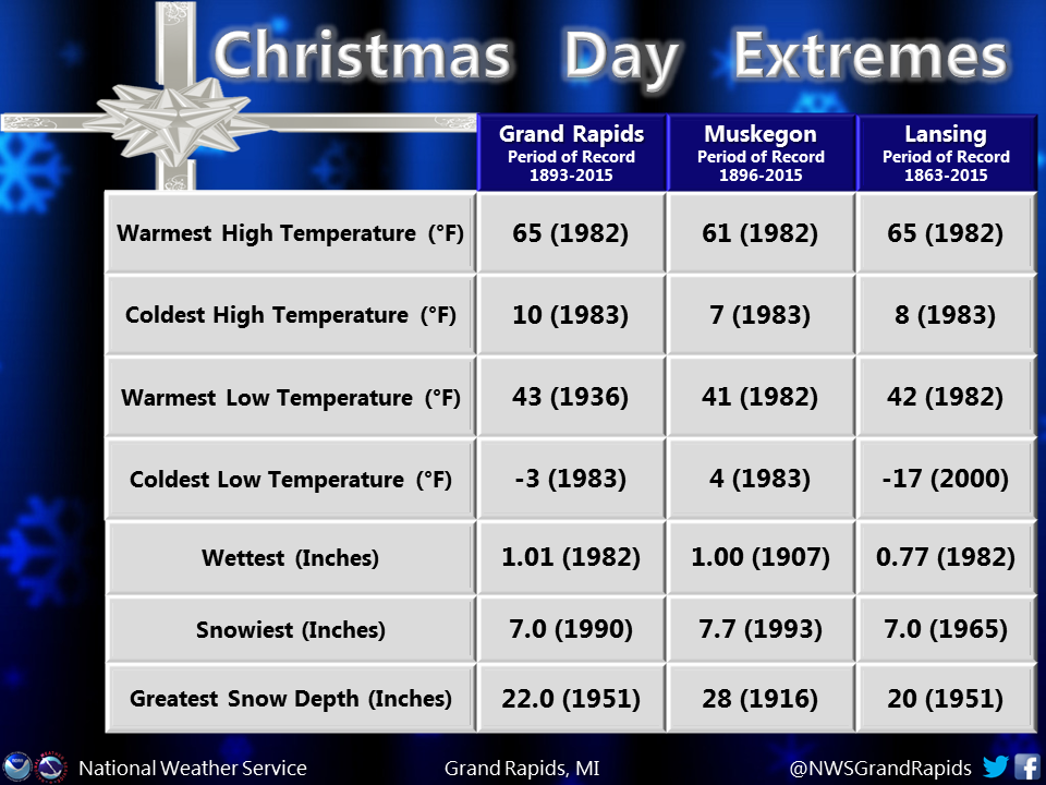
Christmas Day Extremes
.png)
 |
Media use of NWS Web News Stories is encouraged! |
|

