
A heat wave over the Southwest will intensify this week, peaking and expanding into the Intermountain West and northern High Plains this weekend. Critical to extremely critical fire weather conditions are forecast from the Northwest and the northern Great Basin this weekend. Particularly Dangerous Situation Red Flag Warnings have been issued. Read More >
Last Map Update: Sat, Aug 1, 2026 at 7:16:17 pm MDT


|
Text Product Selector (Selected product opens in current window)
|
|


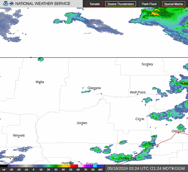 Glasgow Radar
 Satellite
 Current observations
 Forecast discussion
 Montana weather
 Fire weather
 Recreation forecasts
.png) Transportation forecast
Transportation forecast.png) Weather Prediction Center
Weather Prediction Center Storm Prediction Center
 Aviation weather
.png) Skywarn
Skywarn Weather Stats