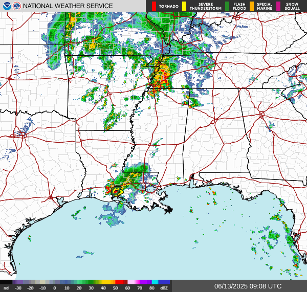
A line of strong to severe storms will enter our western areas early Monday morning, with the risk of damaging winds and isolated tornadoes. Remember, stay weather aware. Have multiple ways to receive warnings and do not drive through flooded roadways.
Storms will continue east throughout the rest of the day on Monday, introducing the risk of a few strong to locally severe storms producing damaging winds and isolated tornadoes. Stay weather aware on Monday!
Intense rainfall rates may lead to localized areas of flash flooding, especially where storms slow down or train over the same areas. Stay weather aware, have multiple ways to get warnings and avoid flooded roadways!
Timing will primarily be early in the morning on Monday around daybreak for western areas, continuing east through the morning into afternoon hours, with the threat diminishing after sunset.


 Regional Radar
 Weather Map
 Tropical Weather Outlook
 Graphical HWO
 Climate Data for Today
 Follow us on YouTube