New Orleans/Baton Rouge
Weather Forecast Office
|
February 13, 2007 Radar Loops |
||
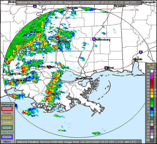
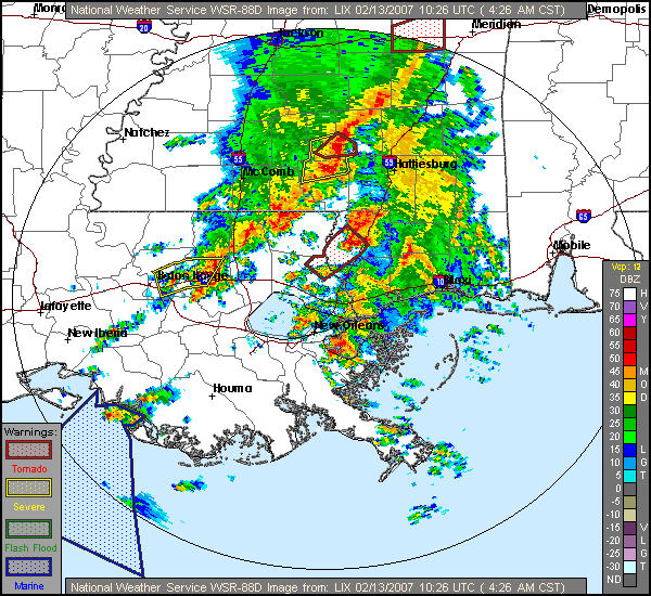
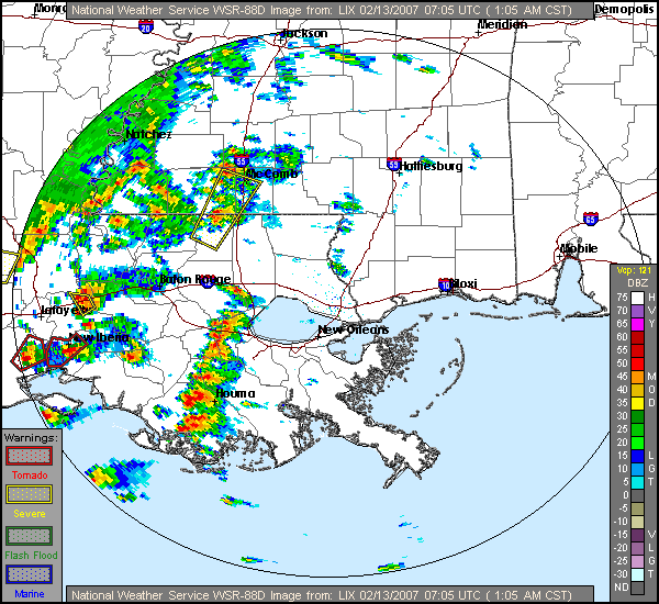
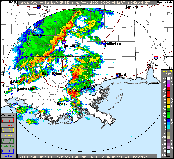
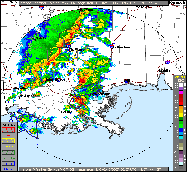
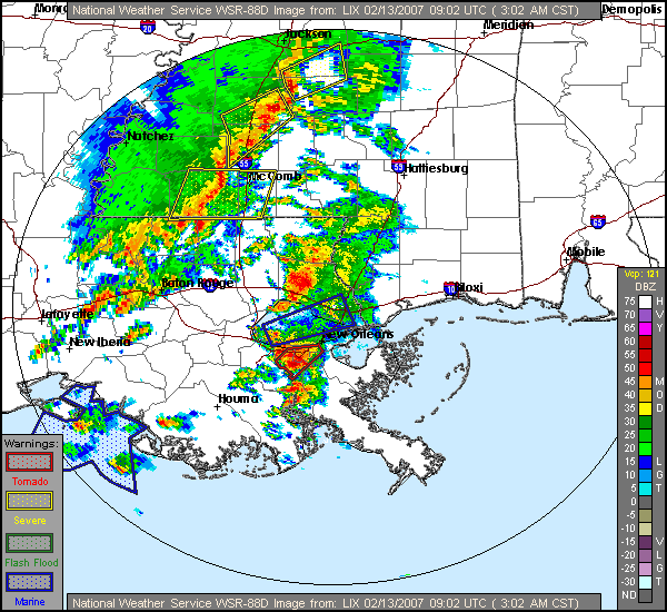
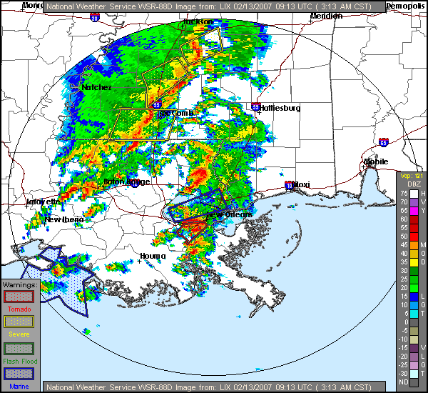
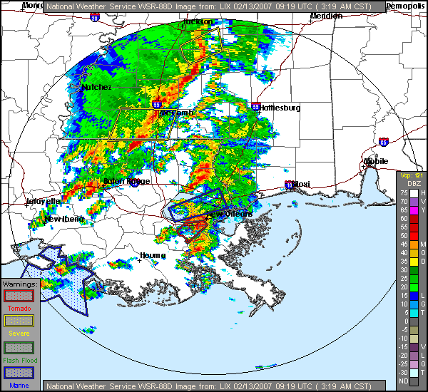
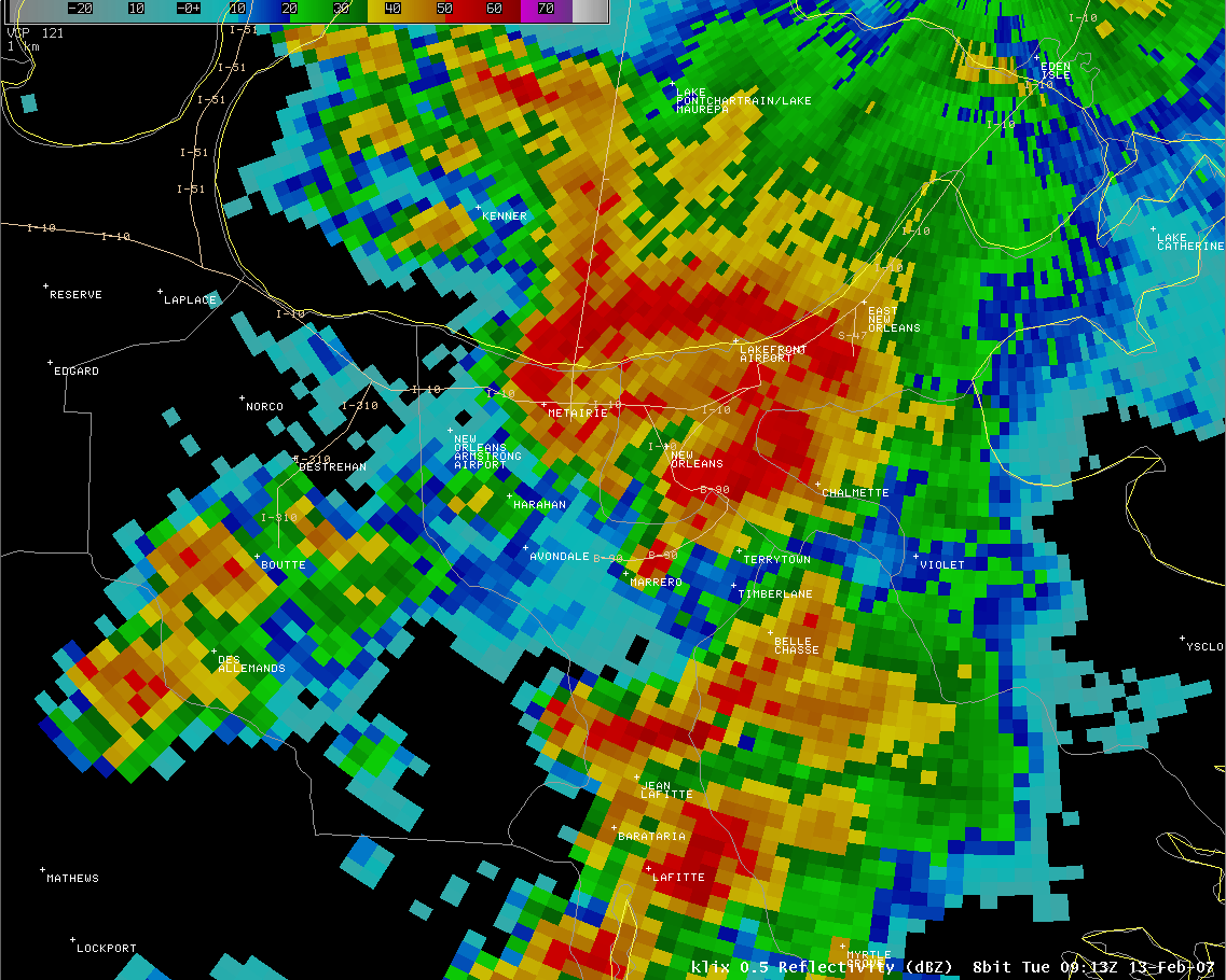
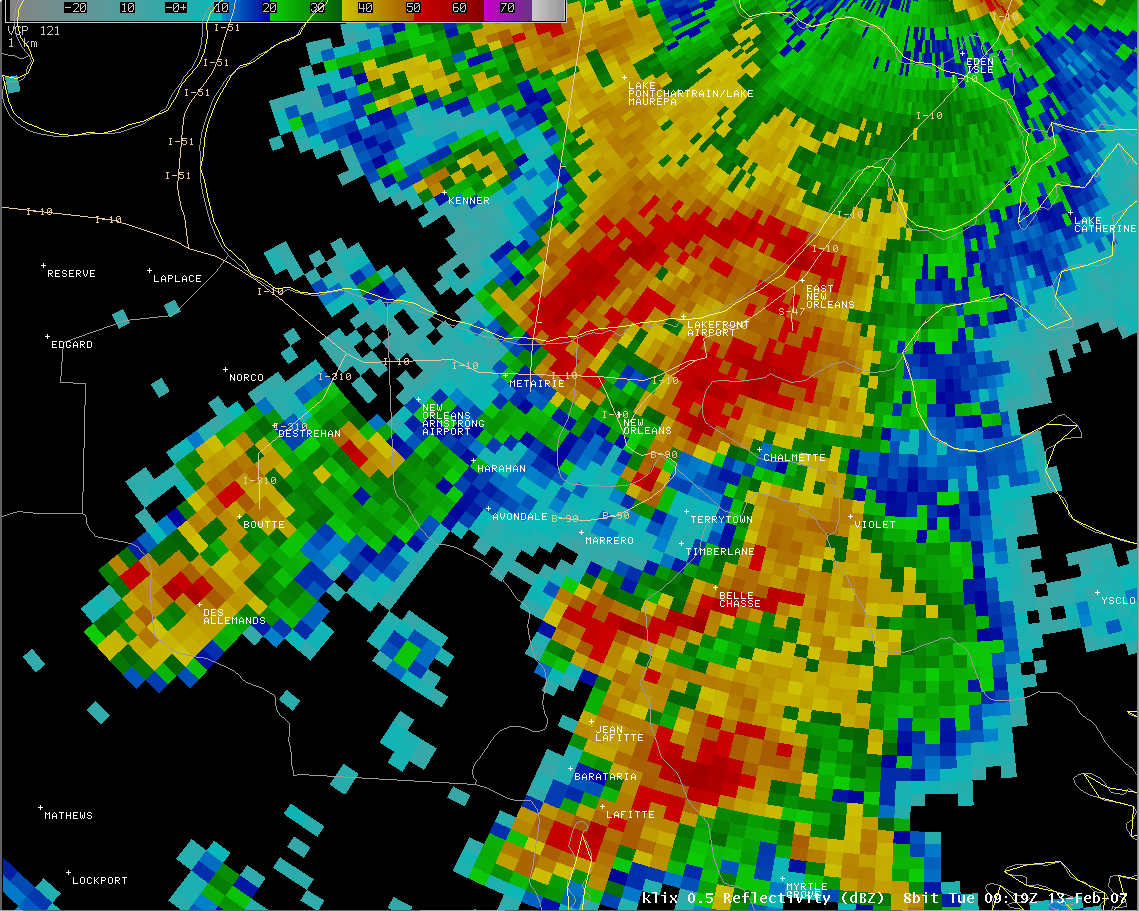
| Ridge Radar New Orleans Loop Mississippi Loop Full Loop 2:52am / 0852Z 2:57am / 0857Z 3:02am / 0902Z 3:08am / 0908Z 3:13am / 0913Z 3:19am / 0919Z |
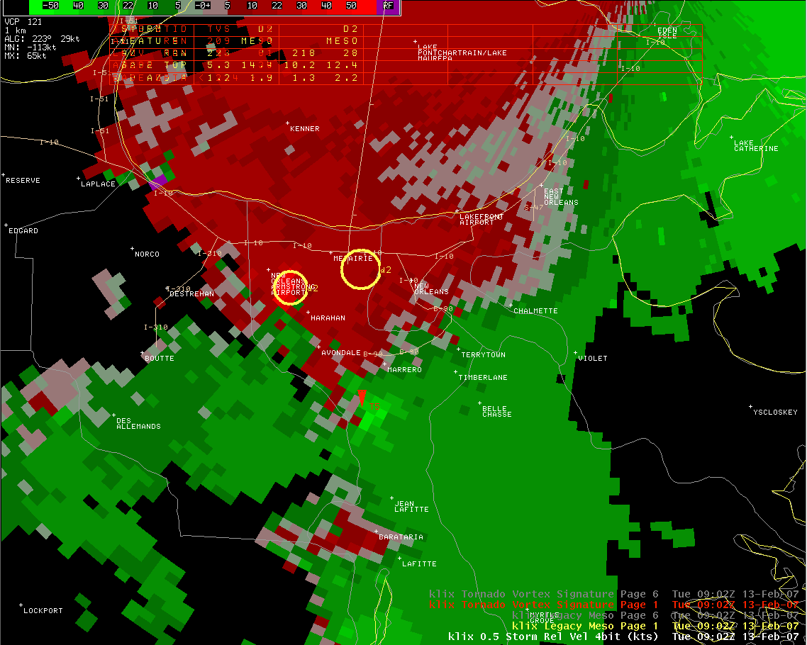
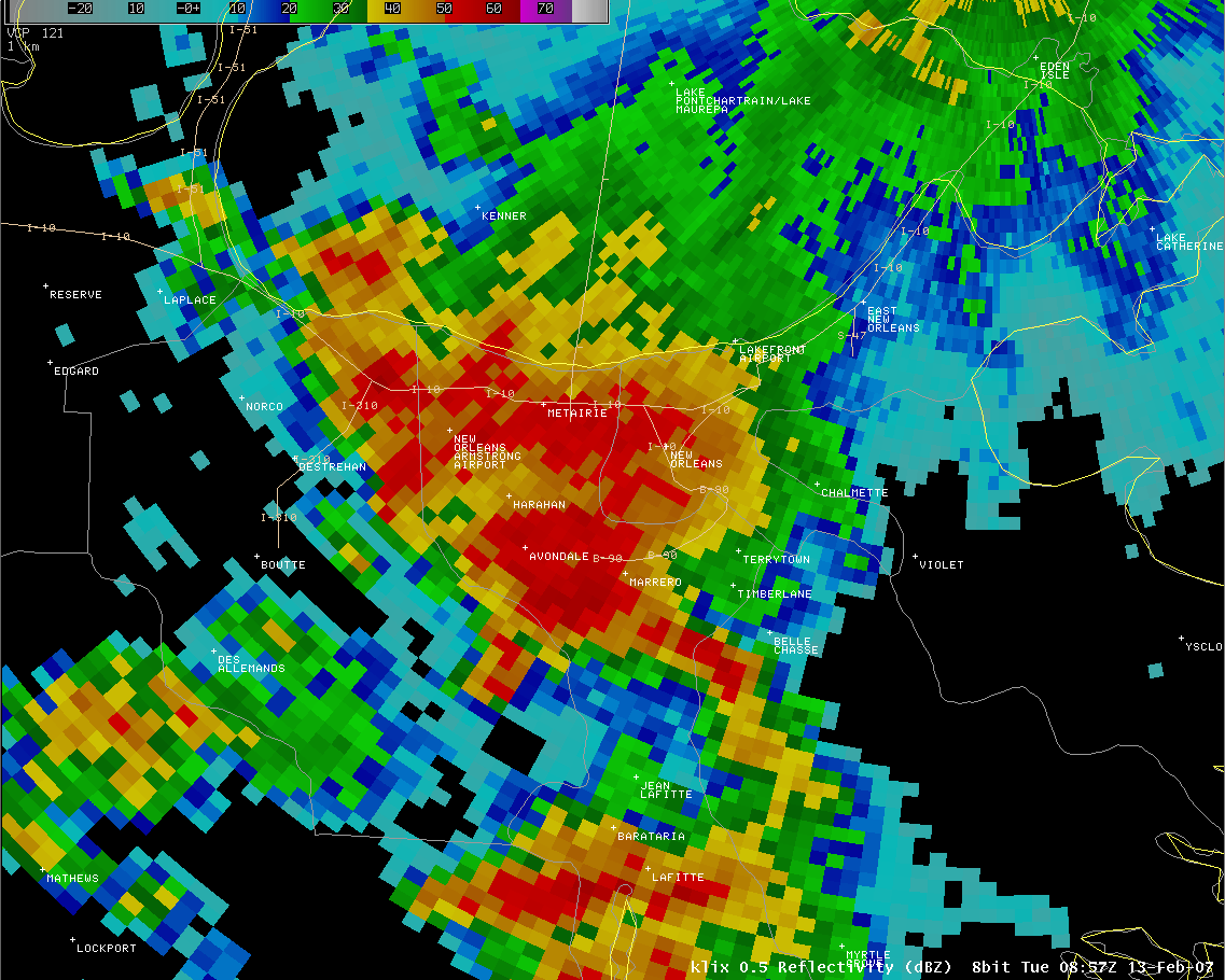
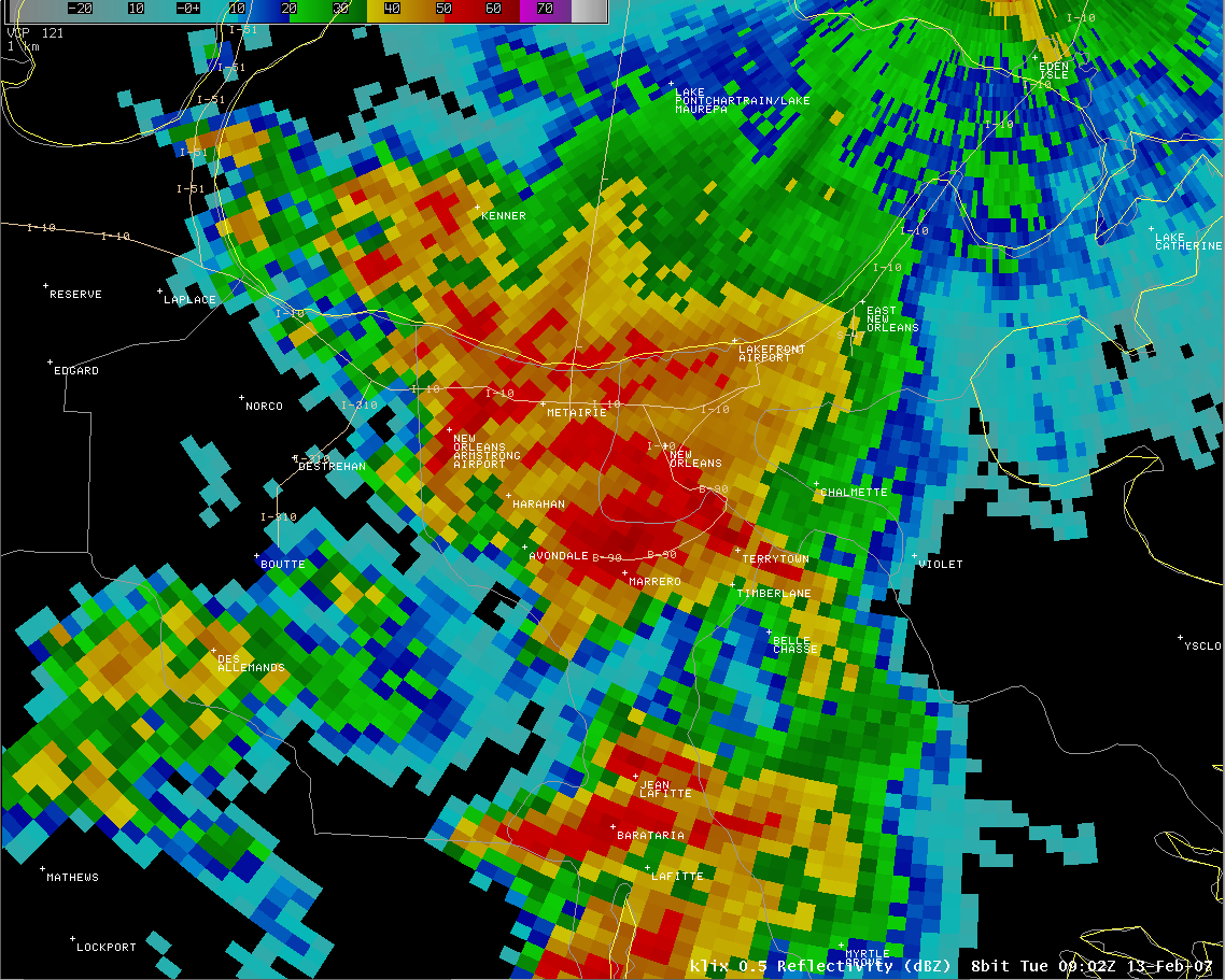
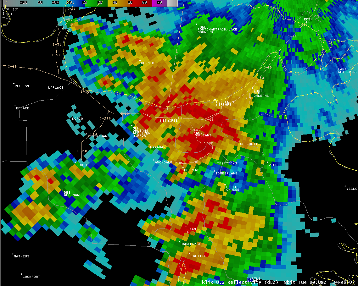
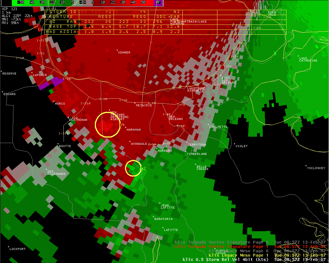
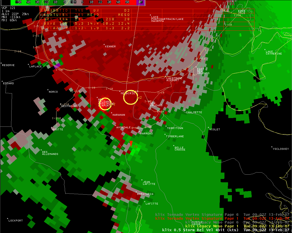
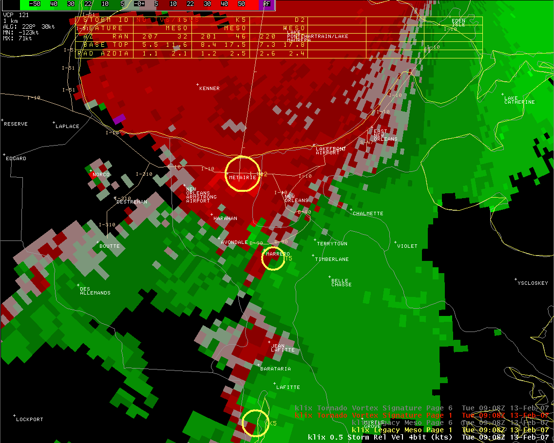
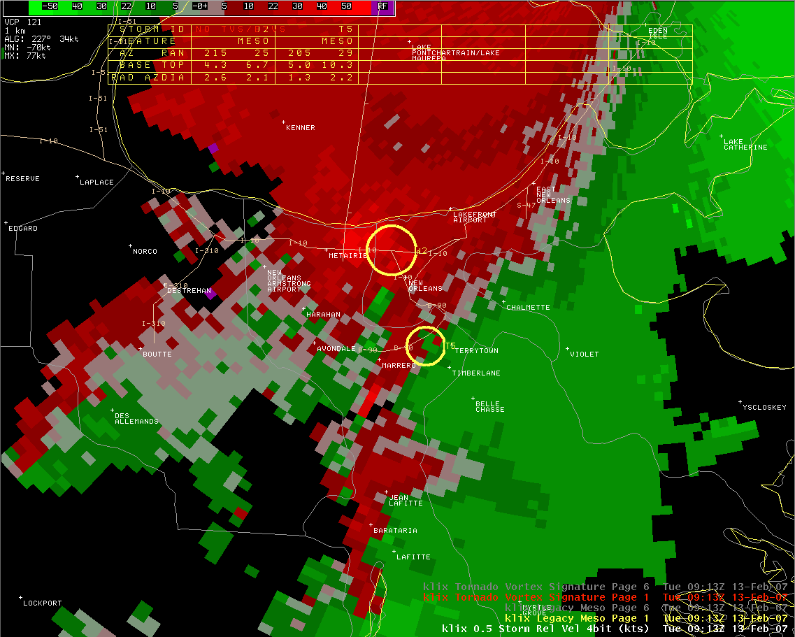
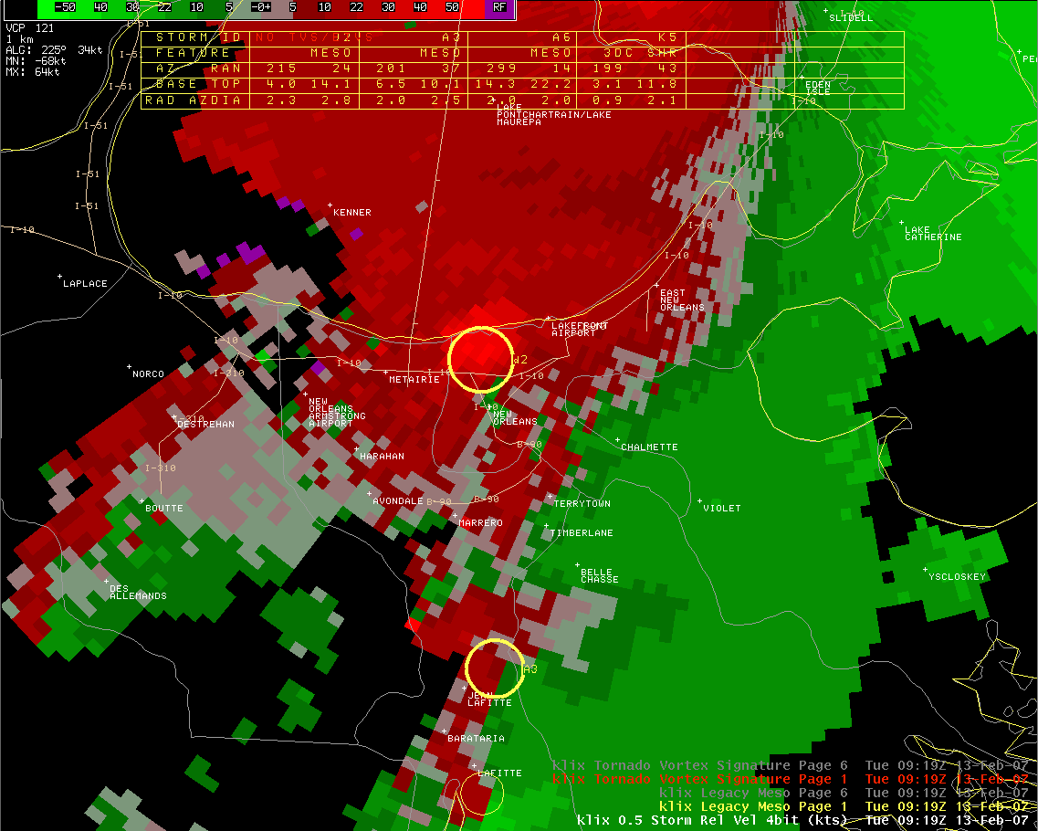
AWIPS Radar (these are large images) New Orleans Reflectivity Loop New Orleans Storm-Relative Motion Loop 2:57am / 0857Z Reflectivity 3:02am / 0902Z Reflectivity 3:08am / 0908Z Reflectivity 3:13am / 0913Z Reflectivity 3:19am / 0919Z Reflectivity 2:57am / 0857Z Storm-Relative Motion 3:02am / 0902Z Storm-Relative Motion 3:08am / 0908Z Storm-Relative Motion 3:13am / 0913Z Storm-Relative Motion 3:19am / 0919Z Storm-Relative Motion |
|
 Note: The warnings did not display on a few of the Ridge images. |
||
| The "Ridge" radar is the standard radar data available through the NWS website. The images here are the base reflectivity with warnings overlayed. The "AWIPS" radar is what is used at the local NWS offices. The "Storm Relative Motion" or "SRM" is the motion measured by the radar with the overall storm motion subtracted from it. This is used to help identify rotation within the storms. Red indicates relative motion away from the radar (which is located in Slidell, to the northeast of New Orleans) and green the relative motion toward the radar. |
||
Current Hazards
Fire Manager Quick Brief
Briefing Page
Storm Prediction Center
Extended Outlooks
Outlooks
Forecasts
Graphical Forecast
Weather Models and Maps
Fire Weather Forecast
Hourly Weather Graph
Air Quality Forecasts
Marine Forecast
Activity Planner
River Forecasts
Tropical Forecast
Forecast Discussion
Aviation Weather Forecast
US Dept of Commerce
National Oceanic and Atmospheric Administration
National Weather Service
New Orleans/Baton Rouge
62300 Airport Rd.
Slidell, LA 70460-5243
504.522.7330 985.649.0429
Comments? Questions? Please Contact Us.

