New Orleans/Baton Rouge
Weather Forecast Office
February 13, 2007 Preliminary Tornado and Damage Tracks
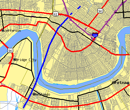
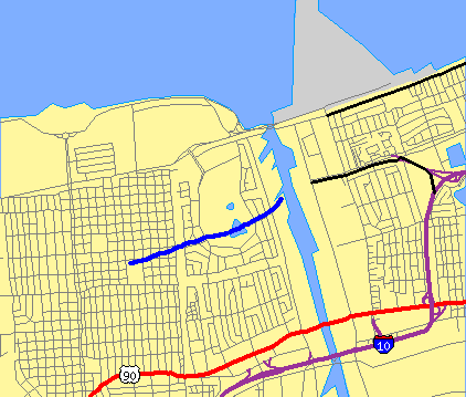
Maps from the Tiger Map Service of the U.S. Census Bureau.
The preliminary tornado damage tracks are in blue. The first tornado track stretched form Westwego on the Jefferson Parish Westbank, across the Mississippi River just west of Audubon Park, and into the Carrollton area of New Orleans. The second tracked northeastward across Gentilly and Pontchartrain Park.
Current Hazards
Outlooks
Fire Manager Quick Brief
Briefing Page
Storm Prediction Center
Extended Outlooks
Forecasts
Tropical Forecast
Forecast Discussion
Aviation Weather Forecast
Graphical Forecast
Weather Models and Maps
Fire Weather Forecast
Hourly Weather Graph
Air Quality Forecasts
Marine Forecast
Activity Planner
River Forecasts
US Dept of Commerce
National Oceanic and Atmospheric Administration
National Weather Service
New Orleans/Baton Rouge
62300 Airport Rd.
Slidell, LA 70460-5243
504.522.7330 985.649.0429
Comments? Questions? Please Contact Us.

