New Orleans/Baton Rouge
Weather Forecast Office
Independence Tornado - March 26, 2009
|
Rating:
|
EF-1
|
|
Estimated Maximum Wind:
|
110 mph
|
|
Injuries/Fatalities:
|
1 injury
|
|
Damage Path Length:
|
0.75 miles
|
|
Maximum Path Width:
|
50 yards
|
|
Approximate Start Point/Time:
|
2 miles E of Independence, LA at 158 AM
|
|
Approximate End Point/Time:
|
2.75 miles ENE of Independence, LA at 203 AM
|
|
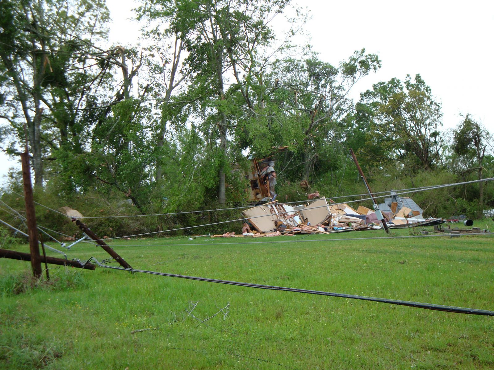
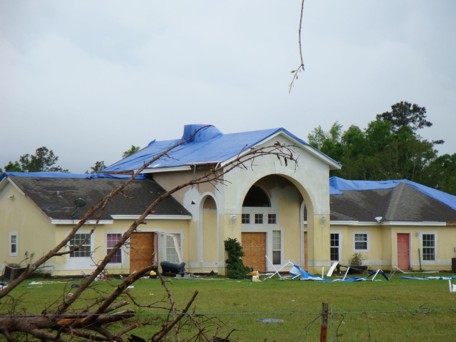
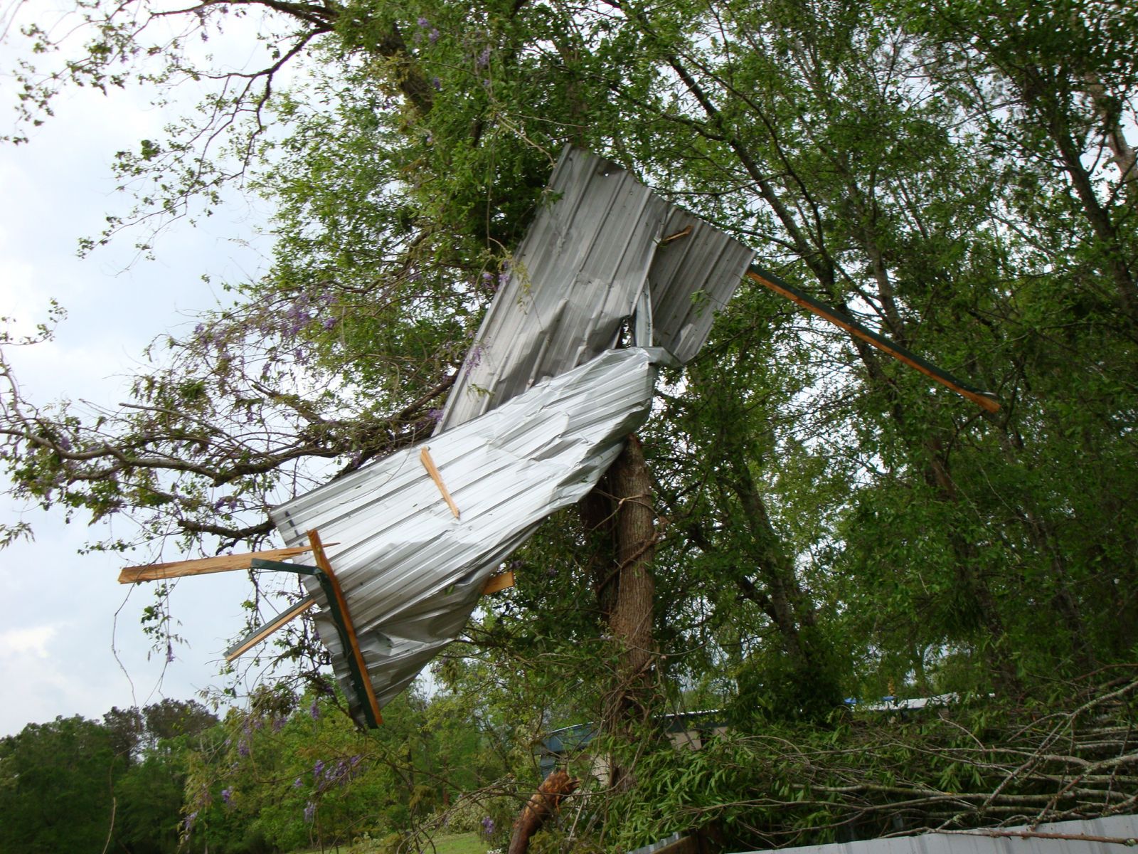
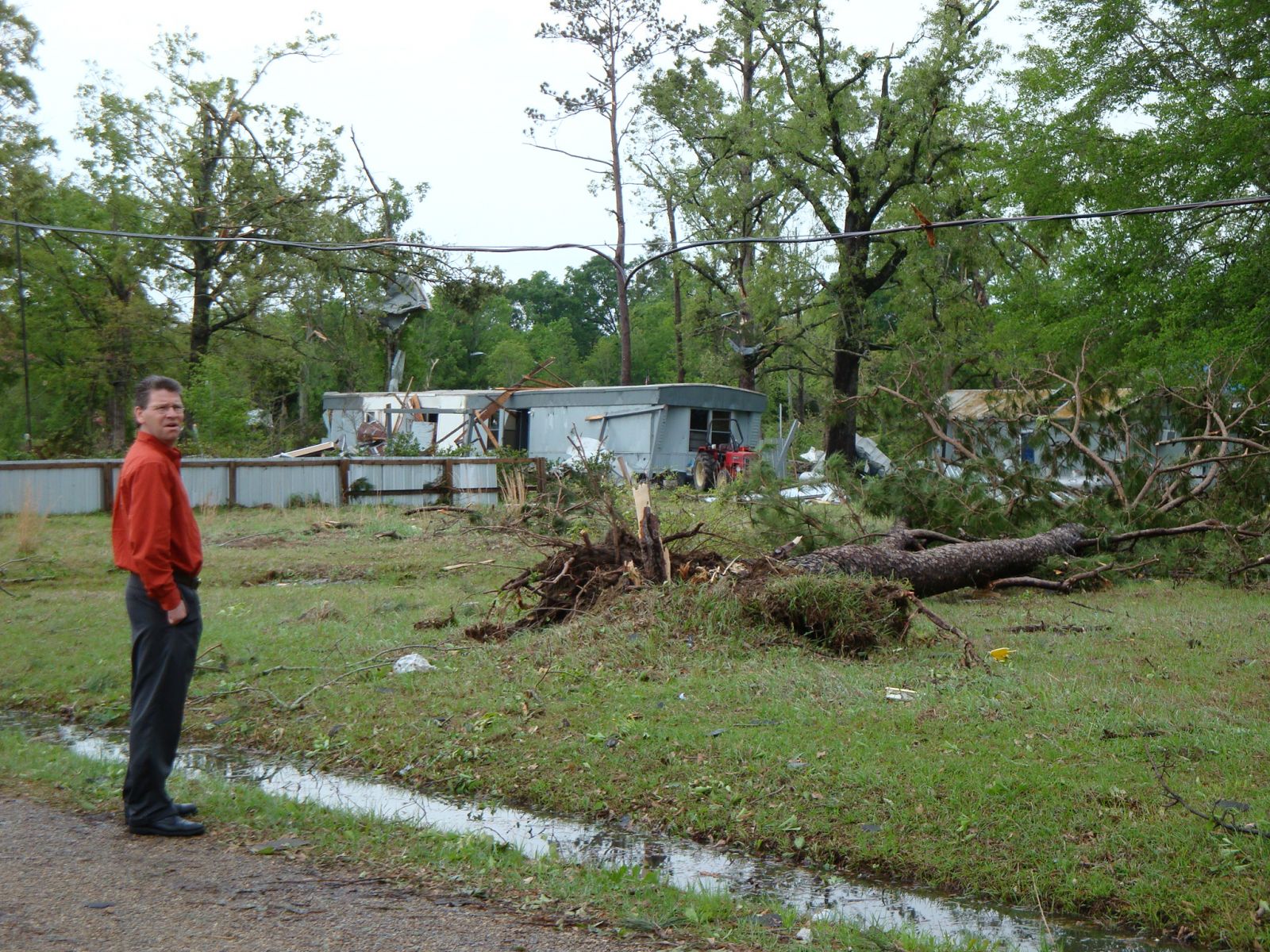
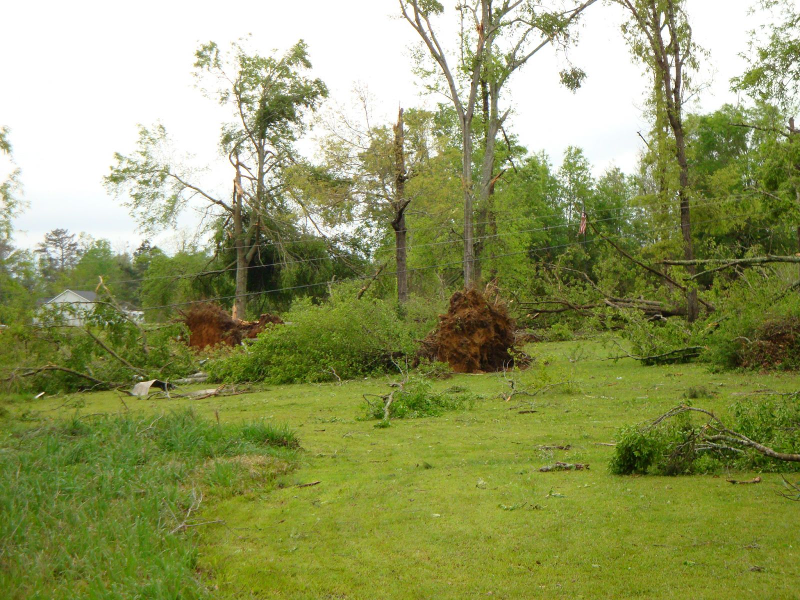
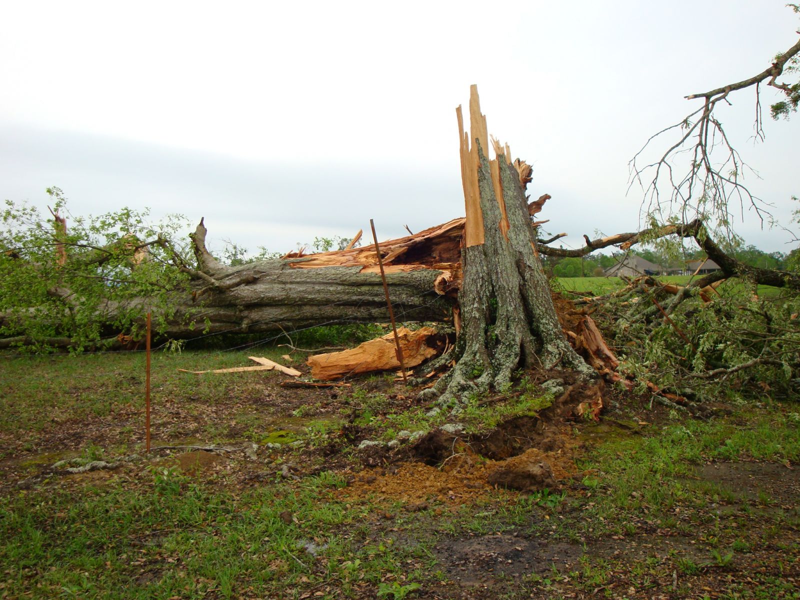
A National Weather Service Damage Assessment Team has surveyed the storm damage in Independence, LA. It has been determined the damage was the result of a tornado. The tornado has been rated an EF-1 on the Enhanced Fujita Scale. Damage estimates were consistent with winds of approximately 110 mph. The tornado damaged 7 homes and 1 mobile home was destroyed in the area around LA State Highway 40 and School Road in Tangipahoa Parish to the east of Independence. The tornado tracked east-northeast for about three quarters of a mile. Numerous hardwood and softwood trees were snapped off and uprooted along the tornado damage path. The tornado damage path was 0.75 miles long and was 50 yards wide at its widest point. One injury was reported. |
|
|
||||||||||||||
Current Hazards
Outlooks
Fire Manager Quick Brief
Briefing Page
Storm Prediction Center
Extended Outlooks
Forecasts
Tropical Forecast
Forecast Discussion
Aviation Weather Forecast
Graphical Forecast
Weather Models and Maps
Fire Weather Forecast
Hourly Weather Graph
Air Quality Forecasts
Marine Forecast
Activity Planner
River Forecasts
US Dept of Commerce
National Oceanic and Atmospheric Administration
National Weather Service
New Orleans/Baton Rouge
62300 Airport Rd.
Slidell, LA 70460-5243
504.522.7330 985.649.0429
Comments? Questions? Please Contact Us.