New Orleans/Baton Rouge
Weather Forecast Office
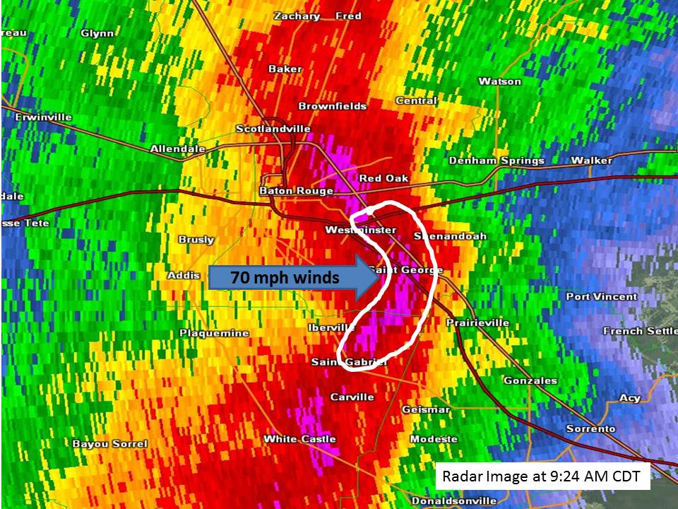
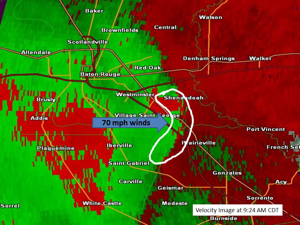
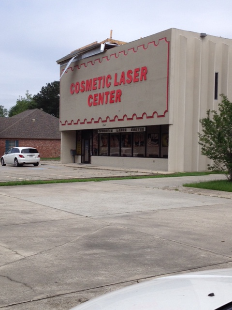
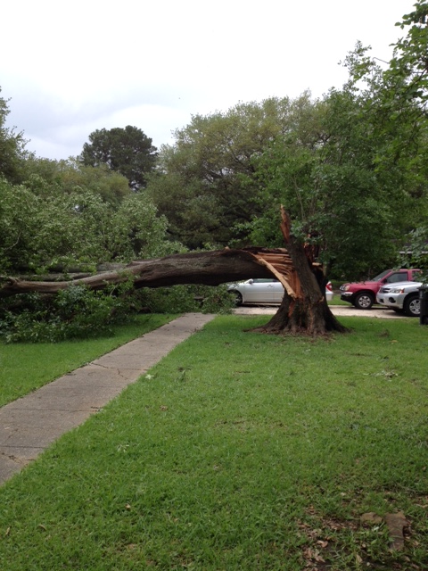
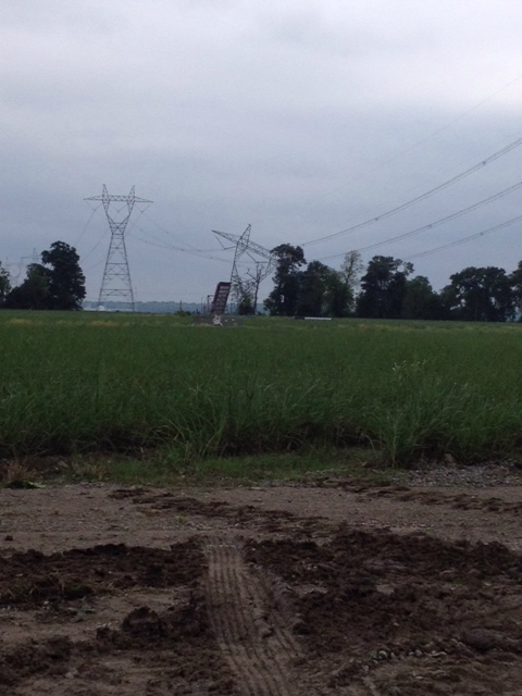
Baton Rouge, LA Damaging Winds - April 27, 2015
|
Estimated Maximum Wind:
|
80 mph
|
|
Injuries/Fatalities:
|
None
|
|
Damage Area:
|
Several miles wide swath of damage
|
|
Approximate Time:
|
9:00 AM - 9:30 AM
|
|
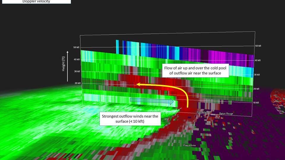
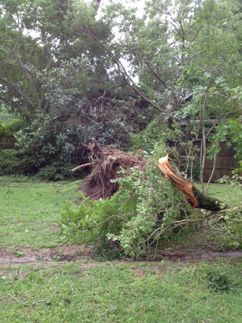
A National Weather Service Damage Assessment Team has surveyed the storm damage in Baton Rouge, LA Metro Area. It has been determined the damage was the result of strong straight line winds that formed along the leading edge of a squall line. Damage estimates were consistent with winds of 70-80 mph. A broad area of wind damage was noted extending across Iberville, West Baton Rouge, East Baton Rouge, Ascension, and Livingston Parishes. Several power poles were either snapped or pushed over by these strong winds. Strong winds damaged trees and some structures. |
|
|
|
|
||||||||||||
Current Hazards
Outlooks
Fire Manager Quick Brief
Briefing Page
Storm Prediction Center
Extended Outlooks
Forecasts
Activity Planner
River Forecasts
Tropical Forecast
Forecast Discussion
Aviation Weather Forecast
Graphical Forecast
Weather Models and Maps
Fire Weather Forecast
Hourly Weather Graph
Air Quality Forecasts
Marine Forecast
US Dept of Commerce
National Oceanic and Atmospheric Administration
National Weather Service
New Orleans/Baton Rouge
62300 Airport Rd.
Slidell, LA 70460-5243
504.522.7330 985.649.0429
Comments? Questions? Please Contact Us.