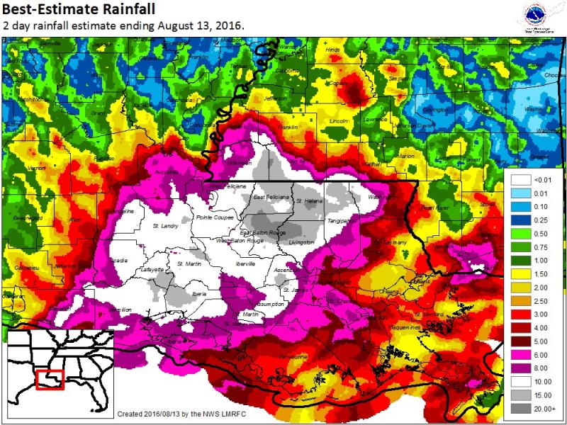
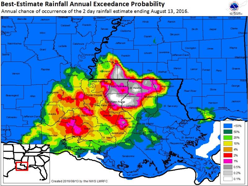
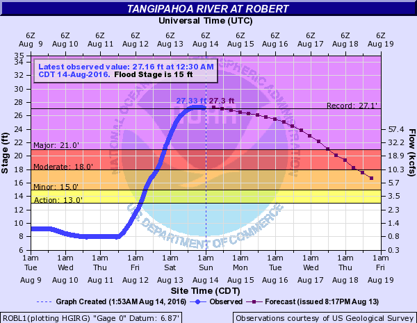
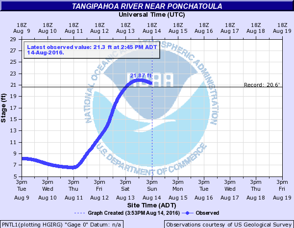
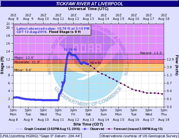
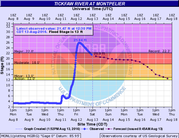
A slow moving upper level low pressure system with a pool of very deep tropical moisture brought very heavy rainfall of 20 to 30 inches to parts of Southeast Louisiana and Southwest Mississippi from August 11th through August 13th. These very heavy rainfall totals led to widespread flash flooding and record river flooding across multiple parishes in Southeast Louisiana and Southwest Mississippi.
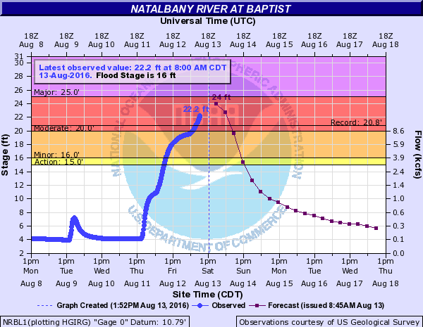
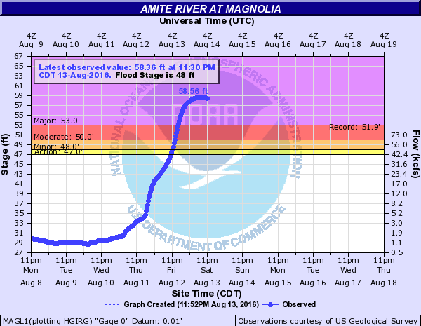
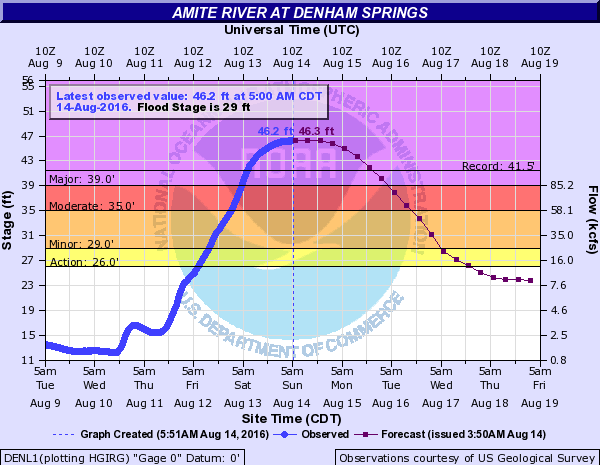
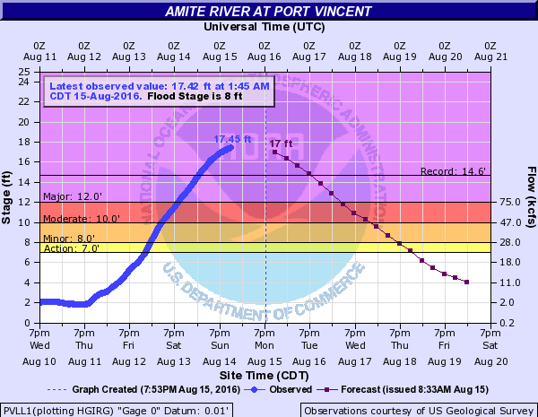
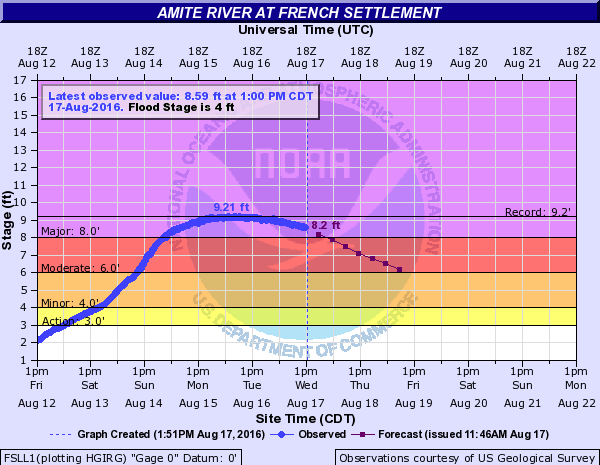
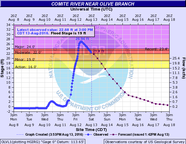
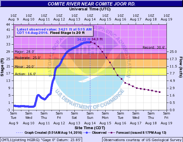
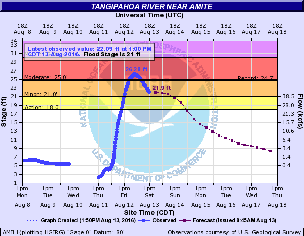
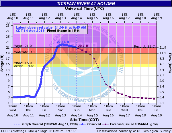
Record flooding was observed in Amite/Comite River Basin, Tickfaw River Basin, Natalbany River Basin, and the Tangipahoa River Basin. The flooding led to interstate closures on both Interstate 10 and 12 for several days, and flooded thousands of homes and businesses across portions of the Baton Rouge and Hammond Metropolitan Areas. A final tally of the number of homes and businesses flooded has not been compiled, but estimates range from 50,000 to 75,000 structures flooded from this event. The most widespread flooding impacted large portions of highly populated East Baton Rouge, Livingston, Ascension, and Tangipahoa Parishes.
The event also resulted in numerous water rescues and unfortunately there were 13 people killed from the flooding in the state. 12 of those deaths occurred in the Baton Rouge and Hammond areas.
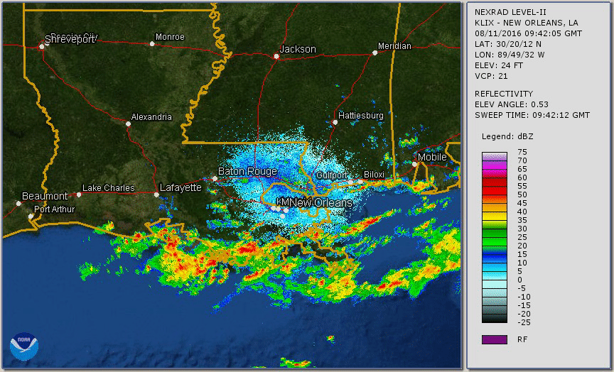
Radar Loop of Event
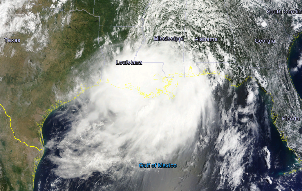
Satellite Image
Rainfall Totals Maps
|
|
|
|
|
|
||||||
|---|---|---|---|---|---|---|---|---|---|---|---|
|
|
|
|
|
|
||||||
|
|
|
|
|
|
||||||
|
|
|
|
|
|
||||||
|
|
|
|
|
|
||||||
|
|
|
|
|
|
Record Flooding Levels
Amite River
Comite River
Tangipahoa River
Tickfaw River
Natalbany River