The post-tropical circulation of Tropical Storm Olga moved rapidly across southeast Louisiana and south Mississippi from midnight through late morning of Saturday October 25, 2019, producing strong winds, high tides and locally heavy rainfall. A summary of the impacts follows.
Winds
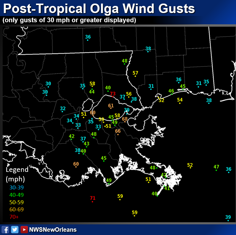
- Strong wind gusts occurred across Terrebonne and Lafourche Parishes northeastward through the metro New Orleans area, north shore and into southern Mississippi
- Wind gusts of 40 to 50 mph were widespread across this corridor with a few gusts as high as 70 mph.
- The highest recorded gust across the region was 73 mph at the Mandeville lakefront.
- The strongest winds generally lasted only 2 to 3 hours as the remnant core of Olga moved northeastward around 25 mph. For example, at New Orleans International Airport tropical storm force gusts begain at 3:24AM and ended at 5:20AM. In Hammond, tropical storm force wind gusts began at 2:55AM and ended at 5:35AM.
- The primary damage was downed tree limbs, downed small trees and significant power outages.
- The map below includes the values and locations of wind gusts greater than 30 mph
- The wind gusts were stronger than what was expected and we will be studying this system over the coming months to learn how we can better forecast any similar situations in the future.
Rainfall
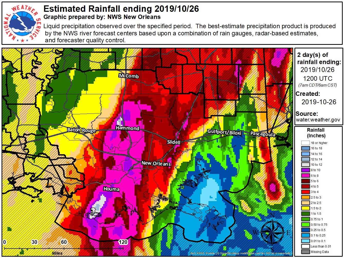
- A swath of heavy rainfall of 6 to 8 inches occurred from Friday into early Saturday from Terrebonne and Lafourche Parishes northeast into Tangipahoa and western Washington Parishes. Within that large swath of heavy rain – 10 to 14 inches of rain was estimated across parts of Terrebonne Parish.
- Widespread and significant street flooding was reported in Houma and surrounding areas during the early morning Saturday. Due to dry soil conditions leading up to the event, only a few rivers reached flood stage, with mostly minor flooding reported.
- The map below is the best estimate storm total rainfall for this event using both rain gauges and radar estimates.
Coastal Flooding
- As the remnant circulation of Olga moved ashore - strong onshore winds raised water levels 2 to 3 feet above normal during the morning hours in coastal areas of southeast Louisiana and Mississippi.
- Along the north shore of Lake Pontchartrain, the Mandeville Lakefront experienced flooding
- Minor coastal flooding also impacted low lying areas of Hancock County in coastal Mississippi

