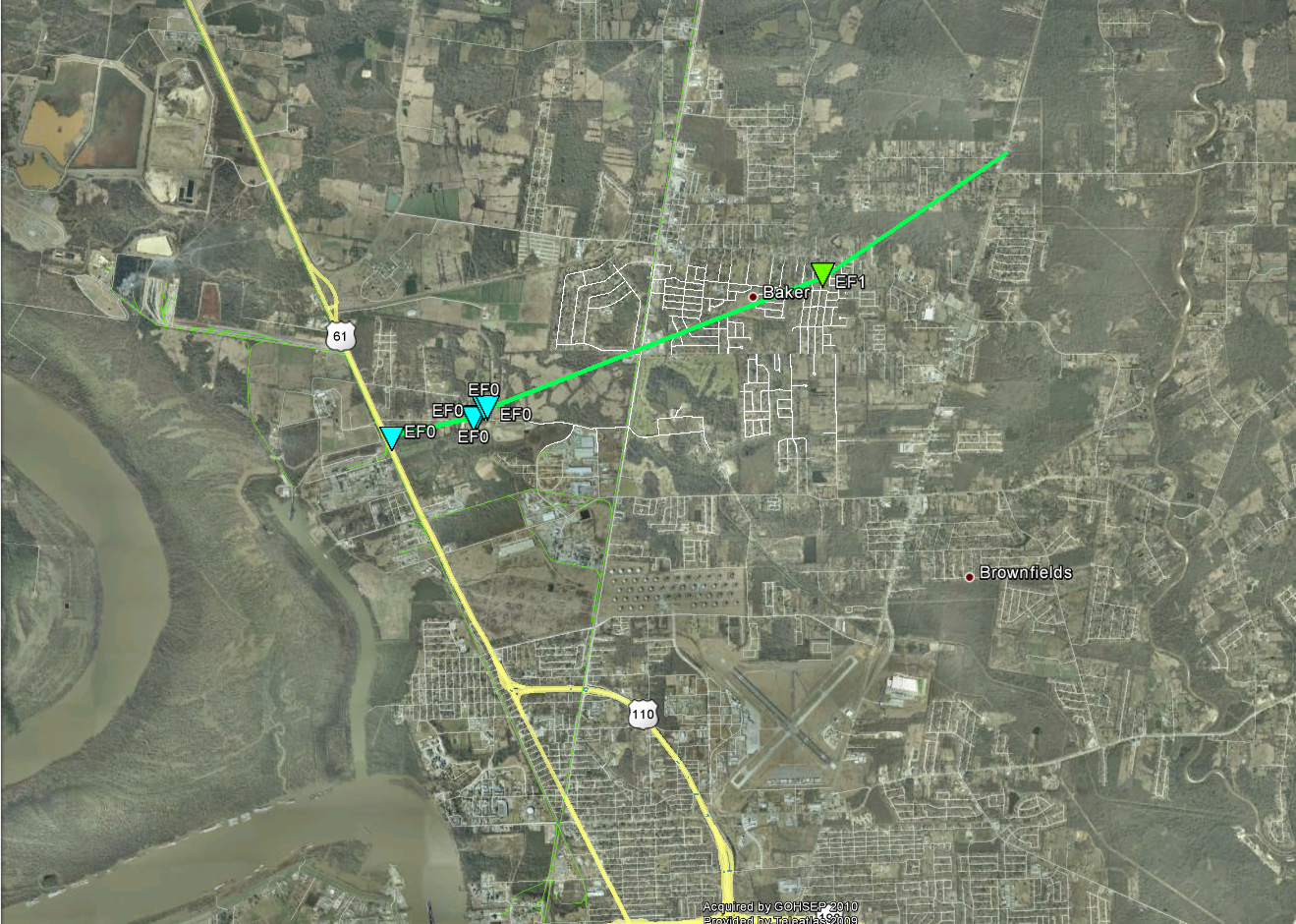
Baker, LA Tornado - December 10, 2012
|
Rating:
|
EF-1
|
|
Estimated Maximum Wind:
|
105 mph
|
|
Injuries/Fatalities:
|
None
|
|
Damage Path Length:
|
5.4 miles
|
|
Maximum Path Width:
|
100 yards
|
|
Approximate Start Point/Time:
|
3.2 miles SW of Baker, LA at 648 AM
|
|
Approximate End Point/Time:
|
2.2 miles ENE of Baker, LA at 657 AM
|
|
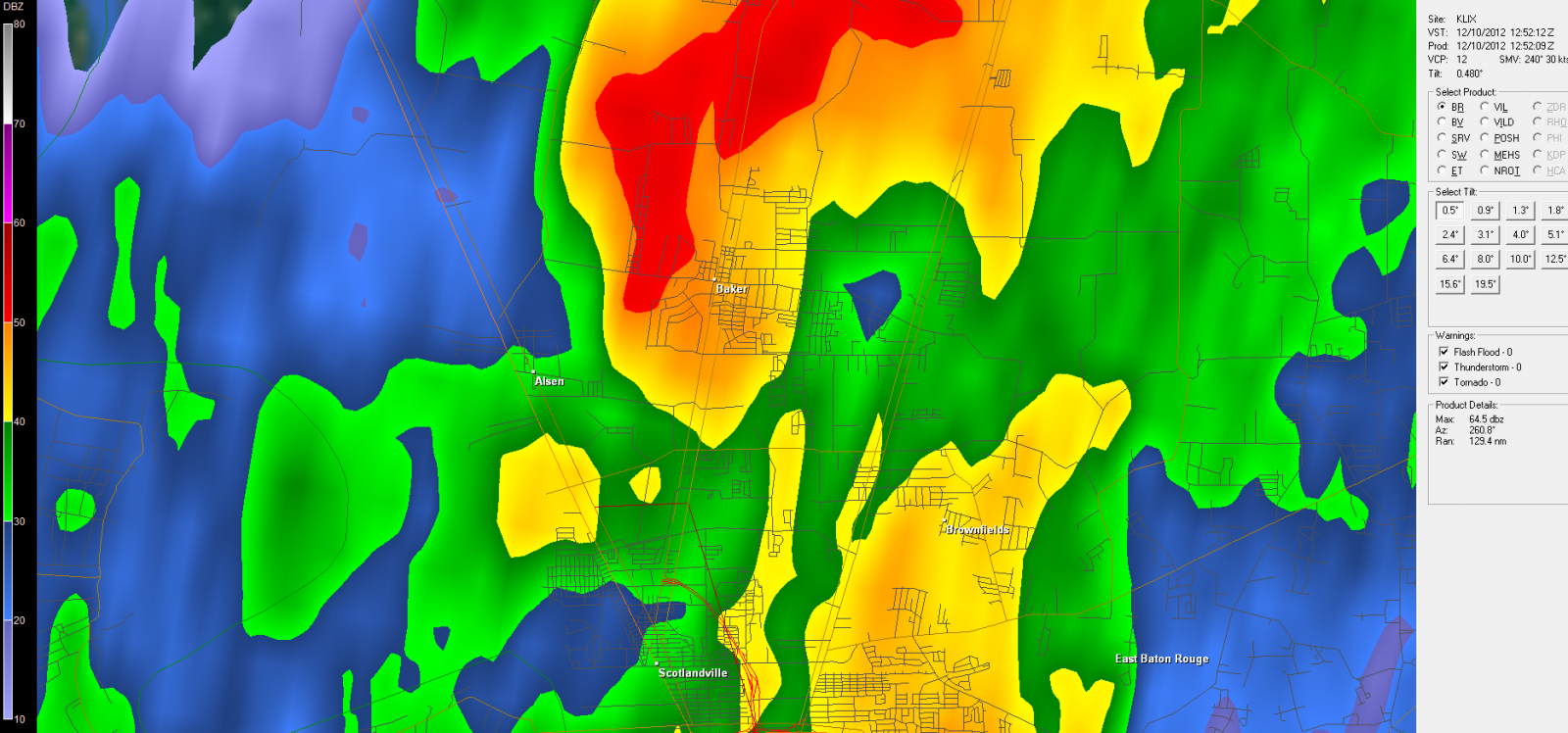
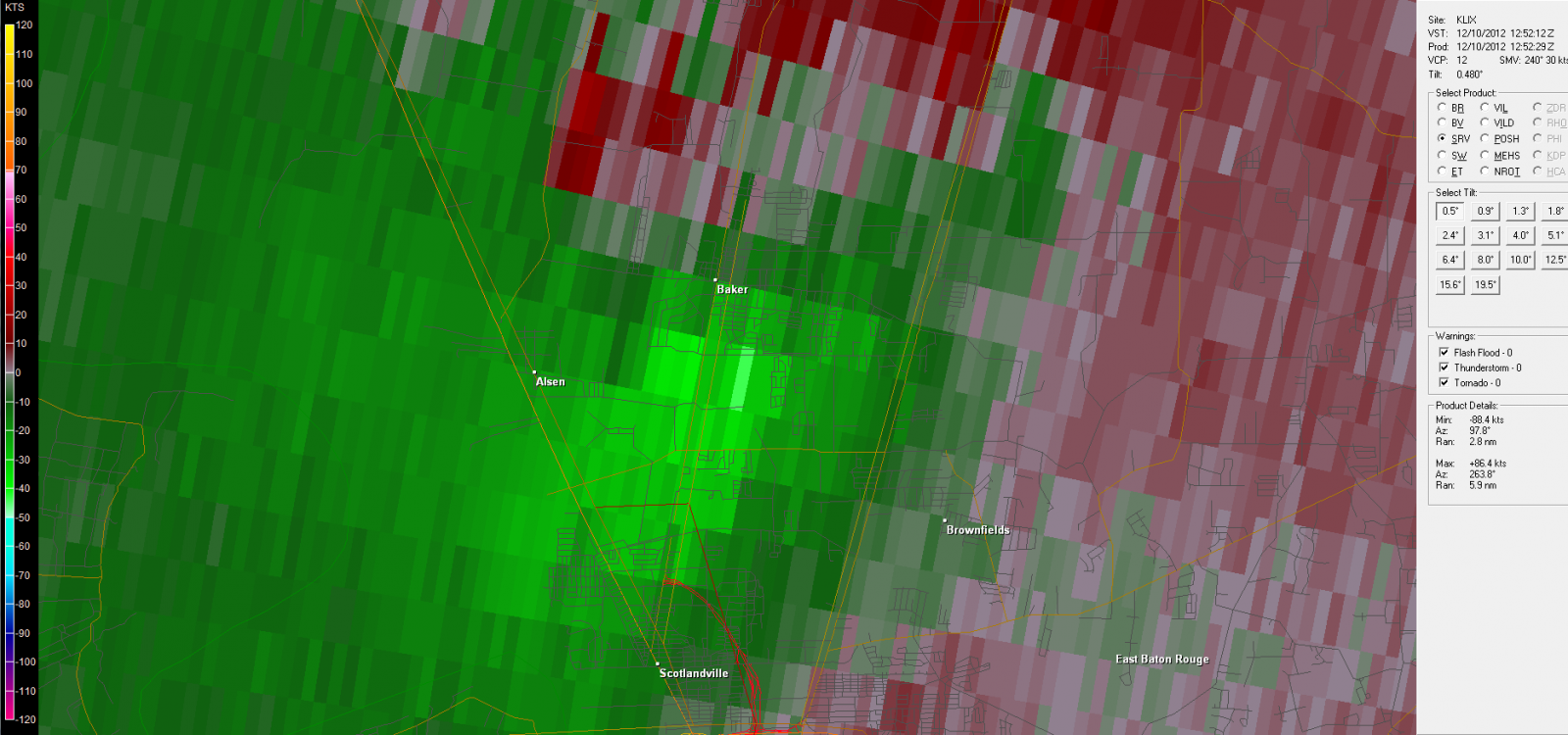
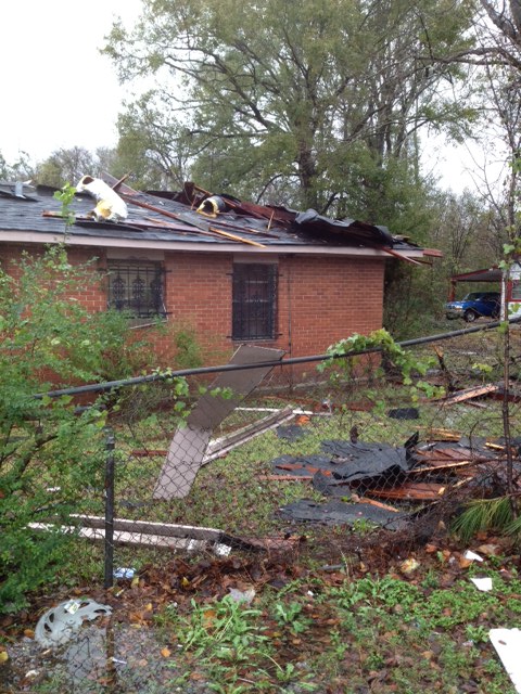
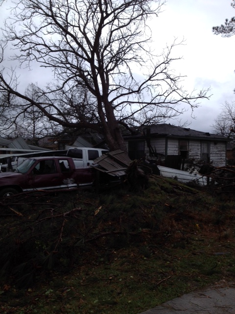
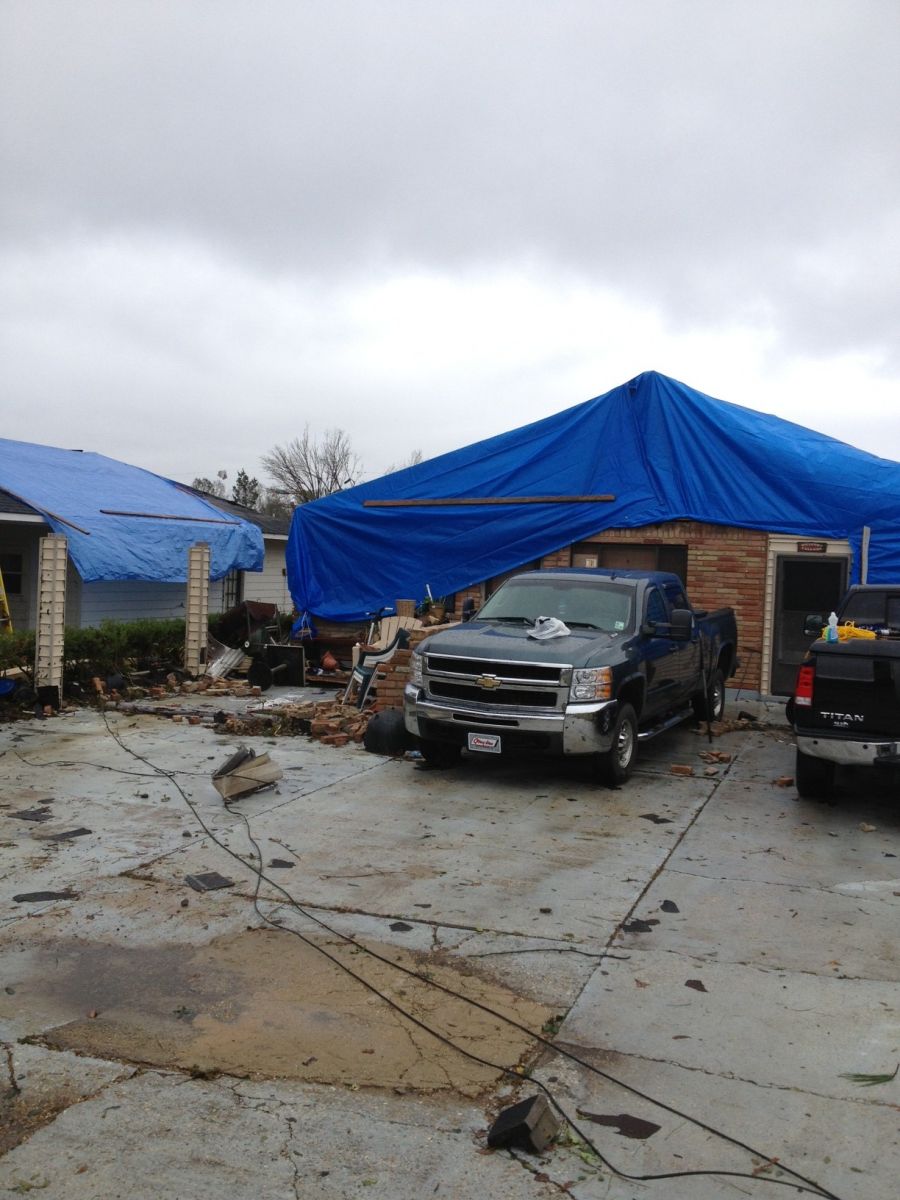
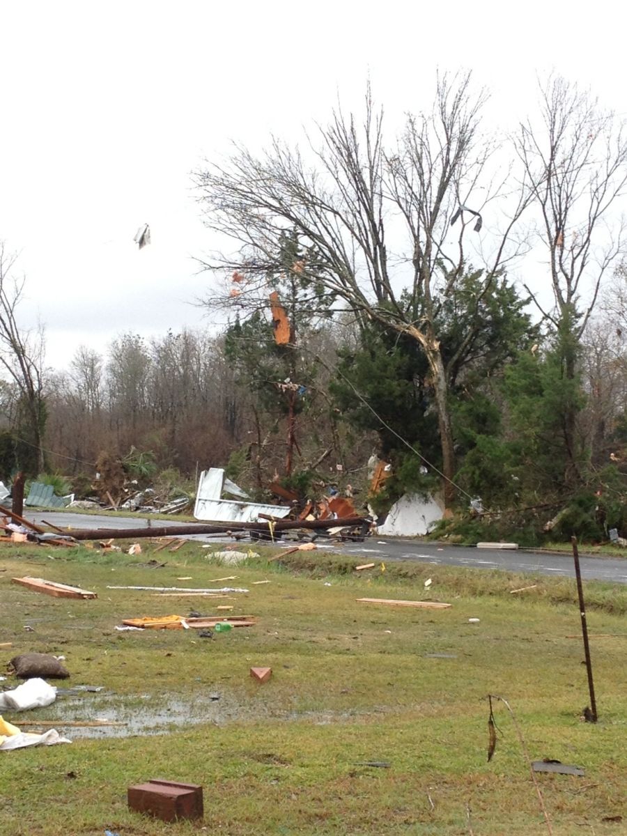
A National Weather Service Damage Assessment Team has surveyed the storm damage in East Baton Rouge Parish near the city of Baker, LA. It has been determined the damage was the result of a tornado. The tornado has been rated an EF-1 on the Enhanced Fujita Scale. Damage estimates were consistent with winds of 105 mph. From the Local Storm Report: TORNADO FIRST TOUCHED DOWN ON HIGHWAY 61 NEAR THE INTERSECTION WITH B R BARGE CANAL. TORNADO CAUSED MODERATE DAMAGE TO A ROOF OF A SINGLE FAMILY RESIDENCE AND MINOR DAMAGE TO A CONVENIENCE STORE. A TREE WAS UPROOTED AT THE SAME LOCATION. THE TORNADO THEN TRAVELED ENE CAUSING SPORADIC TREE DAMAGE UNTIL CROSSED OVER NEW RAFE MEYER ROAD AND MOVED INTO LINCOLN HEIGHTS SUBDIVISION. THIS WAS THE LOCATION OF THE WORST DAMAGE WITH NUMEROUS SOFT WOOD TREES SNAPPED AND A FEW RESIDENCES WITH MODERATE TO MAJOR ROOF DAMAGE. A TRAVEL TRAILER WAS ROLLED OVER 25 TO 30 YARDS AND DESTROYED. THE TORNADO THEN CONTINUED TO TRAVEL TO THE ENE CROSSING OVER HIGHWAY 19 AND CAUSING MODERATE DAMAGE TO THE ROOF OF A CAR WASH. AFTERWARDS IT CONTINUED TO THE ENE CAUSING SPORADIC TREE DAMAGE AND MINOR ROOF DAMAGE TO A FEW HOME BEFORE FINALLY LIFTING NEAR THE INTERSECTION OF PLANK ROAD AND DYER ROAD. |
|
|
|
|
||||||||||||||