Excessive rainfall may produce locally considerable flash flooding over parts of the northwestern Gulf Coast, lower Mississippi River Valley, and Deep South through Thursday. Potential Tropical Cyclone One is forecast to become a tropical storm (Arthur) as it moves along or just off the northwestern Gulf coast through Wednesday. An outbreak of severe weather is forecast in the Midwest Wednesday. Read More >
New Orleans/Baton Rouge
Weather Forecast Office
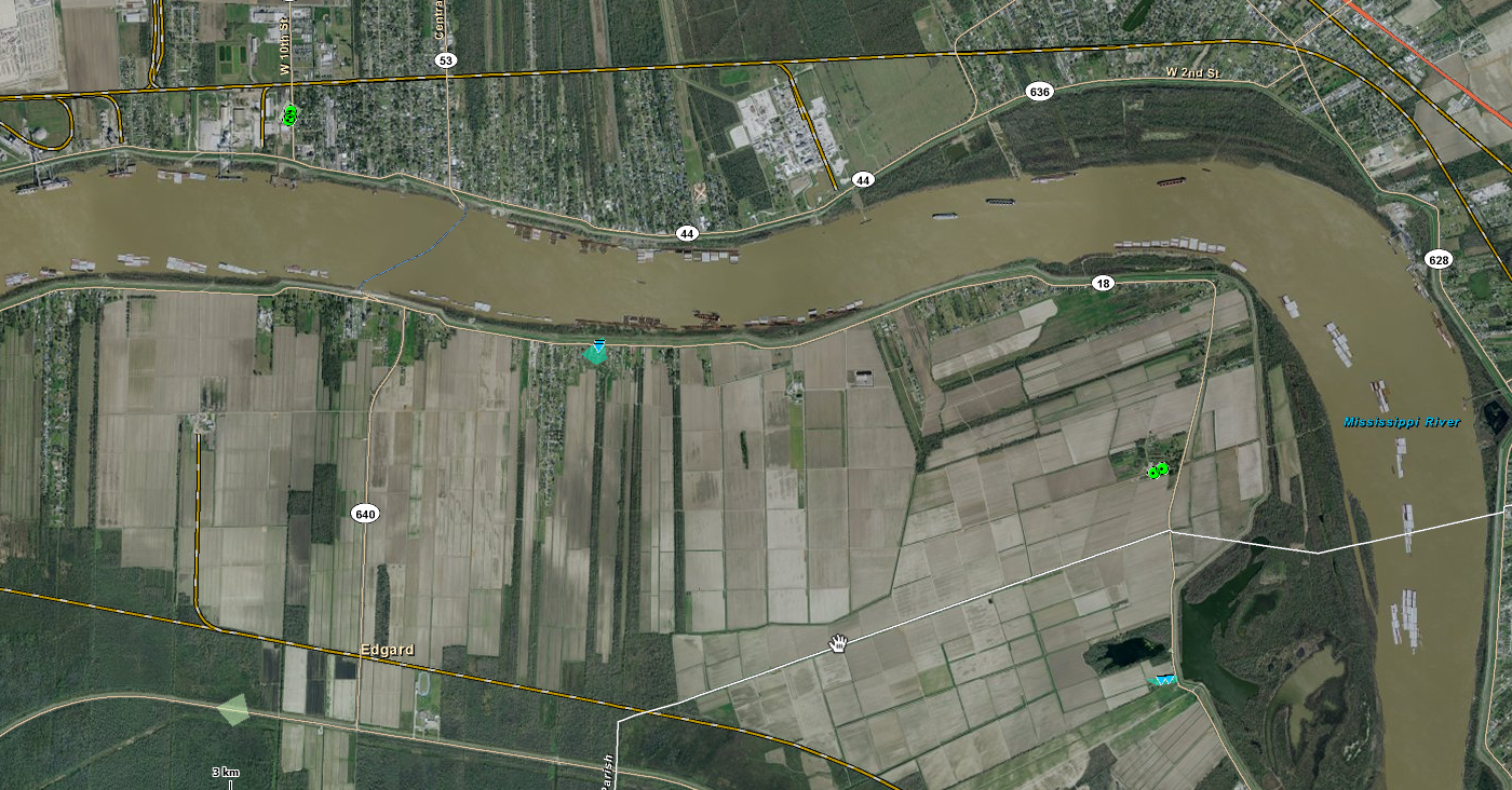
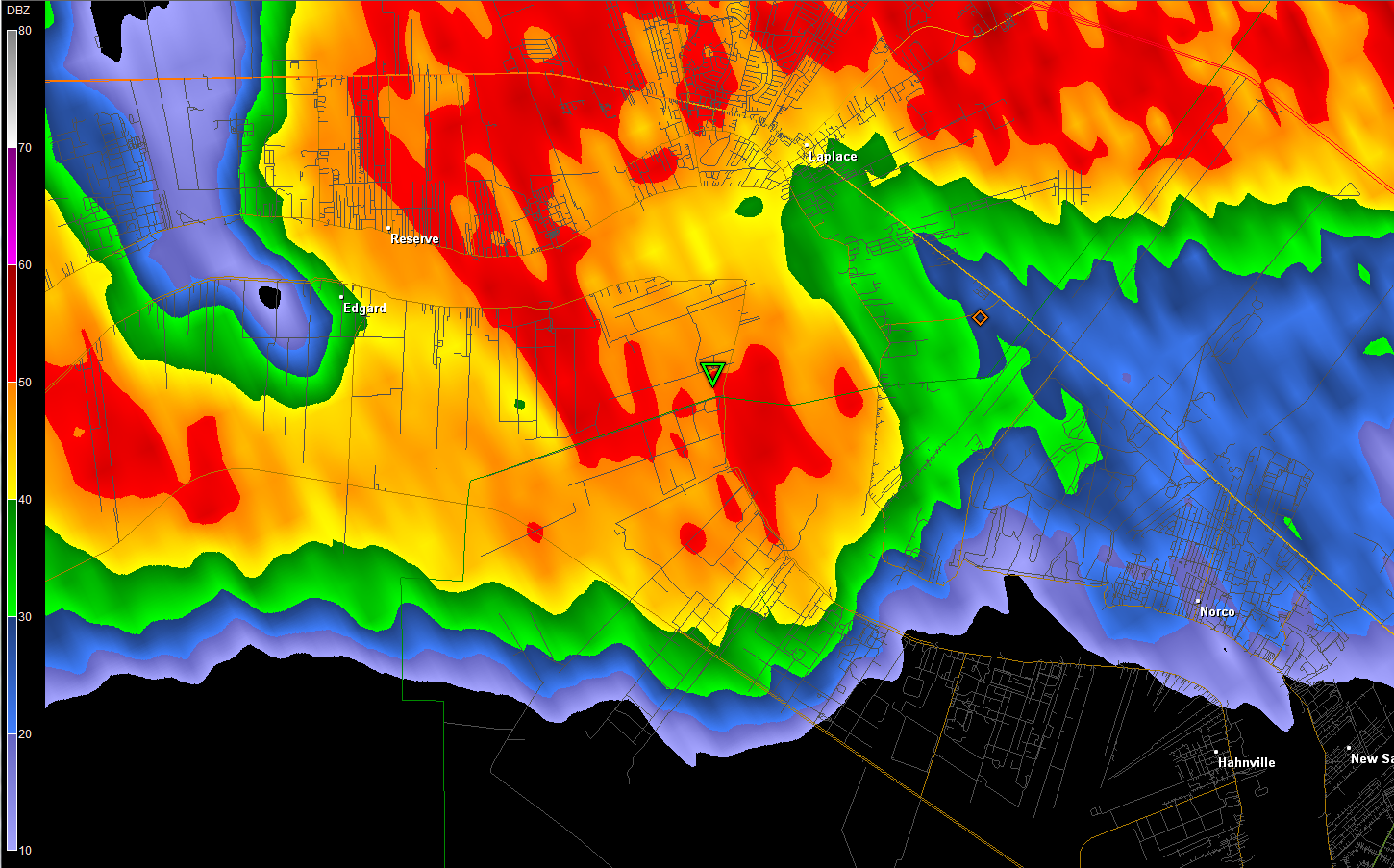
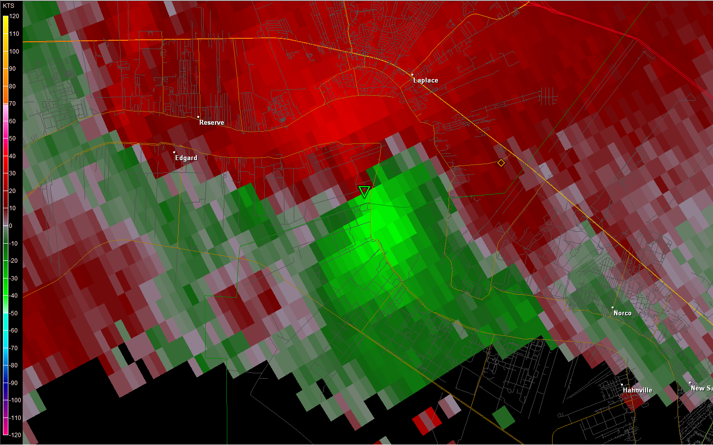
Edgard, LA Tornado - March 29, 2011
|
Rating:
|
EF-0
|
|
Estimated Maximum Wind:
|
65 mph
|
|
Injuries/Fatalities:
|
None
|
|
Damage Path Length:
|
250 yards
|
|
Maximum Path Width:
|
50 yards
|
|
Approximate Start Point/Time:
|
Near Hwy 3127 W of Edgard 515 PM
|
|
Approximate End Point/Time:
|
Hwy 18 along the MS River 520 PM
|
|
A National Weather Service Damage Assessment Team surveyed the storm damage in and around Edgard, Garyville and Reserve. It has been determined portions of the damage was a result of intermittent touch downs of a weak EF-0 tornado on the Enhanced Fujita Scale. Damage estimates were consistent with winds of around 65 mph. |
|
|
|
|
||||||||||
Current Hazards
Storm Prediction Center
Extended Outlooks
Outlooks
Fire Manager Quick Brief
Briefing Page
Forecasts
Hourly Weather Graph
Air Quality Forecasts
Marine Forecast
Activity Planner
River Forecasts
Tropical Forecast
Forecast Discussion
Aviation Weather Forecast
Graphical Forecast
Weather Models and Maps
Fire Weather Forecast
US Dept of Commerce
National Oceanic and Atmospheric Administration
National Weather Service
New Orleans/Baton Rouge
62300 Airport Rd.
Slidell, LA 70460-5243
504.522.7330 985.649.0429
Comments? Questions? Please Contact Us.