New Orleans/Baton Rouge
Weather Forecast Office
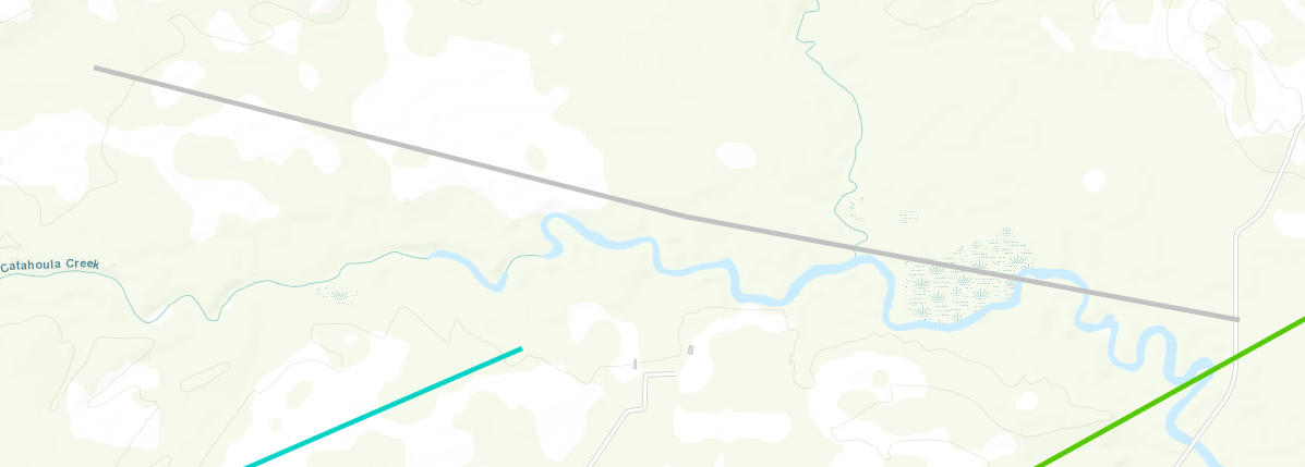
Rural Hancock County, MS Tornado - April 10, 2024
|
Rating:
|
EF-Unknown
|
|
Estimated Maximum Wind:
|
Unknown
|
|
Injuries/Fatalities:
|
None
|
|
Damage Path Length:
|
2.76 miles
|
|
Maximum Path Width:
|
150 yards
|
|
Approximate Start Point/Time:
|
6 miles W of Kiln, MS at 1023 AM CDT
|
|
Approximate End Point/Time:
|
3 miles WSW of Kiln, MS at 1027 AM CDT
|
|
A National Weather Service Damage Assessment Team has surveyed the storm damage in Rural Hancock County, MS. It has been determined the damage was the result of a tornado. The tornado has been rated an EF-U on the Enhanced Fujita Scale. No damage estimate was made due to lack of road access, and no wind speed determination can be made. A short-tracked tornado was identified using high resolution satellite imagery NDVI differencing. This tornado tracked over inaccessible rural lands north of Texas Flat Road along Catahoula Creek and Jourdan River before eventually dissipating as it interacted with the parent mesovortex to its east. No damage could be identified and thus the rating for this tornado is unknown. |
|
|
Current Hazards
Outlooks
Fire Manager Quick Brief
Briefing Page
Storm Prediction Center
Extended Outlooks
Forecasts
Tropical Forecast
Forecast Discussion
Aviation Weather Forecast
Graphical Forecast
Weather Models and Maps
Fire Weather Forecast
Hourly Weather Graph
Air Quality Forecasts
Marine Forecast
Activity Planner
River Forecasts
US Dept of Commerce
National Oceanic and Atmospheric Administration
National Weather Service
New Orleans/Baton Rouge
62300 Airport Rd.
Slidell, LA 70460-5243
504.522.7330 985.649.0429
Comments? Questions? Please Contact Us.