Catastrophic Hurricane Ida Strikes Southeast Louisiana
August 29, 2021
Hurricane Ida made landfall as Category 4 Hurricane in Lower Lafourche Parish near Port Fourchon with maximum sustained wind speeds of 150 mph and a minimum pressure 930 mb. Landfall occurred at 11:55 AM on the morning of August 29, 2021. The storm caused catastrophic damage from wind and storm surge, particularly in the Dulac to Montegut to Grand Isle areas of Lower Terrebonne and Lower Lafourche Parishes. The widespread damage spread well inland across Southeast Louisiana and Southern Mississippi as Hurricane Ida remained at hurricane strength into southwest Mississippi near McComb. For further information on the impacts Hurricane Ida produced across the area, please reference the post-storm report here.
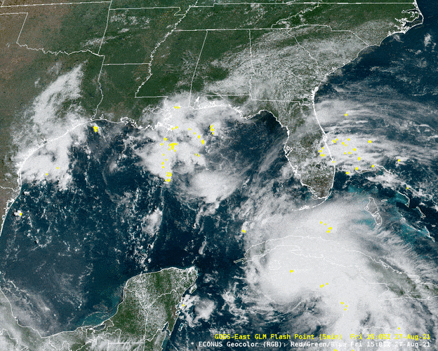 |
| Geocolor Satellite Loop of Hurricane Ida |
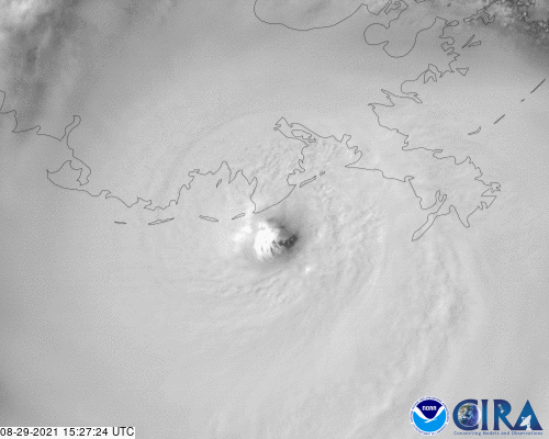 |
| Hurricane Ida Visible Imagery at Landfall |
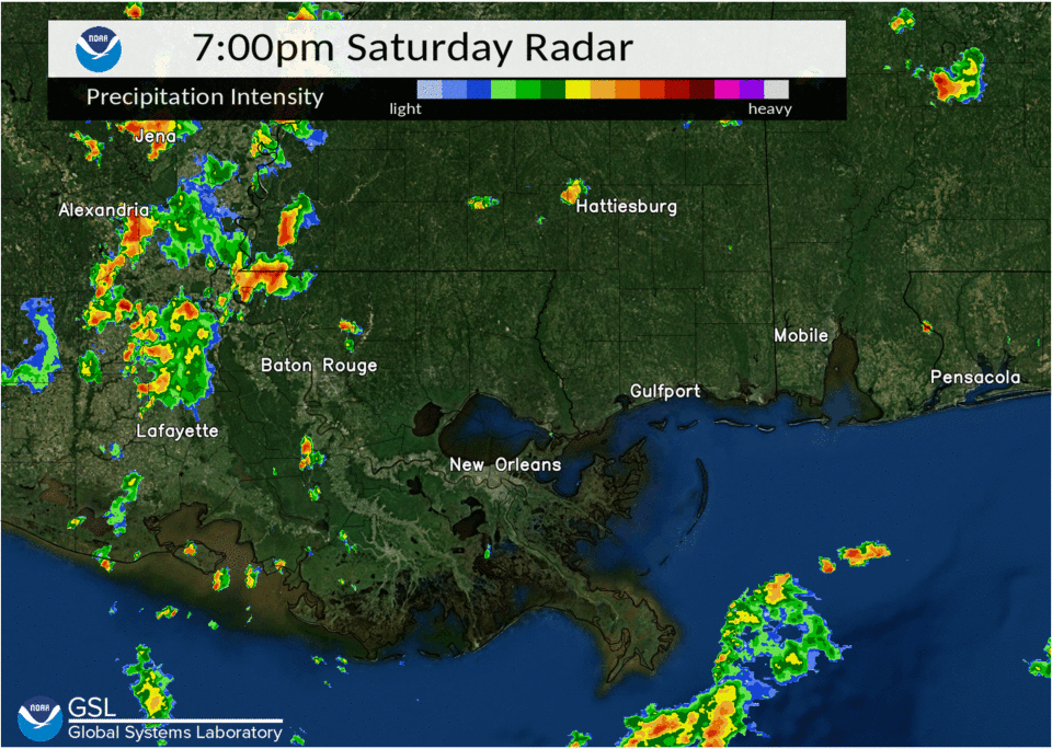 |
| Hurricane Ida radar loop |
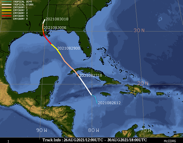 |
| Hurricane Ida track |
| Location | Peak Gust(MPH) | Date and Time |
|---|---|---|
| Dulac, LA | 138 | August 29, 2021 at 3:01 PM CDT |
| Galliano, LA | 121 | August 29, 2021 at 4:14 PM CDT |
| New Orleans, LA | 113 | Not available |
| Killona, LA | 110 | August 29, 2021 at 6:46 PM CDT |
| Mandeville, LA | 110 | August 29, 2021 at 9:04 PM CDT |
| Port Fourchon, LA | 102 | August 29, 2021 at 12:44 PM CDT (Incomplete data) |
| Thibodaux, LA | 100 | August 29, 2021 at 7 PM CDT |
| Bayou Bienvenue, LA | 99 | August 29, 2021 at 6:16 PM CDT |
| Live Oak, LA | 99 | August 29, 2021 at 7:06 PM CDT |
| Raceland, LA | 99 | August 29, 2021 at 7:50 PM CDT |
| Location | Surge Value (feet) | Datum | Date and Time |
| Grand Isle, LA | 10.30 | MHHW | Not Available |
| Port Fourchon, LA | 8.30 | MHHW | Not Available |
| Waveland, MS | 6.91 | MHHW | August 29, 2021 at 11:06 PM CDT |
| Shell Beach, LA | 6.85 | MHHW | August 29, 2021 at 12:48 PM CDT |
| Grand Isle, LA | 5.95 | MHHW | August 29, 2021 at 1:42 PM CDT |
| New Orleans, LA | 5.52 | MHHW | August 30, 2021 at 6:12 AM CDT |
| Pilots Station, LA | 5.17 | MHHW | August 29, 2021 at 7:30 AM CDT |
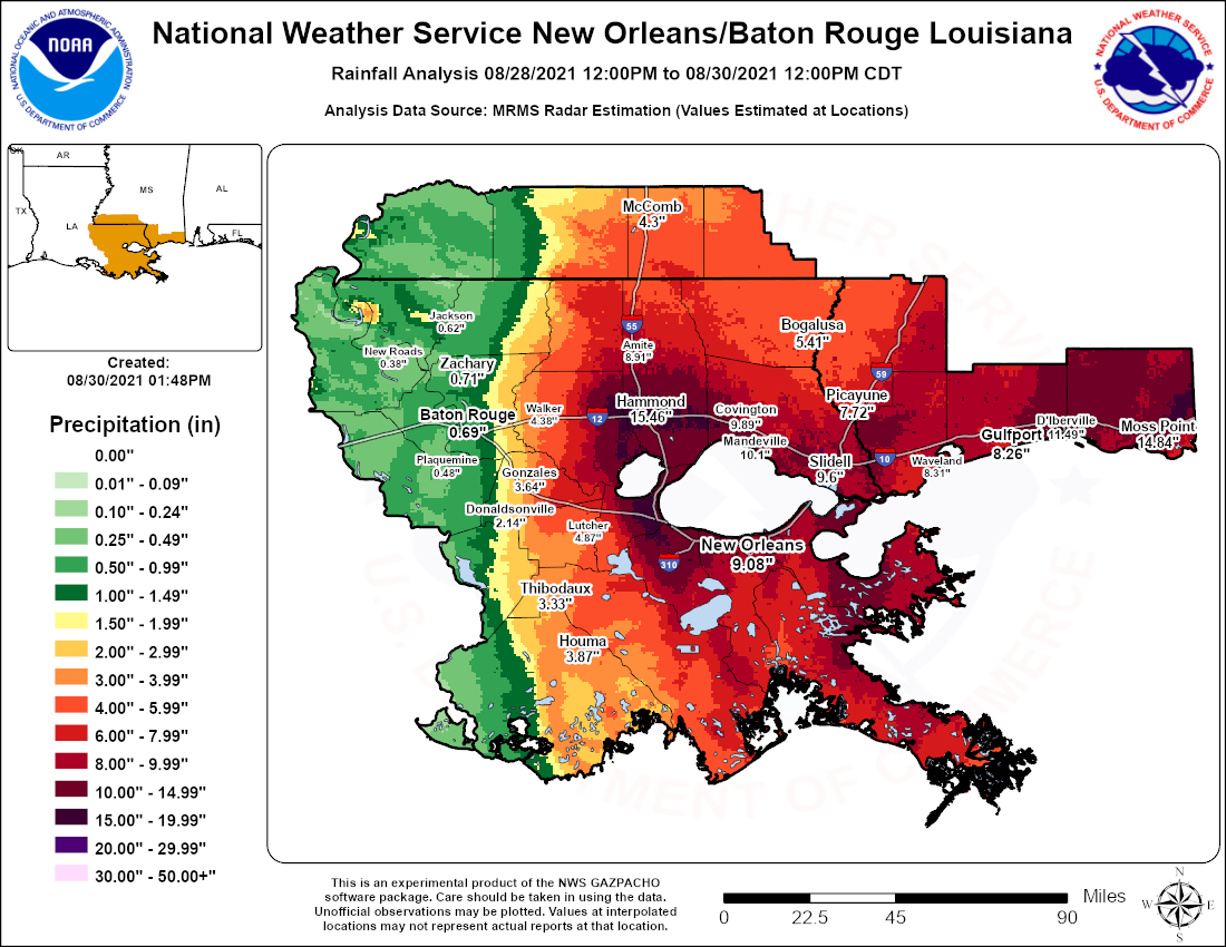
| Location | Rainfall Amount (inches) |
| 3.3 miles north of Kiln, MS | 13.65 |
| 13.1 miles north-northwest of Biloxi, MS | 13.29 |
| 1.4 miles west-southwest of Bay St. Louis, MS | 13.12 |
| 5.6 miles east-southeast of Picayune, MS | 12.83 |
| 1 mile north of Waveland, MS | 12.83 |
| 1.2 miles northwest of Moss Point, MS | 12.78 |
| 6.2 miles east of Pearl River, LA | 12.63 |
| 3.8 miles southeast of Carriere, MS | 12.57 |
| Pascagoula Trent Lott Airport, MS | 12.47 |
| 6.6 miles north of Kiln, MS | 12.36 |
| 3.3 miles northeast of Slidell, LA | 11.66 |
| Slidell, LA (NWS Office) | 11.64 |
| Gulfport, MS | 11.61 |
| 4.4 miles east of Slidell, LA | 11.53 |
| 5 miles north of Pass Christian, MS | 11.34 |
| Slidell, LA | 11.32 |
| White Plains, MS | 11.22 |
| Meraux, LA | 10.96 |
| New Orleans Lakefront Airport, LA | 10.74 |
| Folsom, LA | 10.72 |
| Gulfport-Biloxi International Airport, MS | 10.71 |
| 1.6 miles north-northeast of Vancleave, MS | 10.71 |
| 5.0 miles east-northeast of Biloxi, MS | 10.60 |
| 1.7 miles north-northeast of Saucier, MS | 10.14 |
| 3.2 miles north-northwest of Madisonville, LA | 10.09 |
| 1.4 miles north of Lacombe, LA | 10.06 |

