New Orleans/Baton Rouge
Weather Forecast Office
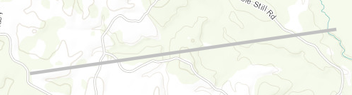
Rural Jackson County, MS Tornado - April 10, 2024
|
Rating:
|
EF-Unknown
|
|
Estimated Maximum Wind:
|
Unknown
|
|
Injuries/Fatalities:
|
None
|
|
Damage Path Length:
|
2.22 miles
|
|
Maximum Path Width:
|
75 yards
|
|
Approximate Start Point/Time:
|
10 miles WNW of Vancleave, MS at 1114 AM CDT
|
|
Approximate End Point/Time:
|
8 miles WNW of Vancleave, MS at 1116 AM CDT
|
|
A National Weather Service Damage Assessment Team has surveyed the storm damage in Rural Jackson County, MS. It has been determined the damage was the result of a tornado. The tornado has been rated an EF-U on the Enhanced Fujita Scale. No damage estimate was made due to lack of road access, and no wind speed determination can be made. An apparent damage path visible on high resolution satellite imagery via NDVI differencing in conjunction with KMOB radar imagery helped to confirm the existence of a weak tornado that tracked through rural parts of the Jackson County on April 10, 2024. No damage indicators could be identified with this analysis and the tornado thus could not be rated. |
|
|
Current Hazards
Briefing Page
Storm Prediction Center
Extended Outlooks
Outlooks
Fire Manager Quick Brief
Forecasts
Graphical Forecast
Weather Models and Maps
Fire Weather Forecast
Hourly Weather Graph
Air Quality Forecasts
Marine Forecast
Activity Planner
River Forecasts
Tropical Forecast
Forecast Discussion
Aviation Weather Forecast
US Dept of Commerce
National Oceanic and Atmospheric Administration
National Weather Service
New Orleans/Baton Rouge
62300 Airport Rd.
Slidell, LA 70460-5243
504.522.7330 985.649.0429
Comments? Questions? Please Contact Us.