Meteorological History | Satellite & Radar | Storm Impact | Storm Statistics
Hurricane Katrina was the costliest and one of the deadliest hurricanes to strike the United States in recorded history. Katrina's destruction wasn't limited to just Louisiana and Mississippi with damage reported as far east as the Florida Panhandle due to the large wind field and storm surge associated with the hurricane. In all, Hurricane Katrina was responsible for 1,392 fatalities and caused $125 billion in damage [unadjusted 2005 dollars].

 Hurricane Katrina formed from the combination of a tropical wave, an upper-level trough, and the mid-level remnants of Tropical Depression Ten. A tropical depression formed on August 23 about 200 miles southeast of Nassau in the Bahamas. Moving northwestward, it became Tropical Storm Katrina during the following day about 75 miles east-southeast of Nassau. The storm moved through the northwestern Bahamas on August 24-25, and then turned westward toward southern Florida. Katrina became a hurricane just before making landfall near the Miami-Dade/Broward county line during the evening of August 25. The hurricane moved southwestward across southern Florida into the eastern Gulf on August 26. Katrina then strengthened significantly, reaching Category 5 intensity on August 28. Later that day, maximum sustained winds reached 175 mph with an aircraft-measured central pressure of 902 mb while centered about 195 miles southeast of the mouth of the Mississippi River. Katrina turned to the northwest and then north, with the center making landfall near Buras, Louisiana at 1110 UTC August 29 with maximum winds estimated at 125 mph (Category 3). Continuing northward, the hurricane made a second landfall near the Louisiana/Mississippi border at 1445 UTC with maximum winds estimated at 120 mph (Category 3). Weakening occurred as Katrina moved north-northeastward over land, but it was still a hurricane near Laurel, Mississippi. The cyclone weakened to a tropical depression over the Tennessee Valley on 30 August. Katrina became an extratropical low on August 31 and was absorbed by a frontal zone later that day over the eastern Great Lakes.
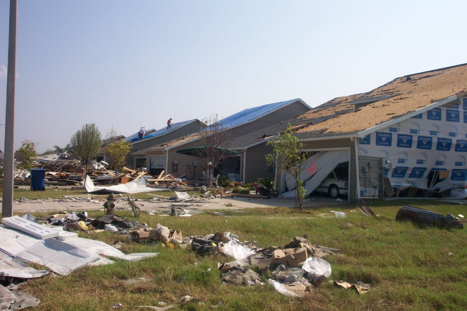
Katrina brought hurricane conditions to southeastern Louisiana, southern Mississippi, and southwestern Alabama. The Coastal Marine Automated Network (C-MAN) station at Grand Isle, Louisiana reported 10-minute average winds of 87 mph at 0820 UTC August 29 with a gust to 114 mph. Higher winds likely occurred there and elsewhere, as many stations were destroyed, lost power, or lost communications during the storm. Storm surge flooding of 25 to 28 feet above normal tide level occurred along portions of the Mississippi coast, with storm surge flooding of 10 to 20 feet above normal tide levels along the southeastern Louisiana coast. Hurricane conditions also occurred over southern Florida and the Dry Tortugas. The National Hurricane Center reported sustained winds of 69 mph at 0115 UTC August 26 with a gust to 87 mph. Additionally, tropical storm conditions occurred along the northern Gulf coast as far east as the coast of the western Florida Panhandle, as well as in the Florida Keys. Katrina caused 10 to 14 inches of rain over southern Florida, and 8 to 12 inches of rain along its track inland from the northern Gulf coast. Thirty-three tornadoes were reported from the storm.
Here are links to reports published by both the New Orleans Weather Forecast Office and the National Hurricane Center. For additional information please reference this link.
Here are some satellite images as Hurricane Katrina made landfall on the morning of August 29th, 2005
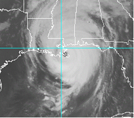 |
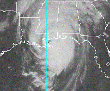 |
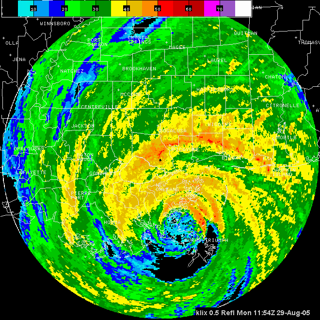
Here are some radar images from the WSR-88D radar based out of Slidell as Hurricane Katrina made Landfall.
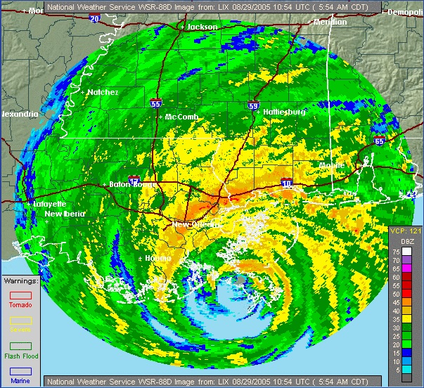
WSR-88D radar image from Slidell at 5:54 AM CDT(1054 UTC) on August 29, 2005. Katrina's eye was passing over Plaquemines Parish, LA. |
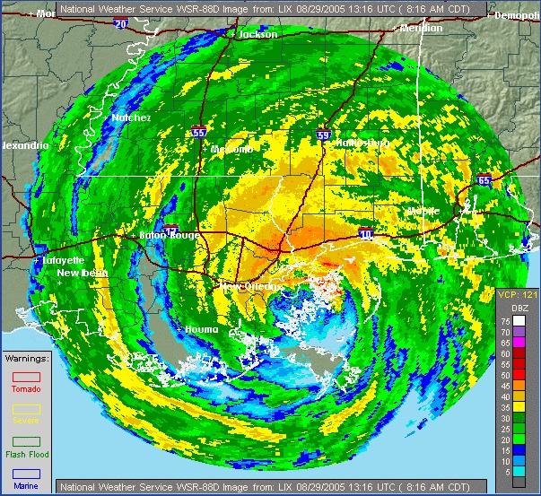
WSR-88D radar image from Slidell at 8:16 AM CDT(1316 UTC) on August 29, 2005. Katrina's eye was passing over St. Bernard Parish, LA. |
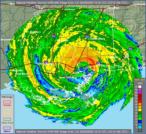
WSR-88D radar image from Slidell at 10:10 AM CDT (1510 UTC) on August 29, 2005. Katrina's eye was passing over the Pearl River on the Louisiana-Mississippi border. |
WSR-88D radar loop as the eye of Hurricane Katrina moved over the region. |
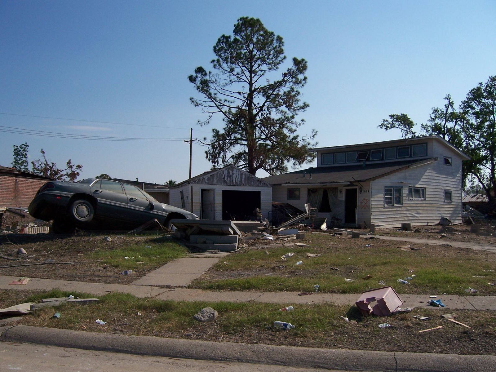
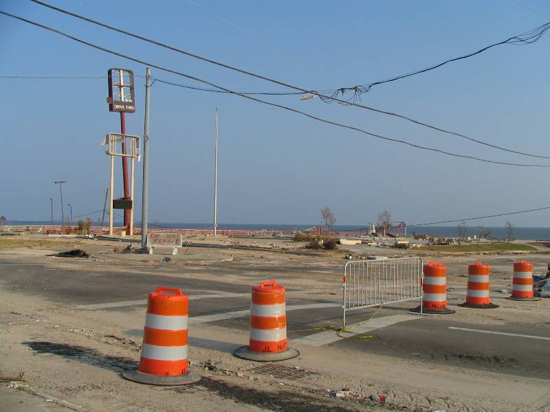
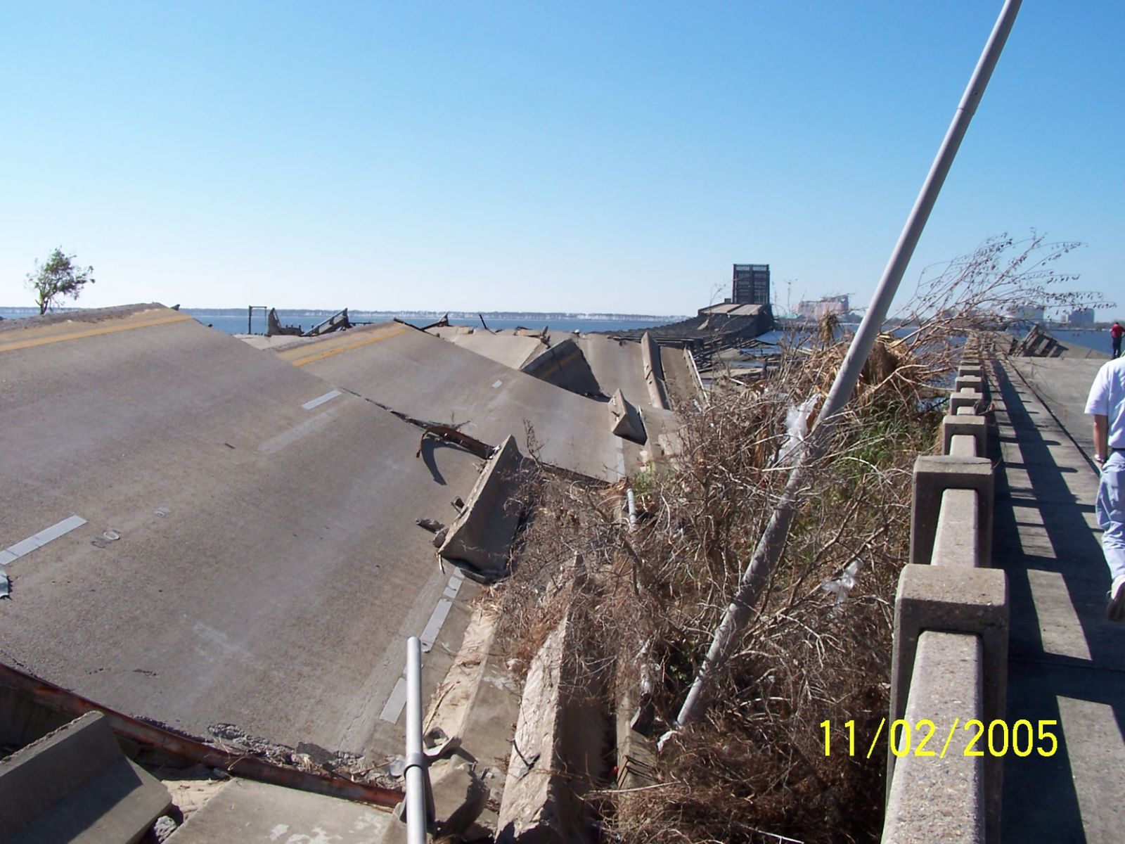
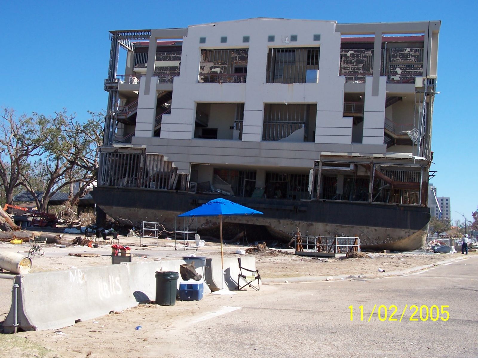
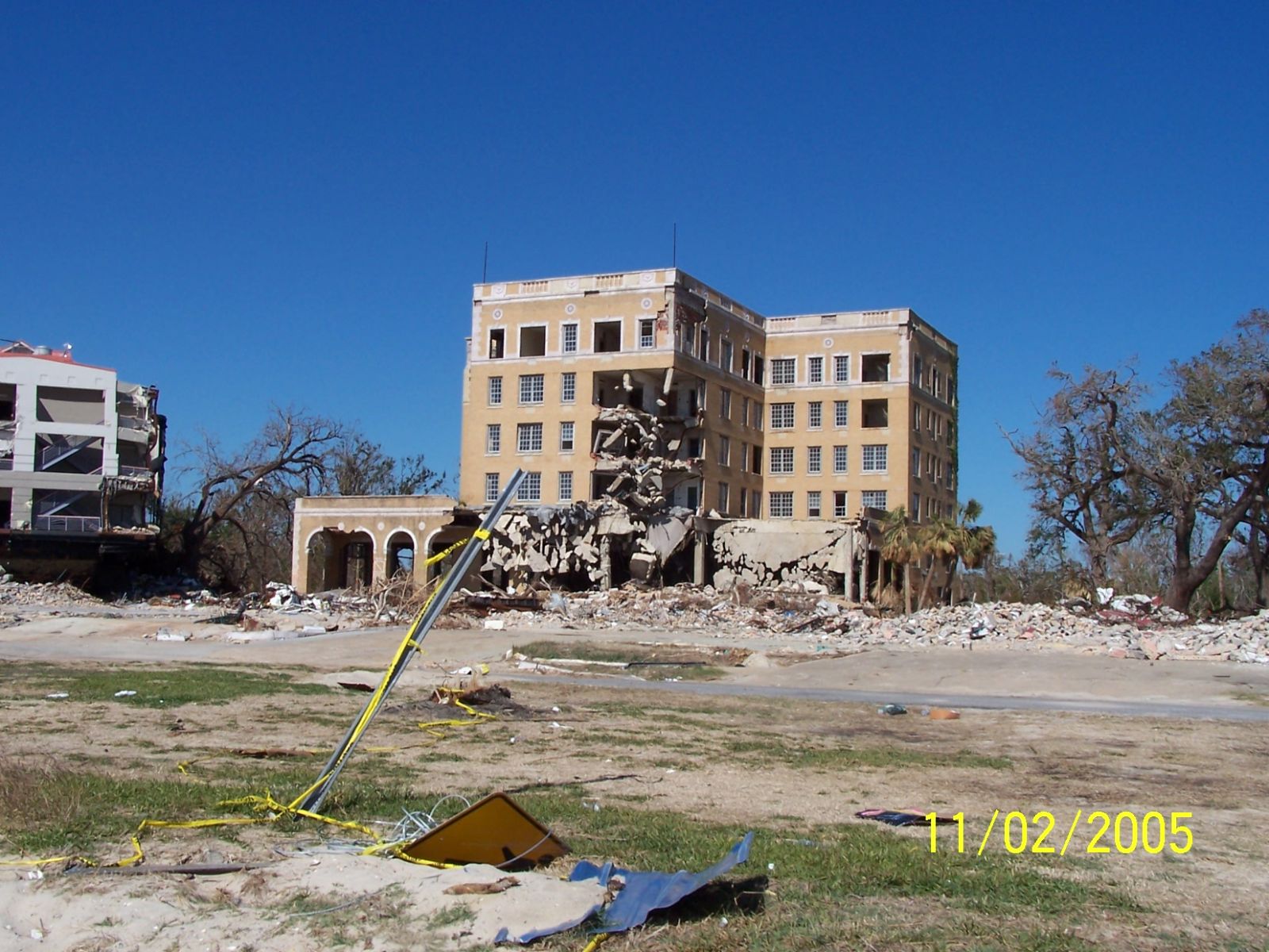
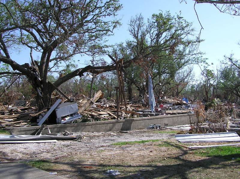
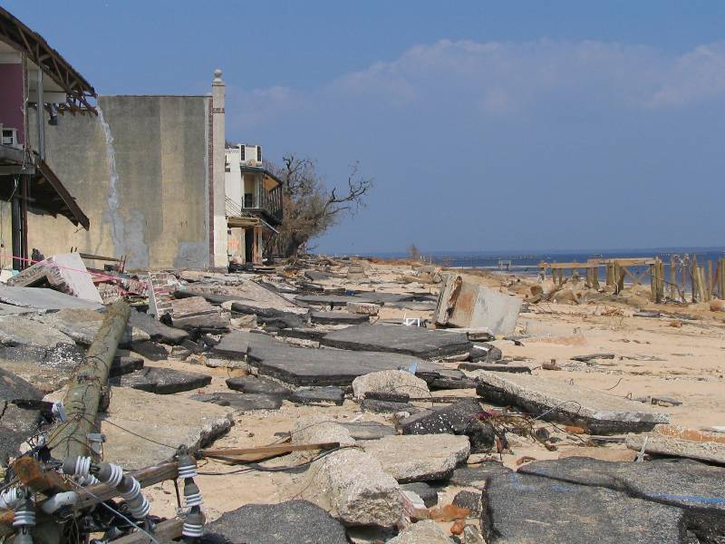
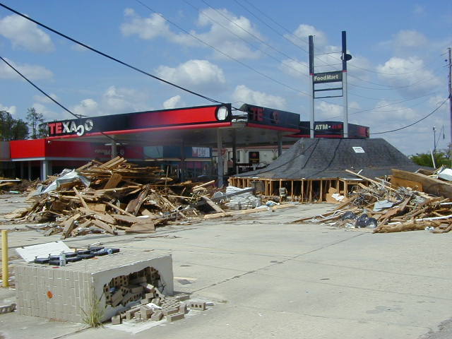
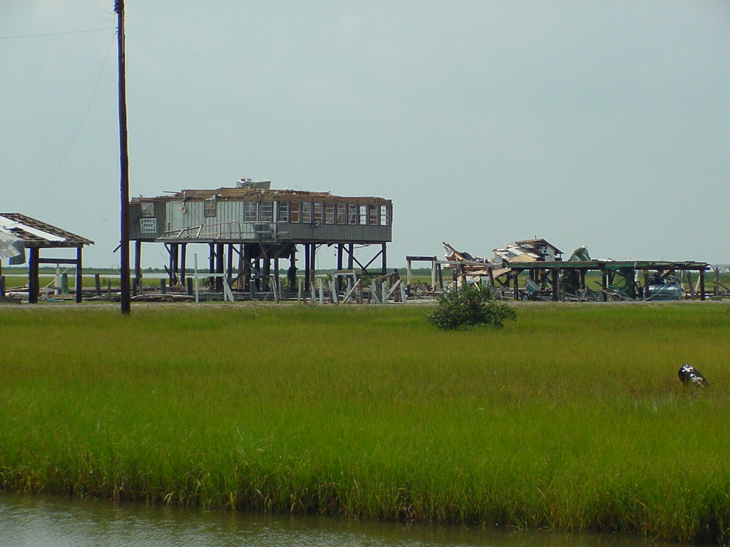
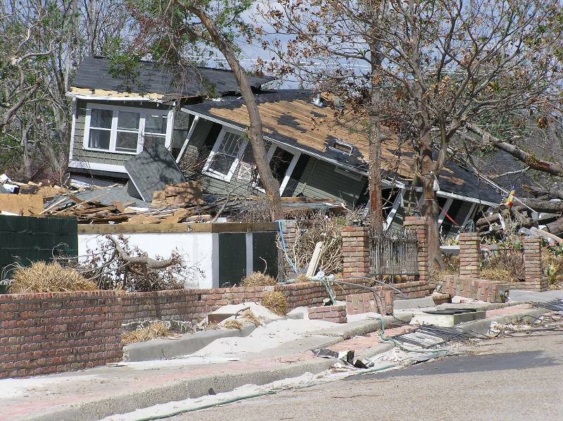
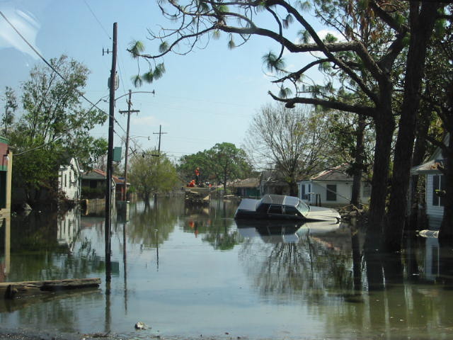
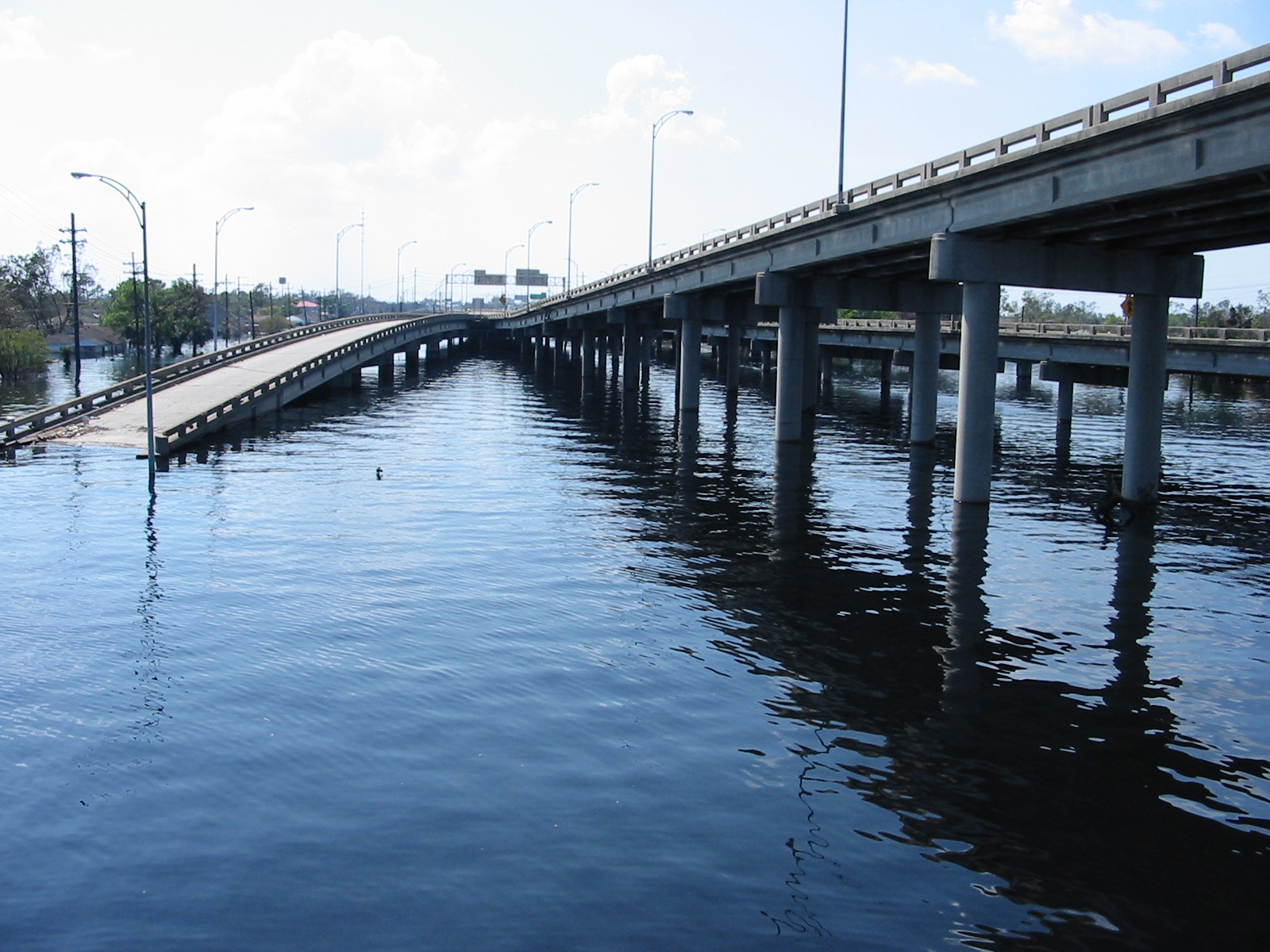
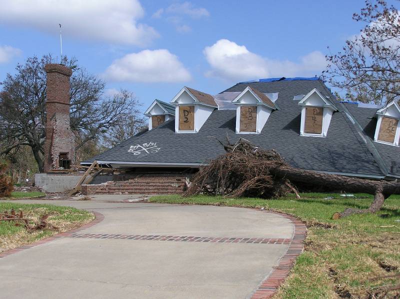
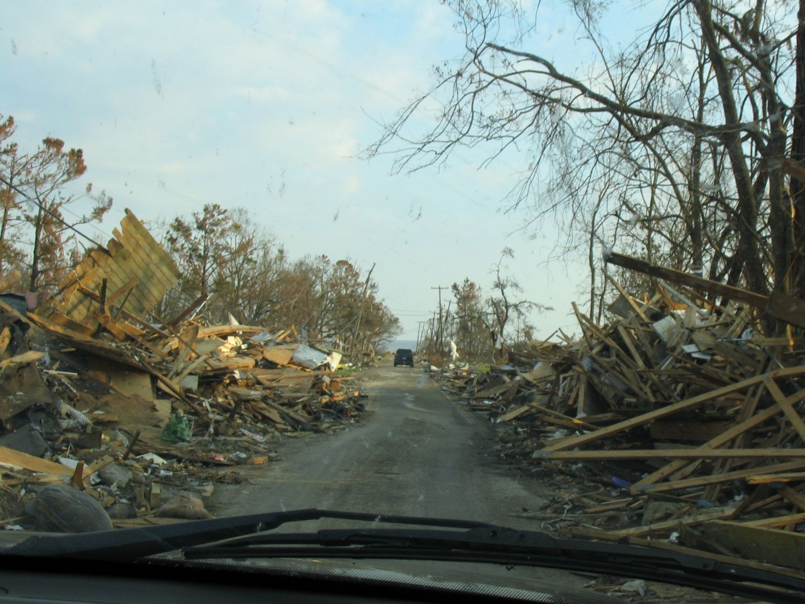
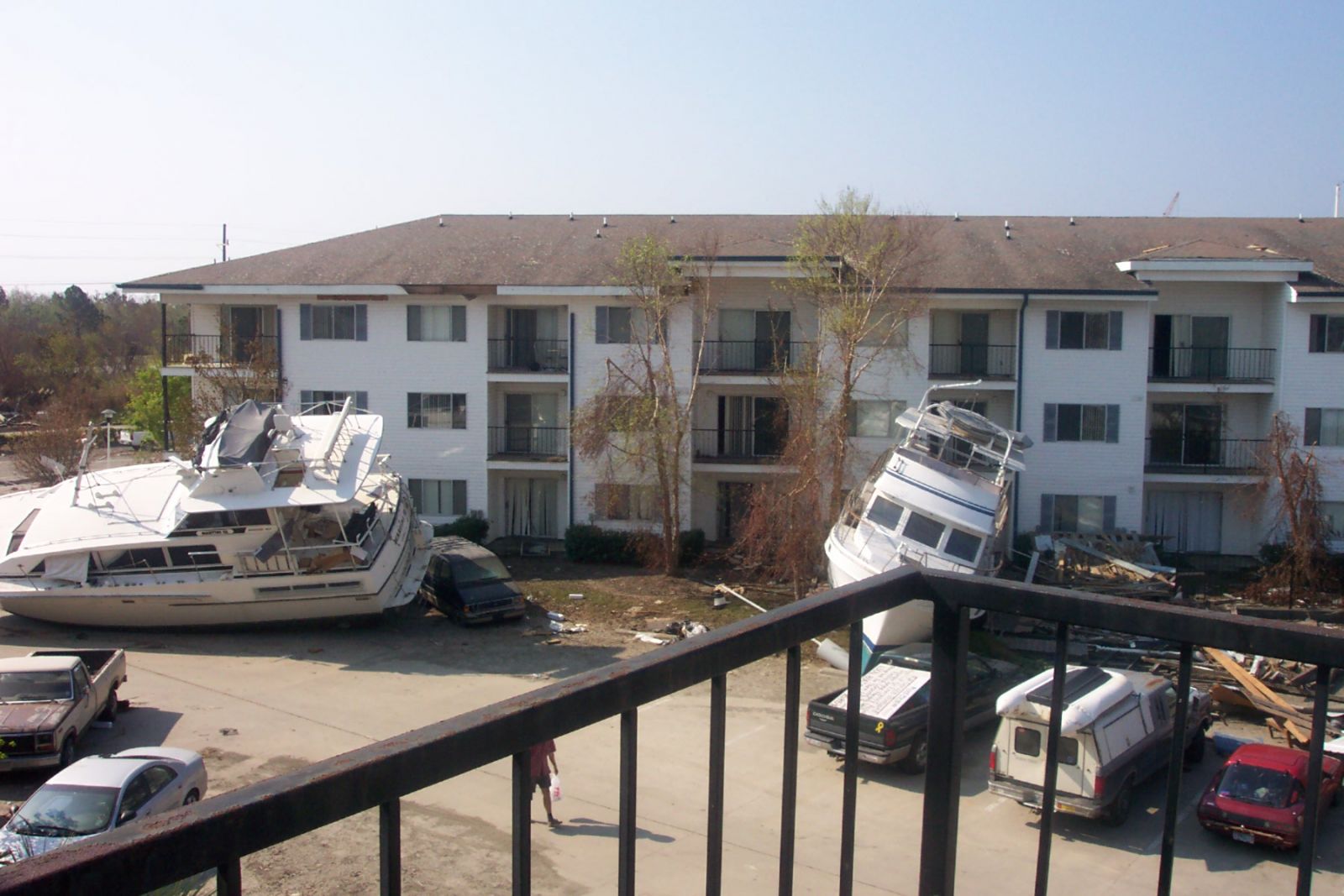
A very large storm surge ranging from 10 to 28 feet impacted much of the coastal areas across Southeast Louisiana and Coastal Mississippi. The highest and most devastating storm surge was recorded in the Bay St. Louis and Pass Christian, MS areas where storm surge heights approached 28 feet. Extreme devastation was recorded along the Mississippi coast due to the combination of storm surge and battering waves with very few structures left standing. In Southeast Louisiana, storm surge values ranged from 10 to 20 feet and impacted areas extending from Terrebonne Parish to the Northshore communities of Lake Pontchartrain including Mandeville and Slidell. Extensive damage to structures was observed throughout these areas. The storm surge overtopped the federal levee system in Orleans and St. Bernard Parishes leading to levee failures and extensive flooding of homes in these parishes. The devastation caused by the storm surge of Hurricane Katrina resulted in one of the largest displacements of a population since the Great Depression.
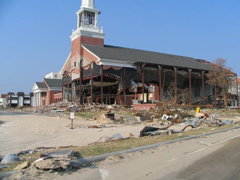
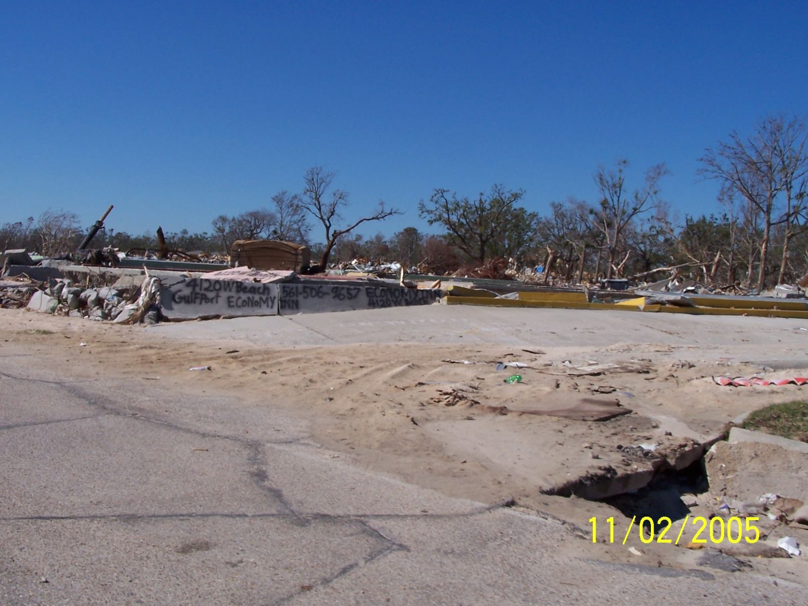
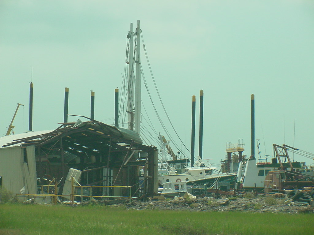
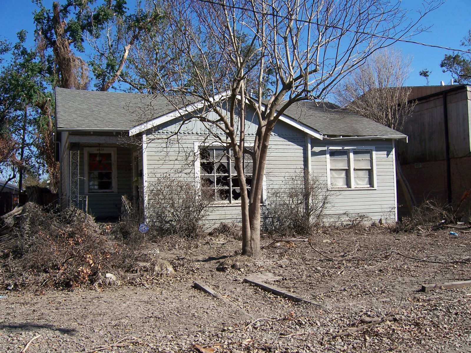
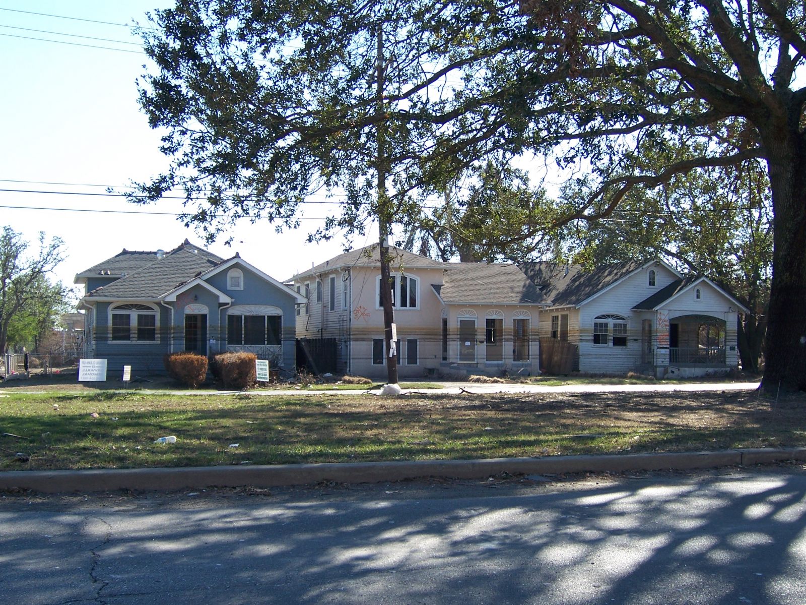
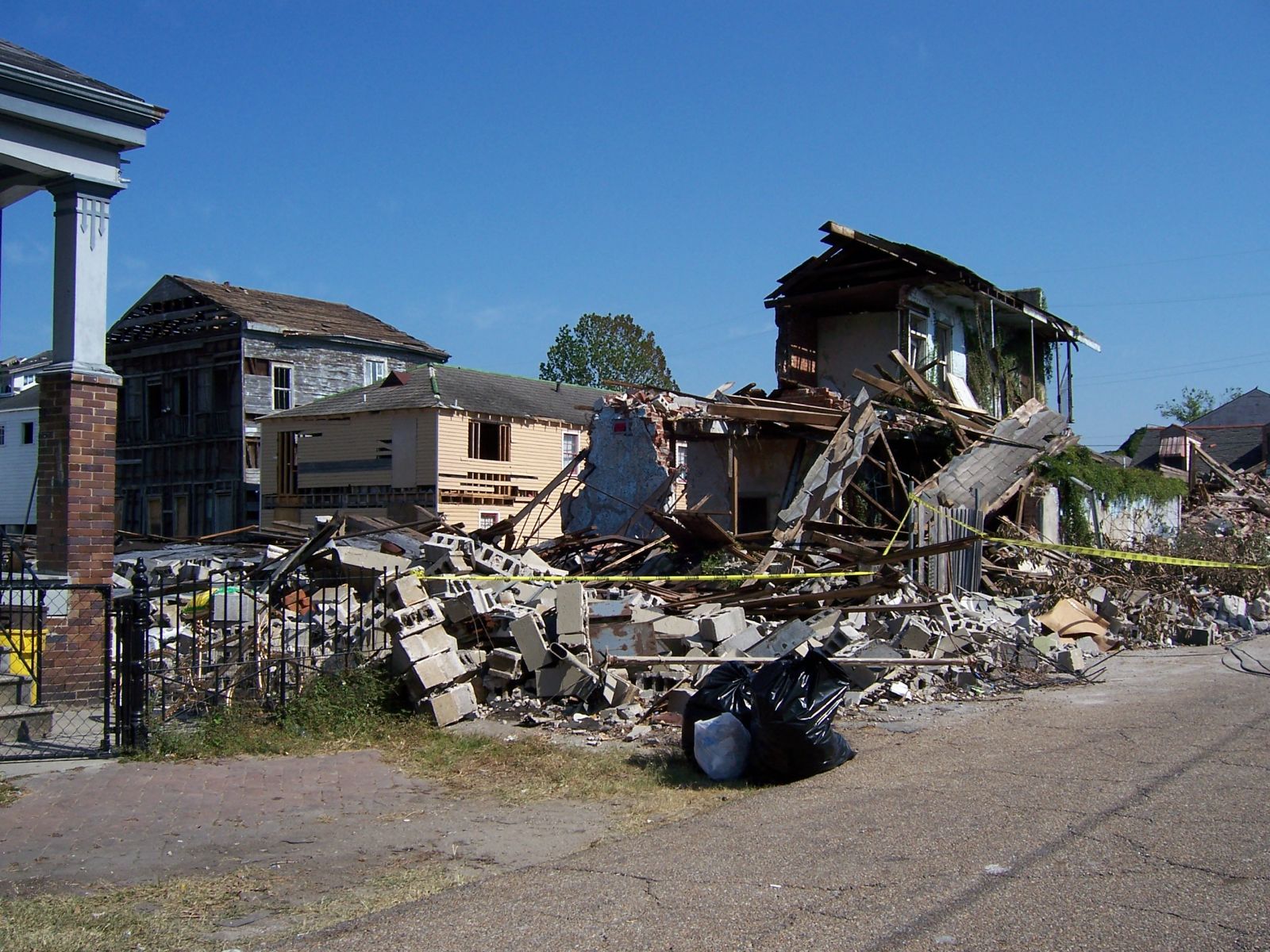
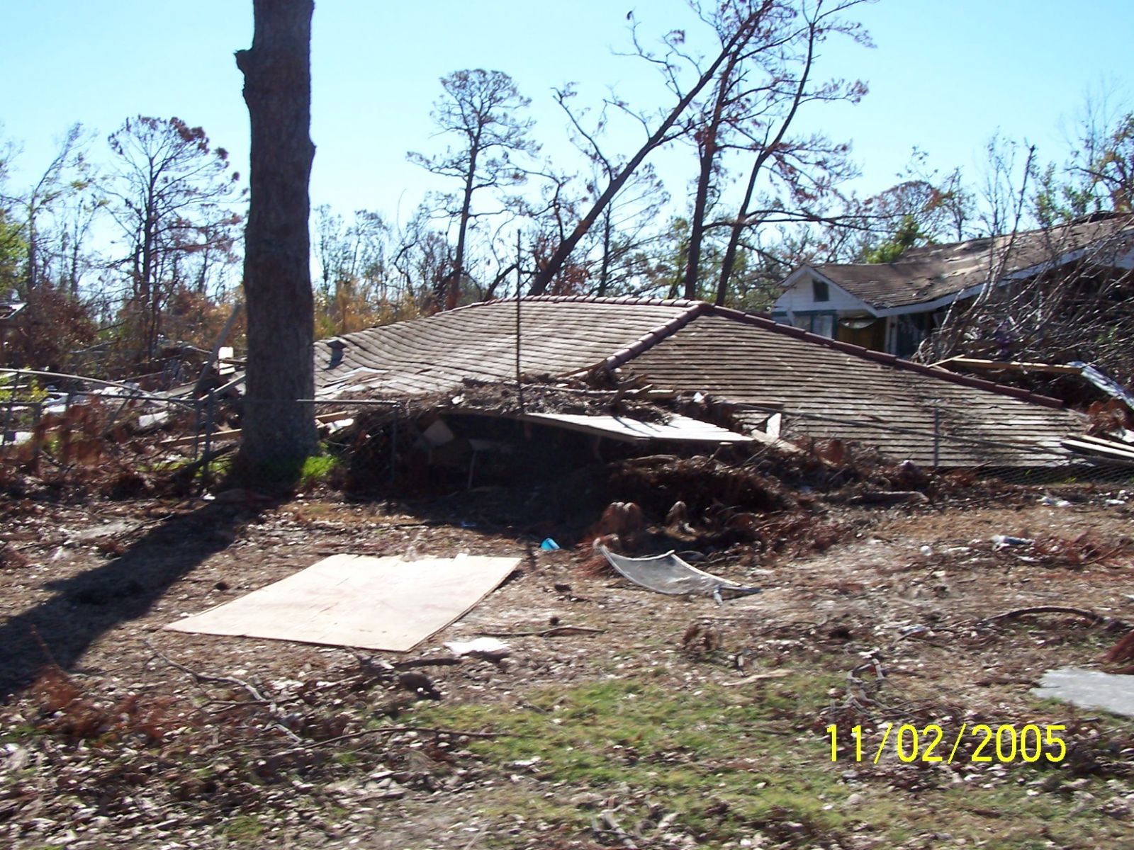
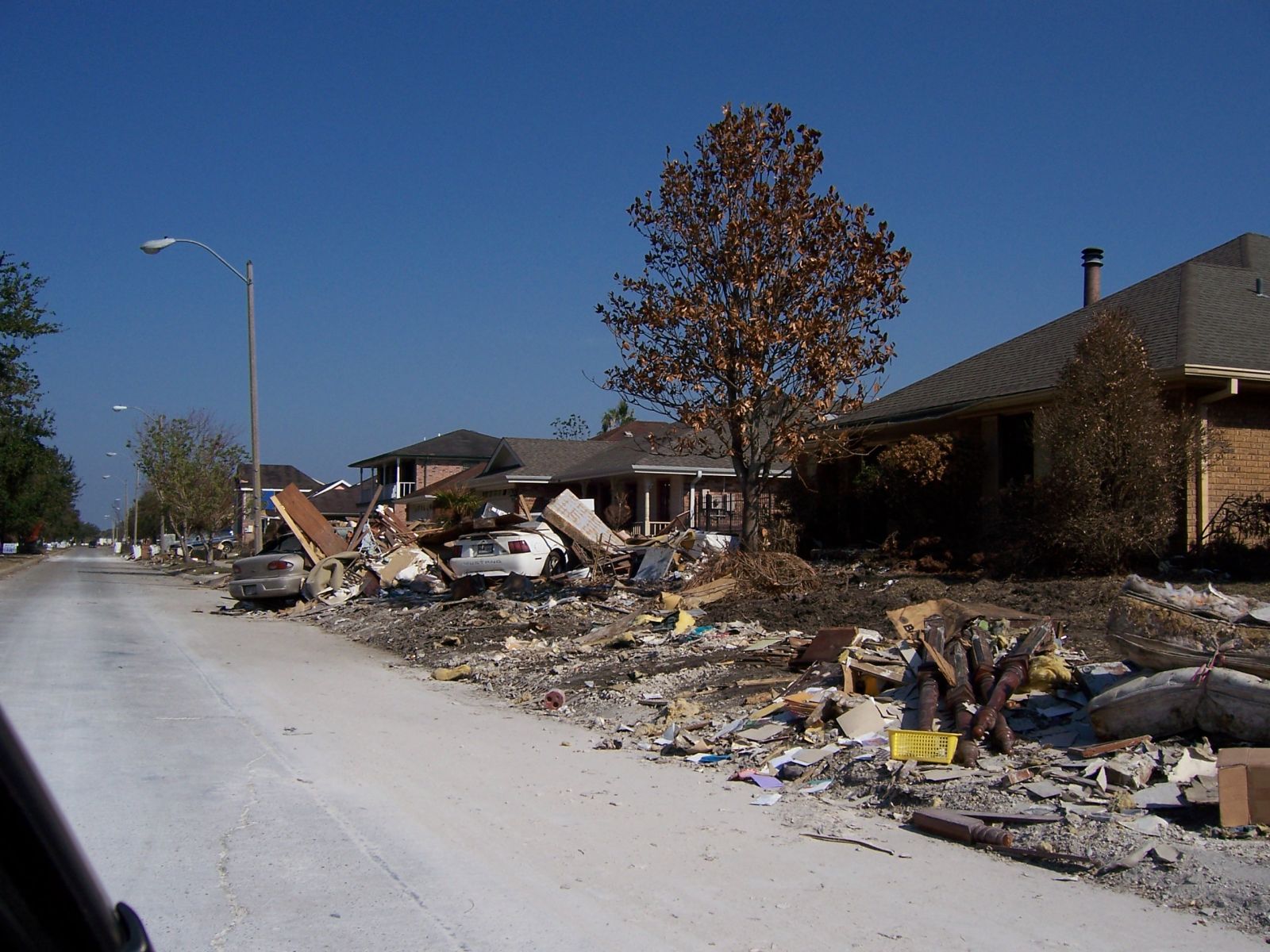
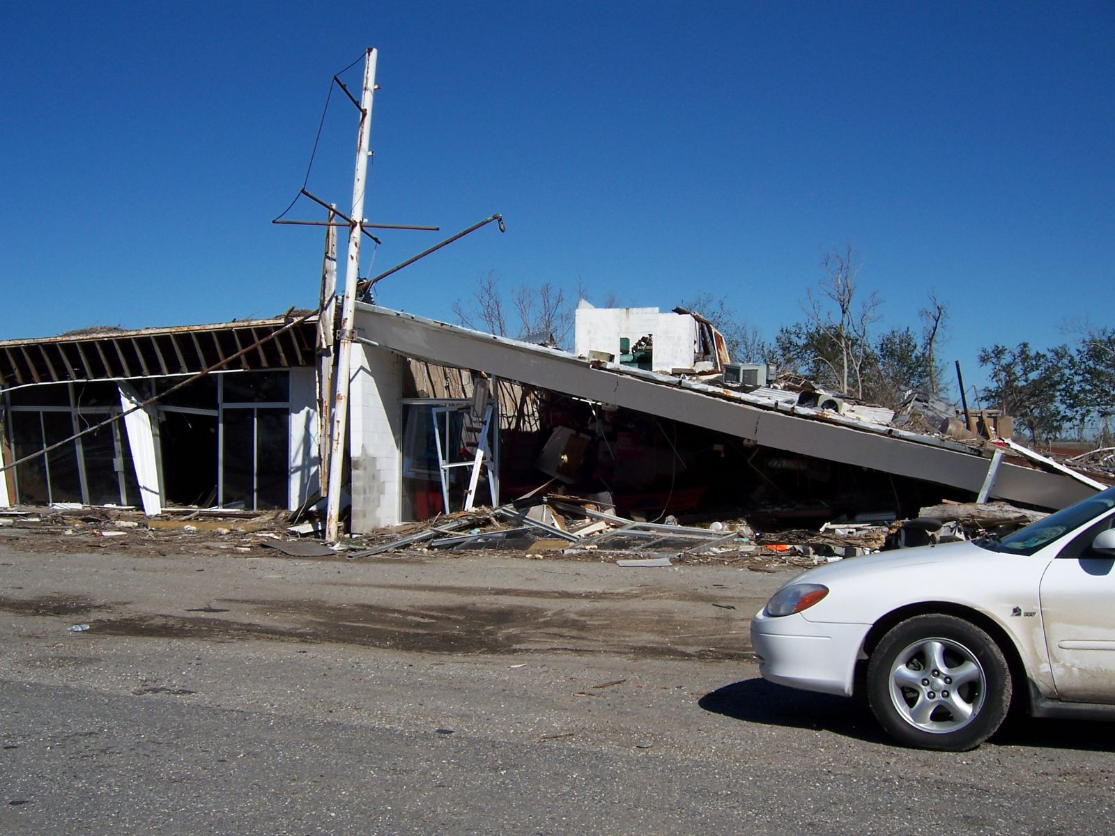
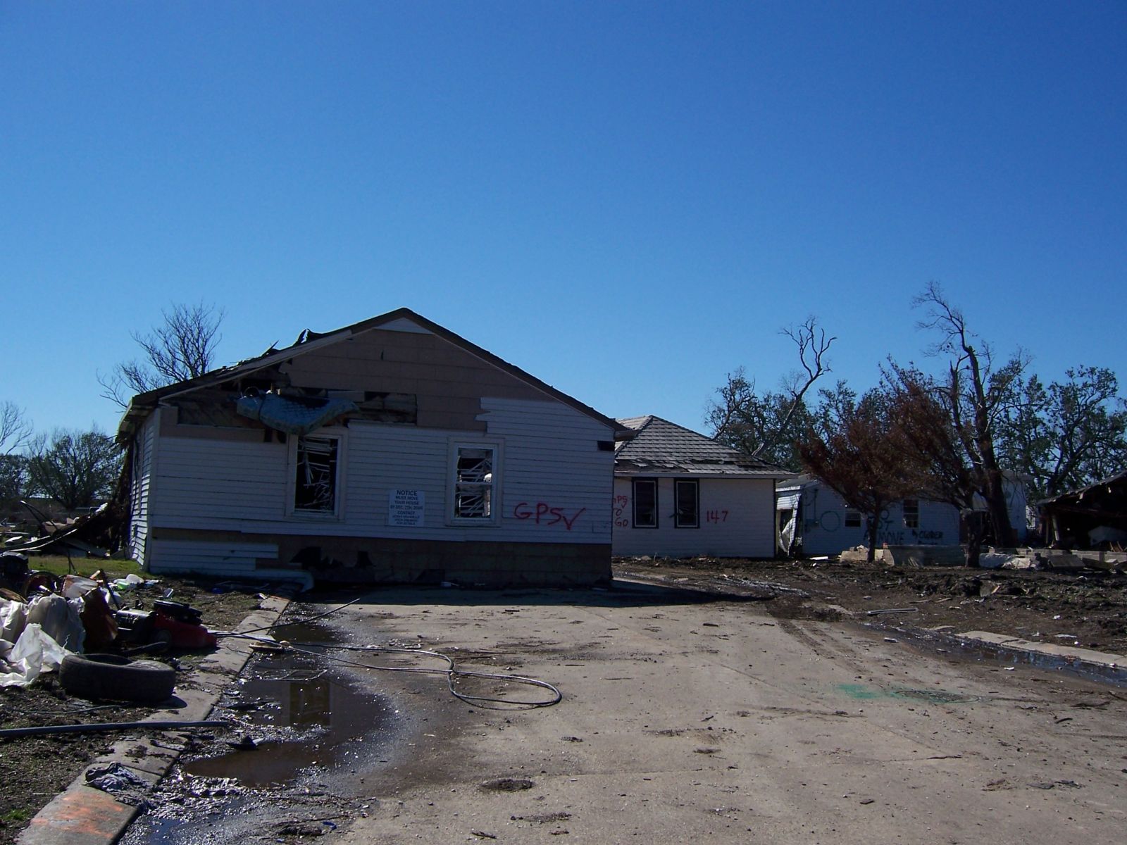
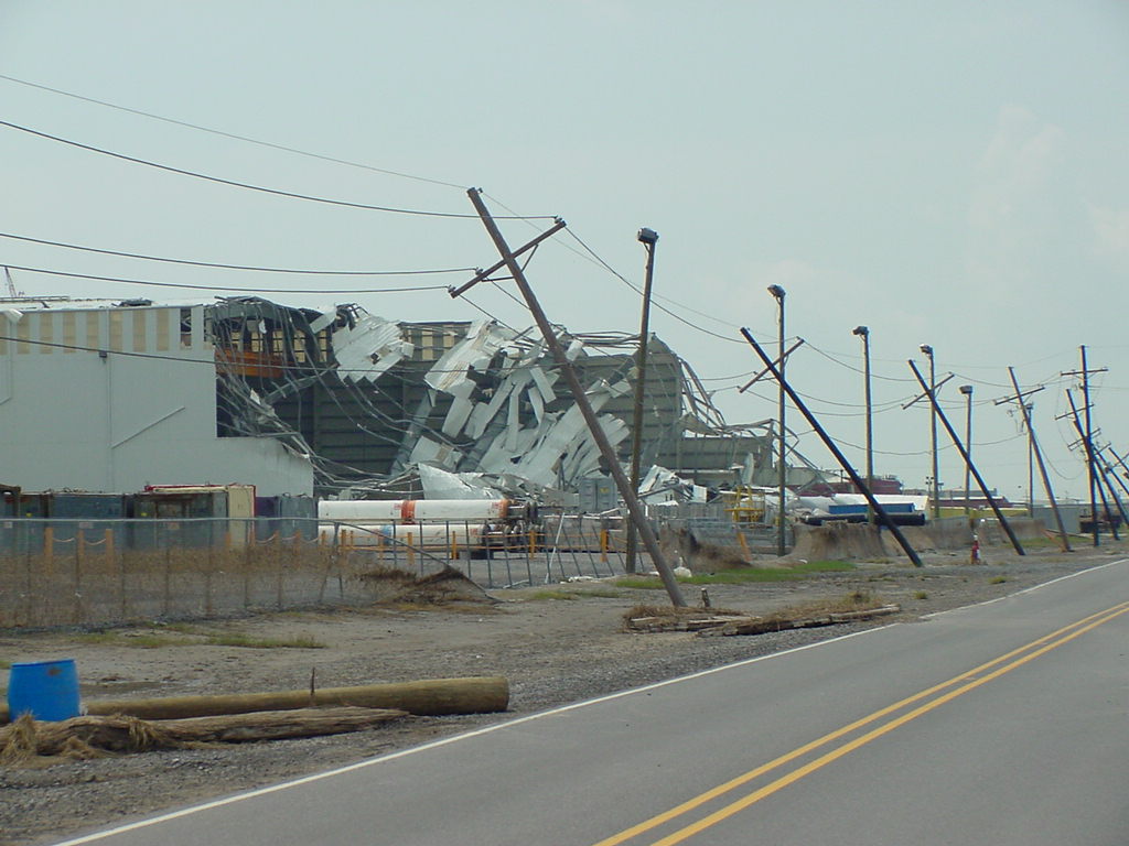
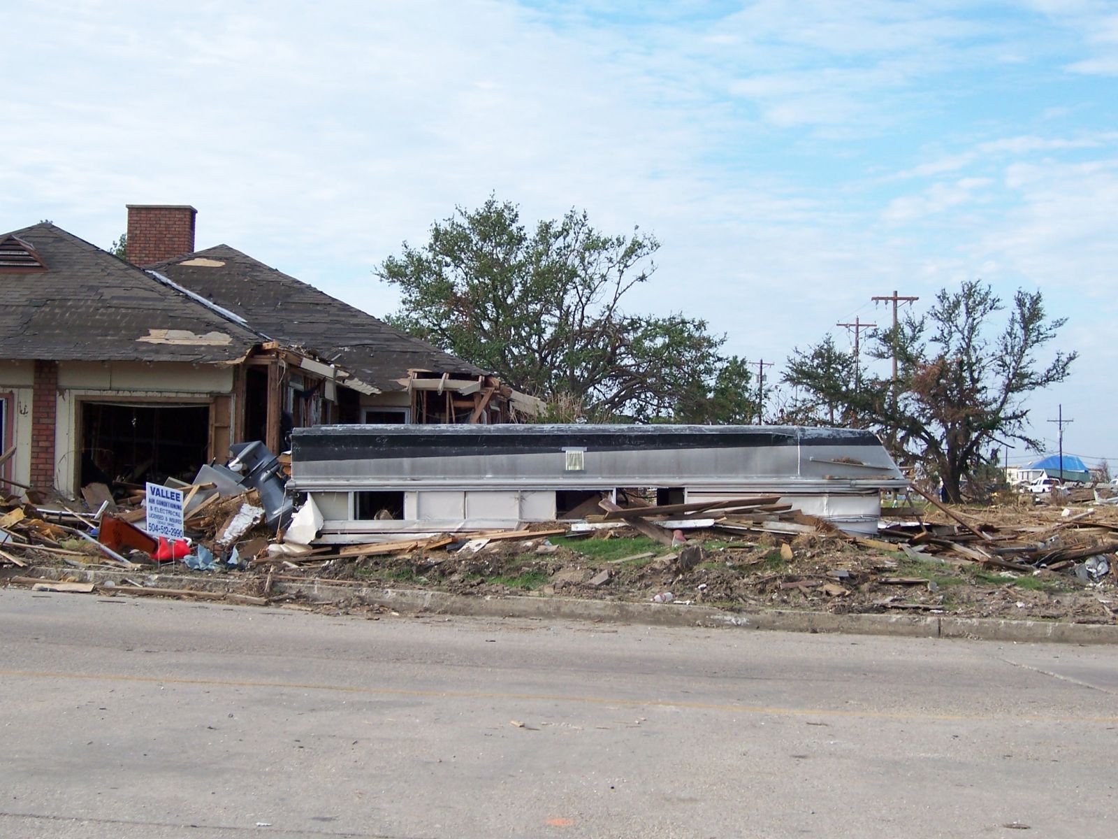
The following are some images of the destruction caused by the wind and storm surge of Hurricane Katrina in Louisiana and Mississippi.
 |
 |
 |
 |
 |
 |
 |
 |
 |
 |
 |
 |
 |
 |
 |
 |
 |
 |
 |
 |
 |
 |
 |
 |
 |
 |
 |
 |
| Lowest Pressure | Highest wind (kts) | Highest Wind (mph) | Storm Rainfall |
Storm surge (ft.) | ||||
| millibars | in. Hg | 1-min avg | gust | 1-min avg | gust | |||
| Mississippi… | ||||||||
| Pascagoula | 976 | 28.82 | 58 | 66 | 67 | 76 | ||
| Wortham (Biloxi River) | 26 | |||||||
| Hancock County EOC | 28 | |||||||
| McComb | 972.2 | 28.71 | 42 | 56 | 48 | 64 | ||
| Hancock RAWS | 43 | 74 | 49 | 85 | 10.05 | |||
| Pass Christian | 27.8 | |||||||
| Long Beach | 106 | 122 | 25.7 | |||||
| Stennis Space Center | 59 | 102 | 68 | 117 | ||||
| Louisiana… | ||||||||
| New Orleans Lakefront | 11.8 | |||||||
| New Orleans International | 64 | 74 | ||||||
| Slidell Airport | 934.1 | 27.58 | 61 | 87 | 70 | 100 | 11.63 | |
| Manchac | 960.9 | 28.37 | 59 | 74 | 68 | 85 | 5.55 | |
| Baton Rouge Ryan Field | 984.4 | 29.07 | 39 | 43 | 45 | 49 | ||
| Big Branch RAWS | 50 | 57 | 14.92 | |||||
| Mississippi River Gulf Outlet | 15.5 | |||||||
| Alluvial City | 18.7 | |||||||
| 10 mi. SE of Slidell | 16.0 | |||||||
| Buras | 920.2 | 27.17 | 73 | 93 | 84 | 107 | ||
| Belle Chasse NAS | 68 | 89 | 78 | 102 | ||||
| Galliano | 67 | 83 | 77 | 95 | ||||
| Vacherie | 48 | 64 | 55 | 74 | ||||
| Franklinton | 953.7 | 28.16 | 43 | 69 | 49 | 79 | 5.03 | |
| Houma | 976.6 | 28.84 | 44 | 60 | 51 | 69 | 3.68 | |
| Hammond | 965.3 | 28.50 | 48 | 66 | 55 | 76 | 4.61 | |
For additional statistics go to either the local post-storm report produced by the New Orleans WFO, or to the National Hurricane Center Tropical Cyclone Report.

