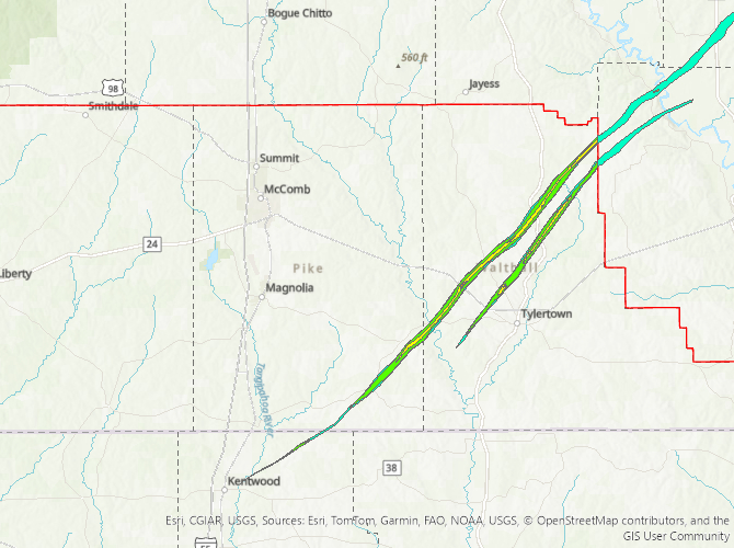
Kentwood, LA to Darbun, MS Tornado - March 15, 2025
|
Rating:
|
EF-4
|
|
Estimated Maximum Wind:
|
170 mph
|
|
Injuries/Fatalities:
|
3 fatalities/unknown injuries |
|
Damage Path Length:
|
36.81 miles
|
|
Maximum Path Width:
|
0.7 miles
|
|
Approximate Start Point/Time:
|
3 miles ENE of Kentwood, LA at 1217 PM CDT
|
|
Approximate End Point/Time:
|
7 miles NE of Salem, MS at 102 PM CDT
|
|
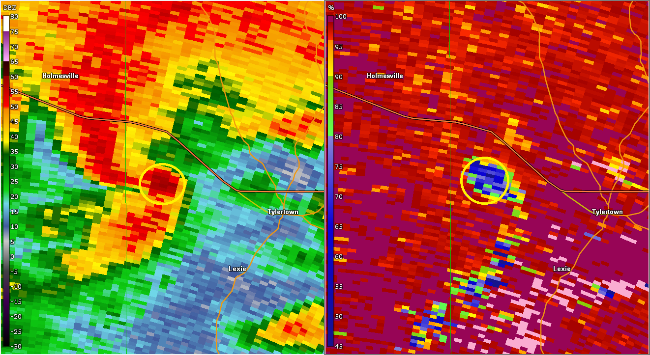
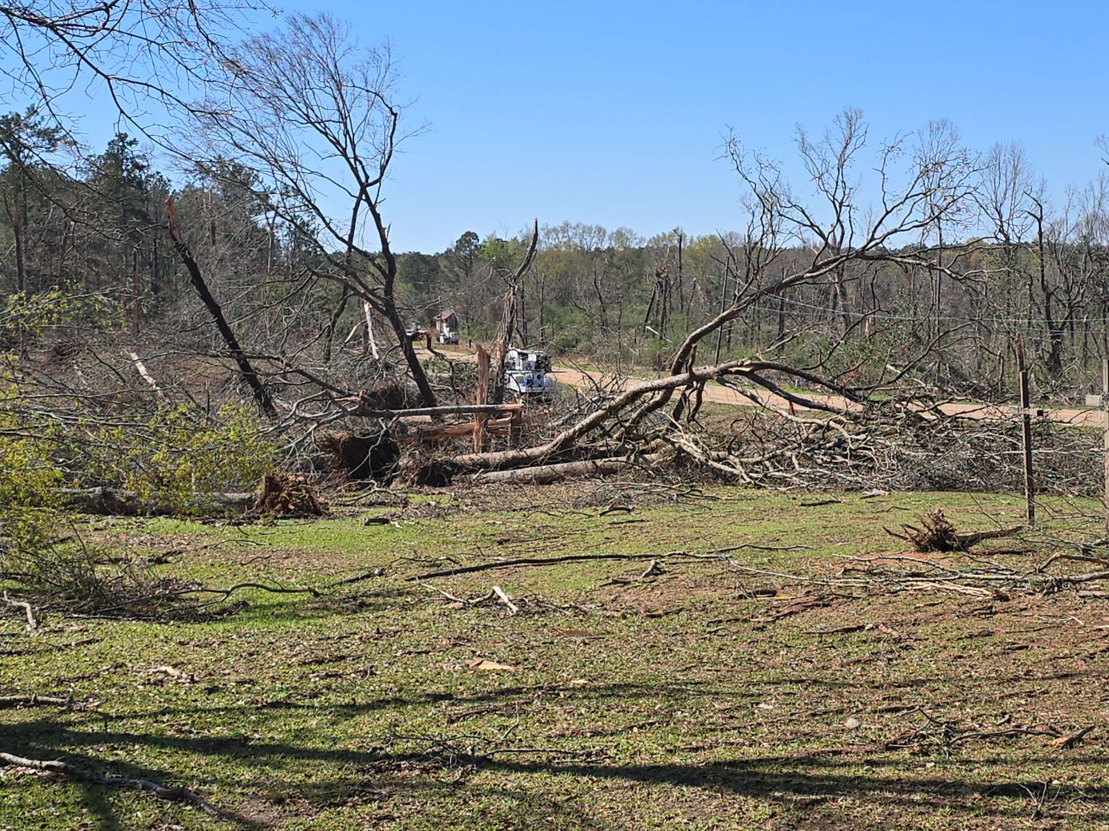
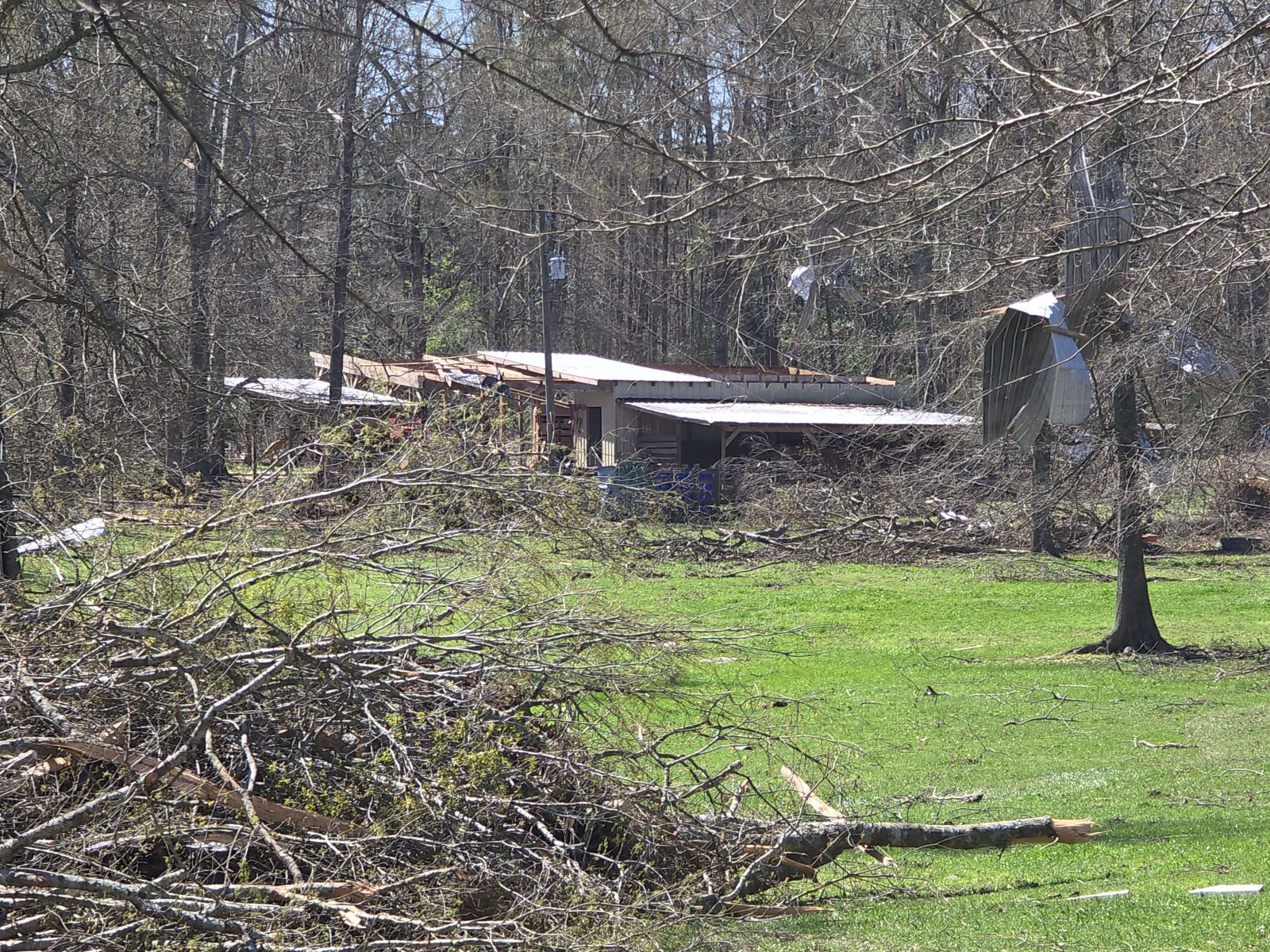
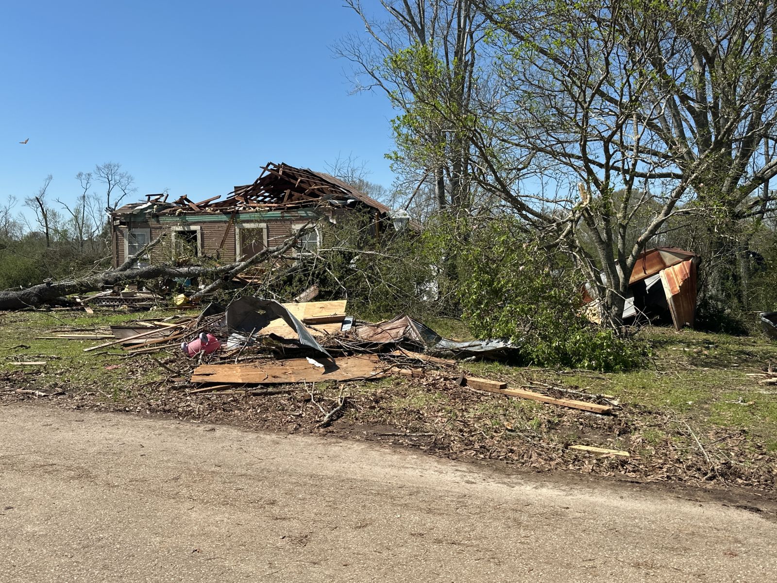
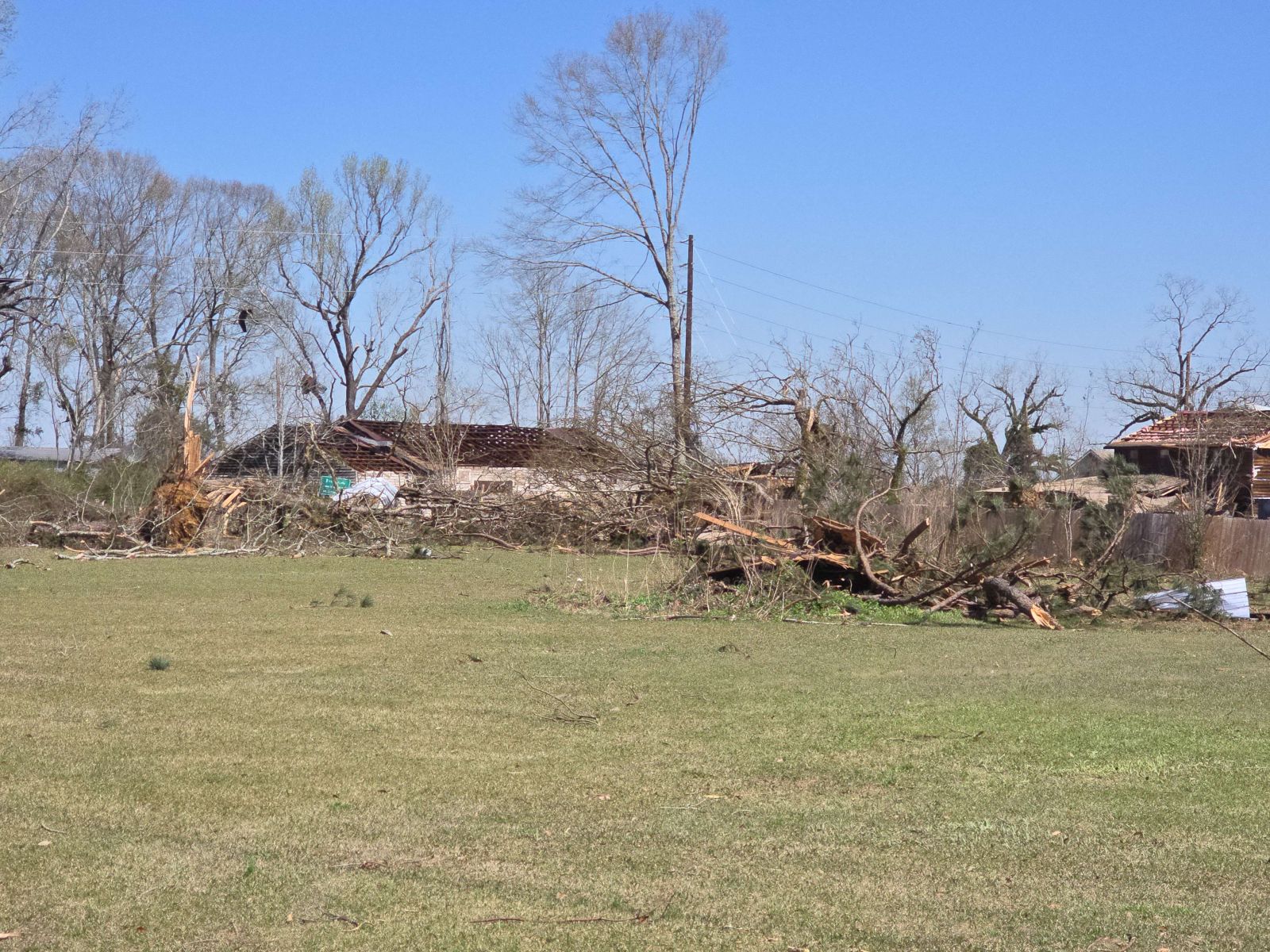
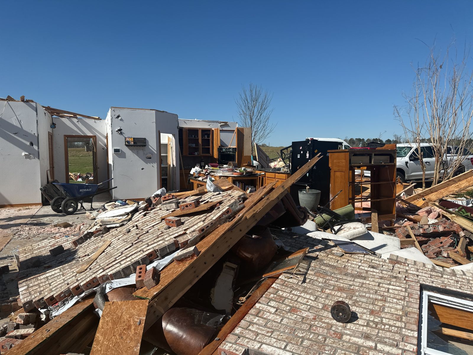
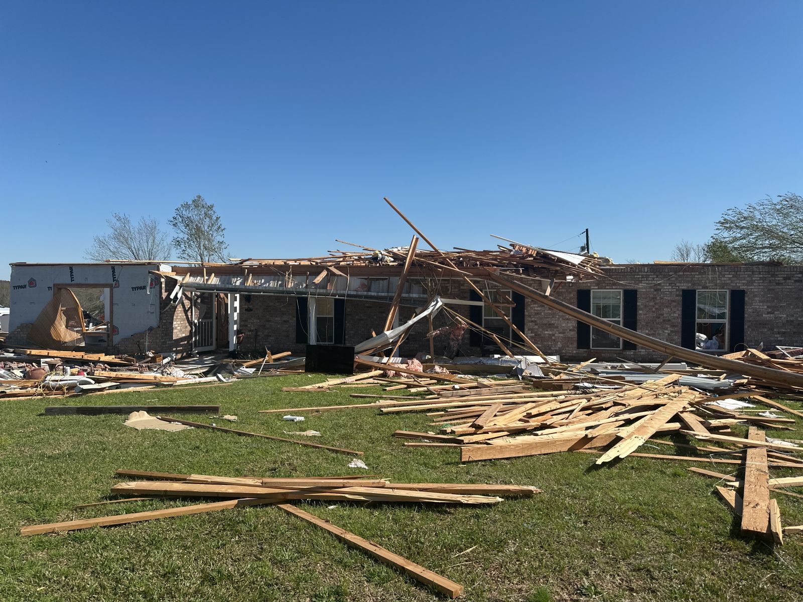
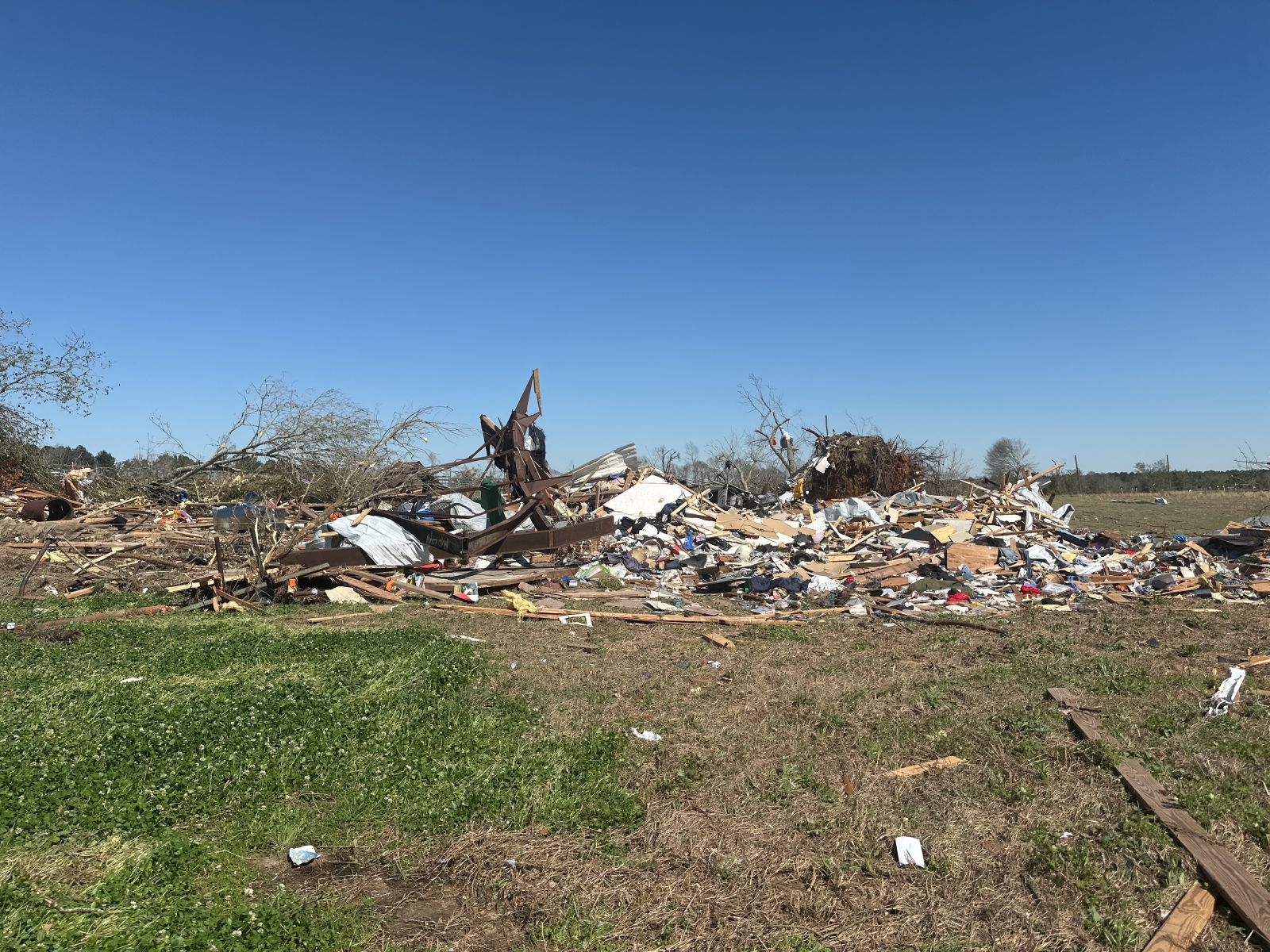
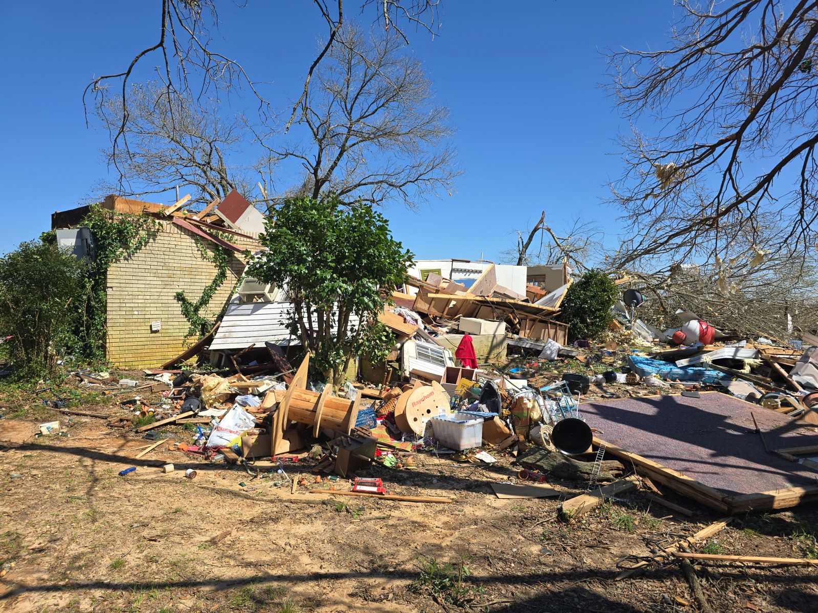
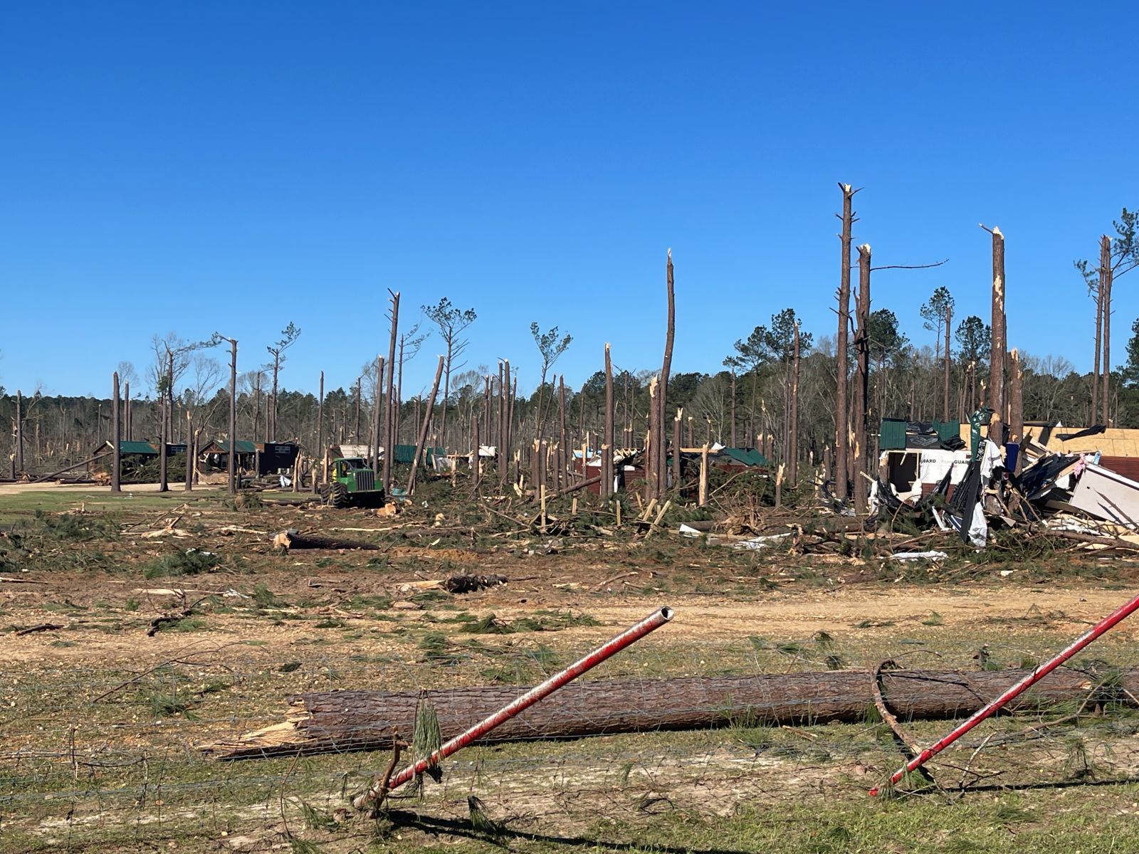
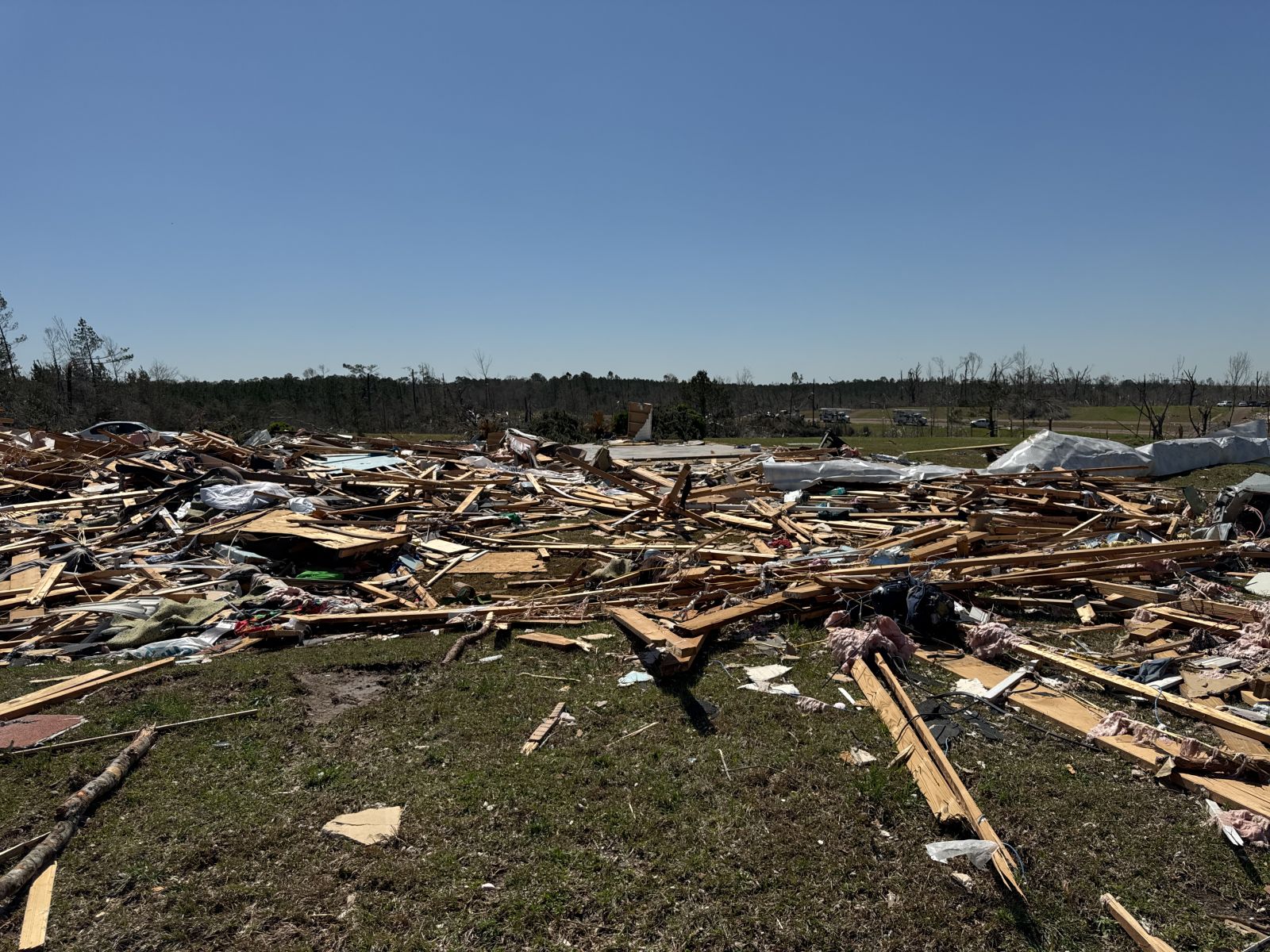
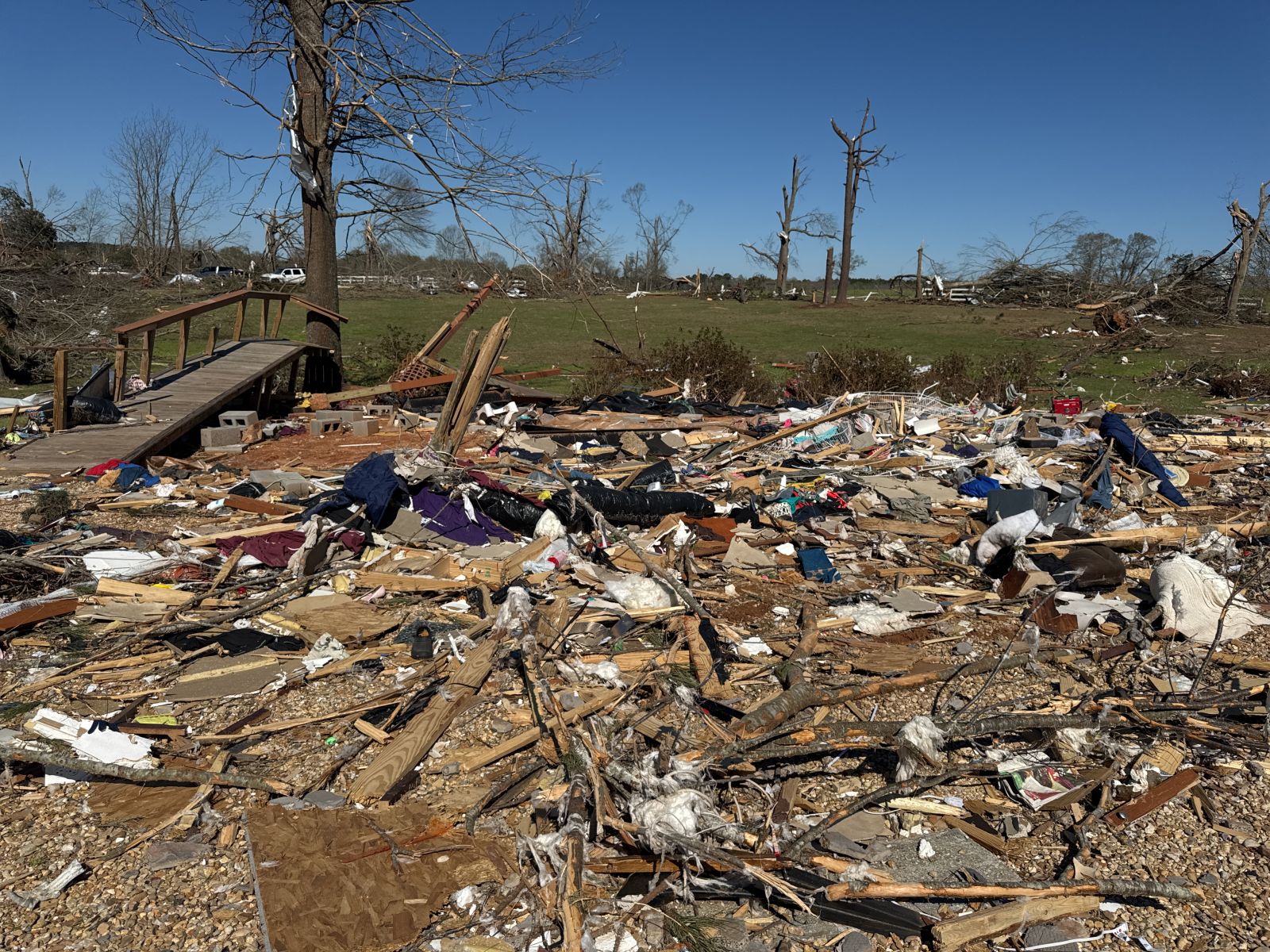
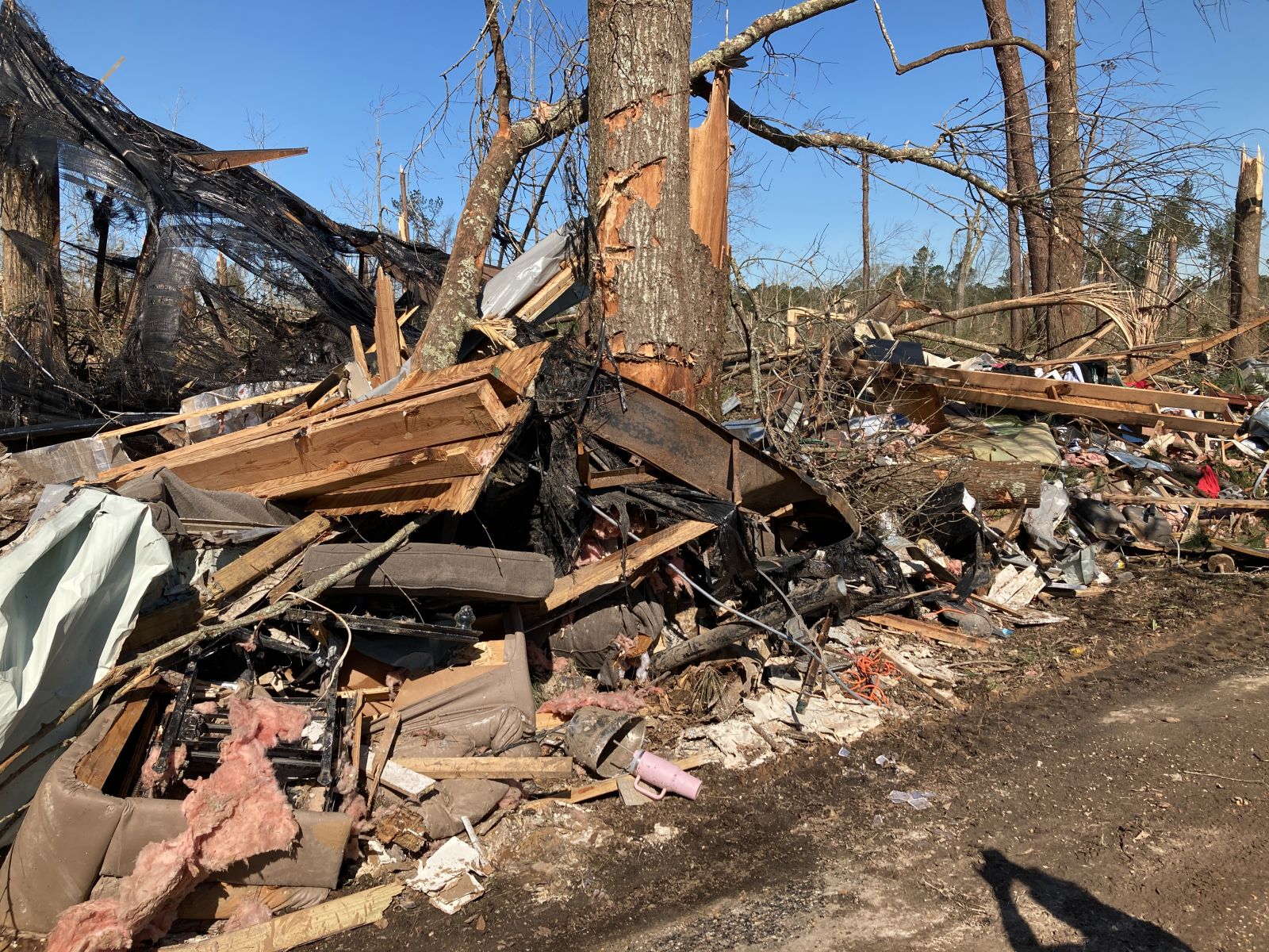
A National Weather Service Damage Assessment Team has surveyed the storm damage between Kentwood, LA and Darbun, MS. It has been determined the damage was the result of a tornado. The tornado has been rated an EF-4 on the Enhanced Fujita Scale. Damage estimates were consistent with winds of 170 mph. This tornado touched down just northeast of Kentwood, LA and produced EF1 damage northeast through most of SE Pike County in MS. As it started to cross into Walthall, EF2 damage was noted. Pockets of EF3 damaged occurred all along the path as it continued through Walthall County. West of Tylertown on the north side of 98, a well built, well anchored home, was swept from the foundation, leaving debris in a pile and thrown behind the home. This home was determined to have 170 MPH EF4 damage. It is likely the tornado was at EF4 strength at other parts on the track but with only manufactured homes in rural areas impacted, this house is currently the only EF4 damage in Walthall County. The EF3 damage throughout the county was all demolished single or double wide manufactured home with the debris swept away. Widespread snapped and uprooted trees were noted on ground surveys and via drone and satellite. 3 fatalities were noted with this tornado. The ground survey team learned about 10 injuries but that was only because family members were around. The total injuries of 10-20 were county based so we are unsure how many were associated with each tornado. The width was estimated via ground survey, satellite and drone data and for now is estimated at 0.7 miles, or around 1200 yards. This may need to be updated in the future. This path continues northeast into Jackson`s county warning area and ends just west of Collins, MS. |
|
|
|
|
||||||||||||||||||||||