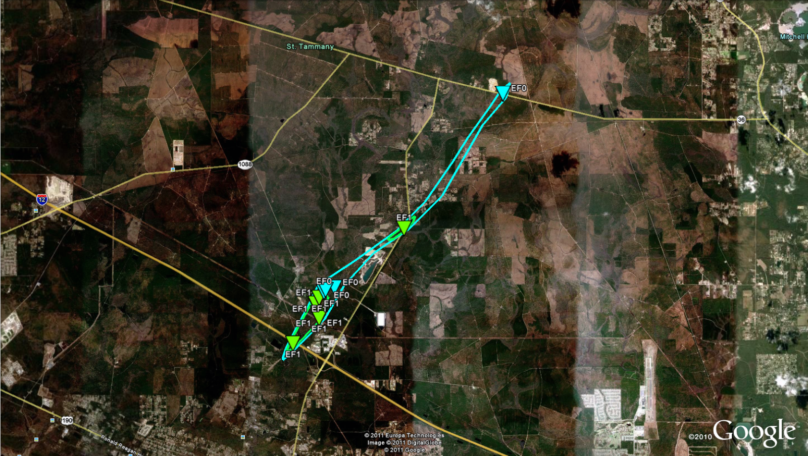
Lacombe, LA Tornado - March 9, 2011
|
Rating:
|
EF-1
|
|
Estimated Maximum Wind:
|
105 mph
|
|
Injuries/Fatalities:
|
None
|
|
Damage Path Length:
|
11 miles
|
|
Maximum Path Width:
|
300 yards
|
|
Approximate Start Point/Time:
|
3 miles N of Lacombe, LA at 450 AM
|
|
Approximate End Point/Time:
|
8 miles SW of Picayune, MS at 515 AM
|
|
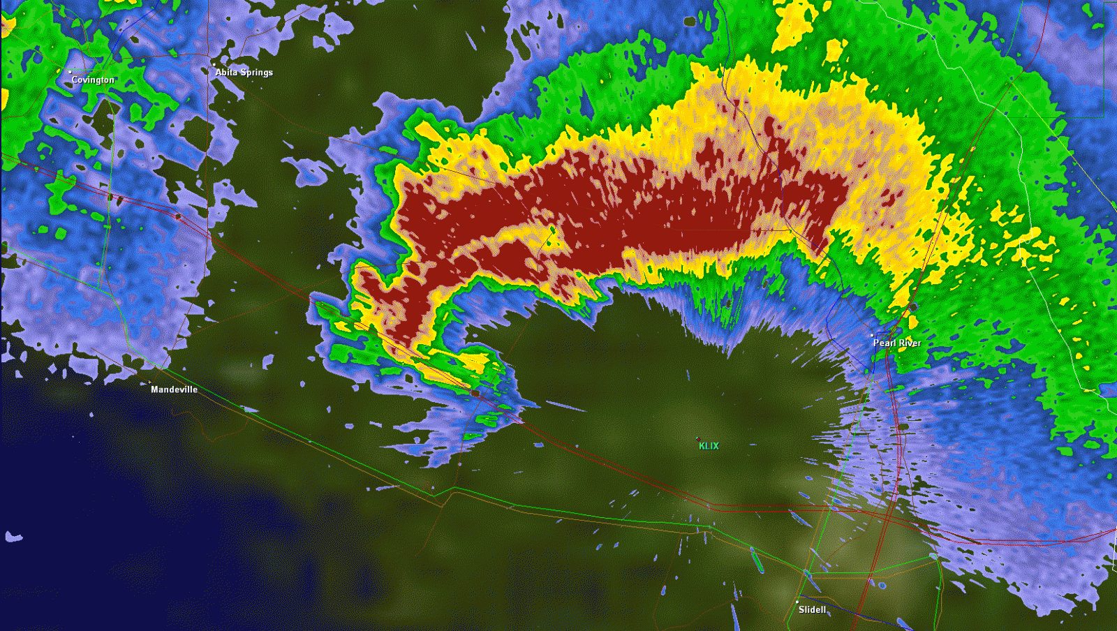
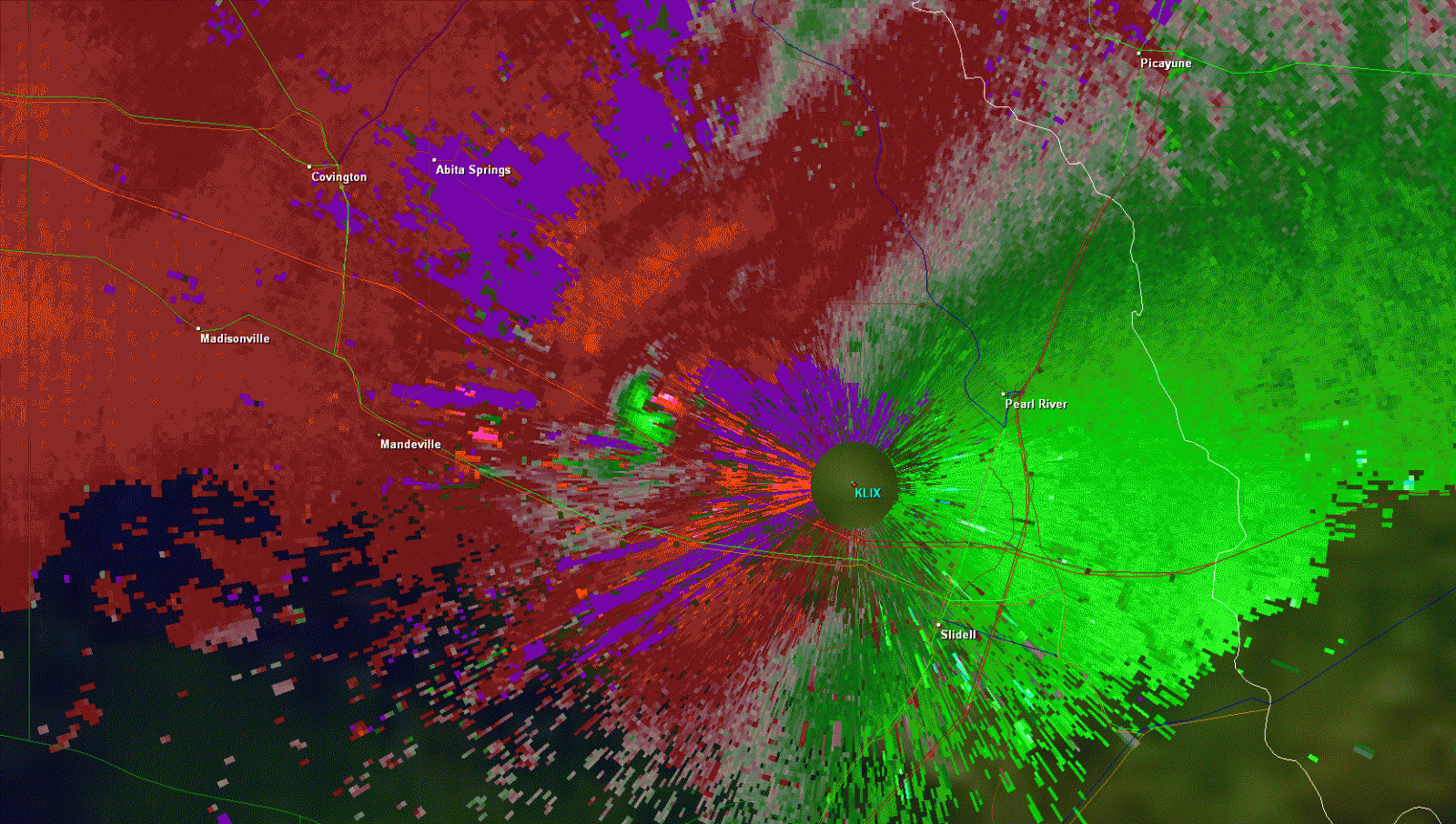
A National Weather Service Damage Assessment Team has surveyed the storm damage in St. Tammany Parish near Lacombe, LA. It has been determined the damage was the result of a tornado. The tornado has been rated an EF-1 on the Enhanced Fujita Scale. Damage estimates were consistent with winds of 105 mph. The tornado touched down just south of Interstate 12 and moved to the north-northeast and northeast to the Pearl River. The greatest damage occurred in the Fairhope neighborhood with numerous trees uprooted or snapped. Moderate damage to one residence occurred as one quarter of the roofing deck lifted off the house and windows blew out after a garage door was blown in. A couple of other houses had minor roof shingle damage. The tornado continued on an intermittent path to the northeast with mostly power pole and tree damage across Highway 434...Highway 36...and ending near Highway 41 just north of the Hickory Community. The tornado damage path was 11 miles long and was 300 yards wide at its widest point. No injuries or deaths were reported. |
|
|
|
|
||||||||||||||