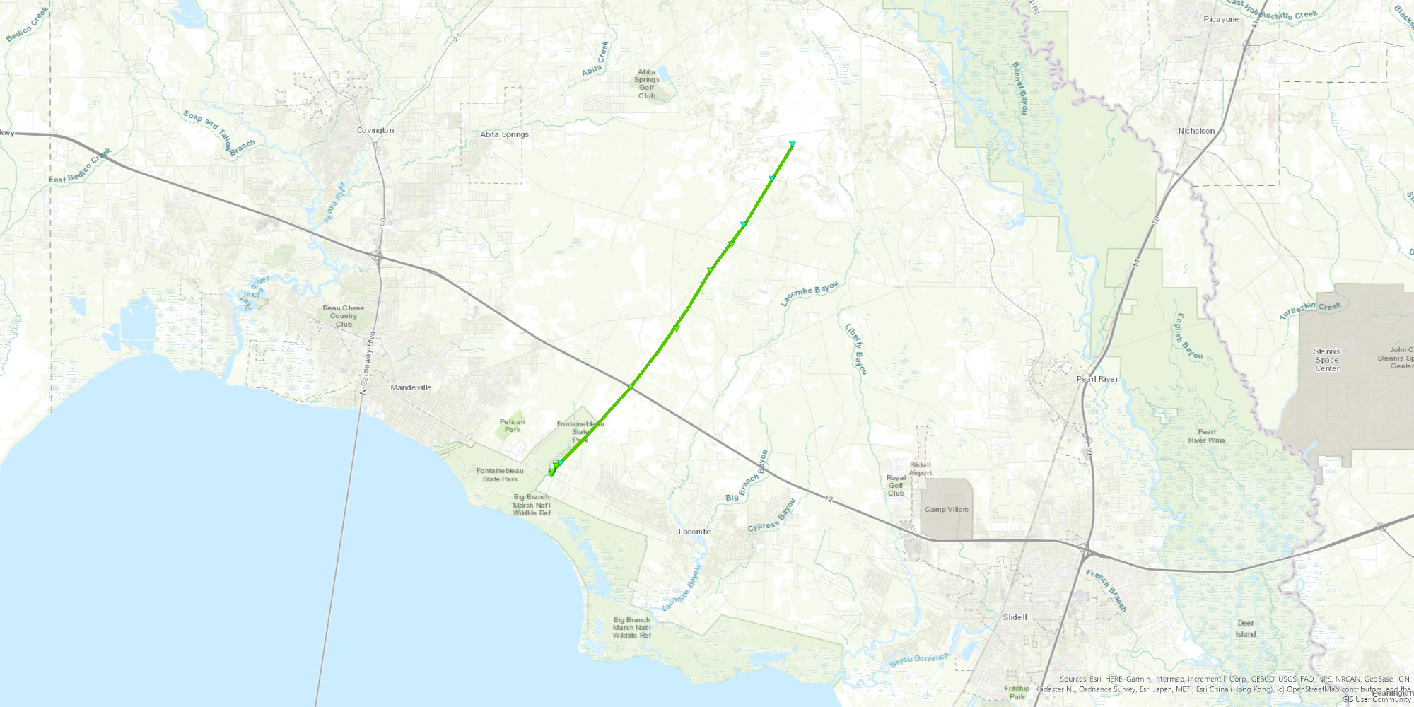
Lacombe, LA Tornado - March 22, 2022
|
Rating:
|
EF-1
|
|
Estimated Maximum Wind:
|
90 mph
|
|
Injuries/Fatalities:
|
None
|
|
Damage Path Length:
|
12.2 miles
|
|
Maximum Path Width:
|
100 yards
|
|
Approximate Start Point/Time:
|
3.8 miles W of Lacombe, LA at 725 PM CDT
|
|
Approximate End Point/Time:
|
11.85 miles NNE of Lacombe, LA at 743 PM CDT
|
|
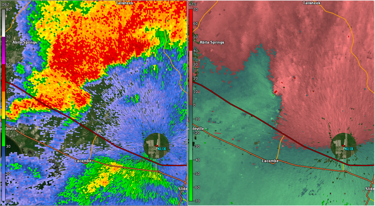
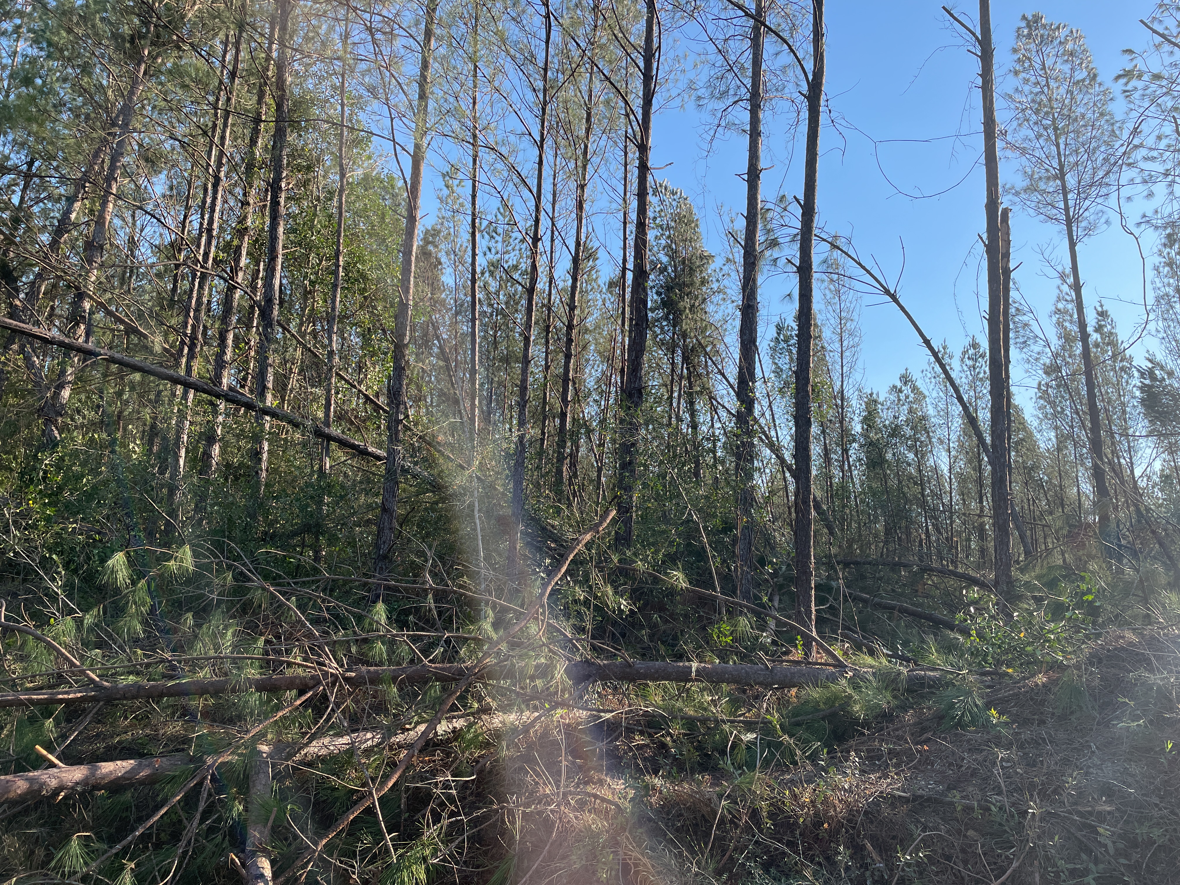
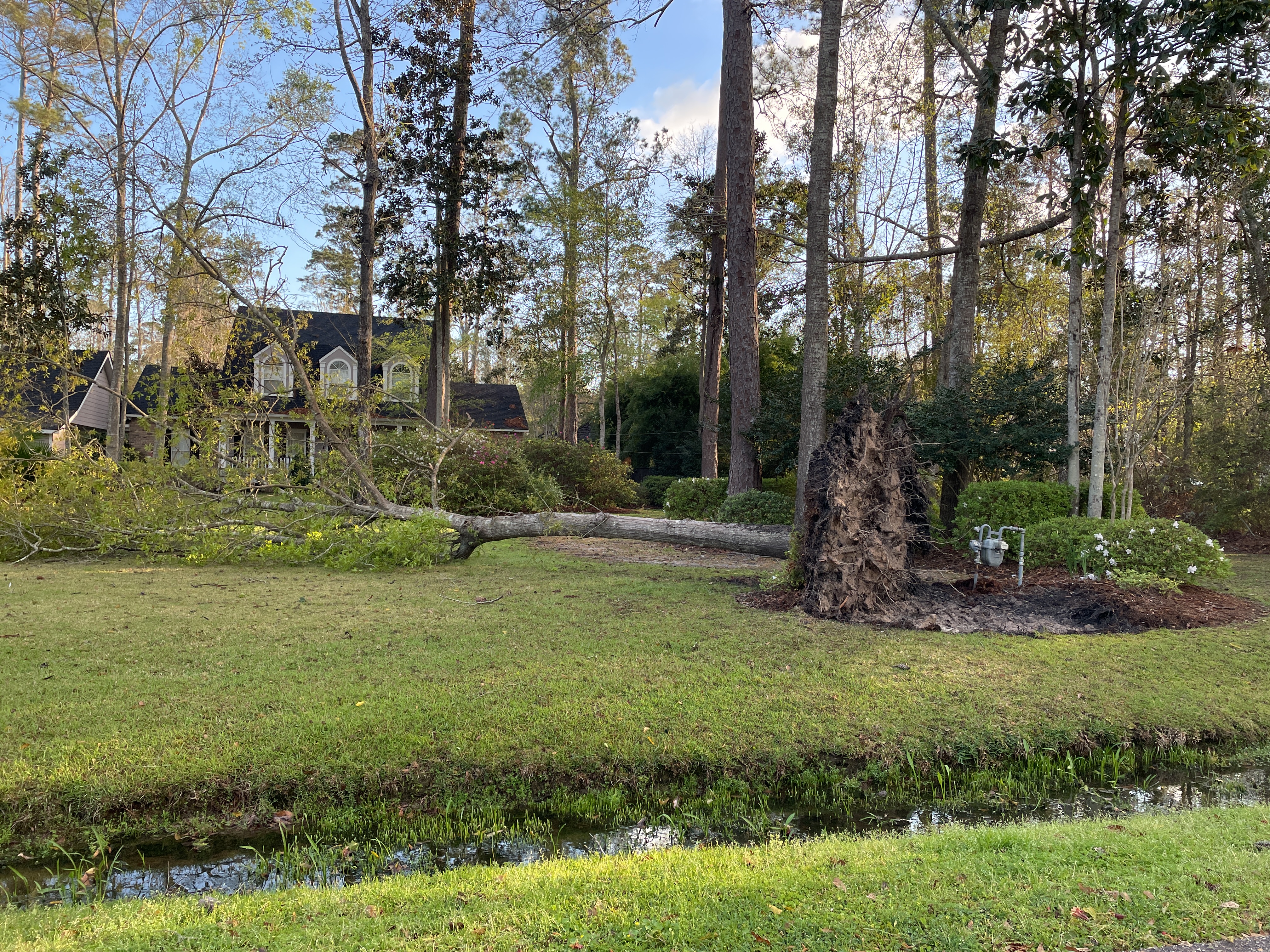
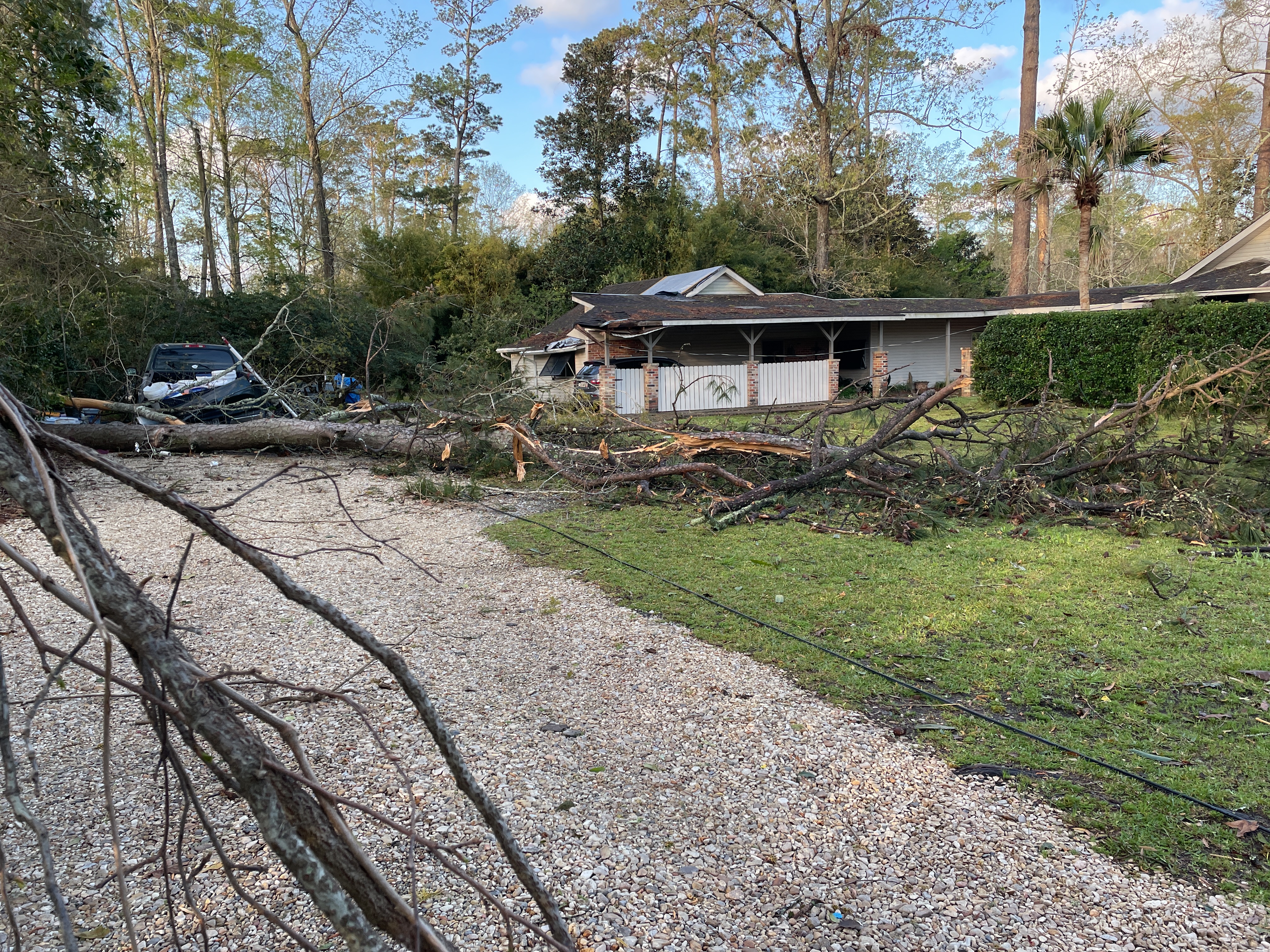
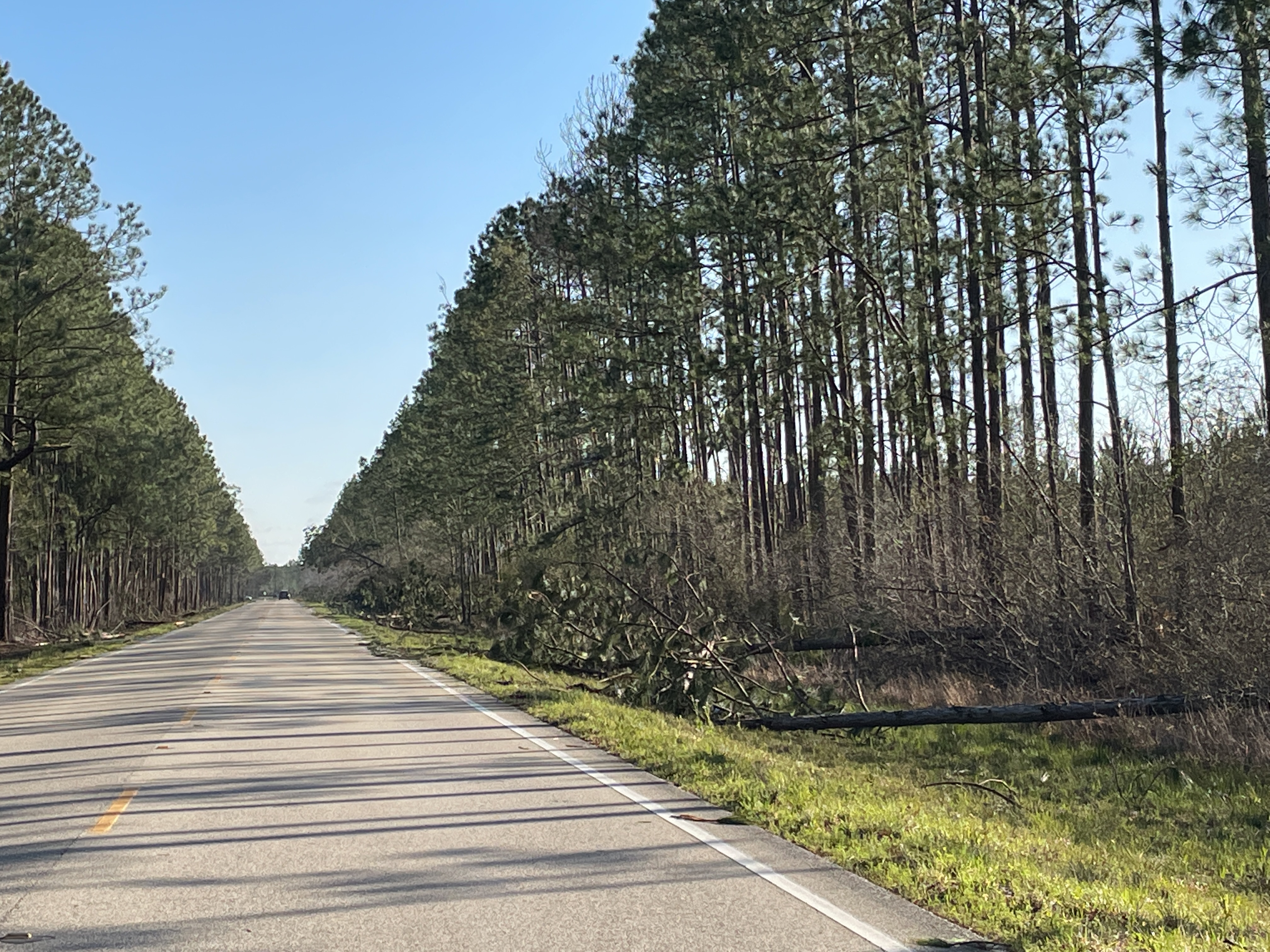
A National Weather Service Damage Assessment Team has surveyed the storm damage near Lacombe, LA. It has been determined the damage was the result of a tornado. The tornado has been rated an EF-1 on the Enhanced Fujita Scale. Damage estimates were consistent with winds of 90 mph. The tornado touched down near Big Branch Marsh National Wildlife Refuge on US Highway 190. Damage was observed at homes just north of US Highway 190. Homes experienced minor roof damage in the form of missing shingles. A shed was also destroyed, and dozens of softwood trees were snapped. The tornado continued moving to the northeast with continued minor roof damage and snapped trees observed along Azalea Street and Cane Bayou Lane. A tree was completely uprooted on the corner of Lound Drive and Blackwell Drive. The tornado continued moving northeast and crossed Interstate 12 near mile marker 71 where snapped softwood pine trees were observed on both sides of the interstate. The tornado then continued to move northeast through a densely wooded area until it intersected Louisiana Highway 1088 just south of Louisiana Highway 36. Dozens of softwood pine trees were observed snapped along the highway. Based on a radar tornadic debris signature (TDS), the tornado continued another 3 miles north of Highway 36 in a densely wooded area with no road access. |
|
|
|
|
||||||||||||