New Orleans/Baton Rouge
Weather Forecast Office
Lacombe, LA Tornado - March 30, 2022
Surveyed Damage Track Near Lacombe, LA
|
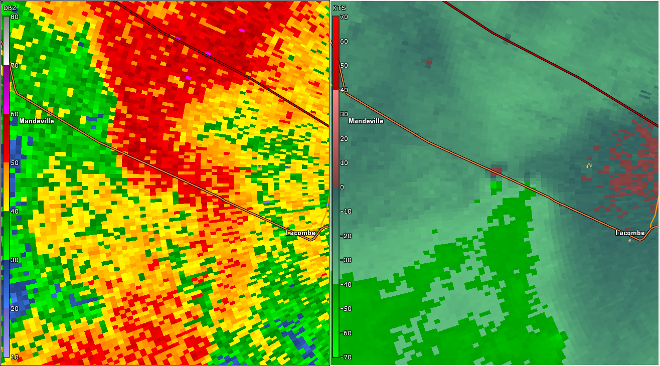
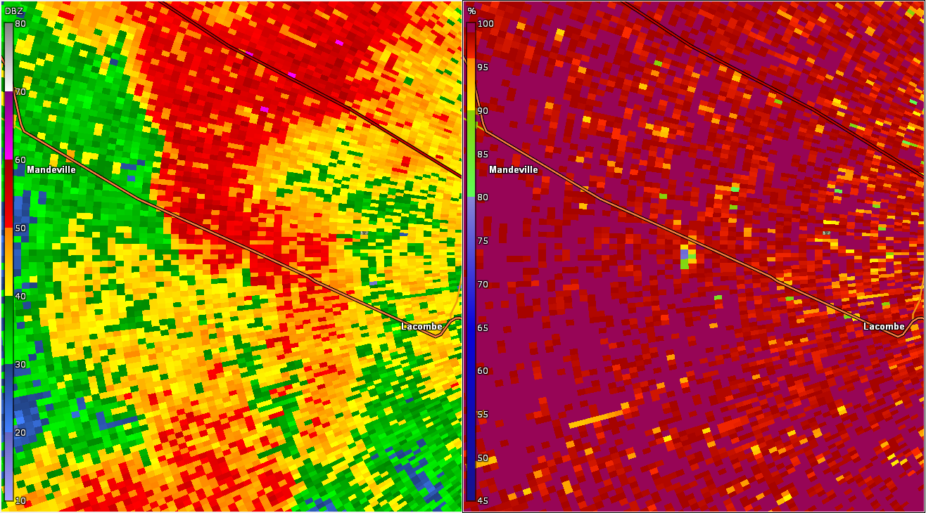
A National Weather Service Damage Assessment Team has surveyed the storm damage near Lacombe, LA in St. Tammany Parish. It has been determined the damage was the result of a tornado. The tornado has been rated an EF-0 on the Enhanced Fujita Scale. Damage estimates were consistent with winds of 65 mph. A waterspout over Lake Pontchartrain moved onshore near the outlet of Cane Bayou. As the tornado raced northeast at 50 to 60 mph, it snapped large limbs and tree tops on property surrounding the Rankin House on Cane Bayou. The tornado continued northeastward and snapped large limbs and uprooted a tree at a residence along U.S. Highway 190. The tornado quickly lifted at this point. An interesting note is that this tornado tracked within 100 yards of another tornado that occurred on March 22, 2022 at most points to the south of U.S. Highway 190. |
|
KLIX WSR-88D base reflectivity/storm relative velocity radar data near Lacombe, LA at 748 PM CDT 3/30/2022
|
Current Hazards
Outlooks
Fire Manager Quick Brief
Briefing Page
Storm Prediction Center
Extended Outlooks
Forecasts
Forecast Discussion
Aviation Weather Forecast
Graphical Forecast
Weather Models and Maps
Fire Weather Forecast
Hourly Weather Graph
Air Quality Forecasts
Marine Forecast
Activity Planner
River Forecasts
Tropical Forecast
US Dept of Commerce
National Oceanic and Atmospheric Administration
National Weather Service
New Orleans/Baton Rouge
62300 Airport Rd.
Slidell, LA 70460-5243
504.522.7330 985.649.0429
Comments? Questions? Please Contact Us.