New Orleans/Baton Rouge
Weather Forecast Office
Liziana, MS Tornado - April 10, 2024
|
Rating:
|
EF-1
|
|
Estimated Maximum Wind:
|
100 mph
|
|
Injuries/Fatalities:
|
None
|
|
Damage Path Length:
|
1.48 miles
|
|
Maximum Path Width:
|
100 yards
|
|
Approximate Start Point/Time:
|
8 miles W of Lyman, MS at 1044 AM CDT
|
|
Approximate End Point/Time:
|
7 miles W of Lyman, MS at 1046 AM CDT
|
|
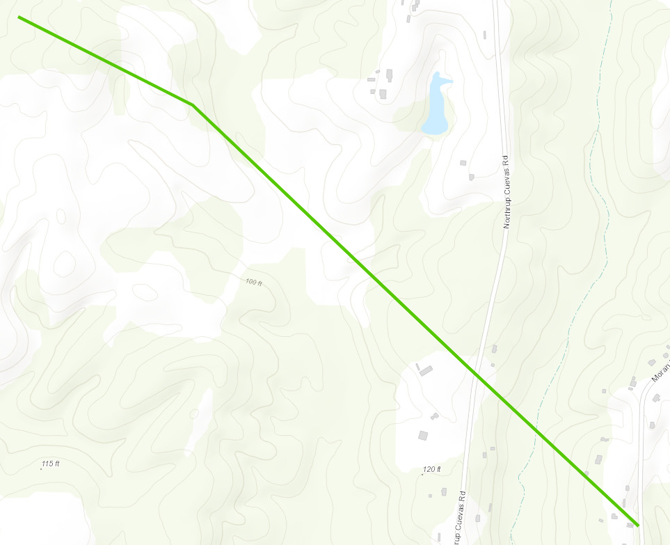
A National Weather Service Damage Assessment Team has surveyed the storm damage in Liziana, MS. It has been determined the damage was the result of a tornado. The tornado has been rated an EF-1 on the Enhanced Fujita Scale. Damage estimates were consistent with winds of 100 mph. NDVI differencing has helped to identify a tornado damage path that aligned with ground survey of a rolled manufactured home in Harrison County. This brief tornado quickly raced southeast also causing tree damage across Northrup Cuevas Road, just north of a longer-lived tornado that tracked near Wolf River. |
|
|
Current Hazards
Extended Outlooks
Outlooks
Fire Manager Quick Brief
Briefing Page
Storm Prediction Center
Forecasts
Marine Forecast
Activity Planner
River Forecasts
Tropical Forecast
Forecast Discussion
Aviation Weather Forecast
Graphical Forecast
Weather Models and Maps
Fire Weather Forecast
Hourly Weather Graph
Air Quality Forecasts
US Dept of Commerce
National Oceanic and Atmospheric Administration
National Weather Service
New Orleans/Baton Rouge
62300 Airport Rd.
Slidell, LA 70460-5243
504.522.7330 985.649.0429
Comments? Questions? Please Contact Us.