New Orleans/Baton Rouge
Weather Forecast Office
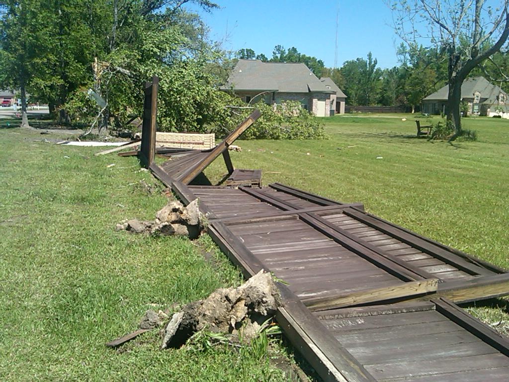
Ocean Springs, MS Tornado - April 4, 2011
|
Rating:
|
EF-1
|
|
Estimated Maximum Wind:
|
90 mph
|
|
Injuries/Fatalities:
|
None
|
|
Damage Path Length:
|
200 yards
|
|
Maximum Path Width:
|
75 yards
|
|
Approximate Start Point/Time:
|
5.5 miles E of Ocean Springs, MS at 845 PM
|
|
Approximate End Point/Time:
|
6 miles E of Ocean Springs, MS at 847 PM
|
|
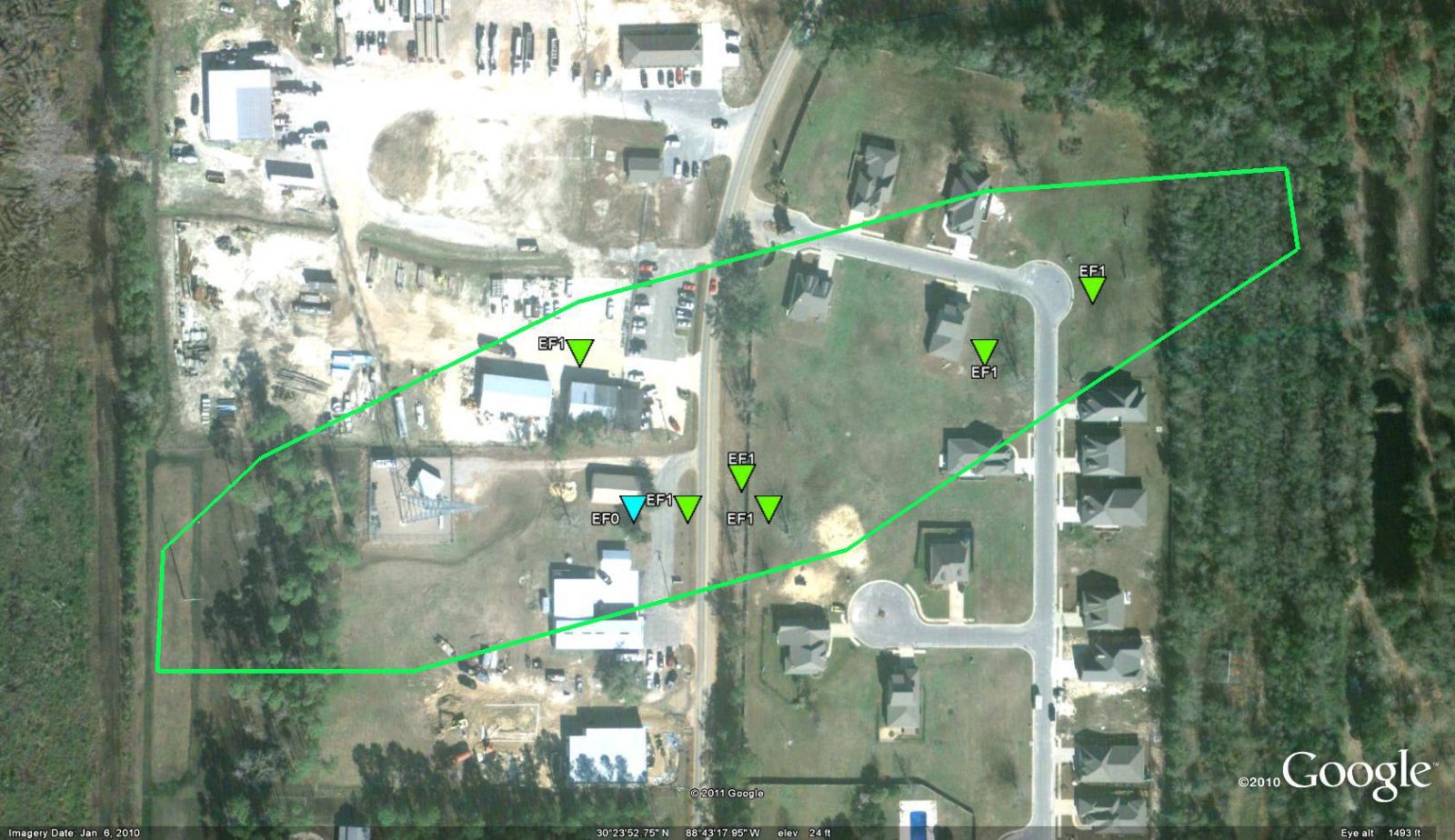
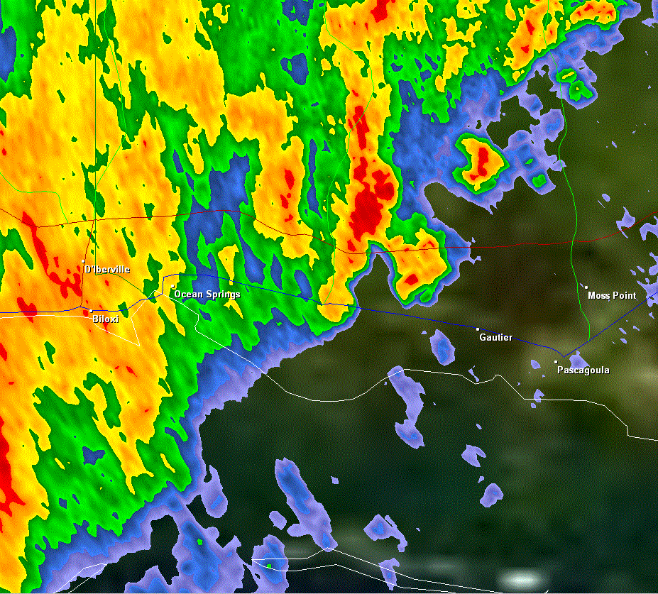
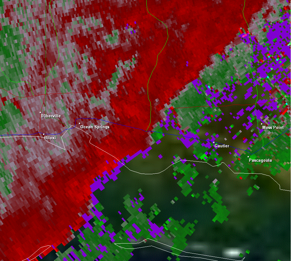
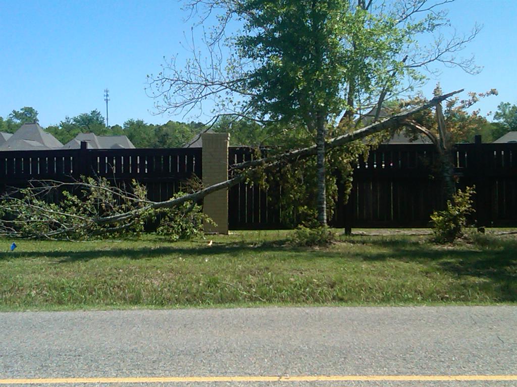
A National Weather Service Damage Assessment Team has surveyed the storm damage in Jackson County near the city of Ocean Springs. It has been determined the damage was the result of a tornado. The tornado has been rated a EF-1 on the Enhanced Fujita Scale. Damage estimates were consistent with winds of 90 mph. The tornado touched down in a field just west of Highway 57 and lifted just east of Highway 57. Metal roofing was peeled off of a couple of metal commercial buildings in the Fountainbleau area. Windows were blown out of two homes and a large section of two fences was blown down. Several trees were also snapped. The tornado damage path was 200 yards long and was 75 yards wide at its widest point. No injuries were reported. |
|
|
|
|
||||||||||||||
Current Hazards
Extended Outlooks
Outlooks
Fire Manager Quick Brief
Briefing Page
Storm Prediction Center
Forecasts
Marine Forecast
Activity Planner
River Forecasts
Tropical Forecast
Forecast Discussion
Aviation Weather Forecast
Graphical Forecast
Weather Models and Maps
Fire Weather Forecast
Hourly Weather Graph
Air Quality Forecasts
US Dept of Commerce
National Oceanic and Atmospheric Administration
National Weather Service
New Orleans/Baton Rouge
62300 Airport Rd.
Slidell, LA 70460-5243
504.522.7330 985.649.0429
Comments? Questions? Please Contact Us.