New Orleans/Baton Rouge
Weather Forecast Office
MS/AL State Line Tornado - March 30, 2022
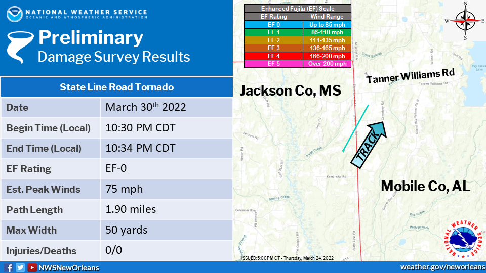
Surveyed Damage Track Near MS/AL State Line in Jackson County, MS
|
A National Weather Service Damage Assessment Team has surveyed the storm damage near the MS/AL in northeast Jackson County, MS. It has been determined the damage was the result of a tornado. The tornado has been rated an EF-0 on the Enhanced Fujita Scale. Damage estimates were consistent with winds of 75 mph. The tornado touched down near Harry Pierce Rd. and moved northeast into Alabama before lifting just east of State Line Rd. Tree damage was observed along the path of the tornado. No structures were impacted by the tornado before it crossed the state line and into NWS Mobile's area of responsibility. |
|
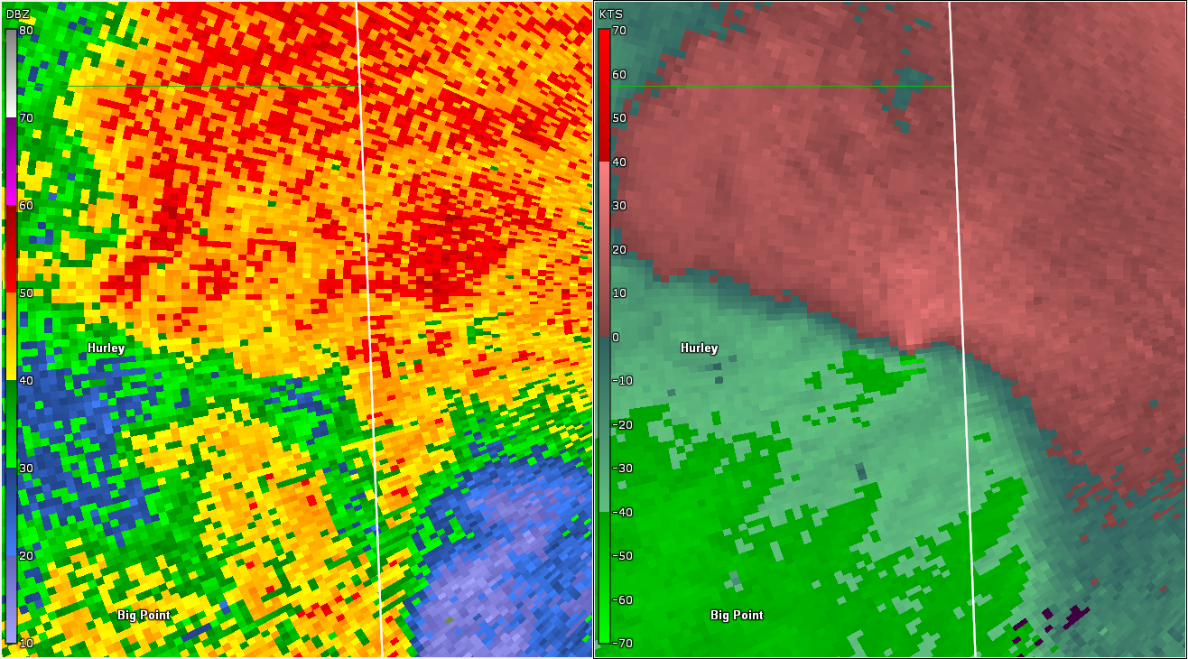
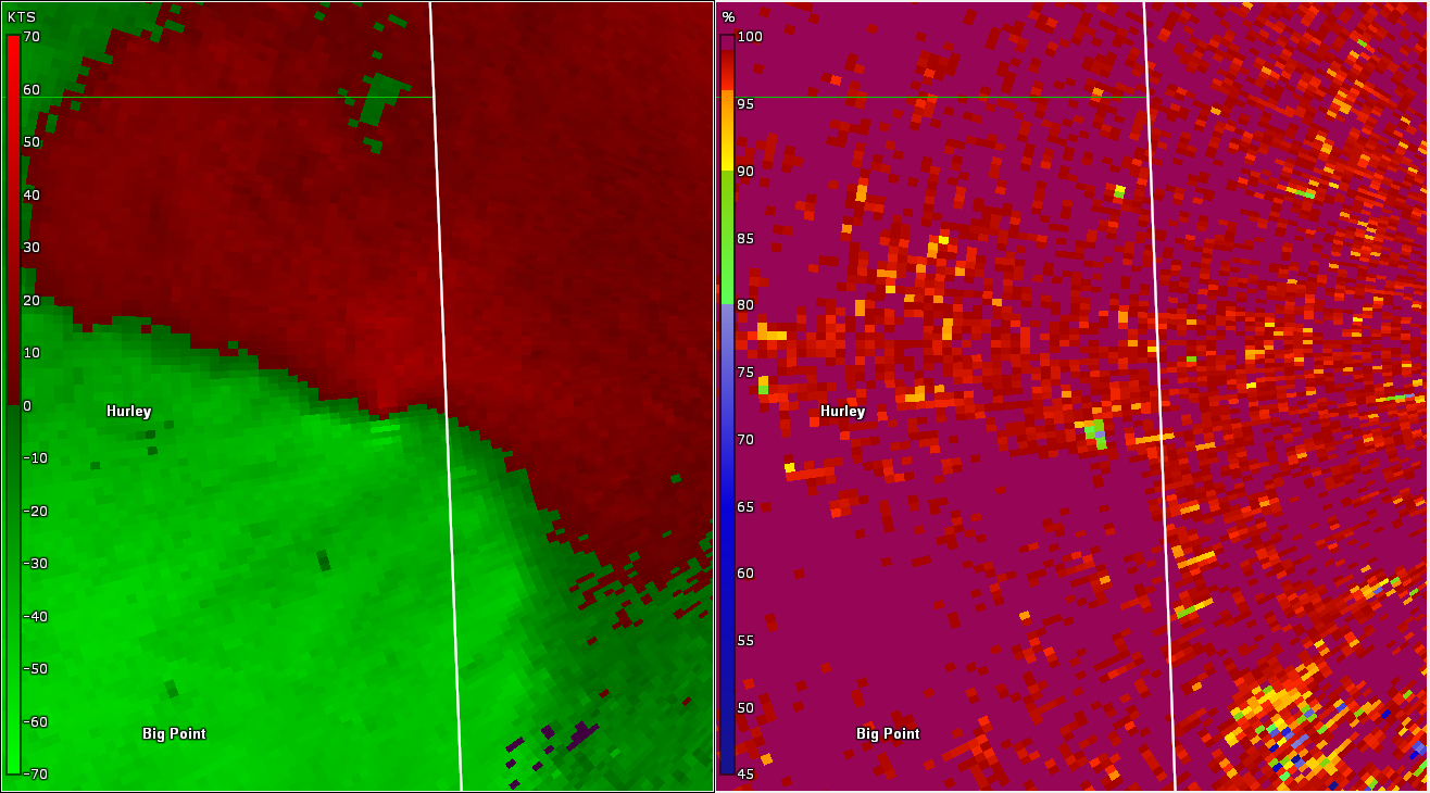
KMOB WSR-88D base reflectivity/storm relative velocity radar data near MS/AL stateline at 1024 PM CDT 3/30/2022
|
Current Hazards
Outlooks
Fire Manager Quick Brief
Briefing Page
Storm Prediction Center
Extended Outlooks
Forecasts
Forecast Discussion
Aviation Weather Forecast
Graphical Forecast
Weather Models and Maps
Fire Weather Forecast
Hourly Weather Graph
Air Quality Forecasts
Marine Forecast
Activity Planner
River Forecasts
Tropical Forecast
US Dept of Commerce
National Oceanic and Atmospheric Administration
National Weather Service
New Orleans/Baton Rouge
62300 Airport Rd.
Slidell, LA 70460-5243
504.522.7330 985.649.0429
Comments? Questions? Please Contact Us.