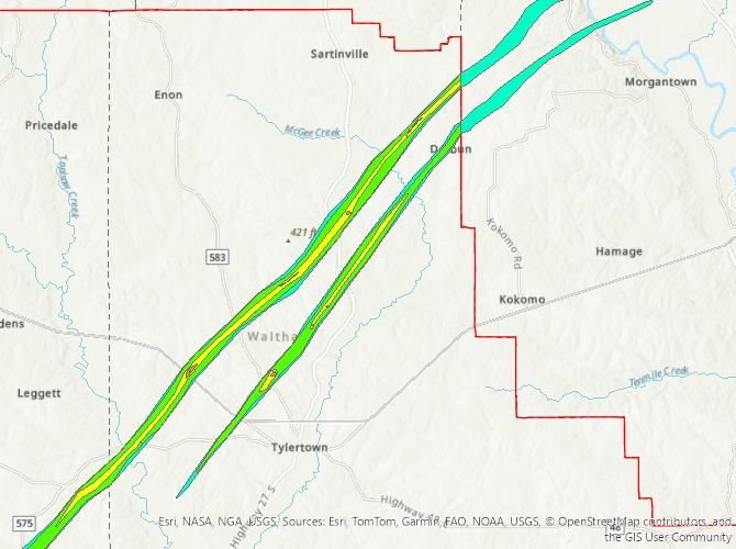
Tylertown, MS to Darbun, MS Tornado - March 15, 2025
|
Rating:
|
EF-3
|
|
Estimated Maximum Wind:
|
140 mph
|
|
Injuries/Fatalities:
|
1 Fatality/Unknown Injuries
|
|
Damage Path Length:
|
17.2 miles
|
|
Maximum Path Width:
|
0.5 miles
|
|
Approximate Start Point/Time:
|
3 miles W of Tylertown, MS at 124 PM CDT
|
|
Approximate End Point/Time:
|
6 miles NE of Salem, MS at 144 PM CDT
|
|
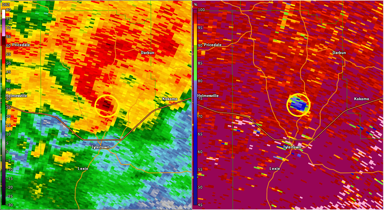
A National Weather Service Damage Assessment Team has surveyed the storm damage between Tylertown, MS and Darbun, MS. It has been determined the damage was the result of a tornado. The tornado has been rated an EF-3 on the Enhanced Fujita Scale. Damage estimates were consistent with winds of 140 mph. An EF3 tornado touched down just southwest of Tylertown, MS and tracked through Darbun and into Marion County, MS and the Jackson NWS office`s area. This is the second Tylertown tornado, the one that tracked just to the east of the stronger one. The tornado moved northeast with many destroyed single and double wide manufactured homes along the entire track as well as miles and miles of snapped and uprooted trees. The EF3 140 MPH points were all destroyed and swept clean manufactured homes. There was one fatality noted in one of these homes. Utilizing satellite and drone imagery and ground surveys found multiple locations with a width around 0.5 mile/880 yards. Adjustments made me needed as more imagery is analyzed. The ending lat/lon may also be adjusted in coordination with Jackson WFO. The injuries for this are unknown as they are based on a county scale, not tornado scale. |
|
|
|
|
||||||||||||||||