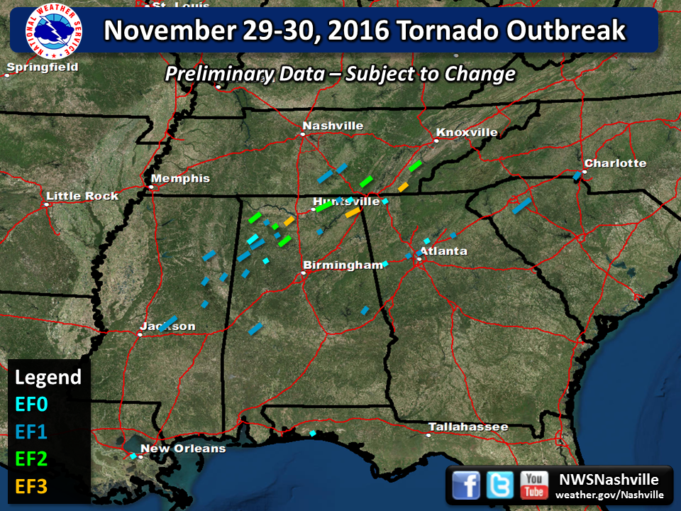
| Tornado Statistics | ||||||||
| # | Counties | Rating | Time (CST) | Length (miles) | Width (yards) | Fatalities | Injuries | |
| 1 | Coffee | EF1 | 2105 | 8.0 | 300 | 0 | 1 | |
| 2 | Coffee | EF1 | 2124 | 3.5 | 200 | 0 | 0 | |
| Overview | |
| A large upper level trough of low pressure combined with a northward moving warm front to spawn numerous supercells and tornadoes across the southeastern US from the afternoon hours on November 29, 2016 through the night and into the next day on November 30. Numerous tornado touched down in Louisiana, Mississippi, Alabama, Middle and Eastern Tennessee, Georgia, Florida, and South Carolina, resulting in 5 deaths and dozens of injuries. Across Middle Tennessee, two tornadoes touched down in Coffee County in Tullahoma and near Manchester, damaging many homes and causing one minor injury. |
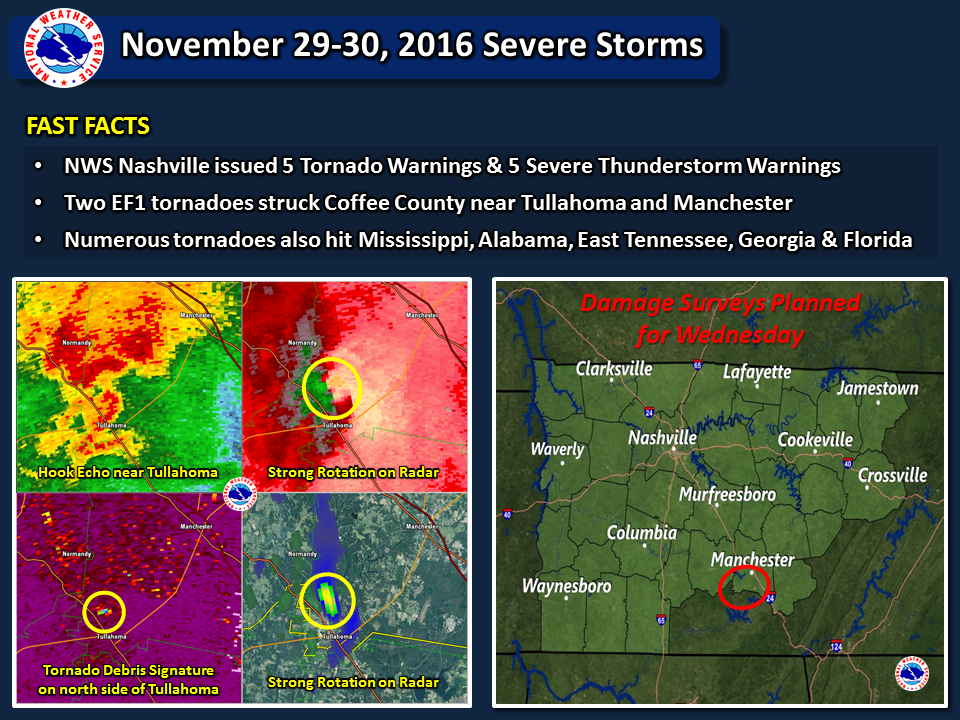
| Reports & Outlooks | |||
| SPC Storm Reports | SPC Event Archive | Local Storm Reports | Public Information Statements |
| NWS Huntsville | NWS Morristown | NWS Birmingham | NWS Jackson MS |
| Radar Imagery | ||
 |
||
| Storm Survey Information | ||
 |
||
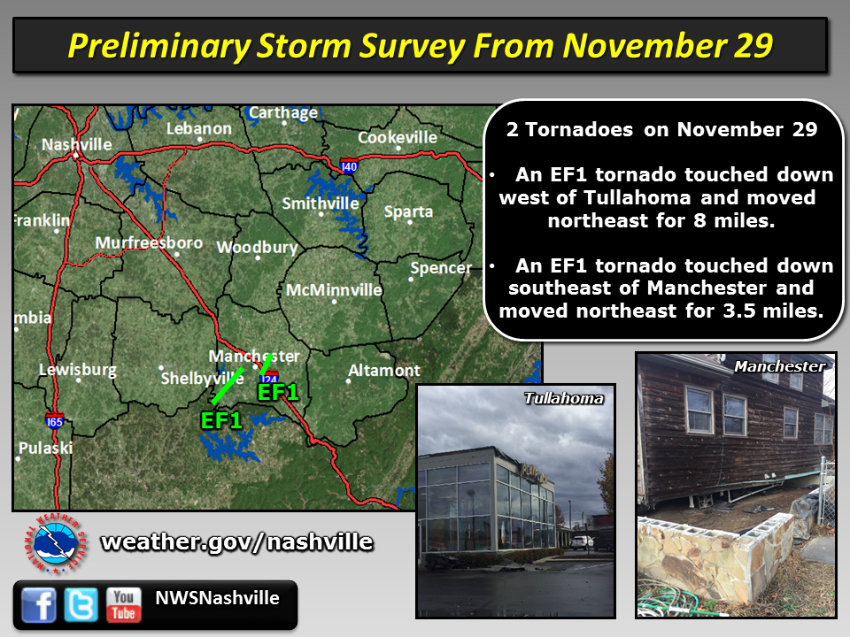
| EF1 Tullahoma Tornado | |
| Counties: | Coffee |
| Time: | 9:05 PM CST |
| EF Scale: | EF1 |
| Estimated Peak Winds: | 105 mph |
| Damage Path Length: | 8.0 miles |
| Damage Path Width: | 300 yards |
| Fatalities: | 0 |
| Injuries | 1 |
|
Storm Survey: An EF-1 tornado touched down just inside the Coffee County line west of Tullahoma. This tornado tracked through the northside of Tullahoma crossing over State Route 16/Jackson Street damaging several businesses with mostly roof damage observed. The tornado then moved across the Lakewood Golf and Country Club and Lake Tullahoma Estates neighborhoods where several hundred trees were uprooted and snapped. Almost all of the structural damage in these neighborhoods were due to downed trees. One person sustained a minor injury when a tree fell on their car. Once the tornado crossed the lake, it lifted just before Cherry Springs Road. |
|
| EF1 Manchester Tornado | |
| Counties: | Coffee |
| Time: | 9:24 PM CST |
| EF Scale: | EF1 |
| Estimated Peak Winds: | 105 mph |
| Damage Path Length: | 8.0 miles |
| Damage Path Width: | 200 yards |
| Fatalities: | 0 |
| Injuries | 0 |
|
Storm Survey: A new circulation formed east southeast of the the Tullahoma tornado and touched down just southeast of Manchester. Although not on the ground for long, several dozen trees were snapped and uprooted and several barns and outbuildings were heavily damaged along the path. A one story log cabin style house was picked up off of the foundation and moved 6-8 feet off of center with most of the house still fully intact. Unfortunately, this house was not properly attached to the foundation hence the EF-1 rating. |
|

