November 28-29, 2016 Severe Weather
Event Summary
Two separate bouts of severe weather impacted a large portion of the ArkLaMiss region over a two day period in late November. The first event began on the afternoon of Monday, November 28th and ended around midnight on Tuesday, November 29th . A potent upper level low pressure system spinning over the Northern Plains caused a strong surface low pressure system to develop and rapidly race northeast from the Central Plains to the Great Lakes region. This resulted in a strong cold front racing east into and through the ArkLaMiss region. As it did so, it encountered a strongly wind-sheared and marginally unstable air mass over the area. This equated to a line of storms racing east across the ArkLaMiss, that downed numerous trees and powerlines across the area. Numerous trees were also reported down well ahead of the front due to widespread sustained gradient winds between 25-35 mph, gusting between 40-50 mph at times over the ArkLaMiss. After this cold front pushed through the region, it stalled near the central gulf coast Tuesday morning, aiding in setting the stage for the second bout of severe weather that would affect the region from Tuesday afternoon into the early morning hours of Wednesday, November 30th.
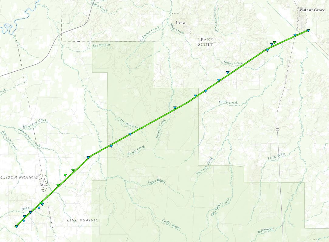
Another piece of upper level energy associated with the low pressure system aloft over the Northern Plains, approached the Southeast United States Tuesday afternoon. As this happened, it caused the front stalled south of the area to begin lifting north through the area as a warm front. As warm moist unstable air overspread the region from the south, both wind shear and forcing over the region became adequate, such that supercell thunderstorms began developing and moving northeast through the area. Numerous storms became severe and produced damaging wind gusts and large hail, primarily ranging from quarter to golfball size. Hen egg size hail was reported in Leake County, while baseball size hail was reported from storms in Sunflower and Neshoba counties. A total of five tornadoes were also confirmed with supercells across the ArkLaMiss. All five of these tornadoes were rated EF1, with one such tornado cutting a 23.6 mile damage path from northeast Rankin County through Scott & Leake counties. Another tornado affected Winston and Noxubee counties. Three more tornado damage paths were found in Oktibbeha, Clay, and Lowndes counties.
As a cold front finally pushed east and through the ArkLaMiss early Wednesday morning, severe weather finally came to an end across the entire area around sunrise.
11/29 Tornado Event Track Map
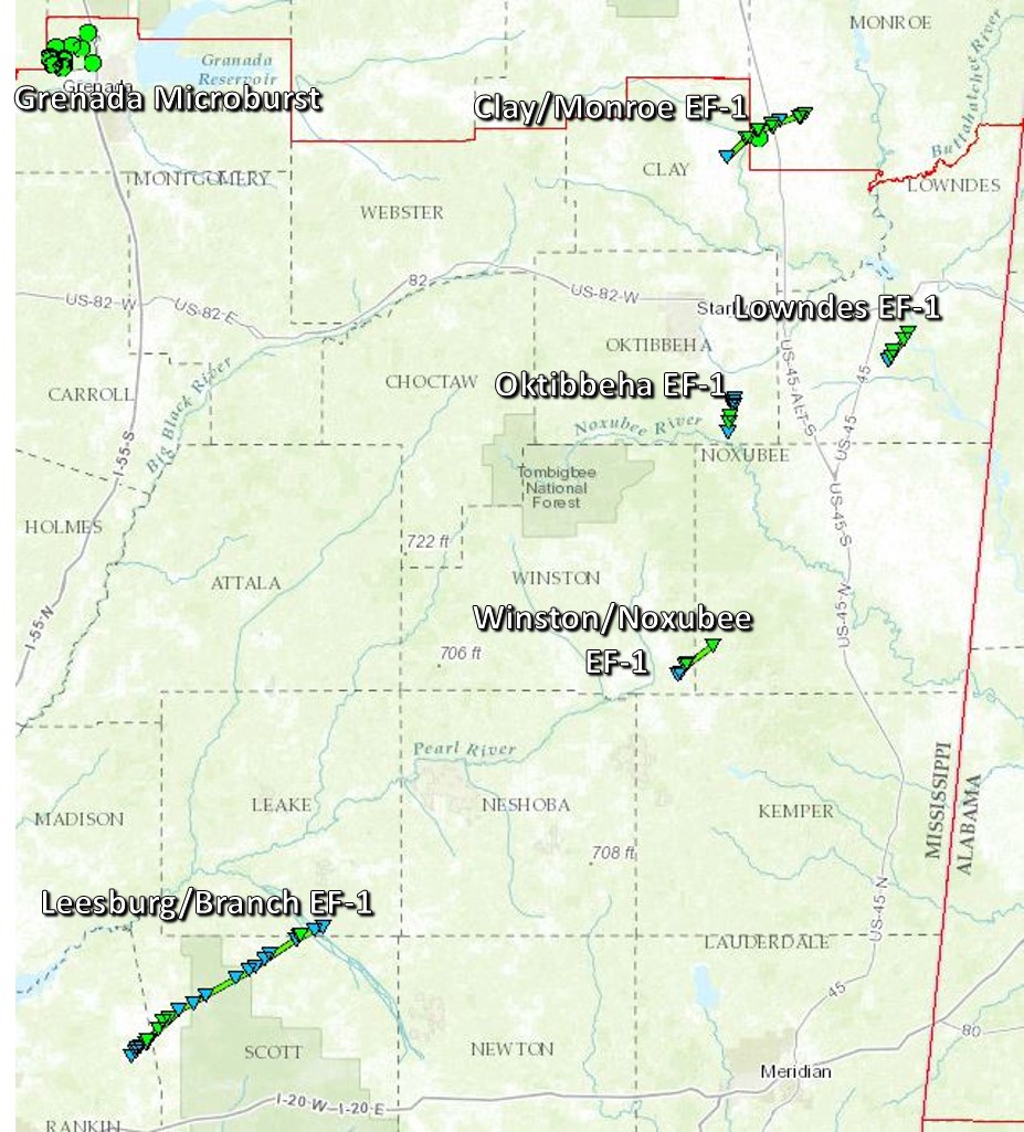
Click on map above to see entire event tracks and damage point notation.
Click on the location in the table for additional maps and details below.
| Location | Start/ End Time |
Event Type | Fatalities/ Injuries |
Path Length | Path Width |
| Rankin/Scott/Leake County 3 SSW Leesburg, Rankin Co. to 1 E Walnut Grove, Leake Co. |
3:57 PM- 4:37 PM |
EF-1 Tornado 100 mph |
none | 23.6 miles | 300 yards |
| Grenada County 4 NNW Bew Springs to 5 N Bew Springs |
4:20 PM- 4:24 PM |
Straight-line winds 90 mph |
none | 4.8 miles | 6160 yards |
| Winston/Noxubee County 5 N Preston, Winston Co. to 5 NNW Gholson, Noxubee Co. |
5:49 PM- 6:00 PM |
EF-1 Tornado 105 mph |
none | 4.6 miles | 170 yards |
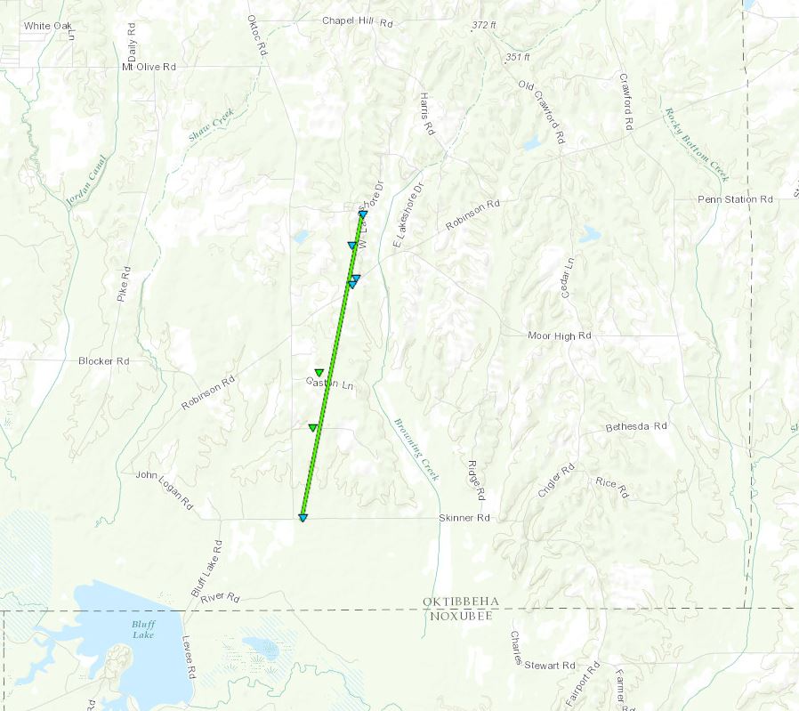
| Oktibbeha County 2 S Oktoc to 1 NNE Oktoc |
5:52 PM- 5:58 PM |
EF-1 Tornado 110 mph |
none | 3.5 miles | 150 yards |
| Clay/Monroe County 1 NE Palo Alto to 5 NE Palo Alto |
6:12 PM- 6:15 PM |
EF-1 Tornado 110 mph |
none |
3 miles in |
50 yards |
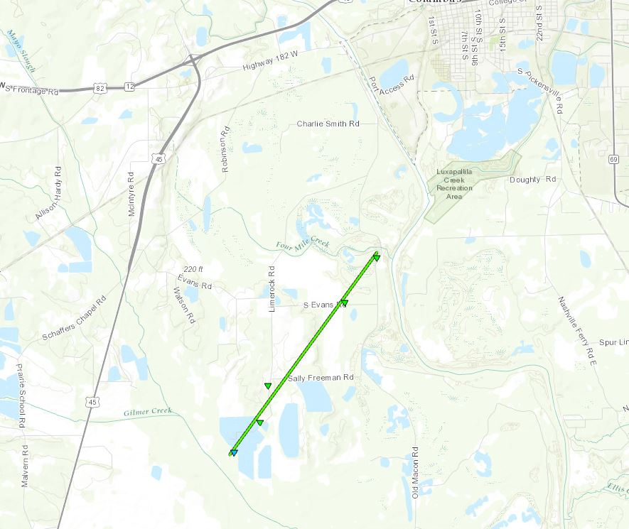
| Lowndes County 4 SE Bent Oak to 5 SSW Columbus |
8:12 PM- 8:19 PM |
EF-1 Tornado 105 mph |
none | 3.5 miles | 100 yards |
Click on map above to see entire damage point notation and damage pictures at select points.
|
Event Summary |
|
Grenada County Straight-Line Wind Damage
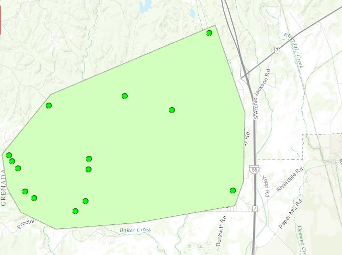
Click on map above to see entire damage point notation and damage pictures at select points.
|
Event Summary |
|
Winston/Noxubee County EF-1 Tornado
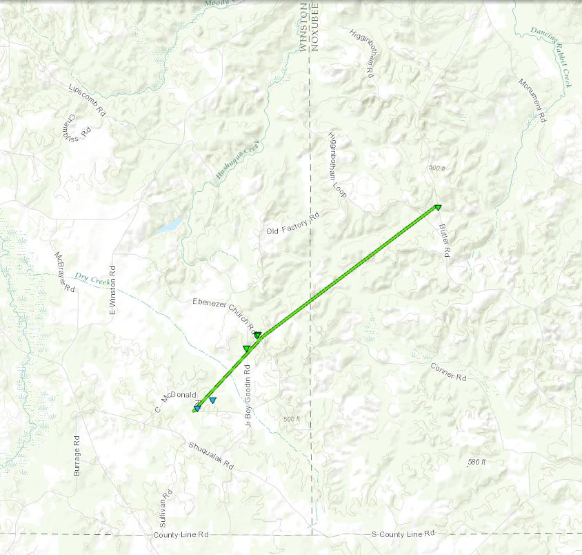
Click on map above to see entire damage point notation and damage pictures at select points.
|
Event Summary |
|
Click on map above to see entire damage point notation and damage pictures at select points.
|
Event Summary |
|
Clay/Monroe County EF-1 Tornado
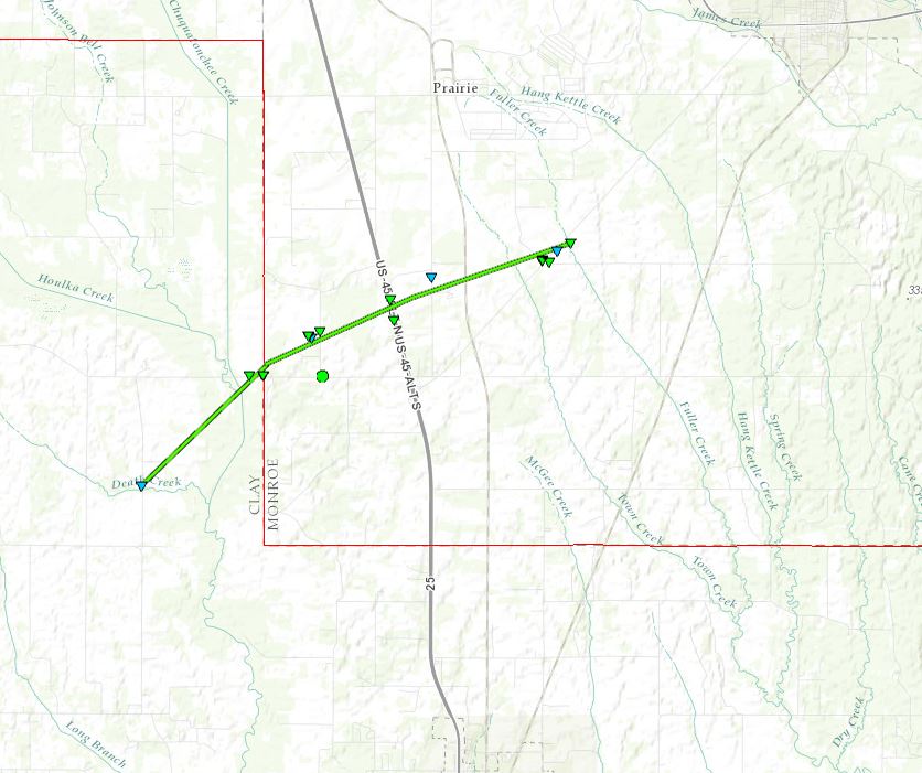
Click on map above to see entire damage point notation and damage pictures at select points.
|
Event Summary |
|
Click on map above to see entire damage point notation and damage pictures at select points.
|
Event Summary |
|
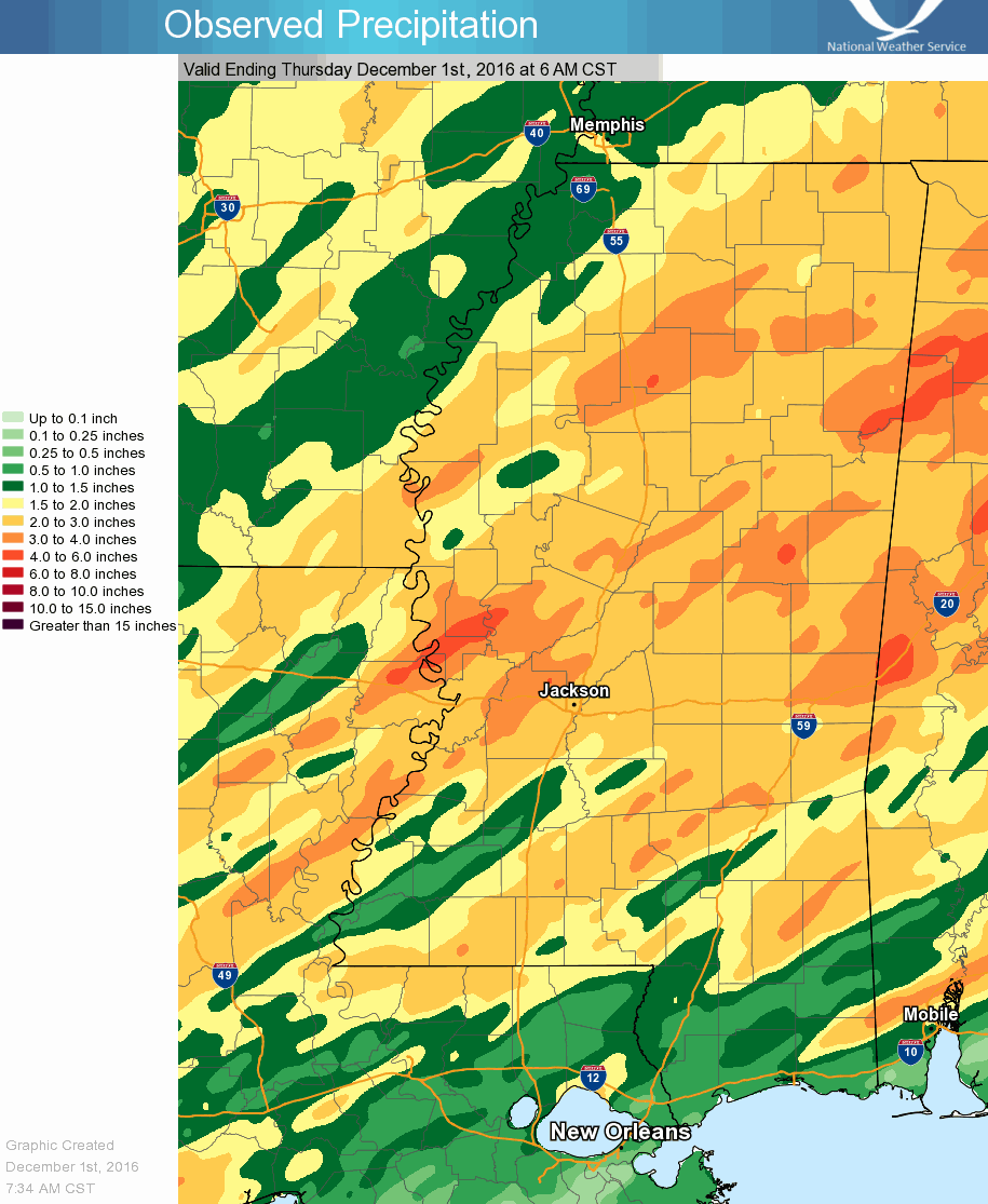
Precipitation Summary
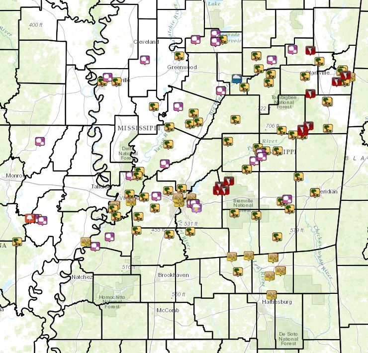
Local Storm Reports
Click on the map for additional details.