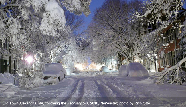
A Nor’easter is a storm along the East Coast of North America, so called because the winds over the coastal area are typically from the northeast. These storms may occur at any time of year but are most frequent and most violent between September and April. Some well known Nor’easters include the notorious Blizzard of 1888, the “Ash Wednesday” storm of March 1962, the New England Blizzard of February 1978, the March 1993 “Superstorm” and the recent Boston snowstorms of January and February 2015. Past Nor’easters have been responsible for billions of dollars in damage, severe economic, transportation and human disruption, and in some cases, disastrous coastal flooding. Damage from the worst storms can exceed a billion dollars.
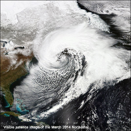
Nor’easters usually develop in the latitudes between Georgia and New Jersey, within 100 miles east or west of the East Coast. These storms progress generally northeastward and typically attain maximum intensity near New England and the Maritime Provinces of Canada. They nearly always bring precipitation in the form of heavy rain or snow, as well as winds of gale force, rough seas, and, occasionally, coastal flooding to the affected regions. The heavily populated region between Washington D.C., Philadelphia, New York and Boston, the “I-95 Corridor,” is especially impacted by Nor’easters.
The U.S. East Coast provides an ideal breeding ground for Nor’easters. During winter, the polar jet stream transports cold Arctic air southward across the plains of Canada and the United States, then eastward toward the Atlantic Ocean where warm air from the Gulf of America and the Atlantic tries to move northward. The warm waters of the Gulf Stream help keep the coastal waters relatively mild during the winter, which in turn helps warm the cold winter air over the water. This difference in temperature between the warm air over the water and cold Arctic air over the land is the fuel that feeds Nor’easters.
Weather forecasters at NWS local forecast offices around the country and at the National Centers for Environmental Prediction near Washington, D.C., monitor conditions conducive for Nor’easters, especially during the fall and winter. When they see conditions are favorable in the upcoming days, forecasters may issue winter storm, blizzard, high wind and coastal flood watches to alert the public that some of the worst effects of Nor’easters might be possible. If conditions are imminent, those watches are changed to warnings.
Follow weather.gov to get the latest forecasts and warnings. If a Nor’easter threatens your home town, take steps to prepare, such as having three days of food, water and other provisions in a disaster supplies kit. A Nor’easter could cut power and leave you in the dark. Also, sit down with your family and create an emergency communications plan so your loved ones know how to stay in touch if you are separated. Stay off the roads if advised by local authorities and never drive into flood waters. These simple actions will help you stay safe during a Nor’easter.

