
Scattered thunderstorms with severe gusts, hail and a tornado risk are possible near a cold front from the Ohio Valley to the Mid-Atlantic tonight. Tropical Storm Bertha is expected to bring tropical storm conditions to portions of the Gulf Coast from the panhandle of Florida into Louisiana through Wednesday. Read More >
San Angelo, TX
Weather Forecast Office
A severe weather event occurred across West Central Texas on March 13. With the approach of a potent upper level storm system and cold front from the west, a line of strong to severe thunderstorms moved quickly east across the area during the post-Midnight hours. Typically, thunderstorms weaken during the overnight hours as conditions become more stable. However, with very strong wind shear and sufficient instability with this system, the line of thunderstorms maintained its intensity well after Midnight. The Abilene and San Angelo Airports both recorded wind gusts 50-55 mph. A number of storms were severe with strong or damaging winds.
A couple of storms along the line produced tornadoes in Zephyr (Brown County) and Junction (Kimble County). The damage from the tornado in Zephyr was rated EF-1 on the Enhanced Fujita scale. The storm in Kimble County produced 2 tornado touchdowns in Junction. The first tornado was rated EF-0, while the second tornado was rated EF-1, based on the assessment of damage.
A total of 17 severe weather reports were received for this event.
Figure 1 shows an animated loop of radar imagery, with the line of thunderstorms moving east across West Central Texas.
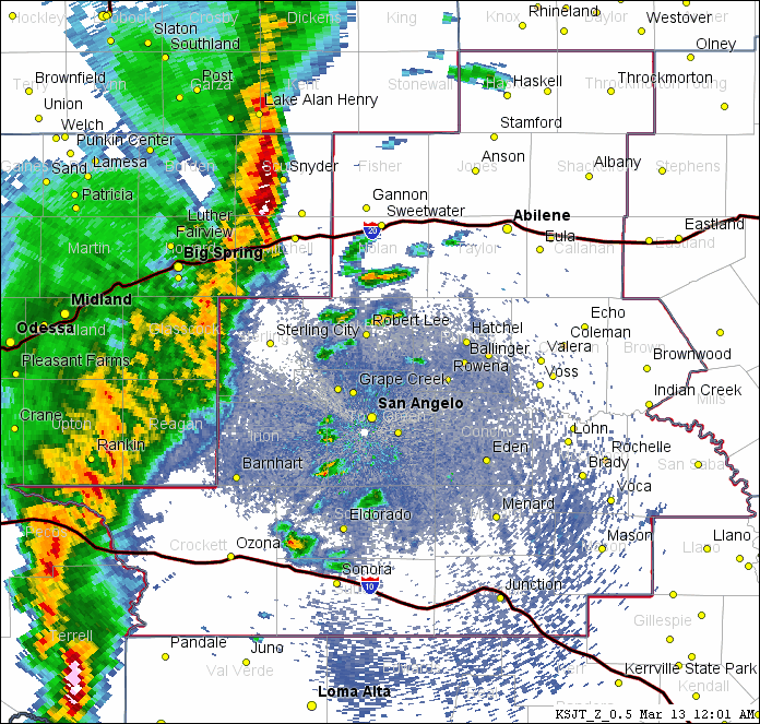
Figure 1: Animated Loop of Radar Imagery on March 13 (between Midnight and 4 AM).
US Dept of Commerce
National Oceanic and Atmospheric Administration
National Weather Service
San Angelo, TX
7654 Knickerbocker Road
San Angelo, TX 76904
325-944-0526
Comments? Questions? Please Contact Us.

