An active weather pattern affected areas of West Central Texas on May 14-17, with severe thunderstorms, heavy rainfall and localized flash flooding.
The setup on May 14-15 was was similar, with the approach of a dryline from West Texas into a very unstable airmass. Scattered thunderstorms developed during the afternoon hours ahead of the dryline, and continued into the nighttime hours before dissipating. Most of the severe weather occurred in the late afternoon through late evening time frame on both days.
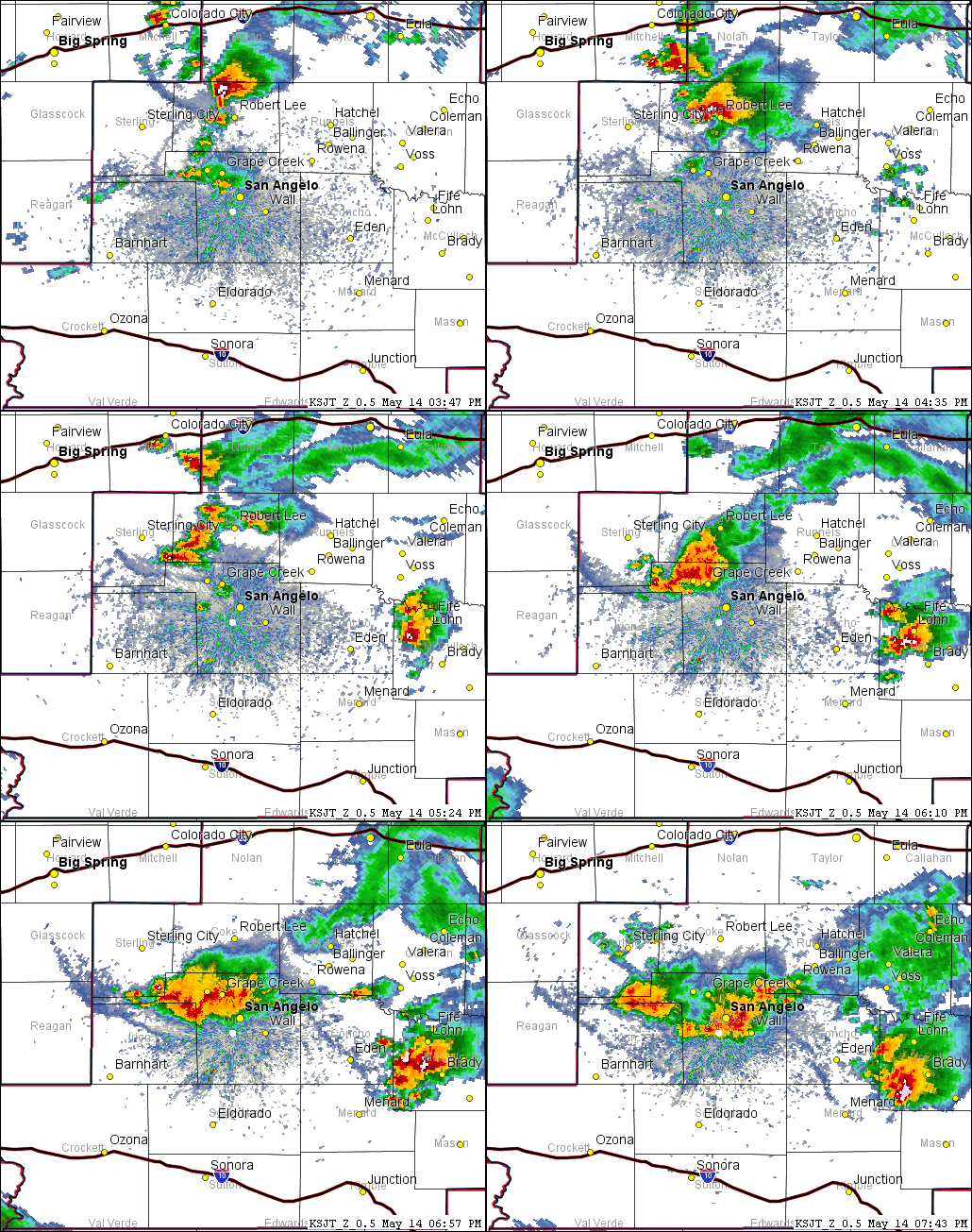
Figure 1 shows an animated loop of radar imagery, with clusters of thunderstorms which affected the Concho Valley and Heartland areas.

Figure 1: Animated Loop of Radar Imagery on May 14 (between 345 PM and 745 PM).
The storm in Coke County produced a funnel cloud (2 miles north of Robert Lee) and dropped hail up to golfball size (7 miles south-southeast of Silver). A funnel cloud was also reported with another storm in Mcculloch County (1 mile west of Brady), along with hail up to golfball size (1 mile east-southeast of Pear Valley).
The slow-moving thunderstorms contained very heavy rainfall. This resulted in flash flooding of streets in San Angelo.
In all, a total of 26 severe weather and flooding reports were received with the storms on May 14.
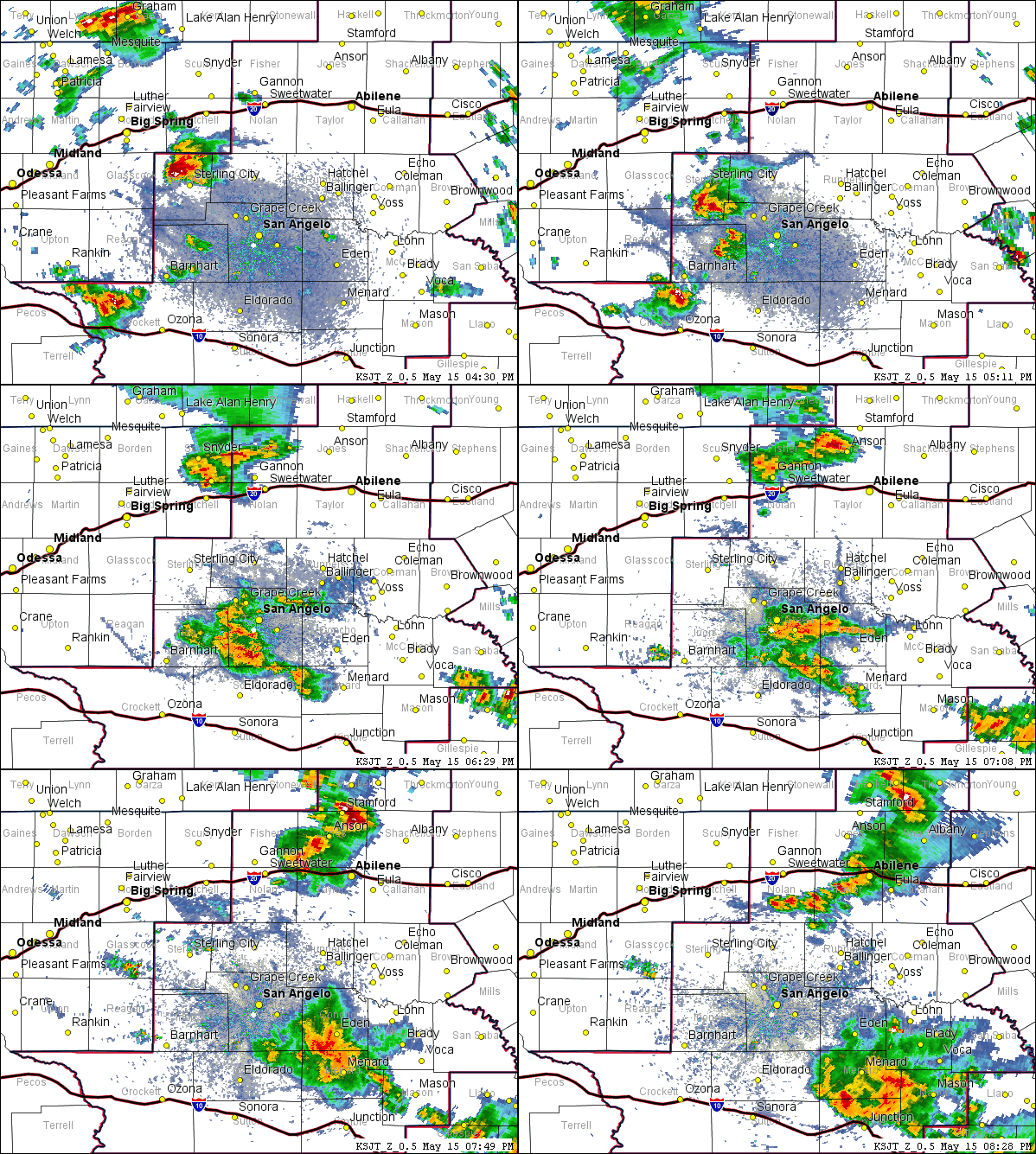
On May 15, severe weather occurred from Sterling City to San Angelo to Menard, and to a lesser extent north of Abilene. Figure 2 shows an animated loop of radar imagery, with the May 15 storms.

Figure 2: Animated Loop of Radar Imagery on May 15 (between 430 PM and 830 PM).
The storm in Sterling County produced hail up to hen egg size (8 miles south of Sterling City) on Highway 163. This storm also produced a wind gust of 72 mph (recorded by a Mesonet site 4 miles west-southwest of Sterling City). A cluster of thunderstorms developed just west of San Angelo and moved southeast through the Menard area. Wind gusts of 60-80 mph were reported in parts of Tom Green County. Very heavy rainfall from these storms caused localized flash flooding of streets in San Angelo. North of Interstate 20 in the Big Country area, storms produced hail of nickel to quarter size north of Abilene.
In all, a total of 19 severe weather reports were received with the storms on May 15, along with 1 flooding report.
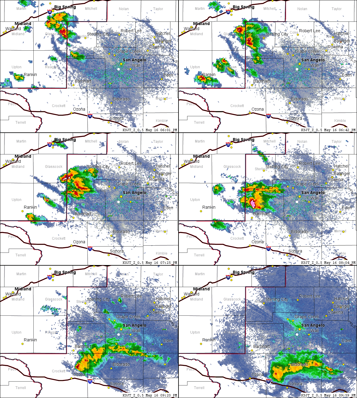
On May 16, a cluster of thunderstorms moved south from Sterling County into Irion County, where one storm became severe and tracked south through the Barnhart area. With this storm, strong winds blew down power lines north of Barnhart). A 70 mph wind gust was reported in Barnhart. Hail from this storm accumulated on a portion of Highway 163 north of Barnhart, requiring the use of equipment from the Texas Department of Transportation for its removal.
Figure 3 shows an animated loop of radar imagery, with the May 16 evening storms.

Figure 3: Animated Loop of Radar Imagery on May 16 (between 6 PM and 10 PM).
Severe weather reports with the storms on May 16.
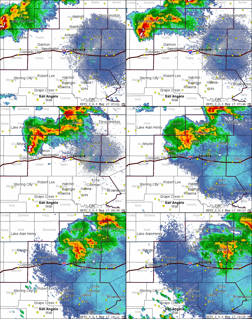
Strong to severe thunderstorms affected the Big Country area north of Interstate 20, on the evening and early nighttime hours of May 17. Strong, gusty winds accompanied some of the storms. An animated loop of radar imagery, with the May 17 storms, is shown in Figure 4.

Figure 4: Animated Loop of Radar Imagery on May 17 (between 7 PM and 11 PM).
Wind reports with the May 17 storms are summarized in the table below.
| Location | County | Peak Wind Speed (mph) | Source | Time (CDT) |
| Rotan 5 W | Fisher | 50 | Mesonet | 819 PM |
| Weinert 2 ENE | Haskell | 43 | Mesonet | 840 PM |
| Stamford 5 ESE | Jones | 56 | Mesonet | 921 PM |
| Hawley 5 NNE | Jones | 60 | Public Report | 933 PM |
With multiple days of thunderstorms across various parts of West Central Texas, rainfall amounts were substantial across a sizeable portion of the area. Figure 5 shows total rainfall amounts for the May 14-17 time period.
Figure 5: Rainfall Amounts for the 7-Day Period ending at 7 AM CDT, May 18.
In Figure 5, rainfall amounts of 1-3 inches are shown in green shading, while 3-5 inch amounts appear in yellow shading. The highest totals, in the 5-6 inch range, appear in orange shading. With this rainfall and associated water runoff into streams and lakes, small increases in water levels were temporarily registered in the E.V. Spence Reservoir, the North Pool of Twin Buttes Reservoir, and in O.C. Fisher Lake.